42:
571:
58:
806:
65:
301:"In 1814, Tennessee Troops joined Andrew Jackson's force which won the Creek Indian War. After Indian removal in 1836, these veterans brought their families here, named this community for their old home in Tennessee. Fayetteville Academy was built in 1850."
41:
880:
870:
851:
488:
885:
875:
86:
890:
844:
409:
710:
481:
57:
695:
837:
400:
256:
474:
659:
674:
373:
405:
466:
295:
427:
140:
605:
288:
813:
498:
338:
280:
145:
276:
244:
118:
395:
626:
272:
32:
776:
753:
720:
249:
539:
783:
715:
229:
304:
In 1920, a new high school was built in the
Fayetteville community called Fayetteville High School.
735:
649:
679:
669:
600:
560:
555:
520:
448:
730:
685:
664:
219:
821:
725:
705:
700:
690:
610:
595:
590:
544:
639:
549:
616:
864:
513:
805:
745:
128:
101:
88:
210:
767:‡This populated place also has portions in an adjacent county or counties
817:
284:
133:
570:
236:
215:
582:
531:
470:
569:
423:
881:
Unincorporated communities in
Talladega County, Alabama
825:
46:
871:
Census-designated places in
Talladega County, Alabama
287:, United States. Its population was 1,284 as of the
762:
744:
648:
625:
581:
530:
255:
243:
226:
209:
201:
193:
188:
180:
172:
164:
156:
151:
139:
127:
117:
23:
18:Census-designated place in Alabama, United States
294:The following is found on a sign erected by the
845:
482:
64:
8:
574:Map of Alabama highlighting Talladega County
852:
838:
489:
475:
467:
311:
20:
410:United States Department of the Interior
365:
254:
242:
208:
187:
179:
150:
116:
81:
50:
38:
331:
886:Unincorporated communities in Alabama
225:
200:
192:
171:
168:17.44 sq mi (45.18 km)
163:
160:19.77 sq mi (51.21 km)
155:
138:
126:
7:
802:
800:
876:Census-designated places in Alabama
401:Geographic Names Information System
176:2.33 sq mi (6.03 km)
824:. You can help Knowledge (XXG) by
497:Municipalities and communities of
449:"Census of Population and Housing"
321:
14:
804:
63:
56:
40:
891:Central Alabama geography stubs
406:United States Geological Survey
296:Alabama Historical Association
1:
376:. United States Census Bureau
820:state location article is a
428:United States Census Bureau
374:"2020 U.S. Gazetteer Files"
205:81.52/sq mi (31.48/km)
907:
799:
772:
567:
511:
500:Talladega County, Alabama
352:
337:
330:
325:
320:
317:
82:
51:
39:
30:
277:unincorporated community
184:436 ft (133 m)
273:census-designated place
33:Census-designated place
575:
573:
424:"U.S. Census website"
353:U.S. Decennial Census
313:Historical population
228: • Summer (
102:33.14556°N 86.40583°W
71:Fayetteville, Alabama
25:Fayetteville, Alabama
785:United States portal
202: • Density
314:
107:33.14556; -86.40583
98: /
576:
312:
194: • Total
173: • Water
157: • Total
833:
832:
794:
793:
606:Talladega Springs
357:
356:
266:
265:
165: • Land
898:
854:
847:
840:
814:Talladega County
808:
801:
786:
779:
572:
523:
516:
506:
501:
491:
484:
477:
468:
461:
460:
458:
456:
445:
439:
438:
436:
434:
420:
414:
413:
392:
386:
385:
383:
381:
370:
333:
328:
323:
315:
281:Talladega County
233:
113:
112:
110:
109:
108:
103:
99:
96:
95:
94:
91:
67:
66:
60:
44:
21:
906:
905:
901:
900:
899:
897:
896:
895:
861:
860:
859:
858:
797:
795:
790:
784:
777:
768:
758:
740:
651:
644:
621:
577:
565:
526:
521:
514:
507:
504:
499:
495:
465:
464:
454:
452:
447:
446:
442:
432:
430:
422:
421:
417:
394:
393:
389:
379:
377:
372:
371:
367:
362:
326:
310:
227:
106:
104:
100:
97:
92:
89:
87:
85:
84:
78:
77:
76:
75:
74:
73:
72:
68:
47:
35:
26:
19:
12:
11:
5:
904:
902:
894:
893:
888:
883:
878:
873:
863:
862:
857:
856:
849:
842:
834:
831:
830:
809:
792:
791:
789:
788:
781:
778:Alabama portal
773:
770:
769:
766:
764:
760:
759:
757:
756:
750:
748:
742:
741:
739:
738:
733:
728:
723:
718:
713:
708:
703:
698:
693:
688:
683:
677:
672:
667:
662:
656:
654:
650:Unincorporated
646:
645:
643:
642:
637:
631:
629:
623:
622:
620:
619:
614:
608:
603:
598:
593:
587:
585:
579:
578:
568:
566:
564:
563:
558:
553:
547:
542:
536:
534:
528:
527:
512:
509:
508:
496:
494:
493:
486:
479:
471:
463:
462:
440:
415:
396:"Fayetteville"
387:
364:
363:
361:
358:
355:
354:
350:
349:
346:
344:
341:
335:
334:
329:
324:
319:
309:
306:
264:
263:
260:
253:
252:
247:
241:
240:
234:
224:
223:
213:
207:
206:
203:
199:
198:
195:
191:
190:
186:
185:
182:
178:
177:
174:
170:
169:
166:
162:
161:
158:
154:
153:
149:
148:
143:
137:
136:
131:
125:
124:
121:
115:
114:
80:
79:
70:
69:
62:
61:
55:
54:
53:
52:
49:
48:
45:
37:
36:
31:
28:
27:
24:
17:
13:
10:
9:
6:
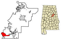
4:
3:
2:
903:
892:
889:
887:
884:
882:
879:
877:
874:
872:
869:
868:
866:
855:
850:
848:
843:
841:
836:
835:
829:
827:
823:
819:
815:
810:
807:
803:
798:
787:
782:
780:
775:
774:
771:
765:
761:
755:
754:Gantts Quarry
752:
751:
749:
747:
743:
737:
734:
732:
729:
727:
724:
722:
721:Old Eastaboga
719:
717:
714:
712:
709:
707:
704:
702:
699:
697:
694:
692:
689:
687:
684:
681:
678:
676:
673:
671:
668:
666:
663:
661:
658:
657:
655:
653:
647:
641:
638:
636:
633:
632:
630:
628:
624:
618:
615:
612:
609:
607:
604:
602:
599:
597:
594:
592:
589:
588:
586:
584:
580:
562:
559:
557:
554:
551:
548:
546:
543:
541:
538:
537:
535:
533:
529:
525:
524:
517:
510:
505:United States
502:
492:
487:
485:
480:
478:
473:
472:
469:
450:
444:
441:
429:
425:
419:
416:
411:
407:
403:
402:
397:
391:
388:
375:
369:
366:
359:
351:
347:
345:
342:
340:
336:
316:
307:
305:
302:
299:
297:
292:
290:
286:
282:
278:
274:
270:
261:
258:
251:
250:256 & 938
248:
246:
238:
235:
231:
221:
220:Central (CST)
217:
214:
212:
204:
196:
183:
175:
167:
159:
147:
144:
142:
135:
132:
130:
123:United States
122:
120:
111:
83:Coordinates:
59:
43:
34:
29:
22:
16:
826:expanding it
811:
796:
711:Liberty Hill
635:Fayetteville
634:
540:Childersburg
519:
453:. Retrieved
451:. Census.gov
443:
431:. Retrieved
418:
399:
390:
378:. Retrieved
368:
308:Demographics
303:
300:
293:
269:Fayetteville
268:
267:
245:Area code(s)
15:
716:Mardisville
652:communities
515:County seat
380:October 29,
289:2010 census
105: /
865:Categories
746:Ghost town
736:Winterboro
360:References
259:feature ID
189:Population
93:86°24′21″W
90:33°08′44″N
763:Footnotes
696:Kahatchie
680:Eastaboga
670:Chinnabee
601:Oak Grove
561:Talladega
556:Sylacauga
522:Talladega
211:Time zone
181:Elevation
146:Talladega
731:Sycamore
686:Fishtrap
665:Bemiston
818:Alabama
726:Renfroe
706:Laniers
701:Kentuck
691:Hopeful
611:Vincent
596:Munford
591:Bon Air
545:Lincoln
455:June 4,
433:May 14,
285:Alabama
134:Alabama
119:Country
660:Alpine
640:Mignon
550:Oxford
532:Cities
318:Census
262:118227
141:County
812:This
675:Curry
617:Waldo
583:Towns
343:1,422
271:is a
239:(CDT)
237:UTC-5
216:UTC-6
197:1,422
129:State
822:stub
627:CDPs
457:2016
435:2011
382:2021
339:2020
327:Note
322:Pop.
275:and
257:GNIS
152:Area
279:in
230:DST
867::
816:,
518::
503:,
426:.
408:,
404:.
398:.
332:%±
298::
291:.
283:,
853:e
846:t
839:v
828:.
682:‡
613:‡
552:‡
490:e
483:t
476:v
459:.
437:.
412:.
384:.
348:—
232:)
222:)
218:(
Text is available under the Creative Commons Attribution-ShareAlike License. Additional terms may apply.