64:
76:
1060:
44:
176:
739:
In the township the population was spread out, with 21.9% under the age of 18, 5.5% from 18 to 24, 25.0% from 25 to 44, 25.6% from 45 to 64, and 22.1% who were 65 years of age or older. The median age was 44 years. For every 100 females, there were 88.9 males. For every 100 females age 18 and over,
707:
of 2000, there were 2,544 people, 971 households, and 728 families residing in the township. The population density was 79.2 inhabitants per square mile (30.6/km). There were 1,098 housing units at an average density of 34.2 per square mile (13.2/km). The racial makeup of the township was 98.86%
735:
living together, 6.0% had a female householder with no husband present, and 25.0% were non-families. 21.8% of all households were made up of individuals, and 11.8% had someone living alone who was 65 years of age or older. The average household size was 2.44 and the average family size was 2.84.
63:
1273:
743:
The median income for a household in the township was $ 34,643, and the median income for a family was $ 42,232. Males had a median income of $ 32,176 versus $ 20,417 for females. The
345:, a separate municipality, lies along the river in the southwestern corner of the township. Unincorporated communities in the township include Macedonia, Arch Rock, Jericho Mills, and
983:
314:, the township has a total area of 32.5 square miles (84.1 km), of which 32.0 square miles (83.0 km) are land and 0.46 square miles (1.2 km), or 1.37%, are water.
1317:
1123:
1133:
1098:
1083:
75:
1108:
334:
43:
1312:
1138:
1113:
326:
1327:
1103:
868:
976:
261:
969:
1171:
1322:
1118:
767:
108:
961:
797:
1128:
1088:
713:
322:
49:
1166:
1156:
1078:
993:
377:
318:
280:
113:
1250:
1222:
945:
876:
311:
1049:
369:
208:
1207:
1039:
1015:
669:
654:
639:
624:
609:
594:
579:
564:
549:
534:
519:
504:
489:
474:
459:
444:
429:
414:
342:
288:
1202:
1187:
1161:
1044:
346:
249:
86:
869:"Geographic Identifiers: 2010 Census Summary File 1 (G001): Fermanagh township, Juniata County, Pennsylvania"
1197:
1176:
1148:
1070:
731:
There were 971 households, out of which 30.4% had children under the age of 18 living with them, 65.6% were
376:
runs through the southern part of the township, coming from the west out of
Mifflintown and leading east to
365:
276:
34:
1227:
1026:
721:
338:
1034:
373:
229:
1257:
725:
218:
717:
709:
1217:
1212:
747:
for the township was $ 17,315. About 7.4% of families and 8.9% of the population were below the
919:
817:
744:
352:
Shade
Mountain forms the northern border of the township, ending at the Lewistown Narrows, a
905:
368:
and crosses
Fermanagh Township, passing to the east of Mifflintown and leading southeast to
295:
829:
361:
1306:
357:
330:
254:
748:
284:
101:
899:
1008:
364:, together forming a four-lane expressway, travels through the gap westward to
96:
1288:
1275:
353:
199:
53:
1241:‡This populated place also has portions in an adjacent county or counties.
751:, including 11.0% of those under age 18 and 6.0% of those age 65 or over.
732:
237:
299:
704:
843:
68:
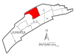
Map of
Juniata County, Pennsylvania highlighting Fermanagh Township
225:
204:
965:
1058:
291:, an increase over the figure of 2,811 tabulated in 2010.
941:
901:
The Origin of
Certain Place Names in the United States
791:
789:
787:
785:
1236:
1186:
1147:
1069:
1025:
260:
248:
236:
215:
198:
190:
182:
169:
164:
156:
148:
140:
135:
127:
119:
107:
95:
85:
23:
287:, United States. The population was 2,865 at the
977:
863:
861:
8:
798:"City and Town Population Totals: 2020-2022"
356:traversed by the Juniata River. U.S. Routes
333:forms the western and southern borders with
984:
970:
962:
728:of any race were 0.55% of the population.
387:
20:
1318:Townships in Juniata County, Pennsylvania
759:
259:
235:
197:
163:
134:
118:
84:
60:
40:
18:Township in Pennsylvania, United States
825:
815:
407:
247:
214:
189:
181:
168:
155:
152:32.05 sq mi (83.00 km)
147:
144:32.49 sq mi (84.15 km)
139:
126:
106:
94:
72:
7:
1313:Populated places established in 1754
875:. U.S. Census Bureau. Archived from
720:, and 0.20% from two or more races.
1328:1754 establishments in Pennsylvania
160:0.44 sq mi (1.15 km)
80:Map of Juniata County, Pennsylvania
992:Municipalities and communities of
920:"Census of Population and Housing"
397:
317:Fermanagh Township is bordered by
14:
844:"Fermanagh Township PA ZIP Code"
175:
174:
74:
62:
42:
1:
904:. Govt. Print. Off. pp.
770:. United States Census Bureau
294:The township was named after
995:Juniata County, Pennsylvania
946:United States Census Bureau
768:"2016 U.S. Gazetteer Files"
312:United States Census Bureau
194:89.00/sq mi (34.36/km)
183: • Estimate
1344:
1323:Townships in Pennsylvania
1246:
1056:
1006:
696:
683:
668:
653:
638:
623:
608:
593:
578:
563:
548:
533:
518:
503:
488:
473:
458:
443:
428:
413:
406:
401:
396:
393:
73:
61:
41:
32:
898:Gannett, Henry (1905).
846:. zipdatamaps.com. 2023
740:there were 84.7 males.
1063:
1289:40.61667°N 77.41639°W
1062:
942:"U.S. Census website"
697:U.S. Decennial Census
389:Historical population
374:Pennsylvania Route 35
217: • Summer (
1259:United States portal
879:on February 13, 2020
191: • Density
1294:40.61667; -77.41639
1285: /
1252:Pennsylvania portal
873:American Factfinder
796:Bureau, US Census.
390:
25:Fermanagh Township,
1064:
828:has generic name (
804:. US Census Bureau
388:
329:to the south. The
273:Fermanagh Township
170: • Total
157: • Water
141: • Total
1268:
1267:
745:per capita income
701:
700:
310:According to the
270:
269:
149: • Land
48:A road cut along
1335:
1300:
1299:
1297:
1296:
1295:
1290:
1286:
1283:
1282:
1281:
1278:
1260:
1253:
1061:
1018:
1011:
1001:
996:
986:
979:
972:
963:
957:
956:
954:
952:
938:
932:
931:
929:
927:
916:
910:
909:
895:
889:
888:
886:
884:
865:
856:
855:
853:
851:
840:
834:
833:
827:
823:
821:
813:
811:
809:
793:
780:
779:
777:
775:
764:
714:African American
409:
404:
399:
391:
335:Milford Township
325:to the east and
323:Fayette Township
296:County Fermanagh
222:
178:
177:
78:
66:
46:
21:
1343:
1342:
1338:
1337:
1336:
1334:
1333:
1332:
1303:
1302:
1293:
1291:
1287:
1284:
1279:
1276:
1274:
1272:
1271:
1269:
1264:
1258:
1251:
1242:
1232:
1189:
1182:
1143:
1065:
1059:
1054:
1021:
1016:
1009:
1002:
999:
994:
990:
960:
950:
948:
940:
939:
935:
925:
923:
918:
917:
913:
897:
896:
892:
882:
880:
867:
866:
859:
849:
847:
842:
841:
837:
824:
814:
807:
805:
795:
794:
783:
773:
771:
766:
765:
761:
757:
733:married couples
402:
386:
327:Walker Township
308:
244:
216:
81:
69:
57:
37:
28:
26:
19:
12:
11:
5:
1341:
1339:
1331:
1330:
1325:
1320:
1315:
1305:
1304:
1266:
1265:
1263:
1262:
1255:
1247:
1244:
1243:
1240:
1238:
1234:
1233:
1231:
1230:
1225:
1220:
1215:
1210:
1205:
1200:
1194:
1192:
1188:Unincorporated
1184:
1183:
1181:
1180:
1174:
1169:
1167:McAlisterville
1164:
1159:
1157:East Waterford
1153:
1151:
1145:
1144:
1142:
1141:
1136:
1131:
1126:
1121:
1116:
1111:
1106:
1101:
1096:
1091:
1086:
1081:
1075:
1073:
1067:
1066:
1057:
1055:
1053:
1052:
1047:
1042:
1037:
1031:
1029:
1023:
1022:
1007:
1004:
1003:
991:
989:
988:
981:
974:
966:
959:
958:
933:
911:
890:
857:
835:
781:
758:
756:
753:
699:
698:
694:
693:
690:
688:
685:
681:
680:
677:
675:
672:
666:
665:
662:
660:
657:
651:
650:
647:
645:
642:
636:
635:
632:
630:
627:
621:
620:
617:
615:
612:
606:
605:
602:
600:
597:
591:
590:
587:
585:
582:
576:
575:
572:
570:
567:
561:
560:
557:
555:
552:
546:
545:
542:
540:
537:
531:
530:
527:
525:
522:
516:
515:
512:
510:
507:
501:
500:
497:
495:
492:
486:
485:
482:
480:
477:
471:
470:
467:
465:
462:
456:
455:
452:
450:
447:
441:
440:
437:
435:
432:
426:
425:
422:
420:
417:
411:
410:
405:
400:
395:
385:
382:
378:McAlisterville
321:to the north,
319:Mifflin County
307:
304:
281:Juniata County
268:
267:
264:
258:
257:
252:
246:
245:
242:
240:
234:
233:
223:
213:
212:
202:
196:
195:
192:
188:
187:
184:
180:
179:
171:
167:
166:
162:
161:
158:
154:
153:
150:
146:
145:
142:
138:
137:
133:
132:
129:
125:
124:
121:
117:
116:
111:
105:
104:
99:
93:
92:
89:
83:
82:
79:
71:
70:
67:
59:
58:
50:U.S. Route 322
47:
39:
38:
33:
30:
29:
24:
17:
13:
10:
9:
6:
4:
3:
2:
1340:
1329:
1326:
1324:
1321:
1319:
1316:
1314:
1311:
1310:
1308:
1301:
1298:
1261:
1256:
1254:
1249:
1248:
1245:
1239:
1235:
1229:
1226:
1224:
1223:Oakland Mills
1221:
1219:
1216:
1214:
1211:
1209:
1206:
1204:
1201:
1199:
1196:
1195:
1193:
1191:
1185:
1178:
1175:
1173:
1170:
1168:
1165:
1163:
1160:
1158:
1155:
1154:
1152:
1150:
1146:
1140:
1137:
1135:
1132:
1130:
1127:
1125:
1122:
1120:
1117:
1115:
1112:
1110:
1107:
1105:
1102:
1100:
1097:
1095:
1092:
1090:
1087:
1085:
1082:
1080:
1077:
1076:
1074:
1072:
1068:
1051:
1048:
1046:
1043:
1041:
1038:
1036:
1033:
1032:
1030:
1028:
1024:
1020:
1019:
1012:
1005:
1000:United States
997:
987:
982:
980:
975:
973:
968:
967:
964:
947:
943:
937:
934:
921:
915:
912:
907:
903:
902:
894:
891:
878:
874:
870:
864:
862:
858:
845:
839:
836:
831:
819:
803:
799:
792:
790:
788:
786:
782:
769:
763:
760:
754:
752:
750:
746:
741:
737:
734:
729:
727:
723:
719:
715:
711:
706:
695:
691:
689:
686:
682:
678:
676:
673:
671:
667:
663:
661:
658:
656:
652:
648:
646:
643:
641:
637:
633:
631:
628:
626:
622:
618:
616:
613:
611:
607:
603:
601:
598:
596:
592:
588:
586:
583:
581:
577:
573:
571:
568:
566:
562:
558:
556:
553:
551:
547:
543:
541:
538:
536:
532:
528:
526:
523:
521:
517:
513:
511:
508:
506:
502:
498:
496:
493:
491:
487:
483:
481:
478:
476:
472:
468:
466:
463:
461:
457:
453:
451:
448:
446:
442:
438:
436:
433:
431:
427:
423:
421:
418:
416:
412:
392:
383:
381:
379:
375:
371:
367:
363:
359:
355:
350:
348:
344:
340:
336:
332:
331:Juniata River
328:
324:
320:
315:
313:
305:
303:
301:
297:
292:
290:
286:
282:
278:
274:
265:
263:
256:
253:
251:
241:
239:
231:
227:
224:
220:
210:
206:
203:
201:
193:
185:
172:
159:
151:
143:
130:
122:
115:
112:
110:
103:
100:
98:
91:United States
90:
88:
77:
65:
55:
52:with visible
51:
45:
36:
31:
22:
16:
1270:
1093:
1050:Thompsontown
1014:
949:. Retrieved
936:
924:. Retrieved
922:. Census.gov
914:
900:
893:
883:November 21,
881:. Retrieved
877:the original
872:
848:. Retrieved
838:
826:|last1=
806:. Retrieved
801:
772:. Retrieved
762:
749:poverty line
742:
738:
730:
702:
384:Demographics
370:Thompsontown
351:
316:
309:
293:
285:Pennsylvania
272:
271:
266:42-067-25648
128:Incorporated
102:Pennsylvania
27:Pennsylvania
15:
1292: /
1208:Honey Grove
1190:communities
1124:Susquehanna
1119:Spruce Hill
1040:Mifflintown
1017:Mifflintown
1010:County seat
951:January 31,
808:January 31,
684:2022 (est.)
343:Mifflintown
289:2020 census
56:rock strata
1307:Categories
1280:77°24′59″W
1277:40°37′00″N
1203:Cuba Mills
1162:East Salem
1045:Port Royal
802:Census.gov
774:August 14,
755:References
703:As of the
347:Cuba Mills
165:Population
1237:Footnotes
1198:Cocolamus
1177:Richfield
1134:Tuscarora
1099:Greenwood
1094:Fermanagh
1071:Townships
366:Lewistown
354:water gap
306:Geography
262:FIPS code
250:Area code
200:Time zone
54:anticline
1228:Oriental
1084:Delaware
1027:Boroughs
818:cite web
722:Hispanic
716:, 0.63%
712:, 0.31%
277:township
238:ZIP code
35:Township
1129:Turbett
1109:Milford
1089:Fayette
1035:Mifflin
926:June 4,
850:May 13,
339:borough
300:Ireland
120:Settled
114:Juniata
87:Country
1172:Mexico
1139:Walker
1114:Monroe
726:Latino
705:census
499:−12.2%
484:−13.1%
394:Census
337:. The
173:2,865
109:County
1079:Beale
718:Asian
710:White
692:−0.4%
687:2,854
674:2,865
664:10.5%
659:2,811
649:13.1%
644:2,544
629:2,249
619:13.0%
614:2,097
604:28.7%
599:1,855
589:11.1%
584:1,441
574:11.7%
569:1,297
554:1,161
544:31.7%
539:1,076
529:−1.0%
514:−2.9%
469:12.2%
464:1,114
454:−9.8%
439:24.1%
434:1,101
275:is a
243:17059
226:UTC-4
205:UTC-5
186:2,854
97:State
1218:Nook
1213:Maze
1149:CDPs
1104:Lack
953:2008
928:2016
885:2018
852:2023
830:help
810:2024
776:2017
679:1.9%
670:2020
655:2010
640:2000
634:7.2%
625:1990
610:1980
595:1970
580:1960
565:1950
559:7.9%
550:1940
535:1930
520:1920
505:1910
490:1900
475:1890
460:1880
445:1870
430:1860
415:1850
403:Note
398:Pop.
360:and
136:Area
131:1755
123:1754
906:125
724:or
524:817
509:825
494:850
479:968
449:993
419:887
362:322
341:of
298:in
279:in
255:717
230:EDT
219:DST
209:EST
1309::
1013::
998:,
944:.
871:.
860:^
822::
820:}}
816:{{
800:.
784:^
408:%±
380:.
372:.
358:22
349:.
302:.
283:,
1179:‡
985:e
978:t
971:v
955:.
930:.
908:.
887:.
854:.
832:)
812:.
778:.
424:—
232:)
228:(
221:)
211:)
207:(
Text is available under the Creative Commons Attribution-ShareAlike License. Additional terms may apply.