39:
275:
471:
457:
123:
505:
142:
104:
86:
631:
489:
437:
248:. From that point, Meyer's ferry would take the travellers across the river to Meyer's Ferry Road at Elston (as Surfers Paradise was then known) along which the travellers would walk to the surf beach. Businesses established along Meyer's Ferry Road at Elston which created the main street of Surfers Paradise now known as
263:
The present day Ferry Road is only southbound part of the original Ferry Road, the remainder which meandered in an easterly direction to the end of the spit and the ferry service was lost as the river was embanked and islands created.
426:
180:
Ferry Road is a continuation of High Street, Southport. It runs for about 2.9 kilometres (1.8 mi) to the intersection with
Slatyer Avenue and Thomas Drive, from where it continues as
252:. Although the surf beaches of Elston were a popular destination, the lack of road access limited the extent of residential and commercial development. It was not until 1925 that the
203:
419:
298:
460:
412:
668:
687:
349:
580:
592:
200:, travellers would follow the Meyer's Ferry Road (now simply Ferry Road) to a spit of land that created a narrow point in the river (
661:
302:
692:
697:
654:
559:
260:
which opened up
Surfers Paradise for tourism and associated development and eliminated the need for the ferry service.
169:
549:
569:
564:
357:
253:
529:
387:
353:
279:
441:
257:
245:
161:
474:
197:
157:
46:
404:
38:
328:
508:
478:
638:
240:). The narrow spit is no longer in existence due to changes in the river and the creation of
274:
379:
630:
554:
524:
241:
681:
544:
249:
534:
464:
193:
181:
145:
79:
436:
488:
165:
29:
607:
594:
219:
205:
324:
192:
In 1887, German immigrant Johann Meyer operated a ferry across the
408:
168:, Australia. Originally a suburban street, it is now part of
637:
This
Australian road or road transport-related article is a
301:. Queensland Government. 21 November 2017. Archived from
642:
299:"Southport-Burleigh Road network improvement project"
517:
496:
448:
136:
114:
98:
93:
78:
70:
62:
57:
23:
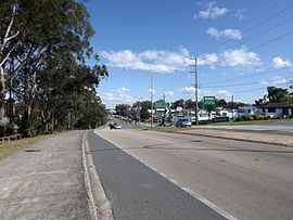
184:. There are no major intersections on this road.
662:
420:
8:
461:Pacific Motorway (Brisbane–Brunswick Heads)
669:
655:
427:
413:
405:
172:, a state controlled road (State Route 3)
37:
20:
16:Road in Southport, Queensland, Australia
380:"History: Understanding the Gold Coast"
290:
479:Coomera Connector (under construction)
7:
627:
625:
688:Roads on the Gold Coast, Queensland
641:. You can help Knowledge (XXG) by
14:
629:
503:
487:
469:
455:
435:
273:
256:was built between Southport and
140:
121:
102:
84:
244:but is in the vicinity of the
1:
384:Cultural Precinct Gold Coast
581:Transport on the Gold Coast
440:Road infrastructure in the
280:Australian Roads portal
714:
624:
608:27.9852639°S 153.4114194°E
570:Surfers Paradise Boulevard
350:"Surfers Paradise history"
128:(State Route 20)
578:
485:
149:(State Route 3)
109:(State Route 3)
74:2.9 km (1.8 mi)
53:
45:
36:
613:-27.9852639; 153.4114194
530:Burleigh Connection Road
156:Ferry Road is a road in
560:Southport–Burleigh Road
388:Gold Coast City Council
354:Gold Coast City Council
170:Southport–Burleigh Road
550:Nerang–Broadbeach Road
246:Gold Coast Arts Centre
693:Southport, Queensland
565:Southport–Nerang Road
475:Smith Street Motorway
698:Australia road stubs
220:28.0011°S 153.4247°E
604: /
329:State of Queensland
305:on 27 February 2018
215: /
58:General information
509:Gold Coast Highway
325:"Queensland Globe"
225:-28.0011; 153.4247
89:State Route 3
650:
649:
587:
586:
154:
153:
150:
129:
110:
705:
671:
664:
657:
633:
626:
619:
618:
616:
615:
614:
609:
605:
602:
601:
600:
597:
507:
506:
491:
473:
472:
459:
458:
439:
429:
422:
415:
406:
399:
398:
396:
394:
376:
370:
369:
367:
365:
356:. Archived from
346:
340:
339:
337:
335:
321:
315:
314:
312:
310:
295:
278:
277:
239:
238:
236:
235:
234:
232:
227:
226:
221:
216:
213:
212:
211:
208:
148:
144:
143:
127:
125:
124:
108:
106:
105:
88:
87:
41:
21:
713:
712:
708:
707:
706:
704:
703:
702:
678:
677:
676:
675:
622:
612:
610:
606:
603:
598:
595:
593:
591:
590:
588:
583:
574:
513:
504:
492:
483:
470:
456:
444:
433:
403:
402:
392:
390:
378:
377:
373:
363:
361:
348:
347:
343:
333:
331:
323:
322:
318:
308:
306:
297:
296:
292:
287:
272:
270:
230:
228:
224:
222:
218:
217:
214:
209:
206:
204:
202:
201:
190:
178:
141:
132:
122:
103:
94:Major junctions
85:
80:Route number(s)
32:
27:
26:
17:
12:
11:
5:
711:
709:
701:
700:
695:
690:
680:
679:
674:
673:
666:
659:
651:
648:
647:
634:
599:153°24′41.11″E
585:
584:
579:
576:
575:
573:
572:
567:
562:
557:
555:Robina Parkway
552:
547:
542:
537:
532:
527:
525:Bermuda Street
521:
519:
515:
514:
512:
511:
500:
498:
494:
493:
486:
484:
482:
481:
467:
452:
450:
446:
445:
434:
432:
431:
424:
417:
409:
401:
400:
371:
360:on 4 June 2016
341:
316:
289:
288:
286:
283:
269:
266:
254:Jubilee Bridge
242:Chevron Island
189:
186:
177:
174:
152:
151:
138:
134:
133:
131:
130:
118:
116:
112:
111:
100:
96:
95:
91:
90:
82:
76:
75:
72:
68:
67:
64:
60:
59:
55:
54:
51:
50:
43:
42:
34:
33:
28:
24:
15:
13:
10:
9:
6:
4:
3:
2:
710:
699:
696:
694:
691:
689:
686:
685:
683:
672:
667:
665:
660:
658:
653:
652:
646:
644:
640:
635:
632:
628:
623:
620:
617:
582:
577:
571:
568:
566:
563:
561:
558:
556:
553:
551:
548:
546:
545:Gooding Drive
543:
541:
538:
536:
533:
531:
528:
526:
523:
522:
520:
516:
510:
502:
501:
499:
495:
490:
480:
476:
468:
466:
462:
454:
453:
451:
447:
443:
438:
430:
425:
423:
418:
416:
411:
410:
407:
389:
385:
381:
375:
372:
359:
355:
351:
345:
342:
330:
326:
320:
317:
304:
300:
294:
291:
284:
282:
281:
276:
267:
265:
261:
259:
255:
251:
250:Cavill Avenue
247:
243:
237:
231:Meyer's Ferry
199:
195:
187:
185:
183:
175:
173:
171:
167:
163:
159:
147:
139:
135:
126:Queen Street
120:
119:
117:
113:
101:
97:
92:
83:
81:
77:
73:
69:
65:
61:
56:
52:
48:
44:
40:
35:
31:
22:
19:
643:expanding it
636:
621:
596:27°59′6.95″S
589:
539:
535:Bundall Road
518:Major roads:
465:Tugun Bypass
393:29 September
391:. Retrieved
383:
374:
362:. Retrieved
358:the original
344:
334:27 September
332:. Retrieved
319:
307:. Retrieved
303:the original
293:
271:
262:
194:Nerang River
191:
182:Bundall Road
179:
155:
146:Bundall Road
107:High Street
18:
611: /
309:27 February
223: /
210:153°25′29″E
682:Categories
540:Ferry Road
449:Motorways:
442:Gold Coast
364:15 January
285:References
258:Main Beach
229: (
207:28°00′04″S
166:Queensland
162:Gold Coast
30:Queensland
25:Ferry Road
497:Highways:
198:Southport
176:Geography
160:, on the
158:Southport
137:South end
99:North end
47:Southport
268:See also
196:. From
188:History
115:
71:Length
49:, 2015
639:stub
463:and
395:2015
366:2015
336:2015
311:2018
66:Road
63:Type
684::
477:,
386:.
382:.
352:.
327:.
164:,
670:e
663:t
656:v
645:.
428:e
421:t
414:v
397:.
368:.
338:.
313:.
233:)
Text is available under the Creative Commons Attribution-ShareAlike License. Additional terms may apply.