43:
82:
114:
260:
221:
213:
969:
235:
266:
271:
595:"}},"text\/plain":{"en":{"":"heading"}}},"{\"value\":{\"amount\":\"+233.23157894736843\",\"unit\":\"http:\\\/\\\/www.wikidata.org\\\/entity\\\/Q28390\"},\"type\":\"quantity\"}":{"text\/html":{"en":{"P7787":"233.23157894736843
204:
103:
591:
65:
61:
57:
53:
47:
968:
963:
73:
42:
312:– You must give appropriate credit, provide a link to the license, and indicate if changes were made. You may do so in any reasonable manner, but not in any way that suggests the licensor endorses you or your use.
147:
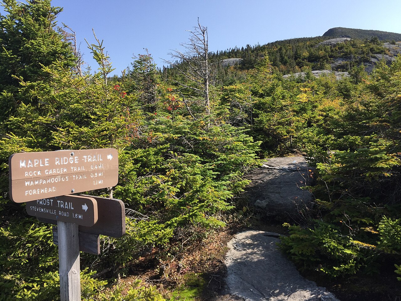
2017-09-11 10 27 43 View east along the Maple Ridge Trail at the junction with the Frost Trail on the western slopes of Mount
Mansfield within Mount Mansfield State Forest in Underhill, Chittenden County,
158:
View east along the Maple Ridge Trail at the junction with the Frost Trail on the western slopes of Mount
Mansfield within Mount Mansfield State Forest in Underhill, Chittenden County, Vermont
592:
802:
714:
678:
544:
508:
228:
1227:
1066:
This file contains additional information, probably added from the digital camera or scanner used to create or digitize it.
319:
428:
897:
860:
823:
768:
734:
698:
662:
633:
606:
492:
464:
449:
436:
421:
795:
564:
528:
394:
377:
1023:
599:"}},"text\/plain":{"en":{"P7787":"233.23157894736843 degree"}}}}": -->
456:
281:
1069:
If the file has been modified from its original state, some details may not fully reflect the modified file.
1293:
318:– If you remix, transform, or build upon the material, you must distribute your contributions under the
1000:
278:
996:
The following pages on the
English Knowledge use this file (pages on other projects are not listed):
1313:
122:
471:
1196:
167:
1053:
234:
1381:
1303:
1267:
1095:
979:
109:
253:
I, the copyright holder of this work, hereby publish it under the following license:
1135:
218:
1347:
187:
1115:
1078:
1105:
1088:
1005:
936:
Click on a date/time to view the file as it appeared at that time.
220:
205:
44° 31′ 06.81″ N, 72° 49′ 55.64″ W
195:
97:
545:
Creative
Commons Attribution-ShareAlike 4.0 International
361:
Add a one-line explanation of what this file represents
87:(3,264 × 2,448 pixels, file size: 3.81 MB, MIME type:
1043:
1033:
141:
121:
Commons is a freely licensed media file repository.
329:https://creativecommons.org/licenses/by-sa/4.0
102:
335:Creative Commons Attribution-Share Alike 4.0
259:
8:
596:
295:– to copy, distribute and transmit the work
1071:
938:
472:http://commons.wikimedia.org/User:Famartin
357:
1016:The following other wikis use this file:
282:Attribution-Share Alike 4.0 International
784:08ca99e29409b692c94440b2c7aea831e0b162d8
210:
1461:
1453:
1445:
1437:
1429:
1421:
1413:
1405:
1397:
1389:
1379:
1371:
1363:
1355:
1345:
1337:
1329:
1321:
1311:
1301:
1291:
1283:
1275:
1265:
1244:
1236:
1225:
1217:
1209:
1201:
1191:
1183:
1175:
1167:
1159:
1151:
1143:
1132:
1124:
1113:
1103:
1093:
1083:
998:
911:
895:
874:
858:
837:
821:
782:
766:
748:
732:
712:
696:
676:
660:
620:
604:
578:
562:
542:
526:
506:
490:
408:
392:
375:
372:
353:
346:
198:
227:View this and other nearby images on:
1073:
7:
1447:Reference for bearing of destination
986:User created page with UploadWizard
927:
270:
265:
1064:
366:
360:
256:
252:
152:
134:
80:
1100:1/1,041 sec (0.00096061479346782)
365:
1431:Reference for direction of image
1126:Date and time of data generation
607:coordinates of the point of view
351:
306:Under the following conditions:
277:This file is licensed under the
269:
264:
258:
233:
219:
211:
101:
31:
21:
348:
153:
14:
1164:871.528 meters above sea level
347:
26:
1:
1368:A directly photographed image
1318:Flash did not fire, auto mode
715:original creation by uploader
622:44°31'6.809"N, 72°49'55.639"W
36:
1331:DateTimeDigitized subseconds
422:object of statement has role
373:Items portrayed in this file
1323:DateTimeOriginal subseconds
1238:Date and time of digitizing
168:11 September 2017, 10:27:43
1483:
1391:Focal length in 35 mm film
1360:One-chip color area sensor
1339:Supported Flashpix version
1050:Usage on uk.wikipedia.org
1040:Usage on ha.wikipedia.org
1030:Usage on fo.wikipedia.org
1020:Usage on bn.wikipedia.org
320:same or compatible license
1246:Meaning of each component
1203:File change date and time
928:
177:
16:
1241:10:27, 11 September 2017
1206:10:27, 11 September 2017
1129:10:27, 11 September 2017
350:
286:
108:This is a file from the
1407:GPS time (atomic clock)
985:
183:
173:
166:
163:
144:
112:. Information from its
1455:Bearing of destination
964:07:47, 16 January 2018
239:44.518558; -72.832122
115:description page there
46:Size of this preview:
1423:Speed of GPS receiver
1177:Horizontal resolution
1001:Geography of Vermont
796:determination method
74:3,264 × 2,448 pixels
70:2,560 × 1,920 pixels
1418:Kilometers per hour
1211:Y and C positioning
1185:Vertical resolution
1075:Camera manufacturer
640:233.23157894736843
301:– to adapt the work
52:Other resolutions:
1439:Direction of image
1399:Scene capture type
1386:Auto white balance
450:Wikimedia username
437:author name string
66:1,280 × 960 pixels
62:1,024 × 768 pixels
1470:
1469:
1466:11 September 2017
1012:Global file usage
989:
598:
580:11 September 2017
529:copyright license
359:
244:
243:
193:
192:
130:
129:
110:Wikimedia Commons
32:Global file usage
1474:
1219:Exposure Program
1156:72° 49′ 55.64″ W
1072:
976:
916:
879:
842:
805:
800:
644:
643:
638:
493:copyright status
474:
469:
459:
454:
444:
441:
431:
426:
342:
339:
336:
333:
330:
322:as the original.
279:Creative Commons
273:
272:
268:
267:
262:
261:
240:
237:
223:
222:
216:
215:
214:
208:
207:
196:
179:
169:
157:
149:
142:
126:
105:
104:
98:
92:
90:
77:
58:640 × 480 pixels
54:320 × 240 pixels
48:800 × 600 pixels
1482:
1481:
1477:
1476:
1475:
1473:
1472:
1471:
1458:53.231566820276
1442:233.23157894737
1288:8.9629990262902
1285:APEX brightness
1280:2.2750071245369
1272:10.023174971031
1148:44° 31′ 6.81″ N
1060:
1010:
997:
990:
982:
974:
930:
929:
926:
925:
924:
923:
922:
921:
920:
919:
917:
914:
904:
903:
902:
900:
889:
888:
887:
886:
885:
884:
883:
882:
880:
877:
867:
866:
865:
863:
852:
851:
850:
849:
848:
847:
846:
845:
843:
840:
830:
829:
828:
826:
815:
814:
813:
812:
811:
810:
809:
808:
807:
806:
801:
798:
789:
788:
787:
785:
775:
774:
773:
771:
760:
759:
758:
757:
756:
755:
754:
753:
751:
741:
740:
739:
737:
726:
725:
724:
723:
722:
721:
720:
719:
717:
705:
704:
703:
701:
690:
689:
688:
687:
686:
685:
684:
683:
681:
669:
668:
667:
665:
654:
653:
652:
651:
650:
649:
648:
647:
646:
645:
641:
639:
636:
627:
626:
625:
623:
613:
612:
611:
609:
590:
589:
588:
587:
586:
585:
584:
583:
581:
571:
570:
569:
567:
556:
555:
554:
553:
552:
551:
550:
549:
547:
535:
534:
533:
531:
520:
519:
518:
517:
516:
515:
514:
513:
511:
499:
498:
497:
495:
484:
483:
482:
481:
480:
479:
478:
477:
476:
475:
470:
467:
461:
460:
455:
452:
446:
445:
442:
439:
433:
432:
427:
424:
415:
414:
413:
411:
401:
400:
399:
397:
386:
385:
384:
383:
382:
380:
364:
363:
362:
345:
344:
343:
340:
337:
334:
331:
328:
327:
285:
274:
255:
254:
249:
238:
212:
203:
202:
199:Camera location
194:
159:
146:
139:
132:
131:
120:
119:
118:is shown below.
94:
88:
86:
79:
78:
51:
12:
11:
5:
1480:
1478:
1468:
1467:
1464:
1460:
1459:
1456:
1452:
1451:
1450:True direction
1448:
1444:
1443:
1440:
1436:
1435:
1434:True direction
1432:
1428:
1427:
1424:
1420:
1419:
1416:
1412:
1411:
1408:
1404:
1403:
1400:
1396:
1395:
1392:
1388:
1387:
1384:
1378:
1377:
1374:
1370:
1369:
1366:
1362:
1361:
1358:
1357:Sensing method
1354:
1353:
1350:
1344:
1343:
1340:
1336:
1335:
1332:
1328:
1327:
1324:
1320:
1319:
1316:
1310:
1309:
1306:
1300:
1299:
1296:
1290:
1289:
1286:
1282:
1281:
1278:
1274:
1273:
1270:
1264:
1263:
1262:
1261:
1260:does not exist
1258:
1255:
1252:
1247:
1243:
1242:
1239:
1235:
1234:
1231:
1224:
1223:
1222:Normal program
1220:
1216:
1215:
1212:
1208:
1207:
1204:
1200:
1199:
1194:
1190:
1189:
1186:
1182:
1181:
1178:
1174:
1173:
1170:
1166:
1165:
1162:
1158:
1157:
1154:
1150:
1149:
1146:
1142:
1141:
1138:
1131:
1130:
1127:
1123:
1122:
1119:
1112:
1111:
1108:
1102:
1101:
1098:
1092:
1091:
1086:
1082:
1081:
1076:
1063:
1059:
1058:
1057:
1056:
1048:
1047:
1046:
1038:
1037:
1036:
1028:
1027:
1026:
1014:
1013:
1009:
1008:
1003:
995:
994:
993:
988:
987:
984:
980:
977:
973:3,264 × 2,448
971:
966:
961:
957:
956:
953:
950:
947:
944:
941:
934:
933:
918:
912:
910:
909:
908:
907:
906:
905:
901:
896:
894:
893:
892:
891:
890:
881:
875:
873:
872:
871:
870:
869:
868:
864:
859:
857:
856:
855:
854:
853:
844:
838:
836:
835:
834:
833:
832:
831:
827:
822:
820:
819:
818:
817:
816:
794:
793:
792:
791:
790:
786:
783:
781:
780:
779:
778:
777:
776:
772:
767:
765:
764:
763:
762:
761:
752:
749:
747:
746:
745:
744:
743:
742:
738:
733:
731:
730:
729:
728:
727:
718:
713:
711:
710:
709:
708:
707:
706:
702:
699:source of file
697:
695:
694:
693:
692:
691:
682:
677:
675:
674:
673:
672:
671:
670:
666:
661:
659:
658:
657:
656:
655:
632:
631:
630:
629:
628:
624:
621:
619:
618:
617:
616:
615:
614:
610:
605:
603:
602:
601:
600:
594:
582:
579:
577:
576:
575:
574:
573:
572:
568:
563:
561:
560:
559:
558:
557:
548:
543:
541:
540:
539:
538:
537:
536:
532:
527:
525:
524:
523:
522:
521:
512:
507:
505:
504:
503:
502:
501:
500:
496:
491:
489:
488:
487:
486:
485:
463:
462:
448:
447:
435:
434:
420:
419:
418:
417:
416:
412:
409:
407:
406:
405:
404:
403:
402:
398:
393:
391:
390:
389:
388:
387:
381:
376:
374:
371:
370:
369:
368:
367:
356:
355:
352:
349:
326:
325:
324:
323:
313:
304:
303:
302:
296:
289:You are free:
276:
275:
257:
251:
250:
248:
245:
242:
241:
231:
225:
200:
191:
190:
185:
181:
180:
175:
171:
170:
165:
161:
160:
150:
140:
138:
135:
133:
128:
127:
106:
96:
95:
45:
41:
40:
39:
34:
29:
24:
19:
13:
10:
9:
6:
4:
3:
2:
1479:
1465:
1462:
1457:
1454:
1449:
1446:
1441:
1438:
1433:
1430:
1425:
1422:
1417:
1414:
1409:
1406:
1401:
1398:
1393:
1390:
1385:
1383:
1382:White balance
1380:
1376:Auto exposure
1375:
1373:Exposure mode
1372:
1367:
1364:
1359:
1356:
1351:
1349:
1346:
1341:
1338:
1333:
1330:
1325:
1322:
1317:
1315:
1312:
1307:
1305:
1304:Metering mode
1302:
1297:
1295:
1294:Exposure bias
1292:
1287:
1284:
1279:
1277:APEX aperture
1276:
1271:
1269:
1268:Shutter speed
1266:
1259:
1256:
1253:
1250:
1249:
1248:
1245:
1240:
1237:
1232:
1229:
1226:
1221:
1218:
1213:
1210:
1205:
1202:
1198:
1195:
1193:Software used
1192:
1187:
1184:
1179:
1176:
1171:
1168:
1163:
1160:
1155:
1152:
1147:
1144:
1139:
1137:
1133:
1128:
1125:
1120:
1117:
1114:
1109:
1107:
1104:
1099:
1097:
1096:Exposure time
1094:
1090:
1087:
1084:
1080:
1077:
1074:
1070:
1067:
1061:
1055:
1052:
1051:
1049:
1045:
1042:
1041:
1039:
1035:
1032:
1031:
1029:
1025:
1022:
1021:
1019:
1018:
1017:
1011:
1007:
1004:
1002:
999:
991:
983:
978:
972:
970:
967:
965:
962:
959:
958:
954:
951:
948:
945:
942:
940:
939:
937:
931:
899:
862:
825:
804:
797:
770:
736:
716:
700:
680:
664:
663:captured with
635:
608:
566:
546:
530:
510:
494:
473:
466:
458:
451:
438:
430:
423:
396:
379:
332:CC BY-SA 4.0
321:
317:
314:
311:
308:
307:
305:
300:
297:
294:
291:
290:
288:
287:
283:
280:
263:
246:
236:
232:
230:
229:OpenStreetMap
226:
224:
206:
201:
197:
189:
186:
182:
176:
172:
162:
156:
151:
143:
136:
124:
117:
116:
111:
107:
100:
99:
93:
84:
83:Original file
75:
71:
67:
63:
59:
55:
49:
44:
38:
35:
33:
30:
28:
25:
23:
20:
18:
15:
1136:focal length
1085:Camera model
1068:
1065:
1015:
935:
932:File history
429:photographer
315:
309:
298:
292:
209:
154:
123:You can help
113:
81:
22:File history
1410:14:27:43.08
1348:Color space
1169:Orientation
509:copyrighted
316:share alike
310:attribution
148:Vermont.jpg
145:Description
1415:Speed unit
1365:Scene type
992:File usage
949:Dimensions
839:3,997,697
750:image/jpeg
735:media type
410:some value
89:image/jpeg
27:File usage
1153:Longitude
1116:ISO speed
975:(3.81 MB)
946:Thumbnail
943:Date/Time
824:data size
565:inception
247:Licensing
155:English:
1463:GPS date
1402:Standard
1214:Centered
1161:Altitude
1145:Latitude
1106:F-number
1089:iPhone 6
1062:Metadata
1024:ভার্মন্ট
981:Famartin
769:checksum
679:iPhone 6
457:Famartin
443:Famartin
354:Captions
299:to remix
293:to share
284:license.
188:Famartin
178:Own work
37:Metadata
1308:Pattern
1230:version
1140:4.15 mm
1054:Вермонт
1044:Vermont
1034:Vermont
1006:Vermont
960:current
955:Comment
634:heading
593:heading
395:creator
378:depicts
358:English
137:Summary
85:
1188:72 dpi
1180:72 dpi
1172:Normal
1118:rating
913:3,264
876:2,448
861:height
642:degree
597:degree
217:
184:Author
174:Source
1394:29 mm
1314:Flash
1197:8.1.1
1134:Lens
1110:f/2.2
1079:Apple
915:pixel
898:width
878:pixel
803:SHA-1
1352:sRGB
1233:2.21
1228:Exif
952:User
841:byte
341:true
338:true
164:Date
17:File
1334:259
1326:259
465:URL
1257:Cr
1254:Cb
1121:32
799::
637::
468::
453::
440::
425::
72:|
68:|
64:|
60:|
56:|
50:.
1426:0
1342:1
1298:0
1251:Y
125:.
91:)
76:.
Text is available under the Creative Commons Attribution-ShareAlike License. Additional terms may apply.
