38:
386:
319:
269:
311:
261:
333:
283:
354:
392:
397:
94:
692:"}},"text\/plain":{"en":{"":"heading"}}},"{\"value\":{\"amount\":\"+135\",\"unit\":\"http:\\\/\\\/www.wikidata.org\\\/entity\\\/Q28390\"},\"type\":\"quantity\"}":{"text\/html":{"en":{"P7787":"135
628:"}},"text\/plain":{"en":{"":"heading"}}},"{\"value\":{\"amount\":\"+135\",\"unit\":\"http:\\\/\\\/www.wikidata.org\\\/entity\\\/Q28390\"},\"type\":\"quantity\"}":{"text\/html":{"en":{"P7787":"135
1225:== {{int:filedesc}} == {{Information |Description={{en|1= The home of Northumberland County Council.}} |Source=From |Date=2015-05-06 |Author= |Permission=Creative Commons Attribution Share-alike license 2.0 |Other fields={{Credit line |Author=Russel Wills |License= |Other=''County Hall, Morpeth'' }} }} {{Location|...
624:
302:
252:
444:– You must give appropriate credit, provide a link to the license, and indicate if changes were made. You may do so in any reasonable manner, but not in any way that suggests the licensor endorses you or your use.
60:
56:
52:
48:
42:
689:
625:
73:
105:
189:
1041:
775:
577:
541:
326:
276:
1395:
361:
1250:
This file contains additional information, probably added from the digital camera or scanner used to create or digitize it.
987:
451:
1136:
1099:
1062:
1007:
937:
903:
866:
832:
795:
759:
730:
703:
666:
639:
525:
1034:
597:
561:
508:
971:
1207:
1202:
64:
37:
348:
407:
1253:
If the file has been modified from its original state, some details may not fully reflect the modified file.
1443:
450:– If you remix, transform, or build upon the material, you must distribute your contributions under the
368:
on the
Geograph website for the photographer's contact details. The copyright on this image is owned by
1218:
404:
696:"}},"text\/plain":{"en":{"P7787":"135 degree"}}}}": -->
632:"}},"text\/plain":{"en":{"P7787":"135 degree"}}}}": -->
1479:
113:
1592:
1364:
205:
1239:
332:
282:
1547:
1461:
1279:
373:
100:
1602:
1557:
1319:
221:
266:
1497:
316:
157:
1299:
1262:
178:
168:
1612:
1289:
1272:
353:
365:
1175:
Click on a date/time to view the file as it appeared at that time.
318:
268:
293:
253:
55° 09′ 14.27″ N, 1° 41′ 09.8″ W
243:
88:
303:
55° 09′ 12.4″ N, 1° 41′ 06″ W
492:
Add a one-line explanation of what this file represents
78:(1,600 × 1,200 pixels, file size: 274 KB, MIME type:
196:
Creative
Commons Attribution Share-alike license 2.0
132:
112:
Commons is a freely licensed media file repository.
578:
Creative
Commons Attribution-ShareAlike 2.0 Generic
1484:Flash did not fire, compulsory flash suppression
461:https://creativecommons.org/licenses/by-sa/2.0
93:
467:Creative Commons Attribution-Share Alike 2.0
385:
8:
693:
629:
427:– to copy, distribute and transmit the work
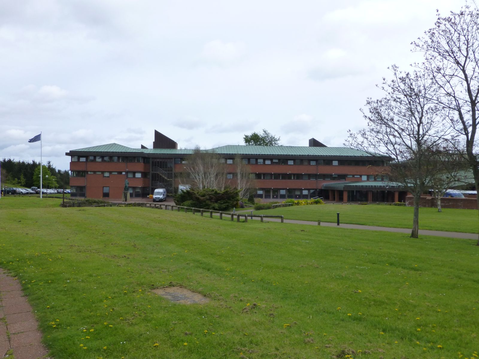
138:County Hall, Morpeth (geograph 4464710).jpg
1255:
1177:
488:
148:The home of Northumberland County Council.
1023:24bb7cfa7f43f49aa5bb1f082a996a7399f2537c
1620:
1610:
1600:
1590:
1582:
1574:
1566:
1555:
1545:
1537:
1529:
1521:
1513:
1505:
1495:
1487:
1477:
1469:
1459:
1451:
1441:
1433:
1412:
1404:
1393:
1385:
1377:
1369:
1359:
1351:
1343:
1335:
1327:
1316:
1308:
1297:
1287:
1277:
1267:
1237:
1150:
1134:
1113:
1097:
1076:
1060:
1021:
1005:
985:
969:
951:
935:
917:
901:
880:
864:
846:
830:
809:
793:
773:
757:
717:
701:
653:
637:
611:
595:
575:
559:
539:
523:
506:
503:
484:
477:
296:
246:
325:View this and other nearby images on:
275:View this and other nearby images on:
1257:
7:
372:and is licensed for reuse under the
1235:The following page uses this file:
1166:
408:Attribution-Share Alike 2.0 Generic
396:
391:
376:Attribution-ShareAlike 2.0 license.
1248:
497:
491:
382:
359:
142:
125:
71:
496:
1310:Date and time of data generation
640:coordinates of the point of view
482:
438:Under the following conditions:
403:This file is licensed under the
395:
390:
384:
352:
331:
317:
309:
281:
267:
259:
92:
21:
479:
143:
14:
478:
360:This image was taken from the
26:
1:
1526:A directly photographed image
704:coordinates of depicted place
31:
504:Items portrayed in this file
308:
258:
1406:Date and time of digitizing
655:55°9'14.267"N, 1°41'9.758"W
1642:
1568:Focal length in 35 mm film
1510:One-chip color area sensor
1489:Supported Flashpix version
452:same or compatible license
1414:Meaning of each component
1371:File change date and time
1167:
719:55°9'12.38"N, 1°41'5.53"W
234:Russel Wills /
215:Russel Wills /
16:
776:Panasonic Lumix DMC-TZ30
481:
418:
99:This is a file from the
1531:Custom image processing
1224:
206:required by the license
184:
174:
163:
156:
153:
135:
103:. Information from its
1456:3.6953125 APEX (f/3.6)
1435:Image compression mode
366:this photograph's page
337:55.153440; -1.684870
287:55.153963; -1.686044
106:description page there
41:Size of this preview:
1453:Maximum land aperture
1345:Horizontal resolution
1518:Digital still camera
1035:determination method
236:County Hall, Morpeth
217:County Hall, Morpeth
65:1,600 × 1,200 pixels
1379:Y and C positioning
1353:Vertical resolution
1284:1/1,000 sec (0.001)
1259:Camera manufacturer
1203:19:48, 9 April 2022
433:– to adapt the work
47:Other resolutions:
1576:Scene capture type
1552:Auto white balance
61:1,280 × 960 pixels
57:1,024 × 768 pixels
1629:
1628:
1409:13:12, 6 May 2015
1374:13:12, 6 May 2015
1313:13:12, 6 May 2015
1228:
695:
631:
562:copyright license
490:
381:
380:
364:collection. See
342:
341:
292:
291:
241:
240:
209:
193:
190:Reusing this file
121:
120:
101:Wikimedia Commons
1633:
1387:Exposure Program
1256:
1215:
1155:
1118:
1081:
1044:
1039:
885:
814:
741:
740:
735:
677:
676:
671:
526:copyright status
474:
471:
468:
465:
462:
454:as the original.
416:
405:Creative Commons
399:
398:
394:
393:
388:
387:
374:Creative Commons
362:Geograph project
356:
349:
338:
335:
321:
320:
314:
313:
312:
306:
305:
294:
288:
285:
271:
270:
264:
263:
262:
256:
255:
244:
203:
187:
159:
147:
139:
133:
117:
96:
95:
89:
83:
81:
68:
53:640 × 480 pixels
49:320 × 240 pixels
43:800 × 600 pixels
1641:
1640:
1636:
1635:
1634:
1632:
1631:
1630:
1622:GPS tag version
1332:55° 9′ 14.27″ N
1244:
1229:
1221:
1220:Chocolateediter
1213:
1169:
1168:
1165:
1164:
1163:
1162:
1161:
1160:
1159:
1158:
1156:
1153:
1143:
1142:
1141:
1139:
1128:
1127:
1126:
1125:
1124:
1123:
1122:
1121:
1119:
1116:
1106:
1105:
1104:
1102:
1091:
1090:
1089:
1088:
1087:
1086:
1085:
1084:
1082:
1079:
1069:
1068:
1067:
1065:
1054:
1053:
1052:
1051:
1050:
1049:
1048:
1047:
1046:
1045:
1040:
1037:
1028:
1027:
1026:
1024:
1014:
1013:
1012:
1010:
999:
998:
997:
996:
995:
994:
993:
992:
990:
978:
977:
976:
974:
963:
962:
961:
960:
959:
958:
957:
956:
954:
944:
943:
942:
940:
929:
928:
927:
926:
925:
924:
923:
922:
920:
910:
909:
908:
906:
895:
894:
893:
892:
891:
890:
889:
888:
886:
883:
873:
872:
871:
869:
858:
857:
856:
855:
854:
853:
852:
851:
849:
839:
838:
837:
835:
824:
823:
822:
821:
820:
819:
818:
817:
815:
812:
802:
801:
800:
798:
787:
786:
785:
784:
783:
782:
781:
780:
778:
766:
765:
764:
762:
751:
750:
749:
748:
747:
746:
745:
744:
743:
742:
738:
736:
733:
724:
723:
722:
720:
710:
709:
708:
706:
687:
686:
685:
684:
683:
682:
681:
680:
679:
678:
674:
672:
669:
660:
659:
658:
656:
646:
645:
644:
642:
623:
622:
621:
620:
619:
618:
617:
616:
614:
604:
603:
602:
600:
589:
588:
587:
586:
585:
584:
583:
582:
580:
568:
567:
566:
564:
553:
552:
551:
550:
549:
548:
547:
546:
544:
532:
531:
530:
528:
517:
516:
515:
514:
513:
511:
495:
494:
493:
476:
475:
472:
469:
466:
463:
460:
459:
417:
414:
411:
400:
377:
347:
336:
310:
301:
300:
297:Object location
286:
260:
251:
250:
247:Camera location
242:
231:
224:
212:
169:geograph.org.uk
149:
137:
130:
123:
122:
111:
110:
109:is shown below.
85:
79:
77:
70:
69:
46:
12:
11:
5:
1639:
1637:
1627:
1626:
1623:
1619:
1618:
1615:
1609:
1608:
1605:
1599:
1598:
1595:
1589:
1588:
1585:
1581:
1580:
1577:
1573:
1572:
1569:
1565:
1564:
1561:
1554:
1553:
1550:
1544:
1543:
1540:
1536:
1535:
1534:Normal process
1532:
1528:
1527:
1524:
1520:
1519:
1516:
1512:
1511:
1508:
1507:Sensing method
1504:
1503:
1500:
1494:
1493:
1490:
1486:
1485:
1482:
1476:
1475:
1472:
1468:
1467:
1464:
1458:
1457:
1454:
1450:
1449:
1446:
1440:
1439:
1436:
1432:
1431:
1430:
1429:
1428:does not exist
1426:
1423:
1420:
1415:
1411:
1410:
1407:
1403:
1402:
1399:
1392:
1391:
1390:Normal program
1388:
1384:
1383:
1380:
1376:
1375:
1372:
1368:
1367:
1362:
1358:
1357:
1354:
1350:
1349:
1346:
1342:
1341:
1338:
1334:
1333:
1330:
1326:
1325:
1322:
1315:
1314:
1311:
1307:
1306:
1303:
1296:
1295:
1292:
1286:
1285:
1282:
1276:
1275:
1270:
1266:
1265:
1260:
1247:
1243:
1242:
1240:Northumberland
1233:
1232:
1227:
1226:
1223:
1219:
1216:
1212:1,600 × 1,200
1210:
1205:
1200:
1196:
1195:
1192:
1189:
1186:
1183:
1180:
1173:
1172:
1157:
1151:
1149:
1148:
1147:
1146:
1145:
1144:
1140:
1135:
1133:
1132:
1131:
1130:
1129:
1120:
1114:
1112:
1111:
1110:
1109:
1108:
1107:
1103:
1098:
1096:
1095:
1094:
1093:
1092:
1083:
1077:
1075:
1074:
1073:
1072:
1071:
1070:
1066:
1061:
1059:
1058:
1057:
1056:
1055:
1033:
1032:
1031:
1030:
1029:
1025:
1022:
1020:
1019:
1018:
1017:
1016:
1015:
1011:
1006:
1004:
1003:
1002:
1001:
1000:
991:
986:
984:
983:
982:
981:
980:
979:
975:
970:
968:
967:
966:
965:
964:
955:
952:
950:
949:
948:
947:
946:
945:
941:
936:
934:
933:
932:
931:
930:
921:
918:
916:
915:
914:
913:
912:
911:
907:
902:
900:
899:
898:
897:
896:
887:
881:
879:
878:
877:
876:
875:
874:
870:
865:
863:
862:
861:
860:
859:
850:
847:
845:
844:
843:
842:
841:
840:
836:
831:
829:
828:
827:
826:
825:
816:
810:
808:
807:
806:
805:
804:
803:
799:
794:
792:
791:
790:
789:
788:
779:
774:
772:
771:
770:
769:
768:
767:
763:
758:
756:
755:
754:
753:
752:
729:
728:
727:
726:
725:
721:
718:
716:
715:
714:
713:
712:
711:
707:
702:
700:
699:
698:
697:
691:
665:
664:
663:
662:
661:
657:
654:
652:
651:
650:
649:
648:
647:
643:
638:
636:
635:
634:
633:
627:
615:
612:
610:
609:
608:
607:
606:
605:
601:
596:
594:
593:
592:
591:
590:
581:
576:
574:
573:
572:
571:
570:
569:
565:
560:
558:
557:
556:
555:
554:
545:
540:
538:
537:
536:
535:
534:
533:
529:
524:
522:
521:
520:
519:
518:
512:
507:
505:
502:
501:
500:
499:
498:
487:
486:
483:
480:
458:
457:
456:
455:
445:
436:
435:
434:
428:
421:You are free:
412:
402:
401:
383:
379:
378:
357:
346:
343:
340:
339:
329:
323:
298:
290:
289:
279:
273:
248:
239:
238:
232:
229:
226:
225:
220:
213:
210:
198:
197:
194:
182:
181:
176:
172:
171:
165:
161:
160:
155:
151:
150:
140:
131:
129:
126:
124:
119:
118:
97:
87:
86:
40:
36:
35:
34:
29:
24:
19:
13:
10:
9:
6:
4:
3:
2:
1638:
1624:
1621:
1616:
1614:
1611:
1606:
1604:
1601:
1596:
1594:
1591:
1586:
1584:Scene control
1583:
1578:
1575:
1570:
1567:
1562:
1559:
1556:
1551:
1549:
1548:White balance
1546:
1542:Auto exposure
1541:
1539:Exposure mode
1538:
1533:
1530:
1525:
1522:
1517:
1514:
1509:
1506:
1501:
1499:
1496:
1491:
1488:
1483:
1481:
1478:
1473:
1470:
1465:
1463:
1462:Metering mode
1460:
1455:
1452:
1447:
1445:
1444:Exposure bias
1442:
1437:
1434:
1427:
1424:
1421:
1418:
1417:
1416:
1413:
1408:
1405:
1400:
1397:
1394:
1389:
1386:
1381:
1378:
1373:
1370:
1366:
1363:
1361:Software used
1360:
1355:
1352:
1347:
1344:
1339:
1336:
1331:
1328:
1323:
1321:
1317:
1312:
1309:
1304:
1301:
1298:
1293:
1291:
1288:
1283:
1281:
1280:Exposure time
1278:
1274:
1271:
1268:
1264:
1261:
1258:
1254:
1251:
1245:
1241:
1238:
1236:
1230:
1222:
1217:
1211:
1209:
1206:
1204:
1201:
1198:
1197:
1193:
1190:
1187:
1184:
1181:
1179:
1178:
1176:
1170:
1138:
1101:
1064:
1043:
1036:
1009:
989:
973:
939:
905:
868:
834:
797:
796:exposure time
777:
761:
760:captured with
732:
705:
668:
641:
599:
579:
563:
543:
527:
510:
464:CC BY-SA 2.0
453:
449:
446:
443:
440:
439:
437:
432:
429:
426:
423:
422:
420:
419:
413:Attribution:
409:
406:
389:
375:
371:
367:
363:
358:
355:
351:
350:
344:
334:
330:
328:
327:OpenStreetMap
324:
322:
304:
299:
295:
284:
280:
278:
277:OpenStreetMap
274:
272:
254:
249:
245:
237:
233:
228:
227:
223:
219: /
218:
214:
207:
202:
200:
199:
195:
191:
186:
183:
180:
177:
173:
170:
166:
162:
152:
146:
141:
134:
127:
115:
108:
107:
102:
98:
91:
90:
84:
75:
74:Original file
66:
62:
58:
54:
50:
44:
39:
33:
30:
28:
25:
23:
20:
18:
15:
1558:Digital zoom
1471:Light source
1320:focal length
1269:Camera model
1252:
1249:
1234:
1174:
1171:File history
867:focal length
447:
441:
430:
424:
415:Russel Wills
370:Russel Wills
369:
307:
257:
235:
222:CC BY-SA 2.0
216:
179:Russel Wills
144:
114:You can help
104:
72:
22:File history
1587:Low gain up
1515:File source
1498:Color space
1337:Orientation
972:instance of
542:copyrighted
448:share alike
442:attribution
201:Attribution
136:Description
1603:Saturation
1523:Scene type
1231:File usage
1188:Dimensions
988:photograph
953:image/jpeg
938:media type
884:millimetre
613:6 May 2015
185:Permission
158:6 May 2015
80:image/jpeg
27:File usage
1613:Sharpness
1365:Ver.1.0
1300:ISO speed
1263:Panasonic
1185:Thumbnail
1182:Date/Time
1063:data size
904:ISO speed
598:inception
345:Licensing
230:InfoField
211:InfoField
145:English:
1593:Contrast
1579:Standard
1382:Co-sited
1329:Latitude
1290:F-number
1273:DMC-TZ30
1246:Metadata
1214:(274 KB)
1078:281,023
1008:checksum
833:f-number
485:Captions
431:to remix
425:to share
410:license.
32:Metadata
1625:0.0.2.2
1474:Unknown
1466:Pattern
1398:version
1356:180 dpi
1348:180 dpi
1199:current
1194:Comment
731:heading
690:heading
667:heading
626:heading
509:depicts
489:English
128:Summary
76:
1617:Normal
1607:Normal
1597:Normal
1340:Normal
1324:5.4 mm
1302:rating
1152:1,600
1115:1,200
1100:height
813:second
811:0.001
739:degree
694:degree
675:degree
630:degree
315:
265:
175:Author
164:Source
1571:30 mm
1560:ratio
1480:Flash
1318:Lens
1154:pixel
1137:width
1117:pixel
1042:SHA-1
167:From
1502:sRGB
1396:Exif
1191:User
1080:byte
882:5.4
737:135
673:135
473:true
470:true
154:Date
17:File
1401:2.3
1305:160
1294:f/4
919:160
1425:Cr
1422:Cb
1038::
734::
670::
63:|
59:|
55:|
51:|
45:.
1563:0
1492:1
1448:0
1438:4
1419:Y
848:4
208:)
204:(
192:)
188:(
116:.
82:)
67:.
Text is available under the Creative Commons Attribution-ShareAlike License. Additional terms may apply.
.jpg)
.jpg¶ms=055.153963_N_-001.686044_E_globe:Earth_type:camera_source:geograph-osgb36(NZ2010584448)_heading:135.00&language=en)
.jpg¶ms=055.153440_N_-001.684870_E_globe:Earth_class:object_type:object_source:geograph-osgb36(NZ20188439)_heading:135.00&language=en)
