155:
108:
161:
67:
166:
631:
38:
214:– You must give appropriate credit, provide a link to the license, and indicate if changes were made. You may do so in any reasonable manner, but not in any way that suggests the licensor endorses you or your use.
78:
46:
125:
805:
800:
815:
123:; with no Invariant Sections, no Front-Cover Texts, and no Back-Cover Texts. A copy of the license is included in the section entitled
115:
770:
725:
464:
376:
359:
323:
675:
649:
221:
745:
559:
522:
485:
430:
396:
307:
120:
457:
343:
290:
795:
735:
695:
810:
715:
710:
705:
641:
630:
625:
175:
37:
780:
765:
760:
750:
730:
661:
The following pages on the
English Knowledge (XXG) use this file (pages on other projects are not listed):
853:
220:– If you remix, transform, or build upon the material, you must distribute your contributions under the
670:
172:
86:
690:
102:
235:
113:
Permission is granted to copy, distribute and/or modify this document under the terms of the
790:
785:
755:
720:
740:
685:
680:
775:
665:
73:
700:
833:
598:
Click on a date/time to view the file as it appeared at that time.
234:
This licensing tag was added to this file as part of the GFDL
149:
61:
648:
Map of
Sacramento county in California. From en: {{GFDL}}
274:
Add a one-line explanation of what this file represents
843:
377:
Creative
Commons Attribution-ShareAlike 3.0 Unported
360:
119:, Version 1.2 or any later version published by the
85:
Commons is a freely licensed media file repository.
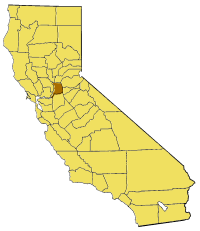
100:Map of Sacramento county in California. From en:
51:(200 × 231 pixels, file size: 22 KB, MIME type:
241:http://creativecommons.org/licenses/by-sa/3.0/
66:
154:
8:
247:Creative Commons Attribution-Share Alike 3.0
47:California_map_showing_Sacramento_County.png
197:– to copy, distribute and transmit the work
600:
270:
826:The following other wikis use this file:
806:Valley View Acres, Sacramento, California
446:3f33dc87df04c388b80a3fac184ed3f58cb1ba1a
801:Upper Land Park, Sacramento, California
663:
650:Category:Maps of counties in California
573:
557:
536:
520:
499:
483:
444:
428:
410:
394:
374:
357:
341:
321:
305:
288:
285:
266:
259:
7:
816:Template:SacramentoCountyCA-geo-stub
176:Attribution-Share Alike 3.0 Unported
131:http://www.gnu.org/copyleft/fdl.html
589:
165:
160:
279:
273:
98:
44:
278:
771:Sunset Lawn Chapel of the Chimes
726:Natomas East Main Drainage Canal
264:
208:Under the following conditions:
171:This file is licensed under the
164:
159:
153:
107:
106:
65:
31:
21:
676:Ben Ali, Sacramento, California
261:
41:No higher resolution available.
14:
260:
137:GNU Free Documentation License
126:GNU Free Documentation License
116:GNU Free Documentation License
26:
1:
834:Sacramento County, California
746:Robla, Sacramento, California
286:Items portrayed in this file
830:Usage on pam.wikipedia.org
872:
850:Usage on yi.wikipedia.org
840:Usage on www.wikidata.org
222:same or compatible license
796:Tyler Island (California)
736:Paintersville, California
696:Grand Island (California)
590:
180:
152:
16:
811:West Island (California)
716:Michigan Bar, California
711:Long Island (California)
706:Jensen Botanical Gardens
263:
121:Free Software Foundation
72:This is a file from the
781:Sutterville, California
766:Stone Lake (California)
761:Sloughhouse, California
751:Rusch Botanical Gardens
647:
76:. Information from its
731:Norristown, California
79:description page there
671:Antelope High School
643:Pyramide~commonswiki
458:determination method
626:15:23, 14 July 2005
203:– to adapt the work
822:Global file usage
691:Dead Horse Island
654:
344:copyright license
272:
258:
257:
148:
147:
94:
93:
74:Wikimedia Commons
32:Global file usage
863:
791:Twitchell Island
786:Swanston Estates
756:Ryde, California
721:Montezuma Island
638:
578:
541:
504:
467:
462:
308:copyright status
254:
251:
248:
245:
242:
239:
236:licensing update
224:as the original.
173:Creative Commons
168:
167:
163:
162:
157:
156:
150:
144:
141:
138:
135:
132:
110:
109:
103:
90:
69:
68:
62:
56:
54:
871:
870:
866:
865:
864:
862:
861:
860:
820:
662:
655:
644:
636:
592:
591:
588:
587:
586:
585:
584:
583:
582:
581:
579:
576:
566:
565:
564:
562:
551:
550:
549:
548:
547:
546:
545:
544:
542:
539:
529:
528:
527:
525:
514:
513:
512:
511:
510:
509:
508:
507:
505:
502:
492:
491:
490:
488:
477:
476:
475:
474:
473:
472:
471:
470:
469:
468:
463:
460:
451:
450:
449:
447:
437:
436:
435:
433:
422:
421:
420:
419:
418:
417:
416:
415:
413:
403:
402:
401:
399:
388:
387:
386:
385:
384:
383:
382:
381:
379:
368:
367:
366:
365:
364:
362:
350:
349:
348:
346:
335:
334:
333:
332:
331:
330:
329:
328:
326:
314:
313:
312:
310:
299:
298:
297:
296:
295:
293:
277:
276:
275:
252:
249:
246:
243:
240:
233:
142:
139:
136:
133:
130:
96:
95:
84:
83:
82:is shown below.
58:
52:
50:
43:
42:
12:
11:
5:
869:
867:
859:
858:
857:
856:
848:
847:
846:
838:
837:
836:
824:
823:
819:
818:
813:
808:
803:
798:
793:
788:
783:
778:
773:
768:
763:
758:
753:
748:
743:
741:Randall Island
738:
733:
728:
723:
718:
713:
708:
703:
698:
693:
688:
686:Carpenter Hill
683:
681:Brannan Island
678:
673:
668:
660:
659:
658:
653:
652:
646:
642:
639:
633:
628:
623:
619:
618:
615:
612:
609:
606:
603:
596:
595:
580:
574:
572:
571:
570:
569:
568:
567:
563:
558:
556:
555:
554:
553:
552:
543:
537:
535:
534:
533:
532:
531:
530:
526:
521:
519:
518:
517:
516:
515:
506:
500:
498:
497:
496:
495:
494:
493:
489:
484:
482:
481:
480:
479:
478:
456:
455:
454:
453:
452:
448:
445:
443:
442:
441:
440:
439:
438:
434:
429:
427:
426:
425:
424:
423:
414:
411:
409:
408:
407:
406:
405:
404:
400:
395:
393:
392:
391:
390:
389:
380:
375:
373:
372:
371:
370:
369:
363:
358:
356:
355:
354:
353:
352:
351:
347:
342:
340:
339:
338:
337:
336:
327:
322:
320:
319:
318:
317:
316:
315:
311:
306:
304:
303:
302:
301:
300:
294:
289:
287:
284:
283:
282:
281:
280:
269:
268:
265:
262:
256:
255:
230:
229:
228:
227:
226:
225:
215:
206:
205:
204:
198:
191:You are free:
186:
185:
182:
181:
179:
169:
146:
145:
111:
97:
92:
91:
70:
60:
59:
40:
36:
35:
34:
29:
24:
19:
13:
10:
9:
6:
4:
3:
2:
868:
855:
852:
851:
849:
845:
842:
841:
839:
835:
832:
831:
829:
828:
827:
821:
817:
814:
812:
809:
807:
804:
802:
799:
797:
794:
792:
789:
787:
784:
782:
779:
777:
776:Sutter Island
774:
772:
769:
767:
764:
762:
759:
757:
754:
752:
749:
747:
744:
742:
739:
737:
734:
732:
729:
727:
724:
722:
719:
717:
714:
712:
709:
707:
704:
702:
699:
697:
694:
692:
689:
687:
684:
682:
679:
677:
674:
672:
669:
667:
666:Andrus Island
664:
656:
651:
645:
640:
634:
632:
629:
627:
624:
621:
620:
616:
613:
610:
607:
604:
602:
601:
599:
593:
561:
524:
487:
466:
459:
432:
398:
378:
361:
345:
325:
309:
292:
237:
232:
231:
223:
219:
216:
213:
210:
209:
207:
202:
199:
196:
193:
192:
190:
189:
188:
187:
184:
183:
177:
174:
170:
158:
151:
128:
127:
122:
118:
117:
112:
105:
104:
101:
88:
81:
80:
75:
71:
64:
63:
57:
48:
39:
33:
30:
28:
25:
23:
20:
18:
15:
825:
597:
594:File history
244:CC BY-SA 3.0
217:
211:
200:
194:
124:
114:
99:
87:You can help
77:
45:
22:File history
324:copyrighted
218:share alike
212:attribution
854:סאקראמענטא
701:Ida Island
657:File usage
635:200 × 231
611:Dimensions
397:media type
27:File usage
844:Q25137489
608:Thumbnail
605:Date/Time
486:data size
412:image/png
178:license.
53:image/png
431:checksum
267:Captions
201:to remix
195:to share
637:(22 KB)
622:current
617:Comment
501:22,751
291:depicts
271:English
49:
523:height
577:pixel
560:width
540:pixel
465:SHA-1
614:User
575:200
538:231
503:byte
253:true
250:true
143:true
140:true
134:GFDL
17:File
461::
238:.
129:.
89:.
55:)
Text is available under the Creative Commons Attribution-ShareAlike License. Additional terms may apply.