155:
108:
161:
67:
166:
631:
214:– You must give appropriate credit, provide a link to the license, and indicate if changes were made. You may do so in any reasonable manner, but not in any way that suggests the licensor endorses you or your use.
38:
78:
125:
46:
790:
695:
815:
715:
690:
705:
123:; with no Invariant Sections, no Front-Cover Texts, and no Back-Cover Texts. A copy of the license is included in the section entitled
115:
825:
464:
376:
359:
323:
649:
221:
785:
780:
559:
522:
485:
430:
396:
307:
120:
795:
457:
343:
290:
820:
740:
735:
641:
175:
665:
760:
720:
630:
625:
37:
710:
220:– If you remix, transform, or build upon the material, you must distribute your contributions under the
810:
685:
172:
765:
670:
86:
805:
800:
730:
102:
235:
113:
Permission is granted to copy, distribute and/or modify this document under the terms of the
700:
680:
770:
725:
73:
775:
750:
745:
675:
843:
755:
863:
598:
Click on a date/time to view the file as it appeared at that time.
234:
This licensing tag was added to this file as part of the GFDL
149:
61:
853:
274:
Add a one-line explanation of what this file represents
873:
648:
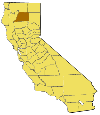
Map of Shasta county in
California. From en: {{GFDL}}
377:
Creative
Commons Attribution-ShareAlike 3.0 Unported
360:
119:, Version 1.2 or any later version published by the
85:
Commons is a freely licensed media file repository.
51:(200 × 231 pixels, file size: 22 KB, MIME type:
241:http://creativecommons.org/licenses/by-sa/3.0/
66:
154:
100:Map of Shasta county in California. From en:
8:
247:Creative Commons Attribution-Share Alike 3.0
197:– to copy, distribute and transmit the work
600:
270:
836:The following other wikis use this file:
791:Summit Lake (Reading Peak, Shasta County)
696:Clear Creek (Sacramento River tributary)
446:db9ac86daa62d4e68843123e5671772b0bc181e8
47:California_map_showing_Shasta_County.png
816:User:Magnolia677/Tunnel Inn, California
716:Happy Valley, Shasta County, California
663:
650:Category:Maps of counties in California
573:
557:
536:
520:
499:
483:
444:
428:
410:
394:
374:
357:
341:
321:
305:
288:
285:
266:
259:
691:Centerville, Shasta County, California
661:The following 33 pages use this file:
706:Enterprise, Shasta County, California
7:
176:Attribution-Share Alike 3.0 Unported
131:http://www.gnu.org/copyleft/fdl.html
589:
165:
160:
279:
273:
98:
44:
278:
826:Template:ShastaCountyCA-geo-stub
264:
208:Under the following conditions:
171:This file is licensed under the
164:
159:
153:
107:
106:
65:
31:
21:
261:
41:No higher resolution available.
14:
260:
137:GNU Free Documentation License
126:GNU Free Documentation License
116:GNU Free Documentation License
26:
1:
844:Área metropolitana de Redding
786:Soldier Mountain (California)
781:Shasta County Superior Court
286:Items portrayed in this file
860:Usage on pam.wikipedia.org
796:Turtle Bay Exploration Park
892:
870:Usage on www.wikidata.org
850:Usage on li.wikipedia.org
840:Usage on es.wikipedia.org
222:same or compatible license
864:Shasta County, California
821:User:Yurikcm/Brushy Butte
590:
180:
152:
16:
761:O'Brien, California
741:Jones Valley, California
736:Johnson Park, California
263:
121:Free Software Foundation
72:This is a file from the
666:Baker Lake (California)
647:
76:. Information from its
721:Hat Creek (California)
79:description page there
711:Gas Point, California
811:Whitmore, California
686:Castella, California
643:Pyramide~commonswiki
458:determination method
766:Oak Run, California
626:15:28, 14 July 2005
203:– to adapt the work
671:Big Bend Rancheria
832:Global file usage
806:Whiskeytown Falls
801:Viola, California
731:Ingot, California
654:
344:copyright license
272:
258:
257:
148:
147:
94:
93:
74:Wikimedia Commons
32:Global file usage
883:
701:Dana, California
681:Bumpass Mountain
638:
578:
541:
504:
467:
462:
308:copyright status
254:
251:
248:
245:
242:
239:
236:licensing update
224:as the original.
173:Creative Commons
168:
167:
163:
162:
157:
156:
150:
144:
141:
138:
135:
132:
110:
109:
103:
90:
69:
68:
62:
56:
54:
891:
890:
886:
885:
884:
882:
881:
880:
830:
771:Ono, California
726:Igo, California
655:
644:
636:
592:
591:
588:
587:
586:
585:
584:
583:
582:
581:
579:
576:
566:
565:
564:
562:
551:
550:
549:
548:
547:
546:
545:
544:
542:
539:
529:
528:
527:
525:
514:
513:
512:
511:
510:
509:
508:
507:
505:
502:
492:
491:
490:
488:
477:
476:
475:
474:
473:
472:
471:
470:
469:
468:
463:
460:
451:
450:
449:
447:
437:
436:
435:
433:
422:
421:
420:
419:
418:
417:
416:
415:
413:
403:
402:
401:
399:
388:
387:
386:
385:
384:
383:
382:
381:
379:
368:
367:
366:
365:
364:
362:
350:
349:
348:
346:
335:
334:
333:
332:
331:
330:
329:
328:
326:
314:
313:
312:
310:
299:
298:
297:
296:
295:
293:
277:
276:
275:
252:
249:
246:
243:
240:
233:
142:
139:
136:
133:
130:
96:
95:
84:
83:
82:is shown below.
58:
52:
50:
43:
42:
12:
11:
5:
889:
887:
879:
878:
877:
876:
868:
867:
866:
858:
857:
856:
848:
847:
846:
834:
833:
829:
828:
823:
818:
813:
808:
803:
798:
793:
788:
783:
778:
773:
768:
763:
758:
753:
748:
743:
738:
733:
728:
723:
718:
713:
708:
703:
698:
693:
688:
683:
678:
673:
668:
659:
658:
653:
652:
646:
642:
639:
633:
628:
623:
619:
618:
615:
612:
609:
606:
603:
596:
595:
580:
574:
572:
571:
570:
569:
568:
567:
563:
558:
556:
555:
554:
553:
552:
543:
537:
535:
534:
533:
532:
531:
530:
526:
521:
519:
518:
517:
516:
515:
506:
500:
498:
497:
496:
495:
494:
493:
489:
484:
482:
481:
480:
479:
478:
456:
455:
454:
453:
452:
448:
445:
443:
442:
441:
440:
439:
438:
434:
429:
427:
426:
425:
424:
423:
414:
411:
409:
408:
407:
406:
405:
404:
400:
395:
393:
392:
391:
390:
389:
380:
375:
373:
372:
371:
370:
369:
363:
358:
356:
355:
354:
353:
352:
351:
347:
342:
340:
339:
338:
337:
336:
327:
322:
320:
319:
318:
317:
316:
315:
311:
306:
304:
303:
302:
301:
300:
294:
289:
287:
284:
283:
282:
281:
280:
269:
268:
265:
262:
256:
255:
230:
229:
228:
227:
226:
225:
215:
206:
205:
204:
198:
191:You are free:
186:
185:
182:
181:
179:
169:
146:
145:
111:
97:
92:
91:
70:
60:
59:
40:
36:
35:
34:
29:
24:
19:
13:
10:
9:
6:
4:
3:
2:
888:
875:
872:
871:
869:
865:
862:
861:
859:
855:
854:Shasta County
852:
851:
849:
845:
842:
841:
839:
838:
837:
831:
827:
824:
822:
819:
817:
814:
812:
809:
807:
804:
802:
799:
797:
794:
792:
789:
787:
784:
782:
779:
777:
774:
772:
769:
767:
764:
762:
759:
757:
754:
752:
749:
747:
744:
742:
739:
737:
734:
732:
729:
727:
724:
722:
719:
717:
714:
712:
709:
707:
704:
702:
699:
697:
694:
692:
689:
687:
684:
682:
679:
677:
674:
672:
669:
667:
664:
662:
656:
651:
645:
640:
634:
632:
629:
627:
624:
621:
620:
616:
613:
610:
607:
604:
602:
601:
599:
593:
561:
524:
487:
466:
459:
432:
398:
378:
361:
345:
325:
309:
292:
237:
232:
231:
223:
219:
216:
213:
210:
209:
207:
202:
199:
196:
193:
192:
190:
189:
188:
187:
184:
183:
177:
174:
170:
158:
151:
128:
127:
122:
118:
117:
112:
105:
104:
101:
88:
81:
80:
75:
71:
64:
63:
57:
48:
39:
33:
30:
28:
25:
23:
20:
18:
15:
835:
776:Rising River
751:Lake McCloud
746:Lake Britton
676:Brushy Butte
660:
597:
594:File history
244:CC BY-SA 3.0
217:
211:
200:
194:
124:
114:
99:
87:You can help
77:
45:
22:File history
324:copyrighted
218:share alike
212:attribution
756:Magee Peak
657:File usage
635:200 × 231
611:Dimensions
397:media type
27:File usage
874:Q25137491
608:Thumbnail
605:Date/Time
486:data size
412:image/png
178:license.
53:image/png
431:checksum
267:Captions
201:to remix
195:to share
637:(22 KB)
622:current
617:Comment
501:22,744
291:depicts
271:English
49:
523:height
577:pixel
560:width
540:pixel
465:SHA-1
614:User
575:200
538:231
503:byte
253:true
250:true
143:true
140:true
134:GFDL
17:File
461::
238:.
129:.
89:.
55:)
Text is available under the Creative Commons Attribution-ShareAlike License. Additional terms may apply.