171:
124:
177:
67:
182:
647:
230:– You must give appropriate credit, provide a link to the license, and indicate if changes were made. You may do so in any reasonable manner, but not in any way that suggests the licensor endorses you or your use.
38:
889:
78:
46:
141:
751:
731:
691:
696:
139:; with no Invariant Sections, no Front-Cover Texts, and no Back-Cover Texts. A copy of the license is included in the section entitled
841:
131:
861:
716:
480:
392:
375:
339:
665:
237:
104:
856:
721:
879:
791:
575:
538:
501:
446:
412:
323:
136:
766:
473:
359:
306:
776:
706:
801:
657:
191:
646:
641:
37:
851:
786:
677:
The following pages on the
English Knowledge (XXG) use this file (pages on other projects are not listed):
816:
236:– If you remix, transform, or build upon the material, you must distribute your contributions under the
188:
836:
86:
806:
781:
771:
686:
118:
251:
129:
Permission is granted to copy, distribute and/or modify this document under the terms of the
811:
761:
746:
711:
701:
796:
741:
831:
736:
681:
73:
846:
726:
821:
756:
826:
109:
909:
614:
Click on a date/time to view the file as it appeared at that time.
250:
This licensing tag was added to this file as part of the GFDL
165:
61:
899:
664:
Map of
Ventura county in California. From en: {{GFDL}}
290:
Add a one-line explanation of what this file represents
919:
393:
376:
Creative
Commons Attribution-ShareAlike 3.0 Unported
135:, Version 1.2 or any later version published by the
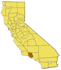
85:
Commons is a freely licensed media file repository.
51:(200 × 231 pixels, file size: 22 KB, MIME type:
257:http://creativecommons.org/licenses/by-sa/3.0/
66:
170:
8:
263:Creative Commons Attribution-Share Alike 3.0
213:– to copy, distribute and transmit the work
616:
286:
872:The following other wikis use this file:
752:Hidden Valley, Ventura County, California
47:California_map_showing_Ventura_County.png
462:090ebdc8c9faab8a806fc9e175758a53219a2a1b
679:
666:Category:Maps of counties in California
589:
573:
552:
536:
515:
499:
460:
444:
426:
410:
390:
373:
357:
337:
321:
304:
301:
282:
275:
732:Dos Vientos, Thousand Oaks, California
7:
692:Buckhorn, Ventura County, California
192:Attribution-Share Alike 3.0 Unported
147:http://www.gnu.org/copyleft/fdl.html
697:CSU Channel Islands University Park
605:
181:
176:
842:Tri Peaks (Santa Monica Mountains)
295:
289:
98:
44:
862:Template:VenturaCountyCA-geo-stub
717:Cobblestone Mountain (California)
294:
280:
224:Under the following conditions:
187:This file is licensed under the
180:
175:
169:
123:
122:
65:
31:
21:
277:
41:No higher resolution available.
14:
276:
153:GNU Free Documentation License
142:GNU Free Documentation License
132:GNU Free Documentation License
26:
1:
857:Ventura County Superior Court
722:Coyote Creek (Ventura County)
792:San Buenaventura State Beach
302:Items portrayed in this file
906:Usage on pam.wikipedia.org
767:Lockwood Valley, California
938:
916:Usage on www.wikidata.org
910:Ventura County, California
896:Usage on li.wikipedia.org
886:Usage on fa.wikipedia.org
876:Usage on bg.wikipedia.org
238:same or compatible license
890:شهرستان ونچورا، کالیفرنیا
777:Mussel Shoals, California
707:Camp Bartlett, California
606:
196:
168:
16:
802:Santa Clara River Valley
279:
137:Free Software Foundation
72:This is a file from the
663:
76:. Information from its
852:Upper Ojai, California
787:Ortonville, California
108:— in western Southern
79:description page there
817:Sea Cliff, California
659:Pyramide~commonswiki
474:determination method
642:15:32, 14 July 2005
219:– to adapt the work
837:Topatopa Mountains
868:Global file usage
807:Santa Rosa Valley
782:Ojala, California
772:Lyons Hot Springs
687:Arroyo Verde Park
670:
360:copyright license
288:
274:
273:
164:
163:
94:
93:
74:Wikimedia Commons
32:Global file usage
929:
812:Sawmill Mountain
762:Knoll Open Space
747:Frazier Mountain
654:
594:
557:
520:
483:
478:
324:copyright status
270:
267:
264:
261:
258:
255:
252:licensing update
240:as the original.
189:Creative Commons
184:
183:
179:
178:
173:
172:
166:
160:
157:
154:
151:
148:
126:
125:
119:
90:
69:
68:
62:
56:
54:
937:
936:
932:
931:
930:
928:
927:
926:
880:Вентура (окръг)
866:
712:Chatsworth Peak
702:Calleguas Creek
678:
671:
660:
652:
608:
607:
604:
603:
602:
601:
600:
599:
598:
597:
595:
592:
582:
581:
580:
578:
567:
566:
565:
564:
563:
562:
561:
560:
558:
555:
545:
544:
543:
541:
530:
529:
528:
527:
526:
525:
524:
523:
521:
518:
508:
507:
506:
504:
493:
492:
491:
490:
489:
488:
487:
486:
485:
484:
479:
476:
467:
466:
465:
463:
453:
452:
451:
449:
438:
437:
436:
435:
434:
433:
432:
431:
429:
419:
418:
417:
415:
404:
403:
402:
401:
400:
399:
398:
397:
395:
384:
383:
382:
381:
380:
378:
366:
365:
364:
362:
351:
350:
349:
348:
347:
346:
345:
344:
342:
330:
329:
328:
326:
315:
314:
313:
312:
311:
309:
293:
292:
291:
268:
265:
262:
259:
256:
249:
158:
155:
152:
149:
146:
96:
95:
84:
83:
82:is shown below.
58:
52:
50:
43:
42:
12:
11:
5:
935:
933:
925:
924:
923:
922:
914:
913:
912:
904:
903:
902:
900:Ventura County
894:
893:
892:
884:
883:
882:
870:
869:
865:
864:
859:
854:
849:
844:
839:
834:
829:
824:
819:
814:
809:
804:
799:
797:Sandstone Peak
794:
789:
784:
779:
774:
769:
764:
759:
754:
749:
744:
742:Fireworks Hill
739:
734:
729:
724:
719:
714:
709:
704:
699:
694:
689:
684:
676:
675:
674:
669:
668:
662:
658:
655:
649:
644:
639:
635:
634:
631:
628:
625:
622:
619:
612:
611:
596:
590:
588:
587:
586:
585:
584:
583:
579:
574:
572:
571:
570:
569:
568:
559:
553:
551:
550:
549:
548:
547:
546:
542:
537:
535:
534:
533:
532:
531:
522:
516:
514:
513:
512:
511:
510:
509:
505:
500:
498:
497:
496:
495:
494:
472:
471:
470:
469:
468:
464:
461:
459:
458:
457:
456:
455:
454:
450:
445:
443:
442:
441:
440:
439:
430:
427:
425:
424:
423:
422:
421:
420:
416:
411:
409:
408:
407:
406:
405:
396:
391:
389:
388:
387:
386:
385:
379:
374:
372:
371:
370:
369:
368:
367:
363:
358:
356:
355:
354:
353:
352:
343:
338:
336:
335:
334:
333:
332:
331:
327:
322:
320:
319:
318:
317:
316:
310:
305:
303:
300:
299:
298:
297:
296:
285:
284:
281:
278:
272:
271:
246:
245:
244:
243:
242:
241:
231:
222:
221:
220:
214:
207:You are free:
202:
201:
198:
197:
195:
185:
162:
161:
127:
114:
113:
105:Ventura County
97:
92:
91:
70:
60:
59:
40:
36:
35:
34:
29:
24:
19:
13:
10:
9:
6:
4:
3:
2:
934:
921:
918:
917:
915:
911:
908:
907:
905:
901:
898:
897:
895:
891:
888:
887:
885:
881:
878:
877:
875:
874:
873:
867:
863:
860:
858:
855:
853:
850:
848:
845:
843:
840:
838:
835:
833:
832:Solimar Beach
830:
828:
825:
823:
820:
818:
815:
813:
810:
808:
805:
803:
800:
798:
795:
793:
790:
788:
785:
783:
780:
778:
775:
773:
770:
768:
765:
763:
760:
758:
755:
753:
750:
748:
745:
743:
740:
738:
737:Exchange Peak
735:
733:
730:
728:
725:
723:
720:
718:
715:
713:
710:
708:
705:
703:
700:
698:
695:
693:
690:
688:
685:
683:
682:Arroyo Sequit
680:
672:
667:
661:
656:
650:
648:
645:
643:
640:
637:
636:
632:
629:
626:
623:
620:
618:
617:
615:
609:
577:
540:
503:
482:
475:
448:
414:
394:
377:
361:
341:
325:
308:
253:
248:
247:
239:
235:
232:
229:
226:
225:
223:
218:
215:
212:
209:
208:
206:
205:
204:
203:
200:
199:
193:
190:
186:
174:
167:
144:
143:
138:
134:
133:
128:
121:
120:
117:
111:
107:
106:
101:
100:
99:
88:
81:
80:
75:
71:
64:
63:
57:
48:
39:
33:
30:
28:
25:
23:
20:
18:
15:
871:
847:Triunfo Pass
727:Cuddy Canyon
613:
610:File history
260:CC BY-SA 3.0
233:
227:
216:
210:
140:
130:
115:
103:
102:{{en|Map of
87:You can help
77:
45:
22:File history
822:Sespe Gorge
340:copyrighted
234:share alike
228:attribution
757:Hines Peak
673:File usage
651:200 × 231
627:Dimensions
413:media type
110:California
27:File usage
920:Q25137520
827:Simi Peak
624:Thumbnail
621:Date/Time
502:data size
428:image/png
194:license.
116:From en:
53:image/png
447:checksum
283:Captions
217:to remix
211:to share
653:(22 KB)
638:current
633:Comment
517:22,818
307:depicts
287:English
49:
539:height
593:pixel
576:width
556:pixel
481:SHA-1
630:User
591:200
554:231
519:byte
269:true
266:true
159:true
156:true
150:GFDL
17:File
477::
254:.
145:.
112:.
89:.
55:)
Text is available under the Creative Commons Attribution-ShareAlike License. Additional terms may apply.