378:
311:
261:
303:
253:
325:
275:
346:
384:
389:
38:
86:
890:"}},"text\/plain":{"en":{"":"heading"}}},"{\"value\":{\"amount\":\"+337\",\"unit\":\"http:\\\/\\\/www.wikidata.org\\\/entity\\\/Q28390\"},\"type\":\"quantity\"}":{"text\/html":{"en":{"P7787":"337
790:"}},"text\/plain":{"en":{"":"heading"}}},"{\"value\":{\"amount\":\"+337\",\"unit\":\"http:\\\/\\\/www.wikidata.org\\\/entity\\\/Q28390\"},\"type\":\"quantity\"}":{"text\/html":{"en":{"P7787":"337
786:
294:
244:
436:– You must give appropriate credit, provide a link to the license, and indicate if changes were made. You may do so in any reasonable manner, but not in any way that suggests the licensor endorses you or your use.
52:
48:
42:
887:
787:
65:
97:
1228:
1350:
181:
1025:
873:
688:
652:
616:
318:
268:
738:
1373:
353:
1244:
This file contains additional information, probably added from the digital camera or scanner used to create or digitize it.
443:
1223:
579:
1120:
1083:
1046:
991:
957:
928:
901:
857:
828:
801:
701:
672:
600:
572:
557:
544:
1018:
759:
731:
716:
636:
517:
500:
1191:
1186:
340:
56:
37:
399:
1266:
1247:
If the file has been modified from its original state, some details may not fully reflect the modified file.
1219:
The following pages on the
English Knowledge (XXG) use this file (pages on other projects are not listed):
1439:
1233:
442:– If you remix, transform, or build upon the material, you must distribute your contributions under the
360:
on the
Geograph website for the photographer's contact details. The copyright on this image is owned by
396:
894:"}},"text\/plain":{"en":{"P7787":"337 degree"}}}}": -->
794:"}},"text\/plain":{"en":{"P7787":"337 degree"}}}}": -->
1467:
105:
723:
708:
564:
197:
1256:
324:
274:
1551:
1457:
1421:
1273:
365:
92:
1561:
1313:
213:
1485:
1202:
258:
149:
1293:
308:
170:
160:
1283:
345:
357:
1159:
Click on a date/time to view the file as it appeared at that time.
310:
260:
285:
235:
80:
245:
52° 12′ 43.1″ N, 0° 06′ 52″ E
295:
52° 12′ 46″ N, 0° 06′ 51″ E
484:
Add a one-line explanation of what this file represents
188:
Creative
Commons Attribution Share-alike license 2.0
124:
104:
Commons is a freely licensed media file repository.
653:
Creative
Commons Attribution-ShareAlike 2.0 Generic
70:(1,024 × 731 pixels, file size: 878 KB, MIME type:
1472:Flash did not fire, compulsory flash suppression
453:https://creativecommons.org/licenses/by-sa/2.0
85:
1229:Cambridgeshire and Isle of Ely County Council
459:Creative Commons Attribution-Share Alike 2.0
377:
8:
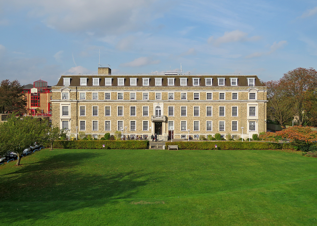
130:Cambridge- Shire Hall (geograph 5942730).jpg
891:
791:
419:– to copy, distribute and transmit the work
1249:
1161:
480:
724:https://www.geograph.org.uk/photo/5942730
565:https://www.geograph.org.uk/profile/38492
1007:89346969755b3686c036f36a123836a1e5c8b2eb
1626:
1618:
1610:
1602:
1594:
1586:
1578:
1570:
1559:
1549:
1541:
1533:
1525:
1517:
1509:
1501:
1493:
1483:
1475:
1465:
1455:
1447:
1437:
1429:
1419:
1411:
1390:
1382:
1371:
1363:
1355:
1345:
1337:
1329:
1321:
1310:
1302:
1291:
1281:
1271:
1261:
1221:
1134:
1118:
1097:
1081:
1060:
1044:
1005:
989:
971:
955:
915:
899:
871:
855:
815:
799:
773:
757:
686:
670:
650:
634:
614:
598:
531:
515:
498:
495:
476:
469:
288:
238:
1351:Adobe Photoshop Elements 3.0 Macintosh
1209:Transferred from geograph.co.uk using
317:View this and other nearby images on:
267:View this and other nearby images on:
1251:
7:
364:and is licensed for reuse under the
1150:
400:Attribution-Share Alike 2.0 Generic
388:
383:
368:Attribution-ShareAlike 2.0 license.
1242:
489:
483:
374:
351:
134:
117:
63:
488:
1304:Date and time of data generation
802:coordinates of the point of view
474:
430:Under the following conditions:
395:This file is licensed under the
387:
382:
376:
344:
323:
309:
301:
273:
259:
251:
84:
21:
1620:Date metadata was last modified
471:
135:
14:
689:file available on the internet
470:
352:This image was taken from the
26:
1:
1224:Cambridgeshire County Council
902:coordinates of depicted place
31:
817:52°12'43.085"N, 0°6'52.304"E
739:Geograph Britain and Ireland
573:object of statement has role
496:Items portrayed in this file
300:
250:
1511:Focal plane resolution unit
1384:Date and time of digitizing
1648:
1588:Supported Flashpix version
1522:One-chip color area sensor
1477:Supported Flashpix version
917:52°12'46.01"N, 0°6'50.87"E
444:same or compatible license
1392:Meaning of each component
1357:File change date and time
1151:
16:
1503:Focal plane Y resolution
1495:Focal plane X resolution
702:geograph.org.uk image ID
473:
410:
226:John Sutton /
207:John Sutton /
91:This is a file from the
1535:Custom image processing
1267:Canon PowerShot SX60 HS
1208:
874:Canon PowerShot SX60 HS
198:required by the license
176:
166:
155:
148:
145:
127:
95:. Information from its
1623:16:13, 16 October 2018
1413:Image compression mode
1387:13:41, 16 October 2018
1360:15:13, 16 October 2018
1307:13:41, 16 October 2018
358:this photograph's page
329:52.212780; 0.114130
279:52.211968; 0.114529
98:description page there
41:Size of this preview:
1449:Maximum land aperture
1331:Horizontal resolution
1234:Shire Hall, Cambridge
228:Cambridge: Shire Hall
209:Cambridge: Shire Hall
140:Cambridge: Shire Hall
1530:Digital still camera
1019:determination method
1365:Y and C positioning
1339:Vertical resolution
1278:1/1,000 sec (0.001)
1253:Camera manufacturer
1187:09:28, 5 April 2019
425:– to adapt the work
47:Other resolutions:
1572:Scene capture type
1556:Auto white balance
545:author name string
57:1,024 × 731 pixels
1635:
1634:
1612:Rating (out of 5)
1212:
893:
793:
637:copyright license
482:
373:
372:
356:collection. See
334:
333:
284:
283:
233:
232:
201:
185:
182:Reusing this file
113:
112:
93:Wikimedia Commons
1639:
1506:18,989.010989011
1498:18,962.962962963
1250:
1199:
1139:
1102:
1065:
1028:
1023:
939:
938:
933:
839:
838:
833:
741:
736:
726:
721:
717:described at URL
711:
706:
601:copyright status
582:
577:
567:
562:
552:
549:
466:
463:
460:
457:
454:
446:as the original.
408:
397:Creative Commons
391:
390:
386:
385:
380:
379:
366:Creative Commons
354:Geograph project
348:
341:
330:
327:
313:
312:
306:
305:
304:
298:
297:
286:
280:
277:
263:
262:
256:
255:
254:
248:
247:
236:
195:
179:
151:
139:
131:
125:
109:
88:
87:
81:
75:
73:
60:
53:640 × 457 pixels
49:320 × 228 pixels
43:800 × 571 pixels
1647:
1646:
1642:
1641:
1640:
1638:
1637:
1636:
1580:GPS tag version
1238:
1220:
1213:
1205:
1197:
1153:
1152:
1149:
1148:
1147:
1146:
1145:
1144:
1143:
1142:
1140:
1137:
1127:
1126:
1125:
1123:
1112:
1111:
1110:
1109:
1108:
1107:
1106:
1105:
1103:
1100:
1090:
1089:
1088:
1086:
1075:
1074:
1073:
1072:
1071:
1070:
1069:
1068:
1066:
1063:
1053:
1052:
1051:
1049:
1038:
1037:
1036:
1035:
1034:
1033:
1032:
1031:
1030:
1029:
1024:
1021:
1012:
1011:
1010:
1008:
998:
997:
996:
994:
983:
982:
981:
980:
979:
978:
977:
976:
974:
964:
963:
962:
960:
949:
948:
947:
946:
945:
944:
943:
942:
941:
940:
936:
934:
931:
922:
921:
920:
918:
908:
907:
906:
904:
885:
884:
883:
882:
881:
880:
879:
878:
876:
864:
863:
862:
860:
849:
848:
847:
846:
845:
844:
843:
842:
841:
840:
836:
834:
831:
822:
821:
820:
818:
808:
807:
806:
804:
785:
784:
783:
782:
781:
780:
779:
778:
776:
775:16 October 2018
766:
765:
764:
762:
751:
750:
749:
748:
747:
746:
745:
744:
743:
742:
737:
734:
728:
727:
722:
719:
713:
712:
707:
704:
695:
694:
693:
691:
679:
678:
677:
675:
664:
663:
662:
661:
660:
659:
658:
657:
655:
643:
642:
641:
639:
628:
627:
626:
625:
624:
623:
622:
621:
619:
607:
606:
605:
603:
592:
591:
590:
589:
588:
587:
586:
585:
584:
583:
578:
575:
569:
568:
563:
560:
554:
553:
550:
547:
538:
537:
536:
534:
524:
523:
522:
520:
509:
508:
507:
506:
505:
503:
487:
486:
485:
468:
467:
464:
461:
458:
455:
452:
451:
409:
406:
403:
392:
369:
339:
328:
302:
293:
292:
289:Object location
278:
252:
243:
242:
239:Camera location
234:
223:
216:
204:
161:geograph.org.uk
150:16 October 2018
141:
129:
122:
115:
114:
103:
102:
101:is shown below.
77:
71:
69:
62:
61:
46:
12:
11:
5:
1645:
1643:
1633:
1632:
1629:
1625:
1624:
1621:
1617:
1616:
1613:
1609:
1608:
1605:
1601:
1600:
1597:
1593:
1592:
1589:
1585:
1584:
1581:
1577:
1576:
1573:
1569:
1568:
1565:
1558:
1557:
1554:
1548:
1547:
1544:
1540:
1539:
1538:Normal process
1536:
1532:
1531:
1528:
1524:
1523:
1520:
1519:Sensing method
1516:
1515:
1512:
1508:
1507:
1504:
1500:
1499:
1496:
1492:
1491:
1488:
1482:
1481:
1478:
1474:
1473:
1470:
1464:
1463:
1460:
1454:
1453:
1450:
1446:
1445:
1442:
1436:
1435:
1432:
1428:
1427:
1424:
1418:
1417:
1414:
1410:
1409:
1408:
1407:
1406:does not exist
1404:
1401:
1398:
1393:
1389:
1388:
1385:
1381:
1380:
1377:
1370:
1369:
1366:
1362:
1361:
1358:
1354:
1353:
1348:
1344:
1343:
1340:
1336:
1335:
1332:
1328:
1327:
1324:
1320:
1319:
1316:
1309:
1308:
1305:
1301:
1300:
1297:
1290:
1289:
1286:
1280:
1279:
1276:
1270:
1269:
1264:
1260:
1259:
1254:
1241:
1237:
1236:
1231:
1226:
1218:
1217:
1216:
1211:
1210:
1207:
1203:
1200:
1194:
1189:
1184:
1180:
1179:
1176:
1173:
1170:
1167:
1164:
1157:
1156:
1141:
1135:
1133:
1132:
1131:
1130:
1129:
1128:
1124:
1119:
1117:
1116:
1115:
1114:
1113:
1104:
1098:
1096:
1095:
1094:
1093:
1092:
1091:
1087:
1082:
1080:
1079:
1078:
1077:
1076:
1067:
1061:
1059:
1058:
1057:
1056:
1055:
1054:
1050:
1045:
1043:
1042:
1041:
1040:
1039:
1017:
1016:
1015:
1014:
1013:
1009:
1006:
1004:
1003:
1002:
1001:
1000:
999:
995:
990:
988:
987:
986:
985:
984:
975:
972:
970:
969:
968:
967:
966:
965:
961:
956:
954:
953:
952:
951:
950:
927:
926:
925:
924:
923:
919:
916:
914:
913:
912:
911:
910:
909:
905:
900:
898:
897:
896:
895:
889:
877:
872:
870:
869:
868:
867:
866:
865:
861:
856:
854:
853:
852:
851:
850:
827:
826:
825:
824:
823:
819:
816:
814:
813:
812:
811:
810:
809:
805:
800:
798:
797:
796:
795:
789:
777:
774:
772:
771:
770:
769:
768:
767:
763:
758:
756:
755:
754:
753:
752:
730:
729:
715:
714:
700:
699:
698:
697:
696:
692:
687:
685:
684:
683:
682:
681:
680:
676:
673:source of file
671:
669:
668:
667:
666:
665:
656:
651:
649:
648:
647:
646:
645:
644:
640:
635:
633:
632:
631:
630:
629:
620:
615:
613:
612:
611:
610:
609:
608:
604:
599:
597:
596:
595:
594:
593:
571:
570:
556:
555:
543:
542:
541:
540:
539:
535:
532:
530:
529:
528:
527:
526:
525:
521:
516:
514:
513:
512:
511:
510:
504:
499:
497:
494:
493:
492:
491:
490:
479:
478:
475:
472:
450:
449:
448:
447:
437:
428:
427:
426:
420:
413:You are free:
404:
394:
393:
375:
371:
370:
349:
338:
335:
332:
331:
321:
315:
290:
282:
281:
271:
265:
240:
231:
230:
224:
221:
218:
217:
212:
205:
202:
190:
189:
186:
174:
173:
168:
164:
163:
157:
153:
152:
147:
143:
142:
132:
123:
121:
118:
116:
111:
110:
89:
79:
78:
40:
36:
35:
34:
29:
24:
19:
13:
10:
9:
6:
4:
3:
2:
1644:
1630:
1627:
1622:
1619:
1614:
1611:
1606:
1603:
1598:
1595:
1590:
1587:
1582:
1579:
1574:
1571:
1566:
1563:
1560:
1555:
1553:
1552:White balance
1550:
1546:Auto exposure
1545:
1543:Exposure mode
1542:
1537:
1534:
1529:
1526:
1521:
1518:
1513:
1510:
1505:
1502:
1497:
1494:
1489:
1487:
1484:
1479:
1476:
1471:
1469:
1466:
1461:
1459:
1458:Metering mode
1456:
1451:
1448:
1443:
1441:
1440:Exposure bias
1438:
1433:
1431:APEX aperture
1430:
1425:
1423:
1422:Shutter speed
1420:
1415:
1412:
1405:
1402:
1399:
1396:
1395:
1394:
1391:
1386:
1383:
1378:
1375:
1372:
1367:
1364:
1359:
1356:
1352:
1349:
1347:Software used
1346:
1341:
1338:
1333:
1330:
1325:
1322:
1317:
1315:
1311:
1306:
1303:
1298:
1295:
1292:
1287:
1285:
1282:
1277:
1275:
1274:Exposure time
1272:
1268:
1265:
1262:
1258:
1255:
1252:
1248:
1245:
1239:
1235:
1232:
1230:
1227:
1225:
1222:
1214:
1206:
1201:
1195:
1193:
1190:
1188:
1185:
1182:
1181:
1177:
1174:
1171:
1168:
1165:
1163:
1162:
1160:
1154:
1122:
1085:
1048:
1027:
1020:
993:
959:
930:
903:
875:
859:
858:captured with
830:
803:
761:
740:
733:
725:
718:
710:
703:
690:
674:
654:
638:
618:
602:
581:
574:
566:
559:
546:
519:
502:
456:CC BY-SA 2.0
445:
441:
438:
435:
432:
431:
429:
424:
421:
418:
415:
414:
412:
411:
405:Attribution:
401:
398:
381:
367:
363:
359:
355:
350:
347:
343:
342:
336:
326:
322:
320:
319:OpenStreetMap
316:
314:
296:
291:
287:
276:
272:
270:
269:OpenStreetMap
266:
264:
246:
241:
237:
229:
225:
220:
219:
215:
211: /
210:
206:
199:
194:
192:
191:
187:
183:
178:
175:
172:
169:
165:
162:
158:
154:
144:
138:
133:
126:
119:
107:
100:
99:
94:
90:
83:
82:
76:
67:
66:Original file
58:
54:
50:
44:
39:
33:
30:
28:
25:
23:
20:
18:
15:
1604:Image height
1562:Digital zoom
1490:Uncalibrated
1452:4 APEX (f/4)
1314:focal length
1263:Camera model
1246:
1243:
1196:1,024 × 731
1158:
1155:File history
580:photographer
439:
433:
422:
416:
361:
299:
249:
227:
214:CC BY-SA 2.0
208:
136:
106:You can help
96:
64:
22:File history
1628:IIM version
1596:Image width
1527:File source
1486:Color space
1323:Orientation
617:copyrighted
551:John Sutton
440:share alike
434:attribution
407:John Sutton
362:John Sutton
193:Attribution
171:John Sutton
128:Description
1215:File usage
1172:Dimensions
973:image/jpeg
958:media type
533:some value
177:Permission
72:image/jpeg
27:File usage
1294:ISO speed
1169:Thumbnail
1166:Date/Time
1047:data size
760:inception
337:Licensing
222:InfoField
203:InfoField
137:English:
1599:1,024 px
1575:Standard
1368:Co-sited
1318:6.196 mm
1284:F-number
1240:Metadata
1198:(878 KB)
1062:898,940
992:checksum
732:operator
477:Captions
423:to remix
417:to share
402:license.
32:Metadata
1583:0.0.3.2
1462:Pattern
1426:9.96875
1376:version
1342:636 dpi
1334:636 dpi
1183:current
1178:Comment
929:heading
888:heading
829:heading
788:heading
709:5942730
518:creator
501:depicts
481:English
120:Summary
68:
1607:731 px
1514:inches
1326:Normal
1296:rating
1204:Tyssil
1136:1,024
1084:height
937:degree
892:degree
837:degree
792:degree
307:
257:
167:Author
156:Source
1564:ratio
1468:Flash
1312:Lens
1257:Canon
1138:pixel
1121:width
1101:pixel
1026:SHA-1
159:From
1374:Exif
1175:User
1099:731
1064:byte
935:337
835:337
465:true
462:true
146:Date
17:File
1379:2.3
1299:125
1288:f/4
558:URL
1403:Cr
1400:Cb
1022::
932::
832::
735::
720::
705::
576::
561::
548::
55:|
51:|
45:.
1631:2
1615:0
1591:1
1567:1
1480:1
1444:0
1434:4
1416:3
1397:Y
200:)
196:(
184:)
180:(
108:.
74:)
59:.
Text is available under the Creative Commons Attribution-ShareAlike License. Additional terms may apply.
.jpg)
.jpg¶ms=052.211968_N_0000.114529_E_globe:Earth_type:camera_source:geograph-osgb36(TL44575919)_heading:337.00&language=en)
.jpg¶ms=052.212780_N_0000.114130_E_globe:Earth_class:object_type:object_source:geograph-osgb36(TL44545928)_heading:337.00&language=en)
