38:
221:
227:
232:
94:
706:
279:– You must give appropriate credit, provide a link to the license, and indicate if changes were made. You may do so in any reasonable manner, but not in any way that suggests the licensor endorses you or your use.
1361:
869:
68:
64:
60:
56:
52:
48:
42:
210:
105:
77:
539:
417:
381:
286:
764:
634:
597:
560:
505:
471:
365:
532:
437:
401:
348:
1077:
944:
183:
242:
1087:
745:
The following pages on the
English Knowledge (XXG) use this file (pages on other projects are not listed):
809:
285:– If you remix, transform, or build upon the material, you must distribute your contributions under the
884:
239:
1059:
143:
170:
834:
728:
113:
705:
700:
37:
731:
highlighted. Equirectangular map projection on WGS 84 datum, with N/S stretched 160% |Source=
999:
994:
167:
1049:
924:
904:
864:
839:
804:
732:
909:
716:
1044:
1029:
1014:
1004:
919:
774:
100:
959:
934:
914:
799:
794:
754:
198:
979:
894:
874:
849:
784:
759:
187:
156:
1039:
1024:
989:
929:
859:
854:
824:
814:
1054:
984:
969:
964:
879:
1282:
1034:
1019:
1009:
954:
844:
819:
789:
769:
949:
889:
829:
749:
148:
Equirectangular map projection on WGS 84 datum, with N/S stretched 160%
176:
Coastline and administrative boundary data from
Boundary-Line product.
974:
939:
1152:
1307:
673:
Click on a date/time to view the file as it appeared at that time.
899:
779:
250:
Contains
Ordnance Survey data © Crown copyright and database right
139:
1117:
724:
88:
82:(SVG file, nominally 1,425 × 1,000 pixels, file size: 1.18 MB)
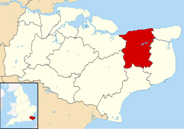
1312:
1302:
1257:
1322:
1177:
1107:
1212:
1352:
1262:
1242:
1217:
1207:
1197:
1347:
1267:
1182:
1332:
1287:
1252:
1167:
1317:
1232:
1227:
1192:
1162:
1147:
1127:
1097:
332:
Add a one-line explanation of what this file represents
1172:
1297:
1292:
1277:
1272:
1237:
1202:
1137:
1327:
1247:
1187:
418:
Creative
Commons Attribution-ShareAlike 3.0 Unported
127:
112:
Commons is a freely licensed media file repository.
1342:
1222:
1142:
1337:
1157:
296:https://creativecommons.org/licenses/by-sa/3.0
93:
302:Creative Commons Attribution-Share Alike 3.0
220:
8:
262:– to copy, distribute and transmit the work
41:Size of this PNG preview of this SVG file:
675:
328:
1070:The following other wikis use this file:
870:Heart's Delight, City of Canterbury
521:c1c4b0558348476ab591f6d88ff6c46798fb6304
747:
648:
632:
611:
595:
574:
558:
519:
503:
485:
469:
451:
435:
415:
399:
379:
363:
346:
343:
324:
317:
7:
243:Attribution-Share Alike 3.0 Unported
201:, created using Ordnance Survey data
664:
231:
226:
723:{{Information |Description=Map of
337:
331:
217:
179:Lake data from Meridian 2 product.
125:
75:
336:
322:
273:Under the following conditions:
238:This file is licensed under the
230:
225:
219:
92:
31:
21:
319:
14:
318:
26:
1:
765:Bekesbourne-with-Patrixbourne
133:Canterbury UK locator map.svg
735:[https://www.ordnancesurvey.
344:Items portrayed in this file
1084:Usage on azb.wikipedia.org
1378:
1134:Usage on fr.wikipedia.org
1124:Usage on fi.wikipedia.org
1114:Usage on es.wikipedia.org
1104:Usage on cy.wikipedia.org
1094:Usage on br.wikipedia.org
1074:Usage on ar.wikipedia.org
287:same or compatible license
1283:Modèle:Palette Canterbury
665:
16:
945:Pett Bottom (Canterbury)
321:
253:
184:England location map.svg
99:This is a file from the
722:
205:
194:
162:
155:
152:
130:
103:. Information from its
1308:Broomfield (Herne Bay)
106:description page there
810:Broomfield, Herne Bay
1118:Ciudad de Canterbury
885:Herne and Broomfield
701:09:06, 2 August 2011
533:determination method
69:1,425 × 1,000 pixels
65:2,560 × 1,796 pixels
1060:Template:Canterbury
268:– to adapt the work
182:Inset derived from
47:Other resolutions:
1153:Cité de Canterbury
835:City of Canterbury
61:1,280 × 898 pixels
57:1,024 × 719 pixels
1362:more global usage
1066:Global file usage
738:
402:copyright license
330:
315:
314:
214:
211:Reusing this file
121:
120:
101:Wikimedia Commons
32:Global file usage
1369:
1313:Eddington (Kent)
1303:Broad Oak (Kent)
1258:Marshside (Kent)
1000:Upper Harbledown
995:Tyler Hill, Kent
713:
653:
616:
579:
542:
537:
366:copyright status
309:
306:
303:
300:
297:
289:as the original.
251:
240:Creative Commons
234:
233:
229:
228:
223:
222:
208:
158:
134:
128:
117:
96:
95:
89:
83:
72:
53:640 × 449 pixels
49:320 × 225 pixels
43:800 × 561 pixels
1377:
1376:
1372:
1371:
1370:
1368:
1367:
1366:
1323:Hawthorn Corner
1178:Kingston (Kent)
1108:Dinas Caergaint
1064:
1050:Woolage Village
925:Marshside, Kent
905:Ickham and Well
865:Hawthorn Corner
840:Eddington, Kent
805:Broad Oak, Kent
746:
739:
733:Ordnance Survey
719:
711:
667:
666:
663:
662:
661:
660:
659:
658:
657:
656:
654:
651:
641:
640:
639:
637:
626:
625:
624:
623:
622:
621:
620:
619:
617:
614:
604:
603:
602:
600:
589:
588:
587:
586:
585:
584:
583:
582:
580:
577:
567:
566:
565:
563:
552:
551:
550:
549:
548:
547:
546:
545:
544:
543:
538:
535:
526:
525:
524:
522:
512:
511:
510:
508:
497:
496:
495:
494:
493:
492:
491:
490:
488:
478:
477:
476:
474:
463:
462:
461:
460:
459:
458:
457:
456:
454:
444:
443:
442:
440:
429:
428:
427:
426:
425:
424:
423:
422:
420:
408:
407:
406:
404:
393:
392:
391:
390:
389:
388:
387:
386:
384:
372:
371:
370:
368:
357:
356:
355:
354:
353:
351:
335:
334:
333:
316:
311:
310:
307:
304:
301:
298:
295:
294:
252:
249:
246:
235:
168:Ordnance Survey
132:
123:
122:
111:
110:
109:is shown below.
85:
81:
74:
73:
46:
12:
11:
5:
1375:
1373:
1364:of this file.
1358:
1357:
1356:
1355:
1350:
1345:
1340:
1335:
1330:
1325:
1320:
1315:
1310:
1305:
1300:
1295:
1290:
1285:
1280:
1275:
1270:
1265:
1260:
1255:
1250:
1245:
1240:
1235:
1230:
1225:
1220:
1215:
1213:Waltham (Kent)
1210:
1205:
1200:
1195:
1190:
1185:
1180:
1175:
1170:
1165:
1160:
1155:
1150:
1145:
1140:
1132:
1131:
1130:
1122:
1121:
1120:
1112:
1111:
1110:
1102:
1101:
1100:
1092:
1091:
1090:
1082:
1081:
1080:
1068:
1067:
1063:
1062:
1057:
1052:
1047:
1042:
1037:
1032:
1027:
1022:
1017:
1012:
1007:
1002:
997:
992:
987:
982:
977:
972:
967:
962:
957:
952:
947:
942:
937:
932:
927:
922:
917:
912:
910:Kingston, Kent
907:
902:
897:
892:
887:
882:
877:
872:
867:
862:
857:
852:
847:
842:
837:
832:
827:
822:
817:
812:
807:
802:
797:
792:
787:
782:
777:
772:
767:
762:
757:
752:
744:
743:
742:
737:
736:
721:
717:
714:
710:1,425 × 1,000
708:
703:
698:
694:
693:
690:
687:
684:
681:
678:
671:
670:
655:
649:
647:
646:
645:
644:
643:
642:
638:
633:
631:
630:
629:
628:
627:
618:
612:
610:
609:
608:
607:
606:
605:
601:
596:
594:
593:
592:
591:
590:
581:
575:
573:
572:
571:
570:
569:
568:
564:
559:
557:
556:
555:
554:
553:
531:
530:
529:
528:
527:
523:
520:
518:
517:
516:
515:
514:
513:
509:
504:
502:
501:
500:
499:
498:
489:
486:
484:
483:
482:
481:
480:
479:
475:
470:
468:
467:
466:
465:
464:
455:
452:
450:
449:
448:
447:
446:
445:
441:
436:
434:
433:
432:
431:
430:
421:
416:
414:
413:
412:
411:
410:
409:
405:
400:
398:
397:
396:
395:
394:
385:
380:
378:
377:
376:
375:
374:
373:
369:
364:
362:
361:
360:
359:
358:
352:
347:
345:
342:
341:
340:
339:
338:
327:
326:
323:
320:
313:
312:
293:
292:
291:
290:
280:
271:
270:
269:
263:
256:You are free:
247:
237:
236:
218:
215:
203:
202:
196:
192:
191:
181:
180:
177:
164:
160:
159:
154:
150:
149:
135:
126:
124:
119:
118:
97:
87:
86:
40:
36:
35:
34:
29:
24:
19:
13:
10:
9:
6:
4:
3:
2:
1374:
1365:
1363:
1354:
1353:Lower Hardres
1351:
1349:
1346:
1344:
1341:
1339:
1336:
1334:
1331:
1329:
1326:
1324:
1321:
1319:
1316:
1314:
1311:
1309:
1306:
1304:
1301:
1299:
1296:
1294:
1291:
1289:
1286:
1284:
1281:
1279:
1276:
1274:
1271:
1269:
1266:
1264:
1263:Woolage Green
1261:
1259:
1256:
1254:
1251:
1249:
1246:
1244:
1243:Barham (Kent)
1241:
1239:
1236:
1234:
1231:
1229:
1226:
1224:
1221:
1219:
1218:Upper Hardres
1216:
1214:
1211:
1209:
1208:Bishopsbourne
1206:
1204:
1201:
1199:
1198:Bridge (Kent)
1196:
1194:
1191:
1189:
1186:
1184:
1181:
1179:
1176:
1174:
1171:
1169:
1166:
1164:
1161:
1159:
1156:
1154:
1151:
1149:
1146:
1144:
1141:
1139:
1136:
1135:
1133:
1129:
1126:
1125:
1123:
1119:
1116:
1115:
1113:
1109:
1106:
1105:
1103:
1099:
1096:
1095:
1093:
1089:
1086:
1085:
1083:
1079:
1076:
1075:
1073:
1072:
1071:
1065:
1061:
1058:
1056:
1053:
1051:
1048:
1046:
1045:Woolage Green
1043:
1041:
1038:
1036:
1033:
1031:
1030:Wickhambreaux
1028:
1026:
1023:
1021:
1018:
1016:
1015:Waltham, Kent
1013:
1011:
1008:
1006:
1005:Upper Hardres
1003:
1001:
998:
996:
993:
991:
988:
986:
983:
981:
978:
976:
973:
971:
968:
966:
963:
961:
958:
956:
953:
951:
948:
946:
943:
941:
938:
936:
933:
931:
928:
926:
923:
921:
920:Lower Hardres
918:
916:
913:
911:
908:
906:
903:
901:
898:
896:
893:
891:
888:
886:
883:
881:
878:
876:
873:
871:
868:
866:
863:
861:
858:
856:
853:
851:
848:
846:
843:
841:
838:
836:
833:
831:
828:
826:
823:
821:
818:
816:
813:
811:
808:
806:
803:
801:
798:
796:
793:
791:
788:
786:
783:
781:
778:
776:
775:Bishopsbourne
773:
771:
768:
766:
763:
761:
758:
756:
753:
751:
748:
740:
734:
730:
726:
720:
715:
709:
707:
704:
702:
699:
696:
695:
691:
688:
685:
682:
679:
677:
676:
674:
668:
636:
599:
562:
541:
534:
507:
487:image/svg+xml
473:
453:2 August 2011
439:
419:
403:
383:
367:
350:
299:CC BY-SA 3.0
288:
284:
281:
278:
275:
274:
272:
267:
264:
261:
258:
257:
255:
254:
248:Attribution:
244:
241:
224:
216:
212:
207:
204:
200:
197:
193:
189:
185:
178:
175:
174:
173:
172:
169:
165:
161:
157:2 August 2011
151:
147:
146:highlighted.
145:
141:
136:
129:
115:
108:
107:
102:
98:
91:
90:
84:
79:
78:Original file
70:
66:
62:
58:
54:
50:
44:
39:
33:
30:
28:
25:
23:
20:
18:
15:
1359:
1348:Littlebourne
1268:Grays (Kent)
1183:Herne (Kent)
1078:سيتي كنتربري
1069:
960:Rough Common
935:Patrixbourne
915:Littlebourne
800:Bridge, Kent
795:Breach, Kent
755:Barham, Kent
672:
669:File history
282:
276:
265:
259:
166:
137:
114:You can help
104:
76:
22:File history
1333:Hillborough
1288:Bekesbourne
1253:Boyden Gate
1168:Swalecliffe
1088:شهر کنتربری
980:Swalecliffe
895:Hillborough
875:Herne, Kent
850:Grays, Kent
785:Boyden Gate
760:Bekesbourne
382:copyrighted
283:share alike
277:attribution
131:Description
1318:Harbledown
1233:Tyler Hill
1228:Hackington
1193:Womenswold
1163:Chestfield
1148:Whitstable
1128:Canterbury
1098:Canterbury
1040:Womenswold
1025:Whitstable
990:Thanington
930:Nackington
860:Harbledown
855:Hackington
825:Chestfield
815:Canterbury
741:File usage
729:Canterbury
727:, UK with
686:Dimensions
576:1,234,755
472:media type
206:Permission
144:Canterbury
142:, UK with
27:File usage
1173:Herne Bay
1055:Yorkletts
985:Tankerton
970:Stodmarsh
965:Seasalter
880:Herne Bay
718:Nilfanion
712:(1.18 MB)
683:Thumbnail
680:Date/Time
561:data size
438:inception
199:Nilfanion
1298:Bapchild
1293:Beltinge
1278:Reculver
1273:Bramling
1238:Westbere
1203:Chartham
1138:Fordwich
1035:Wincheap
1020:Westbere
1010:Upstreet
955:Reculver
845:Fordwich
820:Chartham
790:Bramling
770:Beltinge
506:checksum
325:Captions
266:to remix
260:to share
245:license.
188:Spischot
171:OpenData
1328:Hersden
1248:Chislet
1188:Adisham
950:Radfall
890:Hersden
830:Chislet
750:Adisham
697:current
692:Comment
349:depicts
329:English
138:Map of
80:
1343:Ickham
1223:Petham
1143:Sturry
975:Sturry
940:Petham
650:1,425
613:1,000
598:height
195:Author
163:Source
1360:View
1338:Hoath
1158:Blean
900:Hoath
780:Blean
652:pixel
635:width
615:pixel
540:SHA-1
725:Kent
689:User
578:byte
308:true
305:true
153:Date
140:Kent
17:File
186:by
536::
67:|
63:|
59:|
55:|
51:|
45:.
213:)
209:(
190:.
116:.
71:.
Text is available under the Creative Commons Attribution-ShareAlike License. Additional terms may apply.
