251:
212:
226:
43:
257:
103:
900:
298:– You must give appropriate credit, provide a link to the license, and indicate if changes were made. You may do so in any reasonable manner, but not in any way that suggests the licensor endorses you or your use.
203:
1039:
1242:
931:
733:
575:
505:
469:
219:
1265:
1052:
This file contains additional information, probably added from the digital camera or scanner used to create or digitize it.
1207:
Some rights reserved - You must give appropriate credit, provide a link to the license, and indicate if changes were made.
611:
941:
828:
791:
754:
699:
665:
631:
595:
559:
453:
425:
412:
397:
69:
65:
61:
57:
53:
47:
726:
525:
489:
370:
353:
114:
82:
404:
994:
1055:
If the file has been modified from its original state, some details may not fully reflect the modified file.
927:
The following pages on the
English Knowledge (XXG) use this file (pages on other projects are not listed):
1302:
267:
264:
1330:
122:
1396:
432:
1064:
166:
225:
899:
894:
73:
42:
1320:
1284:
1103:
910:
109:
244:
I, the copyright holder of this work, hereby publish it under the following license:
1143:
1074:
936:
209:
1180:
186:
1123:
1019:
1113:
989:
974:
1009:
624:
867:
Click on a date/time to view the file as it appeared at that time.
1029:
999:
211:
969:
204:
48° 41′ 12.99″ N, 2° 19′ 05.35″ W
194:
97:
984:
995:
Liste des sites classés et inscrits des Côtes-d'Armor
1193:
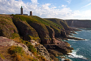
Cap Fréhel
Lighthouse and Cliffs, Côtes d'Armor, Brittany
1172:
Cap Fréhel
Lighthouse and Cliffs, Côtes d'Armor, Brittany
157:
Cap Fréhel
Lighthouse and Cliffs, Côtes d'Armor, Brittany
337:
Add a one-line explanation of what this file represents
959:
87:(5,202 × 3,468 pixels, file size: 4.81 MB, MIME type:
141:
121:
Commons is a freely licensed media file repository.
1095:CC BY 3.0, Jean-Marie Hullot, Some rights reserved
1335:Flash did not fire, compulsory flash suppression
102:
250:
8:
1181:https://creativecommons.org/licenses/by/3.0/
433:https://commons.wikimedia.org/user:Jmhullot
305:https://creativecommons.org/licenses/by/3.0
281:– to copy, distribute and transmit the work
1057:
869:
333:
1243:Adobe Photoshop Lightroom 5.7 (Macintosh)
952:The following other wikis use this file:
506:Creative Commons Attribution 3.0 Unported
715:d6943fb207bf0389e111948032fd6a40aa67571c
1428:
1420:
1412:
1391:
1370:
1362:
1354:
1346:
1338:
1328:
1318:
1310:
1300:
1292:
1282:
1274:
1263:
1255:
1247:
1237:
1229:
1221:
1213:
1204:
1199:
1190:
1185:
1175:
1167:
1159:
1151:
1140:
1132:
1121:
1111:
1101:
1092:
1087:
1079:
1069:
929:
842:
826:
805:
789:
768:
752:
713:
697:
679:
663:
645:
629:
609:
593:
573:
557:
539:
523:
503:
487:
467:
451:
384:
368:
351:
348:
329:
322:
197:
218:View this and other nearby images on:
1059:
7:
917:User created page with UploadWizard
858:
256:
1050:
342:
336:
272:
247:
243:
151:
134:
80:
341:
311:Creative Commons Attribution 3.0
1359:078BC792BACDDB5A90321FBE37B8494A
1134:Date and time of data generation
932:Brittany (administrative region)
647:48°41'12.99001"N, 2°19'5.35199"W
632:coordinates of the point of view
327:
292:Under the following conditions:
263:This file is licensed under the
255:
249:
224:
210:
101:
31:
21:
1348:Date metadata was last modified
1020:Bretania (region aministrativa)
324:
152:
14:
1356:Unique ID of original document
323:
26:
1:
576:original creation by uploader
36:
942:User:WillyMeriwether/sandbox
349:Items portrayed in this file
1276:Date and time of digitizing
1016:Usage on lld.wikipedia.org
1006:Usage on fr.wikivoyage.org
956:Usage on ban.wikipedia.org
1450:
1177:Online copyright statement
1036:Usage on th.wikipedia.org
1026:Usage on nl.wikipedia.org
990:Label Grand Site de France
981:Usage on fr.wikipedia.org
975:Label Grand Site de France
966:Usage on de.wikipedia.org
1249:File change date and time
859:
176:
16:
326:
268:Attribution 3.0 Unported
108:This is a file from the
1414:Province or state shown
916:
182:
172:
165:
162:
144:
112:. Information from its
1010:Grands sites de France
895:23:24, 19 January 2015
230:48.686942; -2.318153
167:25 July 2013, 17:55:47
115:description page there
46:Size of this preview:
1351:17:30, 3 January 2015
1312:Maximum land aperture
1252:16:30, 3 January 2015
1223:Horizontal resolution
1030:Grand Site de France
727:determination method
147:Cap Frehel Cliff.jpg
74:5,202 × 3,468 pixels
70:2,560 × 1,707 pixels
1393:Contact information
1279:17:55, 25 July 2013
1231:Vertical resolution
1137:17:55, 25 July 2013
1061:Camera manufacturer
287:– to adapt the work
52:Other resolutions:
970:Benutzer:To old/SW
413:author name string
398:Wikimedia username
66:1,280 × 853 pixels
62:1,024 × 683 pixels
1437:
1436:
1307:−0.33333333333333
1260:Aperture priority
1084:Jean-Marie Hullot
948:Global file usage
920:
490:copyright license
335:
235:
234:
192:
191:
130:
129:
110:Wikimedia Commons
32:Global file usage
1441:
1407:
1364:Copyright status
1257:Exposure Program
1208:
1194:
1156:48° 41′ 12.99″ N
1108:1/100 sec (0.01)
1096:
1089:Copyright holder
1058:
907:
847:
810:
773:
736:
731:
454:copyright status
435:
430:
420:
417:
407:
402:
318:
315:
312:
309:
306:
265:Creative Commons
259:
258:
253:
252:
231:
228:
214:
213:
207:
206:
195:
178:
168:
156:
148:
142:
126:
105:
104:
98:
92:
90:
77:
58:640 × 427 pixels
54:320 × 213 pixels
48:800 × 533 pixels
1449:
1448:
1444:
1443:
1442:
1440:
1439:
1438:
1409:
1405:
1403:
1399:
1340:GPS tag version
1206:
1192:
1094:
1046:
946:
928:
921:
913:
905:
861:
860:
857:
856:
855:
854:
853:
852:
851:
850:
848:
845:
835:
834:
833:
831:
820:
819:
818:
817:
816:
815:
814:
813:
811:
808:
798:
797:
796:
794:
783:
782:
781:
780:
779:
778:
777:
776:
774:
771:
761:
760:
759:
757:
746:
745:
744:
743:
742:
741:
740:
739:
738:
737:
732:
729:
720:
719:
718:
716:
706:
705:
704:
702:
691:
690:
689:
688:
687:
686:
685:
684:
682:
672:
671:
670:
668:
657:
656:
655:
654:
653:
652:
651:
650:
648:
638:
637:
636:
634:
623:
622:
621:
620:
619:
618:
617:
616:
614:
602:
601:
600:
598:
587:
586:
585:
584:
583:
582:
581:
580:
578:
566:
565:
564:
562:
551:
550:
549:
548:
547:
546:
545:
544:
542:
532:
531:
530:
528:
517:
516:
515:
514:
513:
512:
511:
510:
508:
496:
495:
494:
492:
481:
480:
479:
478:
477:
476:
475:
474:
472:
460:
459:
458:
456:
445:
444:
443:
442:
441:
440:
439:
438:
437:
436:
431:
428:
422:
421:
418:
415:
409:
408:
403:
400:
391:
390:
389:
387:
377:
376:
375:
373:
362:
361:
360:
359:
358:
356:
340:
339:
338:
321:
320:
319:
316:
313:
310:
307:
304:
303:
271:
260:
246:
245:
240:
229:
202:
201:
198:Camera location
193:
158:
146:
139:
132:
131:
120:
119:
118:is shown below.
94:
88:
86:
79:
78:
51:
12:
11:
5:
1447:
1445:
1435:
1434:
1431:
1427:
1426:
1423:
1419:
1418:
1415:
1411:
1410:
1401:
1394:
1390:
1389:
1388:
1387:
1384:
1381:
1378:
1373:
1369:
1368:
1365:
1361:
1360:
1357:
1353:
1352:
1349:
1345:
1344:
1341:
1337:
1336:
1333:
1327:
1326:
1323:
1317:
1316:
1313:
1309:
1308:
1305:
1299:
1298:
1295:
1291:
1290:
1287:
1281:
1280:
1277:
1273:
1272:
1269:
1262:
1261:
1258:
1254:
1253:
1250:
1246:
1245:
1240:
1236:
1235:
1232:
1228:
1227:
1224:
1220:
1219:
1216:
1212:
1211:
1210:
1209:
1202:
1198:
1197:
1196:
1195:
1188:
1184:
1183:
1178:
1174:
1173:
1170:
1166:
1165:
1164:2° 19′ 5.35″ W
1162:
1158:
1157:
1154:
1150:
1149:
1146:
1139:
1138:
1135:
1131:
1130:
1127:
1120:
1119:
1116:
1110:
1109:
1106:
1100:
1099:
1098:
1097:
1090:
1086:
1085:
1082:
1078:
1077:
1072:
1068:
1067:
1062:
1049:
1045:
1044:
1043:
1042:
1034:
1033:
1032:
1024:
1023:
1022:
1014:
1013:
1012:
1004:
1003:
1002:
1000:Fée des houles
997:
992:
987:
979:
978:
977:
972:
964:
963:
962:
950:
949:
945:
944:
939:
934:
926:
925:
924:
919:
918:
915:
911:
908:
904:5,202 × 3,468
902:
897:
892:
888:
887:
884:
881:
878:
875:
872:
865:
864:
849:
843:
841:
840:
839:
838:
837:
836:
832:
827:
825:
824:
823:
822:
821:
812:
806:
804:
803:
802:
801:
800:
799:
795:
790:
788:
787:
786:
785:
784:
775:
769:
767:
766:
765:
764:
763:
762:
758:
753:
751:
750:
749:
748:
747:
725:
724:
723:
722:
721:
717:
714:
712:
711:
710:
709:
708:
707:
703:
698:
696:
695:
694:
693:
692:
683:
680:
678:
677:
676:
675:
674:
673:
669:
664:
662:
661:
660:
659:
658:
649:
646:
644:
643:
642:
641:
640:
639:
635:
630:
628:
627:
626:
625:
615:
610:
608:
607:
606:
605:
604:
603:
599:
594:
592:
591:
590:
589:
588:
579:
574:
572:
571:
570:
569:
568:
567:
563:
560:source of file
558:
556:
555:
554:
553:
552:
543:
540:
538:
537:
536:
535:
534:
533:
529:
524:
522:
521:
520:
519:
518:
509:
504:
502:
501:
500:
499:
498:
497:
493:
488:
486:
485:
484:
483:
482:
473:
468:
466:
465:
464:
463:
462:
461:
457:
452:
450:
449:
448:
447:
446:
424:
423:
411:
410:
396:
395:
394:
393:
392:
388:
385:
383:
382:
381:
380:
379:
378:
374:
369:
367:
366:
365:
364:
363:
357:
352:
350:
347:
346:
345:
344:
343:
332:
331:
328:
325:
302:
301:
300:
299:
290:
289:
288:
282:
275:You are free:
262:
261:
248:
242:
241:
239:
236:
233:
232:
222:
216:
199:
190:
189:
184:
180:
179:
174:
170:
169:
164:
160:
159:
149:
140:
138:
135:
133:
128:
127:
106:
96:
95:
45:
41:
40:
39:
34:
29:
24:
19:
13:
10:
9:
6:
4:
3:
2:
1446:
1432:
1429:
1424:
1422:Country shown
1421:
1416:
1413:
1408:
1400:
1397:
1395:
1392:
1385:
1383:Côtes d'Armor
1382:
1379:
1376:
1375:
1374:
1371:
1366:
1363:
1358:
1355:
1350:
1347:
1342:
1339:
1334:
1332:
1329:
1324:
1322:
1321:Metering mode
1319:
1314:
1311:
1306:
1304:
1303:Exposure bias
1301:
1296:
1294:APEX aperture
1293:
1288:
1286:
1285:Shutter speed
1283:
1278:
1275:
1270:
1267:
1264:
1259:
1256:
1251:
1248:
1244:
1241:
1239:Software used
1238:
1233:
1230:
1225:
1222:
1217:
1214:
1205:
1203:
1200:
1191:
1189:
1186:
1182:
1179:
1176:
1171:
1168:
1163:
1160:
1155:
1152:
1147:
1145:
1141:
1136:
1133:
1128:
1125:
1122:
1117:
1115:
1112:
1107:
1105:
1104:Exposure time
1102:
1093:
1091:
1088:
1083:
1080:
1076:
1073:
1070:
1066:
1063:
1060:
1056:
1053:
1047:
1041:
1038:
1037:
1035:
1031:
1028:
1027:
1025:
1021:
1018:
1017:
1015:
1011:
1008:
1007:
1005:
1001:
998:
996:
993:
991:
988:
986:
983:
982:
980:
976:
973:
971:
968:
967:
965:
961:
958:
957:
955:
954:
953:
947:
943:
940:
938:
935:
933:
930:
922:
914:
909:
903:
901:
898:
896:
893:
890:
889:
885:
882:
879:
876:
873:
871:
870:
868:
862:
830:
793:
756:
735:
728:
701:
667:
633:
613:
597:
596:captured with
577:
561:
527:
507:
491:
471:
455:
434:
427:
414:
406:
399:
372:
355:
297:
294:
293:
291:
286:
283:
280:
277:
276:
274:
273:
269:
266:
254:
237:
227:
223:
221:
220:OpenStreetMap
217:
215:
205:
200:
196:
188:
185:
181:
175:
171:
161:
155:
150:
143:
136:
124:
117:
116:
111:
107:
100:
99:
93:
84:
83:Original file
75:
71:
67:
63:
59:
55:
49:
44:
38:
35:
33:
30:
28:
25:
23:
20:
18:
15:
1402:
1398:
1315:4 APEX (f/4)
1144:focal length
1075:Canon EOS 6D
1071:Camera model
1054:
1051:
1040:แคว้นเบรอตาญ
951:
937:Houles fairy
866:
863:File history
612:Canon EOS 6D
541:25 July 2013
295:
284:
278:
153:
123:You can help
113:
81:
22:File history
1430:IIM version
1367:Copyrighted
1201:Usage terms
1187:Image title
470:copyrighted
296:attribution
145:Description
1380:Cap Fréhel
1215:City shown
985:Cap Fréhel
923:File usage
880:Dimensions
770:5,046,384
681:image/jpeg
666:media type
386:some value
308:CC BY 3.0
89:image/jpeg
27:File usage
1161:Longitude
1124:ISO speed
906:(4.81 MB)
877:Thumbnail
874:Date/Time
755:data size
526:inception
238:Licensing
154:English:
1417:Bretagne
1377:Brittany
1372:Keywords
1289:6.643856
1169:Headline
1153:Latitude
1114:F-number
1048:Metadata
960:Bretagne
912:Jmhullot
700:checksum
419:Jmhullot
405:Jmhullot
330:Captions
285:to remix
279:to share
270:license.
187:Jmhullot
177:Own work
37:Metadata
1343:0.0.2.2
1325:Pattern
1268:version
1234:240 dpi
1226:240 dpi
891:current
886:Comment
371:creator
354:depicts
334:English
137:Summary
85:
1425:France
1406:France
1386:France
1218:Fréhel
1126:rating
1081:Author
844:5,202
807:3,468
792:height
208:
183:Author
173:Source
1404:, ,
1331:Flash
1148:32 mm
1142:Lens
1065:Canon
846:pixel
829:width
809:pixel
734:SHA-1
1266:Exif
1118:f/16
883:User
772:byte
317:true
314:true
163:Date
17:File
1271:2.3
1129:100
426:URL
730::
429::
416::
401::
72:|
68:|
64:|
60:|
56:|
50:.
1433:4
1297:8
125:.
91:)
76:.
Text is available under the Creative Commons Attribution-ShareAlike License. Additional terms may apply.
