348:
281:
231:
273:
223:
295:
245:
316:
354:
359:
72:
824:"}},"text\/plain":{"en":{"":"heading"}}},"{\"value\":{\"amount\":\"+247\",\"unit\":\"http:\\\/\\\/www.wikidata.org\\\/entity\\\/Q28390\"},\"type\":\"quantity\"}":{"text\/html":{"en":{"P7787":"247
760:"}},"text\/plain":{"en":{"":"heading"}}},"{\"value\":{\"amount\":\"+247\",\"unit\":\"http:\\\/\\\/www.wikidata.org\\\/entity\\\/Q28390\"},\"type\":\"quantity\"}":{"text\/html":{"en":{"P7787":"247
820:
264:
214:
43:
406:– You must give appropriate credit, provide a link to the license, and indicate if changes were made. You may do so in any reasonable manner, but not in any way that suggests the licensor endorses you or your use.
1143:== {{int:filedesc}} == {{Information |description={{en|1=Castlegate House Handsome house in Castlegate by John Carr in 1759}} |date=2008-04-15 |source=From |author=[http://www.geograph.org.uk/profi
83:
51:
821:
757:
1167:
1172:
959:
692:
622:
586:
288:
238:
742:
323:
1208:
This file contains additional information, probably added from the digital camera or scanner used to create or digitize it.
413:
1177:
521:
1054:
1017:
980:
925:
891:
862:
835:
798:
771:
720:
676:
570:
544:
529:
514:
952:
735:
705:
642:
606:
487:
470:
310:
1125:
1120:
42:
369:
1211:
If the file has been modified from its original state, some details may not fully reflect the modified file.
412:– If you remix, transform, or build upon the material, you must distribute your contributions under the
330:
on the
Geograph website for the photographer's contact details. The copyright on this image is owned by
1136:
366:
1153:
The following pages on the
English Knowledge use this file (pages on other projects are not listed):
828:"}},"text\/plain":{"en":{"P7787":"247 degree"}}}}": -->
764:"}},"text\/plain":{"en":{"P7787":"247 degree"}}}}": -->
91:
183:
1157:
1162:
727:
712:
536:
167:
294:
244:
335:
78:
135:
278:
228:
156:
146:
315:
327:
1093:
Click on a date/time to view the file as it appeared at that time.
126:
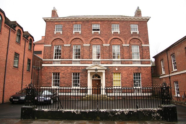
Castlegate House
Handsome house in Castlegate by John Carr in 1759
280:
230:
255:
205:
66:
265:
53° 57′ 25″ N, 1° 04′ 49″ W
215:
53° 57′ 26″ N, 1° 04′ 48″ W
454:
Add a one-line explanation of what this file represents
1195:
110:
90:
Commons is a freely licensed media file repository.
623:
Creative
Commons Attribution-ShareAlike 2.0 Generic
56:(640 × 427 pixels, file size: 91 KB, MIME type:
116:Castlegate House - geograph.org.uk - 857017.jpg
52:Castlegate_House_-_geograph.org.uk_-_857017.jpg
1168:Grade II* listed buildings in the City of York
423:https://creativecommons.org/licenses/by-sa/2.0
71:
429:Creative Commons Attribution-Share Alike 2.0
347:
8:
1173:Grade I listed buildings in the City of York
825:
761:
389:– to copy, distribute and transmit the work
1213:
1095:
450:
1188:The following other wikis use this file:
941:5f82d7e98f3d91313d3c2534c97f7096309f320d
713:https://www.geograph.org.uk/photo/857017
537:https://www.geograph.org.uk/profile/1904
1215:
1155:
1068:
1052:
1031:
1015:
994:
978:
939:
923:
905:
889:
849:
833:
785:
769:
690:
674:
656:
640:
620:
604:
584:
568:
501:
485:
468:
465:
446:
439:
258:
208:
287:View this and other nearby images on:
237:View this and other nearby images on:
7:
334:and is licensed for reuse under the
1084:
370:Attribution-Share Alike 2.0 Generic
358:
353:
338:Attribution-ShareAlike 2.0 license.
1206:
459:
453:
344:
321:
120:
103:
49:
458:
772:coordinates of the point of view
444:
400:Under the following conditions:
365:This file is licensed under the
357:
352:
346:
314:
293:
279:
271:
243:
229:
221:
70:
31:
21:
441:
121:
46:No higher resolution available.
14:
693:file available on the internet
440:
322:This image was taken from the
26:
1:
1178:User:GuillaumeTell/My sandbox
836:coordinates of depicted place
36:
743:Geograph Britain and Ireland
515:object of statement has role
466:Items portrayed in this file
270:
220:
1237:
1192:Usage on www.wikidata.org
851:53°57'25.24"N, 1°4'49.08"W
787:53°57'25.88"N, 1°4'48.00"W
414:same or compatible license
196:Richard Croft /
177:Richard Croft /
1085:
16:
721:geograph.org.uk image ID
443:
380:
77:This is a file from the
1142:
1121:01:52, 21 February 2011
168:required by the license
152:
141:
134:
131:
113:
81:. Information from its
328:this photograph's page
299:53.957010; -1.080300
249:53.957190; -1.080000
84:description page there
953:determination method
395:– to adapt the work
545:author name string
1224:
1223:
1184:Global file usage
1158:Castlegate (York)
1146:
827:
763:
607:copyright license
452:
343:
342:
326:collection. See
304:
303:
254:
253:
203:
202:
171:
99:
98:
79:Wikimedia Commons
32:Global file usage
1228:
1214:
1163:Castlegate House
1133:
1073:
1036:
999:
962:
957:
873:
872:
867:
809:
808:
803:
745:
740:
730:
725:
715:
710:
706:described at URL
571:copyright status
552:
549:
539:
534:
524:
519:
436:
433:
430:
427:
424:
416:as the original.
378:
367:Creative Commons
361:
360:
356:
355:
350:
349:
336:Creative Commons
324:Geograph project
318:
311:
300:
297:
283:
282:
276:
275:
274:
268:
267:
256:
250:
247:
233:
232:
226:
225:
224:
218:
217:
206:
198:Castlegate House
179:Castlegate House
165:
137:
125:
117:
111:
95:
74:
73:
67:
61:
59:
1236:
1235:
1231:
1230:
1229:
1227:
1226:
1225:
1202:
1182:
1154:
1147:
1139:
1131:
1087:
1086:
1083:
1082:
1081:
1080:
1079:
1078:
1077:
1076:
1074:
1071:
1061:
1060:
1059:
1057:
1046:
1045:
1044:
1043:
1042:
1041:
1040:
1039:
1037:
1034:
1024:
1023:
1022:
1020:
1009:
1008:
1007:
1006:
1005:
1004:
1003:
1002:
1000:
997:
987:
986:
985:
983:
972:
971:
970:
969:
968:
967:
966:
965:
964:
963:
958:
955:
946:
945:
944:
942:
932:
931:
930:
928:
917:
916:
915:
914:
913:
912:
911:
910:
908:
898:
897:
896:
894:
883:
882:
881:
880:
879:
878:
877:
876:
875:
874:
870:
868:
865:
856:
855:
854:
852:
842:
841:
840:
838:
819:
818:
817:
816:
815:
814:
813:
812:
811:
810:
806:
804:
801:
792:
791:
790:
788:
778:
777:
776:
774:
755:
754:
753:
752:
751:
750:
749:
748:
747:
746:
741:
738:
732:
731:
726:
723:
717:
716:
711:
708:
699:
698:
697:
695:
683:
682:
681:
679:
668:
667:
666:
665:
664:
663:
662:
661:
659:
649:
648:
647:
645:
634:
633:
632:
631:
630:
629:
628:
627:
625:
613:
612:
611:
609:
598:
597:
596:
595:
594:
593:
592:
591:
589:
577:
576:
575:
573:
562:
561:
560:
559:
558:
557:
556:
555:
554:
553:
550:
547:
541:
540:
535:
532:
526:
525:
520:
517:
508:
507:
506:
504:
494:
493:
492:
490:
479:
478:
477:
476:
475:
473:
457:
456:
455:
438:
437:
434:
431:
428:
425:
422:
421:
379:
376:
373:
362:
339:
309:
298:
272:
263:
262:
259:Object location
248:
222:
213:
212:
209:Camera location
204:
193:
186:
174:
147:geograph.org.uk
127:
115:
108:
101:
100:
89:
88:
87:is shown below.
63:
57:
55:
48:
47:
12:
11:
5:
1234:
1232:
1222:
1221:
1218:
1205:
1201:
1200:
1199:
1198:
1186:
1185:
1181:
1180:
1175:
1170:
1165:
1160:
1152:
1151:
1150:
1145:
1144:
1141:
1137:
1134:
1128:
1123:
1118:
1114:
1113:
1110:
1107:
1104:
1101:
1098:
1091:
1090:
1075:
1069:
1067:
1066:
1065:
1064:
1063:
1062:
1058:
1053:
1051:
1050:
1049:
1048:
1047:
1038:
1032:
1030:
1029:
1028:
1027:
1026:
1025:
1021:
1016:
1014:
1013:
1012:
1011:
1010:
1001:
995:
993:
992:
991:
990:
989:
988:
984:
979:
977:
976:
975:
974:
973:
951:
950:
949:
948:
947:
943:
940:
938:
937:
936:
935:
934:
933:
929:
924:
922:
921:
920:
919:
918:
909:
906:
904:
903:
902:
901:
900:
899:
895:
890:
888:
887:
886:
885:
884:
861:
860:
859:
858:
857:
853:
850:
848:
847:
846:
845:
844:
843:
839:
834:
832:
831:
830:
829:
823:
797:
796:
795:
794:
793:
789:
786:
784:
783:
782:
781:
780:
779:
775:
770:
768:
767:
766:
765:
759:
734:
733:
719:
718:
704:
703:
702:
701:
700:
696:
691:
689:
688:
687:
686:
685:
684:
680:
677:source of file
675:
673:
672:
671:
670:
669:
660:
657:
655:
654:
653:
652:
651:
650:
646:
641:
639:
638:
637:
636:
635:
626:
621:
619:
618:
617:
616:
615:
614:
610:
605:
603:
602:
601:
600:
599:
590:
585:
583:
582:
581:
580:
579:
578:
574:
569:
567:
566:
565:
564:
563:
543:
542:
528:
527:
513:
512:
511:
510:
509:
505:
502:
500:
499:
498:
497:
496:
495:
491:
486:
484:
483:
482:
481:
480:
474:
469:
467:
464:
463:
462:
461:
460:
449:
448:
445:
442:
420:
419:
418:
417:
407:
398:
397:
396:
390:
383:You are free:
374:
364:
363:
345:
341:
340:
319:
308:
305:
302:
301:
291:
285:
260:
252:
251:
241:
235:
210:
201:
200:
194:
191:
188:
187:
182:
175:
172:
160:
159:
154:
150:
149:
143:
139:
138:
133:
129:
128:
118:
109:
107:
104:
102:
97:
96:
75:
65:
64:
45:
41:
40:
39:
34:
29:
24:
19:
13:
10:
9:
6:
4:
3:
2:
1233:
1219:
1216:
1212:
1209:
1203:
1197:
1194:
1193:
1191:
1190:
1189:
1183:
1179:
1176:
1174:
1171:
1169:
1166:
1164:
1161:
1159:
1156:
1148:
1140:
1135:
1129:
1127:
1124:
1122:
1119:
1116:
1115:
1111:
1108:
1105:
1102:
1099:
1097:
1096:
1094:
1088:
1056:
1019:
982:
961:
954:
927:
893:
864:
837:
800:
773:
744:
737:
729:
722:
714:
707:
694:
678:
658:15 April 2008
644:
624:
608:
588:
572:
551:Richard Croft
546:
538:
531:
523:
516:
489:
472:
426:CC BY-SA 2.0
415:
411:
408:
405:
402:
401:
399:
394:
391:
388:
385:
384:
382:
381:
377:Richard Croft
375:Attribution:
371:
368:
351:
337:
333:
332:Richard Croft
329:
325:
320:
317:
313:
312:
306:
296:
292:
290:
289:OpenStreetMap
286:
284:
266:
261:
257:
246:
242:
240:
239:OpenStreetMap
236:
234:
216:
211:
207:
199:
195:
190:
189:
185:
181: /
180:
176:
169:
164:
162:
161:
158:
157:Richard Croft
155:
151:
148:
144:
140:
136:15 April 2008
130:
124:
119:
112:
105:
93:
86:
85:
80:
76:
69:
68:
62:
53:
44:
38:
35:
33:
30:
28:
25:
23:
20:
18:
15:
1210:
1207:
1187:
1092:
1089:File history
522:photographer
409:
403:
392:
386:
331:
269:
219:
197:
184:CC BY-SA 2.0
178:
122:
92:You can help
82:
50:
22:File history
1138:GeographBot
587:copyrighted
410:share alike
404:attribution
163:Attribution
114:Description
1217:_error
1149:File usage
1130:640 × 427
1106:Dimensions
907:image/jpeg
892:media type
503:some value
58:image/jpeg
27:File usage
1196:Q17530658
1103:Thumbnail
1100:Date/Time
981:data size
643:inception
307:Licensing
192:InfoField
173:InfoField
123:English:
1204:Metadata
926:checksum
736:operator
447:Captions
393:to remix
387:to share
372:license.
37:Metadata
1132:(91 KB)
1117:current
1112:Comment
996:92,793
863:heading
822:heading
799:heading
758:heading
488:creator
471:depicts
451:English
106:Summary
54:
1018:height
871:degree
826:degree
807:degree
762:degree
728:857017
277:
227:
153:Author
142:Source
1072:pixel
1055:width
1035:pixel
960:SHA-1
145:From
1109:User
1070:640
1033:427
998:byte
869:247
805:247
435:true
432:true
132:Date
17:File
530:URL
956::
866::
802::
739::
724::
709::
548::
533::
518::
1220:0
170:)
166:(
94:.
60:)
Text is available under the Creative Commons Attribution-ShareAlike License. Additional terms may apply.
_heading:247.00&language=en)
_heading:247.00&language=en)
