343:
276:
226:
268:
218:
290:
240:
311:
349:
354:
67:
819:"}},"text\/plain":{"en":{"":"heading"}}},"{\"value\":{\"amount\":\"+315\",\"unit\":\"http:\\\/\\\/www.wikidata.org\\\/entity\\\/Q28390\"},\"type\":\"quantity\"}":{"text\/html":{"en":{"P7787":"315
634:"}},"text\/plain":{"en":{"":"heading"}}},"{\"value\":{\"amount\":\"+315\",\"unit\":\"http:\\\/\\\/www.wikidata.org\\\/entity\\\/Q28390\"},\"type\":\"quantity\"}":{"text\/html":{"en":{"P7787":"315
815:
259:
209:
38:
401:– You must give appropriate credit, provide a link to the license, and indicate if changes were made. You may do so in any reasonable manner, but not in any way that suggests the licensor endorses you or your use.
78:
46:
816:
631:
1138:== {{int:filedesc}} == {{Information |description={{en|1=Church in Giggleswick}} |date=2009-06-16 |source=From |author= |permission= |other_
1152:
954:
751:
617:
581:
283:
233:
801:
318:
1163:
This file contains additional information, probably added from the digital camera or scanner used to create or digitize it.
408:
516:
1049:
1012:
975:
920:
886:
857:
830:
764:
735:
672:
645:
565:
537:
524:
509:
1120:
1115:
37:
947:
794:
779:
701:
601:
482:
465:
305:
364:
1166:
If the file has been modified from its original state, some details may not fully reflect the modified file.
407:– If you remix, transform, or build upon the material, you must distribute your contributions under the
325:
on the
Geograph website for the photographer's contact details. The copyright on this image is owned by
1131:
361:
823:"}},"text\/plain":{"en":{"P7787":"315 degree"}}}}": -->
638:"}},"text\/plain":{"en":{"P7787":"315 degree"}}}}": -->
86:
786:
771:
544:
162:
289:
239:
330:
73:
178:
130:
273:
223:
151:
141:
310:
322:
1088:
Click on a date/time to view the file as it appeared at that time.
275:
225:
250:
200:
61:
260:
54° 04′ 21″ N, 2° 17′ 22″ W
210:
54° 04′ 19″ N, 2° 17′ 18″ W
449:
Add a one-line explanation of what this file represents
111:
47:
Church_in_Giggleswick_-_geograph.org.uk_-_1370218.jpg
105:
85:
Commons is a freely licensed media file repository.
618:
Creative
Commons Attribution-ShareAlike 2.0 Generic
51:(640 × 480 pixels, file size: 98 KB, MIME type:
418:https://creativecommons.org/licenses/by-sa/2.0
66:
424:Creative Commons Attribution-Share Alike 2.0
342:
8:
820:
635:
384:– to copy, distribute and transmit the work
1168:
1090:
445:
787:https://www.geograph.org.uk/photo/1370218
545:https://www.geograph.org.uk/profile/31248
936:0761eda0758a724cbe0c6b45870a3af9581b038a
1170:
1150:
1063:
1047:
1026:
1010:
989:
973:
934:
918:
900:
884:
844:
828:
749:
733:
715:
699:
659:
643:
615:
599:
579:
563:
496:
480:
463:
460:
441:
434:
253:
203:
282:View this and other nearby images on:
232:View this and other nearby images on:
7:
329:and is licensed for reuse under the
1148:The following page uses this file:
1079:
365:Attribution-Share Alike 2.0 Generic
353:
348:
333:Attribution-ShareAlike 2.0 license.
1161:
454:
448:
339:
316:
115:
98:
44:
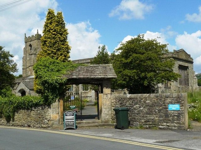
1153:Church of St Alkelda, Giggleswick
453:
646:coordinates of the point of view
439:
395:Under the following conditions:
360:This file is licensed under the
352:
347:
341:
309:
288:
274:
266:
238:
224:
216:
65:
21:
436:
116:
41:No higher resolution available.
14:
752:file available on the internet
435:
317:This image was taken from the
26:
1:
831:coordinates of depicted place
31:
802:Geograph Britain and Ireland
510:object of statement has role
461:Items portrayed in this file
265:
215:
1192:
846:54°4'21.11"N, 2°17'22.20"W
661:54°4'18.52"N, 2°17'18.24"W
409:same or compatible license
191:Andy Jamieson /
172:Andy Jamieson /
1080:
16:
765:geograph.org.uk image ID
438:
375:
72:This is a file from the
1137:
1116:14:22, 28 February 2011
163:required by the license
147:
136:
129:
126:
108:
76:. Information from its
323:this photograph's page
294:54.072530; -2.289500
244:54.071810; -2.288400
79:description page there
193:Church in Giggleswick
174:Church in Giggleswick
121:Church in Giggleswick
948:determination method
390:– to adapt the work
525:author name string
1179:
1178:
1141:
822:
637:
602:copyright license
447:
338:
337:
321:collection. See
299:
298:
249:
248:
198:
197:
166:
94:
93:
74:Wikimedia Commons
1183:
1169:
1128:
1068:
1031:
994:
957:
952:
868:
867:
862:
804:
799:
789:
784:
780:described at URL
774:
769:
683:
682:
677:
566:copyright status
547:
542:
532:
529:
519:
514:
431:
428:
425:
422:
419:
411:as the original.
373:
362:Creative Commons
356:
355:
351:
350:
345:
344:
331:Creative Commons
319:Geograph project
313:
306:
295:
292:
278:
277:
271:
270:
269:
263:
262:
251:
245:
242:
228:
227:
221:
220:
219:
213:
212:
201:
160:
132:
120:
112:
106:
90:
69:
68:
62:
56:
54:
1191:
1190:
1186:
1185:
1184:
1182:
1181:
1180:
1157:
1142:
1134:
1126:
1082:
1081:
1078:
1077:
1076:
1075:
1074:
1073:
1072:
1071:
1069:
1066:
1056:
1055:
1054:
1052:
1041:
1040:
1039:
1038:
1037:
1036:
1035:
1034:
1032:
1029:
1019:
1018:
1017:
1015:
1004:
1003:
1002:
1001:
1000:
999:
998:
997:
995:
992:
982:
981:
980:
978:
967:
966:
965:
964:
963:
962:
961:
960:
959:
958:
953:
950:
941:
940:
939:
937:
927:
926:
925:
923:
912:
911:
910:
909:
908:
907:
906:
905:
903:
893:
892:
891:
889:
878:
877:
876:
875:
874:
873:
872:
871:
870:
869:
865:
863:
860:
851:
850:
849:
847:
837:
836:
835:
833:
814:
813:
812:
811:
810:
809:
808:
807:
806:
805:
800:
797:
791:
790:
785:
782:
776:
775:
770:
767:
758:
757:
756:
754:
742:
741:
740:
738:
727:
726:
725:
724:
723:
722:
721:
720:
718:
708:
707:
706:
704:
693:
692:
691:
690:
689:
688:
687:
686:
685:
684:
680:
678:
675:
666:
665:
664:
662:
652:
651:
650:
648:
629:
628:
627:
626:
625:
624:
623:
622:
620:
608:
607:
606:
604:
593:
592:
591:
590:
589:
588:
587:
586:
584:
572:
571:
570:
568:
557:
556:
555:
554:
553:
552:
551:
550:
549:
548:
543:
540:
534:
533:
530:
527:
521:
520:
515:
512:
503:
502:
501:
499:
489:
488:
487:
485:
474:
473:
472:
471:
470:
468:
452:
451:
450:
433:
432:
429:
426:
423:
420:
417:
416:
374:
371:
368:
357:
334:
304:
293:
267:
258:
257:
254:Object location
243:
217:
208:
207:
204:Camera location
199:
188:
181:
169:
142:geograph.org.uk
122:
110:
103:
96:
95:
84:
83:
82:is shown below.
58:
52:
50:
43:
42:
12:
11:
5:
1189:
1187:
1177:
1176:
1173:
1160:
1156:
1155:
1146:
1145:
1140:
1139:
1136:
1132:
1129:
1123:
1118:
1113:
1109:
1108:
1105:
1102:
1099:
1096:
1093:
1086:
1085:
1070:
1064:
1062:
1061:
1060:
1059:
1058:
1057:
1053:
1048:
1046:
1045:
1044:
1043:
1042:
1033:
1027:
1025:
1024:
1023:
1022:
1021:
1020:
1016:
1011:
1009:
1008:
1007:
1006:
1005:
996:
990:
988:
987:
986:
985:
984:
983:
979:
974:
972:
971:
970:
969:
968:
946:
945:
944:
943:
942:
938:
935:
933:
932:
931:
930:
929:
928:
924:
919:
917:
916:
915:
914:
913:
904:
901:
899:
898:
897:
896:
895:
894:
890:
885:
883:
882:
881:
880:
879:
856:
855:
854:
853:
852:
848:
845:
843:
842:
841:
840:
839:
838:
834:
829:
827:
826:
825:
824:
818:
793:
792:
778:
777:
763:
762:
761:
760:
759:
755:
750:
748:
747:
746:
745:
744:
743:
739:
736:source of file
734:
732:
731:
730:
729:
728:
719:
716:
714:
713:
712:
711:
710:
709:
705:
700:
698:
697:
696:
695:
694:
671:
670:
669:
668:
667:
663:
660:
658:
657:
656:
655:
654:
653:
649:
644:
642:
641:
640:
639:
633:
621:
616:
614:
613:
612:
611:
610:
609:
605:
600:
598:
597:
596:
595:
594:
585:
580:
578:
577:
576:
575:
574:
573:
569:
564:
562:
561:
560:
559:
558:
536:
535:
523:
522:
508:
507:
506:
505:
504:
500:
497:
495:
494:
493:
492:
491:
490:
486:
481:
479:
478:
477:
476:
475:
469:
464:
462:
459:
458:
457:
456:
455:
444:
443:
440:
437:
415:
414:
413:
412:
402:
393:
392:
391:
385:
378:You are free:
369:
359:
358:
340:
336:
335:
314:
303:
300:
297:
296:
286:
280:
255:
247:
246:
236:
230:
205:
196:
195:
189:
186:
183:
182:
177:
170:
167:
155:
154:
149:
145:
144:
138:
134:
133:
128:
124:
123:
113:
104:
102:
99:
97:
92:
91:
70:
60:
59:
40:
36:
35:
34:
29:
24:
19:
13:
10:
9:
6:
4:
3:
2:
1188:
1174:
1171:
1167:
1164:
1158:
1154:
1151:
1149:
1143:
1135:
1130:
1124:
1122:
1119:
1117:
1114:
1111:
1110:
1106:
1103:
1100:
1097:
1094:
1092:
1091:
1089:
1083:
1051:
1014:
977:
956:
949:
922:
888:
859:
832:
803:
796:
788:
781:
773:
766:
753:
737:
703:
674:
647:
619:
603:
583:
567:
546:
539:
531:Andy Jamieson
526:
518:
511:
484:
467:
421:CC BY-SA 2.0
410:
406:
403:
400:
397:
396:
394:
389:
386:
383:
380:
379:
377:
376:
372:Andy Jamieson
370:Attribution:
366:
363:
346:
332:
328:
327:Andy Jamieson
324:
320:
315:
312:
308:
307:
301:
291:
287:
285:
284:OpenStreetMap
281:
279:
261:
256:
252:
241:
237:
235:
234:OpenStreetMap
231:
229:
211:
206:
202:
194:
190:
185:
184:
180:
176: /
175:
171:
164:
159:
157:
156:
153:
152:Andy Jamieson
150:
146:
143:
139:
135:
125:
119:
114:
107:
100:
88:
81:
80:
75:
71:
64:
63:
57:
48:
39:
33:
30:
28:
25:
23:
20:
18:
15:
1165:
1162:
1147:
1087:
1084:File history
717:16 June 2009
517:photographer
404:
398:
387:
381:
326:
264:
214:
192:
179:CC BY-SA 2.0
173:
131:16 June 2009
117:
87:You can help
77:
45:
22:File history
1133:GeographBot
582:copyrighted
405:share alike
399:attribution
158:Attribution
109:Description
1172:_error
1144:File usage
1125:640 × 480
1101:Dimensions
902:image/jpeg
887:media type
498:some value
53:image/jpeg
27:File usage
1098:Thumbnail
1095:Date/Time
976:data size
702:inception
302:Licensing
187:InfoField
168:InfoField
118:English:
1159:Metadata
991:100,285
921:checksum
795:operator
442:Captions
388:to remix
382:to share
367:license.
32:Metadata
1127:(98 KB)
1112:current
1107:Comment
858:heading
817:heading
772:1370218
673:heading
632:heading
483:creator
466:depicts
446:English
101:Summary
49:
1013:height
866:degree
821:degree
681:degree
636:degree
272:
222:
148:Author
137:Source
1067:pixel
1050:width
1030:pixel
955:SHA-1
140:From
1104:User
1065:640
1028:480
993:byte
864:315
679:315
430:true
427:true
127:Date
17:File
538:URL
951::
861::
798::
783::
768::
676::
541::
528::
513::
1175:0
165:)
161:(
89:.
55:)
Text is available under the Creative Commons Attribution-ShareAlike License. Additional terms may apply.
_heading:315.00&language=en)
_heading:315.00&language=en)
