290:
223:
237:
258:
296:
301:
72:
974:
214:
348:– You must give appropriate credit, provide a link to the license, and indicate if changes were made. You may do so in any reasonable manner, but not in any way that suggests the licensor endorses you or your use.
43:
991:== {{int:filedesc}} == {{Information |description={{en|1=Cul Beag Cul Beag from the slopes of Beinn an Eoin.}} |date=2009-04-11 |source=From |author=[http://www.geograph.org.uk/profile/19111 Colin
83:
51:
807:
600:
564:
528:
230:
620:
265:
1036:
This file contains additional information, probably added from the digital camera or scanner used to create or digitize it.
355:
463:
902:
865:
828:
773:
739:
705:
628:
584:
512:
484:
471:
456:
800:
671:
643:
613:
548:
429:
412:
252:
311:
1039:
If the file has been modified from its original state, some details may not fully reflect the modified file.
973:
968:
42:
354:– If you remix, transform, or build upon the material, you must distribute your contributions under the
272:
on the
Geograph website for the photographer's contact details. The copyright on this image is owned by
984:
308:
91:
650:
635:
491:
167:
236:
277:
78:
183:
1005:
135:
220:
156:
146:
257:
269:
941:
Click on a date/time to view the file as it appeared at that time.
222:
698:
205:
66:
1023:
215:
58° 01′ 46″ N, 5° 08′ 59″ W
396:
Add a one-line explanation of what this file represents
110:
90:
Commons is a freely licensed media file repository.
565:
Creative
Commons Attribution-ShareAlike 2.0 Generic
126:
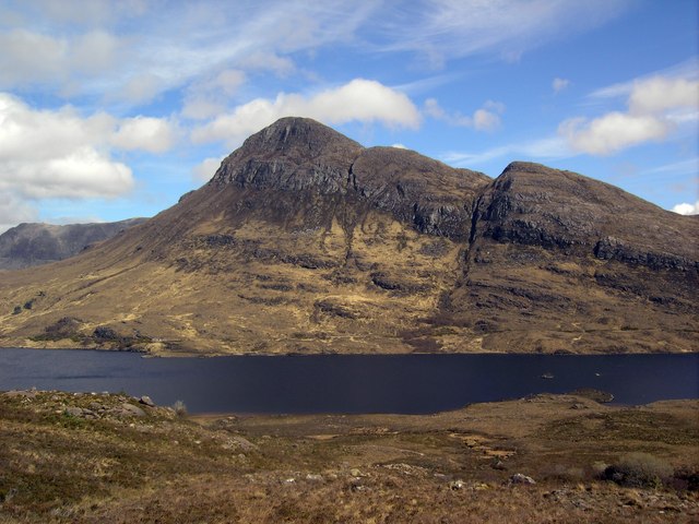
Cul Beag Cul Beag from the slopes of Beinn an Eoin.
56:(640 × 480 pixels, file size: 75 KB, MIME type:
365:https://creativecommons.org/licenses/by-sa/2.0
71:
371:Creative Commons Attribution-Share Alike 2.0
289:
8:
331:– to copy, distribute and transmit the work
1041:
943:
392:
1016:The following other wikis use this file:
651:https://www.geograph.org.uk/photo/1263240
492:https://www.geograph.org.uk/profile/19111
789:60caeabba956c66c5c4e8ff494ac9fb169591fcf
116:Cul Beag - geograph.org.uk - 1263240.jpg
52:Cul_Beag_-_geograph.org.uk_-_1263240.jpg
1043:
1003:
916:
900:
879:
863:
842:
826:
787:
771:
753:
737:
719:
703:
685:
669:
598:
582:
562:
546:
526:
510:
443:
427:
410:
407:
388:
381:
208:
229:View this and other nearby images on:
7:
276:and is licensed for reuse under the
1001:The following page uses this file:
932:
312:Attribution-Share Alike 2.0 Generic
300:
295:
280:Attribution-ShareAlike 2.0 license.
1034:
401:
395:
286:
263:
120:
103:
49:
400:
386:
342:Under the following conditions:
307:This file is licensed under the
299:
294:
288:
256:
235:
221:
70:
31:
21:
383:
121:
46:No higher resolution available.
14:
601:file available on the internet
382:
264:This image was taken from the
26:
1:
706:coordinates of depicted place
36:
621:Geograph Britain and Ireland
457:object of statement has role
408:Items portrayed in this file
1020:Usage on sco.wikipedia.org
1065:
356:same or compatible license
196:Colin Kinnear /
177:Colin Kinnear /
933:
721:58°1'45.98"N, 5°8'58.56"W
16:
629:geograph.org.uk image ID
385:
322:
77:This is a file from the
990:
969:23:06, 26 February 2011
168:required by the license
152:
141:
134:
131:
113:
81:. Information from its
270:this photograph's page
241:58.029440; -5.149600
84:description page there
801:determination method
337:– to adapt the work
472:author name string
1052:
1051:
1012:Global file usage
994:
549:copyright license
394:
285:
284:
268:collection. See
246:
245:
203:
202:
171:
99:
98:
79:Wikimedia Commons
32:Global file usage
1056:
1042:
981:
921:
884:
847:
810:
805:
653:
648:
644:described at URL
638:
633:
623:
618:
513:copyright status
494:
489:
479:
476:
466:
461:
378:
375:
372:
369:
366:
358:as the original.
320:
309:Creative Commons
303:
302:
298:
297:
292:
291:
278:Creative Commons
266:Geograph project
260:
253:
242:
239:
225:
224:
218:
217:
206:
165:
137:
125:
117:
111:
95:
74:
73:
67:
61:
59:
1064:
1063:
1059:
1058:
1057:
1055:
1054:
1053:
1030:
1010:
995:
987:
979:
935:
934:
931:
930:
929:
928:
927:
926:
925:
924:
922:
919:
909:
908:
907:
905:
894:
893:
892:
891:
890:
889:
888:
887:
885:
882:
872:
871:
870:
868:
857:
856:
855:
854:
853:
852:
851:
850:
848:
845:
835:
834:
833:
831:
820:
819:
818:
817:
816:
815:
814:
813:
812:
811:
806:
803:
794:
793:
792:
790:
780:
779:
778:
776:
765:
764:
763:
762:
761:
760:
759:
758:
756:
746:
745:
744:
742:
731:
730:
729:
728:
727:
726:
725:
724:
722:
712:
711:
710:
708:
697:
696:
695:
694:
693:
692:
691:
690:
688:
678:
677:
676:
674:
663:
662:
661:
660:
659:
658:
657:
656:
655:
654:
649:
646:
640:
639:
634:
631:
625:
624:
619:
616:
607:
606:
605:
603:
591:
590:
589:
587:
576:
575:
574:
573:
572:
571:
570:
569:
567:
555:
554:
553:
551:
540:
539:
538:
537:
536:
535:
534:
533:
531:
519:
518:
517:
515:
504:
503:
502:
501:
500:
499:
498:
497:
496:
495:
490:
487:
481:
480:
477:
474:
468:
467:
462:
459:
450:
449:
448:
446:
436:
435:
434:
432:
421:
420:
419:
418:
417:
415:
399:
398:
397:
380:
379:
376:
373:
370:
367:
364:
363:
321:
318:
315:
304:
281:
251:
240:
213:
212:
209:Object location
204:
193:
186:
174:
147:geograph.org.uk
127:
115:
108:
101:
100:
89:
88:
87:is shown below.
63:
57:
55:
48:
47:
12:
11:
5:
1062:
1060:
1050:
1049:
1046:
1033:
1029:
1028:
1027:
1026:
1014:
1013:
1009:
1008:
999:
998:
993:
992:
989:
985:
982:
976:
971:
966:
962:
961:
958:
955:
952:
949:
946:
939:
938:
923:
917:
915:
914:
913:
912:
911:
910:
906:
901:
899:
898:
897:
896:
895:
886:
880:
878:
877:
876:
875:
874:
873:
869:
864:
862:
861:
860:
859:
858:
849:
843:
841:
840:
839:
838:
837:
836:
832:
827:
825:
824:
823:
822:
821:
799:
798:
797:
796:
795:
791:
788:
786:
785:
784:
783:
782:
781:
777:
772:
770:
769:
768:
767:
766:
757:
754:
752:
751:
750:
749:
748:
747:
743:
738:
736:
735:
734:
733:
732:
723:
720:
718:
717:
716:
715:
714:
713:
709:
704:
702:
701:
700:
699:
689:
686:
684:
683:
682:
681:
680:
679:
675:
670:
668:
667:
666:
665:
664:
642:
641:
627:
626:
612:
611:
610:
609:
608:
604:
599:
597:
596:
595:
594:
593:
592:
588:
585:source of file
583:
581:
580:
579:
578:
577:
568:
563:
561:
560:
559:
558:
557:
556:
552:
547:
545:
544:
543:
542:
541:
532:
527:
525:
524:
523:
522:
521:
520:
516:
511:
509:
508:
507:
506:
505:
483:
482:
470:
469:
455:
454:
453:
452:
451:
447:
444:
442:
441:
440:
439:
438:
437:
433:
428:
426:
425:
424:
423:
422:
416:
411:
409:
406:
405:
404:
403:
402:
391:
390:
387:
384:
362:
361:
360:
359:
349:
340:
339:
338:
332:
325:You are free:
316:
306:
305:
287:
283:
282:
261:
250:
247:
244:
243:
233:
227:
210:
201:
200:
194:
191:
188:
187:
182:
175:
172:
160:
159:
154:
150:
149:
143:
139:
138:
133:
129:
128:
118:
109:
107:
104:
102:
97:
96:
75:
65:
64:
45:
41:
40:
39:
34:
29:
24:
19:
13:
10:
9:
6:
4:
3:
2:
1061:
1047:
1044:
1040:
1037:
1031:
1025:
1022:
1021:
1019:
1018:
1017:
1011:
1007:
1004:
1002:
996:
988:
983:
977:
975:
972:
970:
967:
964:
963:
959:
956:
953:
950:
947:
945:
944:
942:
936:
904:
867:
830:
809:
802:
775:
741:
707:
687:11 April 2009
673:
652:
645:
637:
630:
622:
615:
602:
586:
566:
550:
530:
514:
493:
486:
478:Colin Kinnear
473:
465:
458:
431:
414:
368:CC BY-SA 2.0
357:
353:
350:
347:
344:
343:
341:
336:
333:
330:
327:
326:
324:
323:
319:Colin Kinnear
317:Attribution:
313:
310:
293:
279:
275:
274:Colin Kinnear
271:
267:
262:
259:
255:
254:
248:
238:
234:
232:
231:OpenStreetMap
228:
226:
216:
211:
207:
199:
195:
190:
189:
185:
181: /
180:
176:
169:
164:
162:
161:
158:
157:Colin Kinnear
155:
151:
148:
144:
140:
136:11 April 2009
130:
124:
119:
112:
105:
93:
86:
85:
80:
76:
69:
68:
62:
53:
44:
38:
35:
33:
30:
28:
25:
23:
20:
18:
15:
1038:
1035:
1015:
1000:
940:
937:File history
464:photographer
351:
345:
334:
328:
273:
197:
184:CC BY-SA 2.0
178:
122:
92:You can help
82:
50:
22:File history
986:GeographBot
529:copyrighted
352:share alike
346:attribution
163:Attribution
114:Description
1045:_error
997:File usage
978:640 × 480
954:Dimensions
755:image/jpeg
740:media type
445:some value
58:image/jpeg
27:File usage
951:Thumbnail
948:Date/Time
829:data size
672:inception
249:Licensing
192:InfoField
173:InfoField
123:English:
1032:Metadata
1024:Cùl Beag
1006:Cùl Beag
774:checksum
614:operator
389:Captions
335:to remix
329:to share
314:license.
198:Cul Beag
179:Cul Beag
37:Metadata
980:(75 KB)
965:current
960:Comment
844:76,691
636:1263240
430:creator
413:depicts
393:English
106:Summary
54:
866:height
219:
153:Author
142:Source
920:pixel
903:width
883:pixel
808:SHA-1
145:From
957:User
918:640
881:480
846:byte
377:true
374:true
132:Date
17:File
485:URL
804::
647::
632::
617::
488::
475::
460::
1048:0
170:)
166:(
94:.
60:)
Text is available under the Creative Commons Attribution-ShareAlike License. Additional terms may apply.
_&language=en)
