285:
218:
232:
253:
291:
296:
72:
829:
799:
43:
343:– You must give appropriate credit, provide a link to the license, and indicate if changes were made. You may do so in any reasonable manner, but not in any way that suggests the licensor endorses you or your use.
209:
83:
51:
828:
823:
632:
476:
440:
225:
1068:
260:
931:
This file contains additional information, probably added from the digital camera or scanner used to create or digitize it.
350:
727:
690:
653:
598:
564:
530:
424:
625:
496:
460:
407:
798:
793:
247:
42:
306:
934:
If the file has been modified from its original state, some details may not fully reflect the modified file.
856:
The following pages on the
English Knowledge (XXG) use this file (pages on other projects are not listed):
1116:
349:– If you remix, transform, or build upon the material, you must distribute your contributions under the
267:
on the
Geograph website for the photographer's contact details. The copyright on this image is owned by
303:
1152:
91:
178:
1265:
1037:
953:
162:
839:
135:
231:
1220:
1134:
968:
272:
78:
1275:
1230:
1008:
215:
1170:
988:
809:
943:
860:
1285:
978:
252:
264:
766:
Click on a date/time to view the file as it appeared at that time.
878:
523:
217:
210:
54° 10′ 00.87″ N, 1° 14′ 46.44″ W
200:
66:
898:
391:
Add a one-line explanation of what this file represents
908:
888:
918:
126:
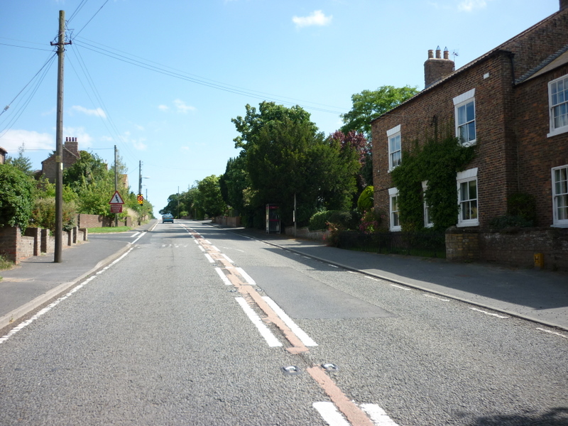
Looking along the A19 at
Thormanby, North Yorkshire.
110:
90:
Commons is a freely licensed media file repository.
477:
Creative
Commons Attribution-ShareAlike 2.0 Generic
56:(800 × 600 pixels, file size: 304 KB, MIME type:
1157:Flash did not fire, compulsory flash suppression
116:A19 at Thormanby - Geograph-2526849-by-Ian-S.jpg
52:A19_at_Thormanby_-_Geograph-2526849-by-Ian-S.jpg
360:https://creativecommons.org/licenses/by-sa/2.0
71:
366:Creative Commons Attribution-Share Alike 2.0
284:
8:
326:– to copy, distribute and transmit the work
936:
768:
387:
871:The following other wikis use this file:
816:Higher-resolution version from Geograph.
614:8ee48c47bebec9d51169cfcd4f3f53320f0427c3
1301:
1293:
1283:
1273:
1263:
1255:
1247:
1239:
1228:
1218:
1210:
1202:
1194:
1186:
1178:
1168:
1160:
1150:
1142:
1132:
1124:
1114:
1106:
1085:
1077:
1066:
1058:
1050:
1042:
1032:
1024:
1016:
1005:
997:
986:
976:
966:
958:
948:
858:
741:
725:
704:
688:
667:
651:
612:
596:
578:
562:
544:
528:
510:
494:
474:
458:
438:
422:
405:
402:
383:
376:
203:
224:View this and other nearby images on:
938:
193:The A19 at Thormanby, North Yorkshire
174:The A19 at Thormanby, North Yorkshire
7:
271:and is licensed for reuse under the
846:User created page with UploadWizard
757:
307:Attribution-Share Alike 2.0 Generic
295:
290:
275:Attribution-ShareAlike 2.0 license.
929:
396:
390:
281:
258:
120:
103:
49:
395:
1298:4bdd065f062b294ee20e9b786554b1b5
999:Date and time of data generation
531:coordinates of the point of view
381:
337:Under the following conditions:
302:This file is licensed under the
294:
289:
283:
251:
230:
216:
70:
31:
21:
378:
121:
46:No higher resolution available.
14:
377:
259:This image was taken from the
26:
1:
1199:A directly photographed image
36:
546:54°10'0.872"N, 1°14'46.435"W
403:Items portrayed in this file
1079:Date and time of digitizing
895:Usage on lld.wikipedia.org
875:Usage on ceb.wikipedia.org
1323:
1241:Focal length in 35 mm film
1183:One-chip color area sensor
1162:Supported Flashpix version
915:Usage on www.wikidata.org
905:Usage on pl.wikipedia.org
885:Usage on fr.wikipedia.org
351:same or compatible license
136:15 February 2013, 15:54:58
1087:Meaning of each component
1044:File change date and time
758:
16:
380:
317:
77:This is a file from the
1204:Custom image processing
845:
824:16:03, 15 February 2013
815:
163:required by the license
149:
141:
134:
131:
113:
81:. Information from its
1108:Image compression mode
265:this photograph's page
236:54.166909; -1.246232
84:description page there
1126:Maximum land aperture
1018:Horizontal resolution
973:1/640 sec (0.0015625)
1191:Digital still camera
626:determination method
1082:15:24, 24 July 2011
1052:Y and C positioning
1047:15:24, 24 July 2011
1026:Vertical resolution
1002:15:24, 24 July 2011
940:Camera manufacturer
879:Thormanby (lungsod)
332:– to adapt the work
1249:Scene capture type
1225:Auto white balance
794:22:08, 5 July 2017
191:Ian S /
172:Ian S /
145:www.geograph.co.uk
1310:
1309:
867:Global file usage
849:
461:copyright license
389:
280:
279:
263:collection. See
241:
240:
198:
197:
166:
99:
98:
79:Wikimedia Commons
32:Global file usage
1314:
1060:Exposure Program
937:
836:
806:
746:
709:
672:
635:
630:
512:15 February 2013
425:copyright status
373:
370:
367:
364:
361:
353:as the original.
315:
304:Creative Commons
298:
297:
293:
292:
287:
286:
273:Creative Commons
261:Geograph project
255:
248:
237:
234:
220:
219:
213:
212:
201:
160:
137:
125:
117:
111:
95:
74:
73:
67:
61:
59:
1322:
1321:
1317:
1316:
1315:
1313:
1312:
1311:
1295:Unique image ID
1129:3 APEX (f/2.83)
925:
865:
857:
850:
842:
834:
812:
804:
760:
759:
756:
755:
754:
753:
752:
751:
750:
749:
747:
744:
734:
733:
732:
730:
719:
718:
717:
716:
715:
714:
713:
712:
710:
707:
697:
696:
695:
693:
682:
681:
680:
679:
678:
677:
676:
675:
673:
670:
660:
659:
658:
656:
645:
644:
643:
642:
641:
640:
639:
638:
637:
636:
631:
628:
619:
618:
617:
615:
605:
604:
603:
601:
590:
589:
588:
587:
586:
585:
584:
583:
581:
571:
570:
569:
567:
556:
555:
554:
553:
552:
551:
550:
549:
547:
537:
536:
535:
533:
522:
521:
520:
519:
518:
517:
516:
515:
513:
503:
502:
501:
499:
488:
487:
486:
485:
484:
483:
482:
481:
479:
467:
466:
465:
463:
452:
451:
450:
449:
448:
447:
446:
445:
443:
431:
430:
429:
427:
416:
415:
414:
413:
412:
410:
394:
393:
392:
375:
374:
371:
368:
365:
362:
359:
358:
316:
313:
310:
299:
276:
246:
235:
208:
207:
204:Camera location
199:
188:
181:
169:
127:
115:
108:
101:
100:
89:
88:
87:is shown below.
63:
57:
55:
48:
47:
12:
11:
5:
1320:
1318:
1308:
1307:
1304:
1300:
1299:
1296:
1292:
1291:
1288:
1282:
1281:
1278:
1272:
1271:
1268:
1262:
1261:
1258:
1254:
1253:
1250:
1246:
1245:
1242:
1238:
1237:
1234:
1227:
1226:
1223:
1217:
1216:
1213:
1209:
1208:
1207:Normal process
1205:
1201:
1200:
1197:
1193:
1192:
1189:
1185:
1184:
1181:
1180:Sensing method
1177:
1176:
1173:
1167:
1166:
1163:
1159:
1158:
1155:
1149:
1148:
1145:
1141:
1140:
1137:
1131:
1130:
1127:
1123:
1122:
1119:
1113:
1112:
1109:
1105:
1104:
1103:
1102:
1101:does not exist
1099:
1096:
1093:
1088:
1084:
1083:
1080:
1076:
1075:
1072:
1065:
1064:
1063:Normal program
1061:
1057:
1056:
1053:
1049:
1048:
1045:
1041:
1040:
1035:
1031:
1030:
1027:
1023:
1022:
1019:
1015:
1014:
1011:
1004:
1003:
1000:
996:
995:
992:
985:
984:
981:
975:
974:
971:
965:
964:
961:
957:
956:
951:
947:
946:
941:
928:
924:
923:
922:
921:
913:
912:
911:
903:
902:
901:
893:
892:
891:
883:
882:
881:
869:
868:
864:
863:
855:
854:
853:
848:
847:
844:
840:
837:
831:
826:
821:
818:
817:
814:
810:
807:
801:
796:
791:
787:
786:
783:
780:
777:
774:
771:
764:
763:
748:
742:
740:
739:
738:
737:
736:
735:
731:
726:
724:
723:
722:
721:
720:
711:
705:
703:
702:
701:
700:
699:
698:
694:
689:
687:
686:
685:
684:
683:
674:
668:
666:
665:
664:
663:
662:
661:
657:
652:
650:
649:
648:
647:
646:
624:
623:
622:
621:
620:
616:
613:
611:
610:
609:
608:
607:
606:
602:
597:
595:
594:
593:
592:
591:
582:
579:
577:
576:
575:
574:
573:
572:
568:
563:
561:
560:
559:
558:
557:
548:
545:
543:
542:
541:
540:
539:
538:
534:
529:
527:
526:
525:
524:
514:
511:
509:
508:
507:
506:
505:
504:
500:
495:
493:
492:
491:
490:
489:
480:
475:
473:
472:
471:
470:
469:
468:
464:
459:
457:
456:
455:
454:
453:
444:
439:
437:
436:
435:
434:
433:
432:
428:
423:
421:
420:
419:
418:
417:
411:
406:
404:
401:
400:
399:
398:
397:
386:
385:
382:
379:
357:
356:
355:
354:
344:
335:
334:
333:
327:
320:You are free:
311:
301:
300:
282:
278:
277:
256:
245:
242:
239:
238:
228:
222:
205:
196:
195:
189:
186:
183:
182:
177:
170:
167:
155:
154:
151:
147:
146:
143:
139:
138:
133:
129:
128:
118:
109:
107:
104:
102:
97:
96:
75:
65:
64:
45:
41:
40:
39:
34:
29:
24:
19:
13:
10:
9:
6:
4:
3:
2:
1319:
1305:
1302:
1297:
1294:
1289:
1287:
1284:
1279:
1277:
1274:
1269:
1267:
1264:
1259:
1257:Scene control
1256:
1251:
1248:
1243:
1240:
1235:
1232:
1229:
1224:
1222:
1221:White balance
1219:
1215:Auto exposure
1214:
1212:Exposure mode
1211:
1206:
1203:
1198:
1195:
1190:
1187:
1182:
1179:
1174:
1172:
1169:
1164:
1161:
1156:
1154:
1151:
1146:
1143:
1138:
1136:
1135:Metering mode
1133:
1128:
1125:
1120:
1118:
1117:Exposure bias
1115:
1110:
1107:
1100:
1097:
1094:
1091:
1090:
1089:
1086:
1081:
1078:
1073:
1070:
1067:
1062:
1059:
1054:
1051:
1046:
1043:
1039:
1036:
1034:Software used
1033:
1028:
1025:
1020:
1017:
1012:
1010:
1006:
1001:
998:
993:
990:
987:
982:
980:
977:
972:
970:
969:Exposure time
967:
962:
959:
955:
952:
949:
945:
942:
939:
935:
932:
926:
920:
917:
916:
914:
910:
907:
906:
904:
900:
897:
896:
894:
890:
887:
886:
884:
880:
877:
876:
874:
873:
872:
866:
862:
859:
851:
843:
838:
832:
830:
827:
825:
822:
820:
819:
813:
808:
802:
800:
797:
795:
792:
789:
788:
784:
781:
778:
775:
772:
770:
769:
767:
761:
729:
692:
655:
634:
627:
600:
566:
532:
498:
478:
462:
442:
426:
409:
363:CC BY-SA 2.0
352:
348:
345:
342:
339:
338:
336:
331:
328:
325:
322:
321:
319:
318:
312:Attribution:
308:
305:
288:
274:
270:
266:
262:
257:
254:
250:
249:
243:
233:
229:
227:
226:OpenStreetMap
223:
221:
211:
206:
202:
194:
190:
185:
184:
180:
176: /
175:
171:
164:
159:
157:
156:
152:
148:
144:
140:
130:
124:
119:
112:
105:
93:
86:
85:
80:
76:
69:
68:
62:
53:
44:
38:
35:
33:
30:
28:
25:
23:
20:
18:
15:
1231:Digital zoom
1144:Light source
1009:focal length
950:Camera model
933:
930:
870:
765:
762:File history
346:
340:
329:
323:
268:
192:
179:CC BY-SA 2.0
173:
122:
92:You can help
82:
50:
22:File history
1303:IIM version
1188:File source
1171:Color space
441:copyrighted
347:share alike
341:attribution
158:Attribution
114:Description
1276:Saturation
1196:Scene type
852:File usage
841:Rimmer1993
833:640 × 480
803:800 × 600
779:Dimensions
580:image/jpeg
565:media type
58:image/jpeg
27:File usage
1286:Sharpness
1038:Ver.1.0
989:ISO speed
944:Panasonic
909:Thormanby
899:Thormanby
889:Thormanby
861:Thormanby
776:Thumbnail
773:Date/Time
654:data size
497:inception
244:Licensing
187:InfoField
168:InfoField
123:English:
1266:Contrast
1252:Standard
1055:Co-sited
979:F-number
927:Metadata
919:Q2164664
805:(304 KB)
669:311,793
599:checksum
384:Captions
330:to remix
324:to share
309:license.
37:Metadata
1147:Unknown
1139:Pattern
1071:version
1029:180 dpi
1021:180 dpi
835:(82 KB)
790:current
785:Comment
408:depicts
388:English
106:Summary
54:
1290:Normal
1280:Normal
1270:Normal
1013:5.5 mm
991:rating
963:Picasa
960:Author
954:DMC-F2
691:height
214:
150:Author
142:Source
1244:33 mm
1233:ratio
1153:Flash
1007:Lens
983:f/2.8
811:Bjh21
745:pixel
728:width
708:pixel
633:SHA-1
314:Ian S
269:Ian S
153:Ian S
1260:None
1175:sRGB
1074:2.21
1069:Exif
782:User
743:800
706:600
671:byte
372:true
369:true
132:Date
17:File
1098:Cr
1095:Cb
994:80
629::
1306:4
1236:0
1165:1
1121:0
1111:4
1092:Y
165:)
161:(
94:.
60:)
Text is available under the Creative Commons Attribution-ShareAlike License. Additional terms may apply.
