43:
346:
279:
271:
293:
314:
352:
357:
99:
758:"}},"text\/plain":{"en":{"":"heading"}}},"{\"value\":{\"amount\":\"+180\",\"unit\":\"http:\\\/\\\/www.wikidata.org\\\/entity\\\/Q28390\"},\"type\":\"quantity\"}":{"text\/html":{"en":{"P7787":"180
1060:
754:
157:
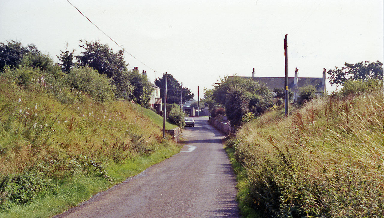
Ex-NBR Carlisle (left) - Silloth (right) line, closed completely 7/9/64: the bridge abutments remain, the station having been up to the left and a mile further on had been Abbey
Junction (see NY1851 : Abbey Junction station
404:– You must give appropriate credit, provide a link to the license, and indicate if changes were made. You may do so in any reasonable manner, but not in any way that suggests the licensor endorses you or your use.
65:
61:
57:
53:
47:
110:
78:
755:
1182:
199:
1059:
1054:
893:
656:
620:
584:
286:
69:
42:
676:
321:
1132:
This file contains additional information, probably added from the digital camera or scanner used to create or digitize it.
411:
519:
988:
951:
914:
859:
825:
796:
769:
684:
640:
568:
540:
527:
512:
886:
727:
699:
669:
604:
485:
468:
1091:
308:
367:
1135:
If the file has been modified from its original state, some details may not fully reflect the modified file.
410:– If you remix, transform, or build upon the material, you must distribute your contributions under the
328:
on the
Geograph website for the photographer's contact details. The copyright on this image is owned by
364:
762:"}},"text\/plain":{"en":{"P7787":"180 degree"}}}}": -->
118:
231:
706:
691:
547:
215:
292:
333:
105:
276:
1197:
1070:
167:
188:
178:
313:
325:
1027:
Click on a date/time to view the file as it appeared at that time.
278:
263:
54° 50′ 44.77″ N, 3° 17′ 25.81″ W
253:
143:
Abbey Town station site geograph-3222645-by-Ben-Brooksbank.jpg
93:
452:
Add a one-line explanation of what this file represents
1109:
83:(2,395 × 1,358 pixels, file size: 3.17 MB, MIME type:
1119:
206:
Creative
Commons Attribution Share-alike license 2.0
137:
117:
Commons is a freely licensed media file repository.
621:
Creative
Commons Attribution-ShareAlike 2.0 Generic
421:https://creativecommons.org/licenses/by-sa/2.0
98:
427:Creative Commons Attribution-Share Alike 2.0
345:
8:
759:
387:– to copy, distribute and transmit the work
1137:
1029:
448:
1102:The following other wikis use this file:
707:https://www.geograph.org.uk/photo/3222645
548:https://www.geograph.org.uk/profile/44502
875:145c1b2f3365eb2c61978c43be69e0e34a262470
1237:
1229:
1221:
1213:
1205:
1195:
1187:
1177:
1169:
1161:
1153:
1144:
1139:
1089:
1002:
986:
965:
949:
928:
912:
873:
857:
839:
823:
783:
767:
741:
725:
654:
638:
618:
602:
582:
566:
499:
483:
466:
463:
444:
437:
256:
285:View this and other nearby images on:
7:
1183:Adobe Photoshop Elements 3.0 Windows
332:and is licensed for reuse under the
1087:The following page uses this file:
1018:
368:Attribution-Share Alike 2.0 Generic
356:
351:
336:Attribution-ShareAlike 2.0 license.
1130:
457:
451:
342:
319:
147:
130:
76:
456:
154:Site of Abbey Town station, 1991.
770:coordinates of the point of view
442:
398:Under the following conditions:
363:This file is licensed under the
355:
350:
344:
312:
291:
277:
269:
246:Site of Abbey Town station, 1991
227:Site of Abbey Town station, 1991
97:
31:
21:
1231:Date metadata was last modified
439:
148:
14:
657:file available on the internet
438:
320:This image was taken from the
26:
1:
785:54°50'44.768"N, 3°17'25.807"W
36:
677:Geograph Britain and Ireland
513:object of statement has role
464:Items portrayed in this file
268:
1223:Date and time of digitizing
244:Ben Brooksbank /
225:Ben Brooksbank /
1259:
1116:Usage on www.wikidata.org
1106:Usage on br.wikipedia.org
1092:Abbey Town railway station
412:same or compatible license
1189:File change date and time
1019:
16:
685:geograph.org.uk image ID
441:
378:
104:This is a file from the
1234:17:42, 13 November 2012
1226:17:42, 13 November 2012
1192:17:42, 13 November 2012
1076:
1055:21:34, 23 November 2012
216:required by the license
194:
184:
173:
166:
163:
140:
108:. Information from its
326:this photograph's page
297:54.845769; -3.290502
111:description page there
46:Size of this preview:
1163:Horizontal resolution
887:determination method
70:2,395 × 1,358 pixels
1171:Vertical resolution
1147:EPSON scanner image
393:– to adapt the work
52:Other resolutions:
528:author name string
66:1,280 × 726 pixels
62:1,024 × 581 pixels
1246:
1245:
1098:Global file usage
1080:
761:
605:copyright license
450:
341:
340:
324:collection. See
302:
301:
251:
250:
219:
203:
200:Reusing this file
126:
125:
106:Wikimedia Commons
32:Global file usage
1250:
1148:
1138:
1067:
1007:
970:
933:
896:
891:
807:
806:
801:
743:1 September 1991
709:
704:
700:described at URL
694:
689:
679:
674:
569:copyright status
550:
545:
535:
532:
522:
517:
434:
431:
428:
425:
422:
414:as the original.
376:
365:Creative Commons
359:
358:
354:
353:
348:
347:
334:Creative Commons
322:Geograph project
316:
309:
298:
295:
281:
280:
274:
273:
272:
266:
265:
254:
213:
197:
169:
168:1 September 1991
158:(site/remains)).
152:
144:
138:
122:
101:
100:
94:
88:
86:
73:
58:640 × 363 pixels
54:320 × 181 pixels
48:800 × 454 pixels
1258:
1257:
1253:
1252:
1251:
1249:
1248:
1247:
1146:
1126:
1096:
1081:
1073:
1065:
1021:
1020:
1017:
1016:
1015:
1014:
1013:
1012:
1011:
1010:
1008:
1005:
995:
994:
993:
991:
980:
979:
978:
977:
976:
975:
974:
973:
971:
968:
958:
957:
956:
954:
943:
942:
941:
940:
939:
938:
937:
936:
934:
931:
921:
920:
919:
917:
906:
905:
904:
903:
902:
901:
900:
899:
898:
897:
892:
889:
880:
879:
878:
876:
866:
865:
864:
862:
851:
850:
849:
848:
847:
846:
845:
844:
842:
832:
831:
830:
828:
817:
816:
815:
814:
813:
812:
811:
810:
809:
808:
804:
802:
799:
790:
789:
788:
786:
776:
775:
774:
772:
753:
752:
751:
750:
749:
748:
747:
746:
744:
734:
733:
732:
730:
719:
718:
717:
716:
715:
714:
713:
712:
711:
710:
705:
702:
696:
695:
690:
687:
681:
680:
675:
672:
663:
662:
661:
659:
647:
646:
645:
643:
632:
631:
630:
629:
628:
627:
626:
625:
623:
611:
610:
609:
607:
596:
595:
594:
593:
592:
591:
590:
589:
587:
575:
574:
573:
571:
560:
559:
558:
557:
556:
555:
554:
553:
552:
551:
546:
543:
537:
536:
533:
530:
524:
523:
518:
515:
506:
505:
504:
502:
492:
491:
490:
488:
477:
476:
475:
474:
473:
471:
455:
454:
453:
436:
435:
432:
429:
426:
423:
420:
419:
377:
374:
371:
360:
337:
307:
296:
270:
261:
260:
257:Camera location
252:
241:
234:
222:
179:geograph.org.uk
159:
142:
135:
128:
127:
116:
115:
114:is shown below.
90:
84:
82:
75:
74:
51:
12:
11:
5:
1256:
1254:
1244:
1243:
1240:
1236:
1235:
1232:
1228:
1227:
1224:
1220:
1219:
1216:
1212:
1211:
1208:
1204:
1203:
1200:
1194:
1193:
1190:
1186:
1185:
1180:
1176:
1175:
1172:
1168:
1167:
1164:
1160:
1159:
1156:
1152:
1151:
1150:
1149:
1142:
1129:
1125:
1124:
1123:
1122:
1114:
1113:
1112:
1100:
1099:
1095:
1094:
1085:
1084:
1079:
1078:
1075:
1071:
1068:
1064:2,395 × 1,358
1062:
1057:
1052:
1048:
1047:
1044:
1041:
1038:
1035:
1032:
1025:
1024:
1009:
1003:
1001:
1000:
999:
998:
997:
996:
992:
987:
985:
984:
983:
982:
981:
972:
966:
964:
963:
962:
961:
960:
959:
955:
950:
948:
947:
946:
945:
944:
935:
929:
927:
926:
925:
924:
923:
922:
918:
913:
911:
910:
909:
908:
907:
885:
884:
883:
882:
881:
877:
874:
872:
871:
870:
869:
868:
867:
863:
858:
856:
855:
854:
853:
852:
843:
840:
838:
837:
836:
835:
834:
833:
829:
824:
822:
821:
820:
819:
818:
795:
794:
793:
792:
791:
787:
784:
782:
781:
780:
779:
778:
777:
773:
768:
766:
765:
764:
763:
757:
745:
742:
740:
739:
738:
737:
736:
735:
731:
726:
724:
723:
722:
721:
720:
698:
697:
683:
682:
668:
667:
666:
665:
664:
660:
655:
653:
652:
651:
650:
649:
648:
644:
641:source of file
639:
637:
636:
635:
634:
633:
624:
619:
617:
616:
615:
614:
613:
612:
608:
603:
601:
600:
599:
598:
597:
588:
583:
581:
580:
579:
578:
577:
576:
572:
567:
565:
564:
563:
562:
561:
539:
538:
534:Ben Brooksbank
526:
525:
511:
510:
509:
508:
507:
503:
500:
498:
497:
496:
495:
494:
493:
489:
484:
482:
481:
480:
479:
478:
472:
467:
465:
462:
461:
460:
459:
458:
447:
446:
443:
440:
418:
417:
416:
415:
405:
396:
395:
394:
388:
381:You are free:
375:Ben Brooksbank
372:
362:
361:
343:
339:
338:
330:Ben Brooksbank
317:
306:
303:
300:
299:
289:
283:
258:
249:
248:
242:
239:
236:
235:
230:
223:
220:
208:
207:
204:
192:
191:
189:Ben Brooksbank
186:
182:
181:
175:
171:
170:
165:
161:
160:
145:
136:
134:
131:
129:
124:
123:
102:
92:
91:
45:
41:
40:
39:
34:
29:
24:
19:
13:
10:
9:
6:
4:
3:
2:
1255:
1241:
1238:
1233:
1230:
1225:
1222:
1217:
1214:
1209:
1206:
1201:
1199:
1196:
1191:
1188:
1184:
1181:
1179:Software used
1178:
1173:
1170:
1165:
1162:
1157:
1154:
1145:
1143:
1140:
1136:
1133:
1127:
1121:
1118:
1117:
1115:
1111:
1108:
1107:
1105:
1104:
1103:
1097:
1093:
1090:
1088:
1082:
1074:
1069:
1063:
1061:
1058:
1056:
1053:
1050:
1049:
1045:
1042:
1039:
1036:
1033:
1031:
1030:
1028:
1022:
990:
953:
916:
895:
888:
861:
827:
798:
771:
729:
708:
701:
693:
686:
678:
671:
658:
642:
622:
606:
586:
570:
549:
542:
529:
521:
514:
487:
470:
424:CC BY-SA 2.0
413:
409:
406:
403:
400:
399:
397:
392:
389:
386:
383:
382:
380:
379:
373:Attribution:
369:
366:
349:
335:
331:
327:
323:
318:
315:
311:
310:
304:
294:
290:
288:
287:OpenStreetMap
284:
282:
264:
259:
255:
247:
243:
238:
237:
233:
229: /
228:
224:
217:
212:
210:
209:
205:
201:
196:
193:
190:
187:
183:
180:
176:
172:
162:
156:
155:
151:
146:
139:
132:
120:
113:
112:
107:
103:
96:
95:
89:
80:
79:Original file
71:
67:
63:
59:
55:
49:
44:
38:
35:
33:
30:
28:
25:
23:
20:
18:
15:
1215:Image height
1202:Uncalibrated
1134:
1131:
1101:
1086:
1026:
1023:File history
520:photographer
407:
401:
390:
384:
329:
267:
245:
232:CC BY-SA 2.0
226:
153:
149:
119:You can help
109:
77:
22:File history
1239:IIM version
1207:Image width
1198:Color space
1155:Orientation
1141:Image title
585:copyrighted
408:share alike
402:attribution
211:Attribution
141:Description
1083:File usage
1040:Dimensions
930:3,319,031
841:image/jpeg
826:media type
501:some value
195:Permission
85:image/jpeg
27:File usage
1110:Abbeytown
1066:(3.17 MB)
1037:Thumbnail
1034:Date/Time
915:data size
728:inception
305:Licensing
240:InfoField
221:InfoField
150:English:
1218:1,358 px
1210:2,395 px
1128:Metadata
1120:Q4664062
860:checksum
670:operator
445:Captions
391:to remix
385:to share
370:license.
37:Metadata
1174:157 dpc
1166:157 dpc
1051:current
1046:Comment
797:heading
756:heading
692:3222645
486:creator
469:depicts
449:English
133:Summary
81:
1158:Normal
1072:Chevin
1004:2,395
967:1,358
952:height
805:degree
760:degree
275:
185:Author
174:Source
1006:pixel
989:width
969:pixel
894:SHA-1
177:From
1043:User
932:byte
803:180
433:true
430:true
164:Date
17:File
541:URL
890::
800::
703::
688::
673::
544::
531::
516::
68:|
64:|
60:|
56:|
50:.
1242:2
218:)
214:(
202:)
198:(
121:.
87:)
72:.
Text is available under the Creative Commons Attribution-ShareAlike License. Additional terms may apply.

