43:
258:
264:
269:
99:
1338:
754:
1348:
316:– You must give appropriate credit, provide a link to the license, and indicate if changes were made. You may do so in any reasonable manner, but not in any way that suggests the licensor endorses you or your use.
1295:
786:
775:, UK with the following information shown: *Administrative borders *Coastline, lakes and rivers *Roads and railways *Urban areas Equirectangular map projection on WGS 84 datum, with
1602:
73:
69:
65:
61:
57:
53:
47:
110:
82:
1108:
247:
587:
465:
429:
1613:
This file contains additional information, probably added from the digital camera or scanner used to create or digitize it.
356:
323:
1433:
1078:
1198:
682:
645:
608:
553:
519:
413:
1033:
958:
580:
485:
449:
396:
1038:
893:
218:
1288:
1063:
279:
1013:
1616:
If the file has been modified from its original state, some details may not fully reflect the modified file.
1158:
903:
785:
More than 100 pages use this file. The following list shows the first 100 pages that use this file only. A
1123:
1093:
913:
1313:
1258:
1068:
898:
818:
803:
322:– If you remix, transform, or build upon the material, you must distribute your contributions under the
1323:
1278:
968:
853:
276:
1248:
1218:
1128:
963:
863:
753:
748:
42:
204:
1438:
1053:
118:
1153:
888:
813:
1373:
1073:
953:
201:
1358:
843:
838:
1368:
928:
908:
878:
858:
764:
222:
144:
1133:
1103:
1088:
1023:
798:
772:
105:
1223:
1098:
918:
235:
1043:
1003:
993:
973:
938:
883:
793:
190:
1243:
1228:
1208:
1178:
1168:
1058:
933:
823:
1238:
1203:
1193:
1163:
1118:
1048:
1273:
1253:
1233:
1173:
1148:
1138:
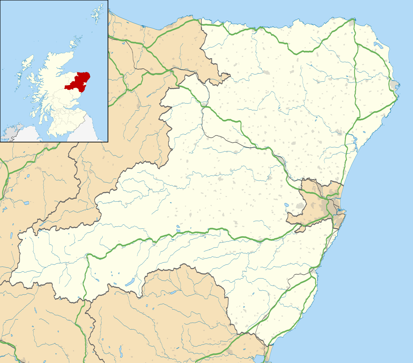
1113:
868:
848:
833:
828:
164:
Equirectangular map projection on WGS 84 datum, with N/S stretched 180%
1478:
1283:
1263:
1213:
1143:
1083:
988:
983:
978:
948:
943:
923:
873:
1488:
1568:
1383:
1188:
1018:
808:
211:
Administrative borders and coastline data from
Boundary-Line product.
1558:
1458:
1443:
1434:
Wikiproyecto:Ilustración/Taller de
Cartografía/Realizaciones/Europa
1388:
721:
Click on a date/time to view the file as it appeared at that time.
1498:
1493:
1328:
1268:
1028:
1008:
998:
287:
Contains
Ordnance Survey data © Crown copyright and database right
1593:
1183:
93:
87:(SVG file, nominally 1,425 × 1,253 pixels, file size: 1.84 MB)
1448:
1393:
1403:
1408:
1423:
1378:
1553:
1413:
1538:
1483:
1473:
1463:
1583:
1518:
1398:
380:
Add a one-line explanation of what this file represents
1573:
1543:
1588:
1548:
1508:
1503:
1563:
1528:
1513:
466:
Creative
Commons Attribution-ShareAlike 3.0 Unported
132:
117:
Commons is a freely licensed media file repository.
1578:
1533:
1523:
1453:
1468:
1339:Ҡалып:ПозКарта Бөйөк Британия Шотландия Абердиншир
214:All other geographic data from Meridian 2 product.
1439:Plantilla:Mapa de localización de Aberdeenshire
1374:Vorlage:Positionskarte Schottland Aberdeenshire
333:https://creativecommons.org/licenses/by-sa/3.0
98:
1359:Plantilya:Location map Scotland Aberdeenshire
339:Creative Commons Attribution-Share Alike 3.0
257:
8:
299:– to copy, distribute and transmit the work
147:, UK with the following information shown:
46:Size of this PNG preview of this SVG file:
1618:
723:
376:
1306:The following other wikis use this file:
1314:قالب:Location map Scotland Aberdeenshire
771:{{Information |Description=Blank map of
569:d519b311f1ee536393c8319db5dafde3314568ba
1628:
1620:
1369:Nationalparks im Vereinigten Königreich
791:
696:
680:
659:
643:
622:
606:
567:
551:
533:
517:
499:
483:
463:
447:
427:
411:
394:
391:
372:
365:
1324:Şablon:Yer xəritəsi Şotlandiya Aberdin
217:Inset derived from Inset derived from
7:
1349:Шаблон:ПК Великобритания Абърдийншър
280:Attribution-Share Alike 3.0 Unported
238:, created using Ordnance Survey data
1109:List of monastic houses in Scotland
712:
357:File:Aberdeenshire UK blank map.svg
268:
263:
1611:
385:
379:
254:
130:
80:
384:
138:Aberdeenshire UK location map.svg
370:
310:Under the following conditions:
275:This file is licensed under the
267:
262:
256:
97:
31:
21:
367:
14:
366:
219:File:Scotland location map.svg
26:
1:
1079:Kincardine Community Hospital
36:
1199:Peterhead Community Hospital
392:Items portrayed in this file
1355:Usage on ceb.wikipedia.org
1034:Insch War Memorial Hospital
959:Durris transmitting station
154:Coastline, lakes and rivers
1650:
1479:Inverallochy and Cairnbulg
1430:Usage on es.wikipedia.org
1420:Usage on eo.wikipedia.org
1365:Usage on de.wikipedia.org
1345:Usage on bg.wikipedia.org
1335:Usage on ba.wikipedia.org
1320:Usage on az.wikipedia.org
1310:Usage on ar.wikipedia.org
1039:Inverallochy and Cairnbulg
894:Campbell Hospital, Portsoy
324:same or compatible license
1489:Blackburn (Aberdeenshire)
1014:Glen o' Dee Hospital
713:
16:
1569:Kingseat (Aberdeenshire)
1384:Kinnaird Head Lighthouse
1289:Turriff Cottage Hospital
1064:Jubilee Hospital, Huntly
749:19:59, 26 September 2010
369:
290:
104:This is a file from the
1559:Kintore (Aberdeenshire)
1459:Gourdon (Aberdeenshire)
1159:Newburgh, Aberdeenshire
904:Cornhill, Aberdeenshire
770:
352:
242:
231:
196:
189:
186:
135:
108:. Information from its
1444:Alford (Aberdeenshire)
1389:Buchan Ness Lighthouse
1124:Macduff, Aberdeenshire
1094:Kintore, Aberdeenshire
914:Crathie, Aberdeenshire
151:Administrative borders
111:description page there
1499:Ellon (Aberdeenshire)
1494:Banff (Aberdeenshire)
1259:Strichen stone circle
1069:Kemnay, Aberdeenshire
899:Christie Park, Huntly
819:Alford, Aberdeenshire
804:Aberdeenshire Council
1594:Maud (Aberdeenshire)
1279:Towie, Aberdeenshire
969:Ellon, Aberdeenshire
854:Banff, Aberdeenshire
581:determination method
74:1,425 × 1,253 pixels
70:2,329 × 2,048 pixels
66:1,165 × 1,024 pixels
1249:Stonehaven Tolbooth
1219:Princess Royal Park
1129:Maud, Aberdeenshire
964:Echt, Aberdeenshire
864:Battle of Lumphanan
305:– to adapt the work
167:Geographic limits:
52:Other resolutions:
1054:Inverurie Hospital
157:Roads and railways
1637:
1636:
1603:more global usage
1302:Global file usage
1154:New Slains Castle
889:Bullers of Buchan
814:Aden Country Park
778:
501:26 September 2010
450:copyright license
378:
363:
362:
251:
248:Reusing this file
191:26 September 2010
126:
125:
106:Wikimedia Commons
32:Global file usage
1641:
1619:
1449:Hatton of Cruden
1394:Balmoral Stadium
1329:Dannottar qalası
1074:Kildrummy Castle
954:Dunnottar Castle
761:
701:
664:
627:
590:
585:
414:copyright status
346:
343:
340:
337:
334:
326:as the original.
288:
277:Creative Commons
271:
270:
266:
265:
260:
259:
245:
192:
139:
133:
122:
101:
100:
94:
88:
77:
62:873 × 768 pixels
58:546 × 480 pixels
54:273 × 240 pixels
48:682 × 600 pixels
1649:
1648:
1644:
1643:
1642:
1640:
1639:
1638:
1607:
1404:Balmoor Stadium
1300:
844:Balmoral Castle
839:Balmoor Stadium
779:
767:
759:
715:
714:
711:
710:
709:
708:
707:
706:
705:
704:
702:
699:
689:
688:
687:
685:
674:
673:
672:
671:
670:
669:
668:
667:
665:
662:
652:
651:
650:
648:
637:
636:
635:
634:
633:
632:
631:
630:
628:
625:
615:
614:
613:
611:
600:
599:
598:
597:
596:
595:
594:
593:
592:
591:
586:
583:
574:
573:
572:
570:
560:
559:
558:
556:
545:
544:
543:
542:
541:
540:
539:
538:
536:
526:
525:
524:
522:
511:
510:
509:
508:
507:
506:
505:
504:
502:
492:
491:
490:
488:
477:
476:
475:
474:
473:
472:
471:
470:
468:
456:
455:
454:
452:
441:
440:
439:
438:
437:
436:
435:
434:
432:
420:
419:
418:
416:
405:
404:
403:
402:
401:
399:
383:
382:
381:
364:
348:
347:
344:
341:
338:
335:
332:
331:
289:
286:
283:
272:
202:Ordnance Survey
137:
128:
127:
116:
115:
114:is shown below.
90:
86:
79:
78:
51:
12:
11:
5:
1647:
1645:
1635:
1634:
1631:
1627:
1626:
1623:
1610:
1605:of this file.
1599:
1598:
1597:
1596:
1591:
1586:
1581:
1576:
1571:
1566:
1561:
1556:
1551:
1546:
1541:
1536:
1531:
1526:
1521:
1516:
1511:
1506:
1501:
1496:
1491:
1486:
1481:
1476:
1471:
1466:
1461:
1456:
1451:
1446:
1441:
1436:
1428:
1427:
1426:
1418:
1417:
1416:
1411:
1409:Borough Briggs
1406:
1401:
1396:
1391:
1386:
1381:
1376:
1371:
1363:
1362:
1361:
1353:
1352:
1351:
1343:
1342:
1341:
1333:
1332:
1331:
1326:
1318:
1317:
1316:
1304:
1303:
1298:to this file.
1292:
1291:
1286:
1281:
1276:
1271:
1266:
1261:
1256:
1251:
1246:
1241:
1236:
1231:
1226:
1221:
1216:
1211:
1206:
1201:
1196:
1191:
1186:
1181:
1176:
1171:
1166:
1161:
1156:
1151:
1146:
1141:
1136:
1131:
1126:
1121:
1116:
1111:
1106:
1101:
1096:
1091:
1086:
1081:
1076:
1071:
1066:
1061:
1056:
1051:
1046:
1041:
1036:
1031:
1026:
1021:
1016:
1011:
1006:
1001:
996:
991:
986:
981:
976:
971:
966:
961:
956:
951:
946:
941:
936:
931:
929:Crimond Church
926:
921:
916:
911:
909:Crathes Castle
906:
901:
896:
891:
886:
881:
879:Braemar Castle
876:
871:
866:
861:
859:Barthol Chapel
856:
851:
846:
841:
836:
831:
826:
821:
816:
811:
806:
801:
796:
789:is available.
783:
782:
777:
776:
769:
765:
762:
758:1,425 × 1,253
756:
751:
746:
742:
741:
738:
735:
732:
729:
726:
719:
718:
703:
697:
695:
694:
693:
692:
691:
690:
686:
681:
679:
678:
677:
676:
675:
666:
660:
658:
657:
656:
655:
654:
653:
649:
644:
642:
641:
640:
639:
638:
629:
623:
621:
620:
619:
618:
617:
616:
612:
607:
605:
604:
603:
602:
601:
579:
578:
577:
576:
575:
571:
568:
566:
565:
564:
563:
562:
561:
557:
552:
550:
549:
548:
547:
546:
537:
534:
532:
531:
530:
529:
528:
527:
523:
518:
516:
515:
514:
513:
512:
503:
500:
498:
497:
496:
495:
494:
493:
489:
484:
482:
481:
480:
479:
478:
469:
464:
462:
461:
460:
459:
458:
457:
453:
448:
446:
445:
444:
443:
442:
433:
428:
426:
425:
424:
423:
422:
421:
417:
412:
410:
409:
408:
407:
406:
400:
395:
393:
390:
389:
388:
387:
386:
375:
374:
371:
368:
361:
360:
354:
353:Other versions
350:
349:
330:
329:
328:
327:
317:
308:
307:
306:
300:
293:You are free:
284:
274:
273:
255:
252:
240:
239:
233:
229:
228:
227:
226:
215:
212:
198:
194:
193:
188:
184:
183:
182:
181:
178:
175:
172:
162:
161:
158:
155:
152:
140:
131:
129:
124:
123:
102:
92:
91:
45:
41:
40:
39:
34:
29:
24:
19:
13:
10:
9:
6:
4:
3:
2:
1646:
1632:
1629:
1624:
1621:
1617:
1614:
1608:
1606:
1604:
1595:
1592:
1590:
1587:
1585:
1582:
1580:
1577:
1575:
1572:
1570:
1567:
1565:
1562:
1560:
1557:
1555:
1552:
1550:
1547:
1545:
1542:
1540:
1537:
1535:
1532:
1530:
1527:
1525:
1522:
1520:
1517:
1515:
1512:
1510:
1507:
1505:
1502:
1500:
1497:
1495:
1492:
1490:
1487:
1485:
1482:
1480:
1477:
1475:
1472:
1470:
1467:
1465:
1462:
1460:
1457:
1455:
1452:
1450:
1447:
1445:
1442:
1440:
1437:
1435:
1432:
1431:
1429:
1425:
1424:Aberdeenshire
1422:
1421:
1419:
1415:
1412:
1410:
1407:
1405:
1402:
1400:
1397:
1395:
1392:
1390:
1387:
1385:
1382:
1380:
1379:Bellslea Park
1377:
1375:
1372:
1370:
1367:
1366:
1364:
1360:
1357:
1356:
1354:
1350:
1347:
1346:
1344:
1340:
1337:
1336:
1334:
1330:
1327:
1325:
1322:
1321:
1319:
1315:
1312:
1311:
1309:
1308:
1307:
1301:
1299:
1297:
1290:
1287:
1285:
1282:
1280:
1277:
1275:
1272:
1270:
1267:
1265:
1262:
1260:
1257:
1255:
1252:
1250:
1247:
1245:
1242:
1240:
1237:
1235:
1232:
1230:
1227:
1225:
1222:
1220:
1217:
1215:
1212:
1210:
1207:
1205:
1202:
1200:
1197:
1195:
1192:
1190:
1187:
1185:
1182:
1180:
1177:
1175:
1172:
1170:
1167:
1165:
1162:
1160:
1157:
1155:
1152:
1150:
1147:
1145:
1142:
1140:
1137:
1135:
1134:Maud Hospital
1132:
1130:
1127:
1125:
1122:
1120:
1117:
1115:
1112:
1110:
1107:
1105:
1104:Leslie Castle
1102:
1100:
1097:
1095:
1092:
1090:
1089:Kinnaird Head
1087:
1085:
1082:
1080:
1077:
1075:
1072:
1070:
1067:
1065:
1062:
1060:
1057:
1055:
1052:
1050:
1047:
1045:
1042:
1040:
1037:
1035:
1032:
1030:
1027:
1025:
1024:Huntly Castle
1022:
1020:
1017:
1015:
1012:
1010:
1007:
1005:
1002:
1000:
997:
995:
992:
990:
987:
985:
982:
980:
977:
975:
972:
970:
967:
965:
962:
960:
957:
955:
952:
950:
947:
945:
942:
940:
937:
935:
932:
930:
927:
925:
922:
920:
917:
915:
912:
910:
907:
905:
902:
900:
897:
895:
892:
890:
887:
885:
882:
880:
877:
875:
872:
870:
867:
865:
862:
860:
857:
855:
852:
850:
847:
845:
842:
840:
837:
835:
832:
830:
827:
825:
822:
820:
817:
815:
812:
810:
807:
805:
802:
800:
799:Aberdeenshire
797:
795:
792:
790:
788:
780:
774:
773:Aberdeenshire
768:
763:
757:
755:
752:
750:
747:
744:
743:
739:
736:
733:
730:
727:
725:
724:
722:
716:
684:
647:
610:
589:
582:
555:
535:image/svg+xml
521:
487:
467:
451:
431:
415:
398:
358:
355:
351:
336:CC BY-SA 3.0
325:
321:
318:
315:
312:
311:
309:
304:
301:
298:
295:
294:
292:
291:
285:Attribution:
281:
278:
261:
253:
249:
244:
241:
237:
234:
230:
224:
220:
216:
213:
210:
209:
208:
206:
203:
199:
195:
185:
180:South: 56.70N
179:
177:North: 57.75N
176:
173:
170:
169:
168:
165:
159:
156:
153:
150:
149:
148:
146:
145:Aberdeenshire
143:Blank map of
141:
134:
120:
113:
112:
107:
103:
96:
95:
89:
84:
83:Original file
75:
71:
67:
63:
59:
55:
49:
44:
38:
35:
33:
30:
28:
25:
23:
20:
18:
15:
1615:
1612:
1600:
1554:Laurencekirk
1414:Station Park
1305:
1293:
1224:RNAS Rattray
1099:Laurencekirk
919:Crathie Kirk
784:
720:
717:File history
319:
313:
302:
296:
223:NordNordWest
200:
166:
163:
142:
119:You can help
109:
81:
22:File history
1539:Aberchirder
1484:Inverbervie
1474:Fraserburgh
1464:Gardenstown
1044:Inverbervie
1004:Gardenstown
994:Fraserburgh
974:Fettercairn
939:Drum Castle
884:Buchanhaven
794:Aberchirder
430:copyrighted
359:- Blank map
320:share alike
314:attribution
174:East: 1.70W
171:West: 3.85W
160:Urban areas
136:Description
1584:Portlethen
1519:Auchenblae
1399:Links Park
1296:more links
1244:Stonehaven
1229:Rosehearty
1209:Portlethen
1179:Oldmeldrum
1169:Newtonhill
1059:Johnshaven
934:Cruden Bay
824:Arbuthnott
781:File usage
734:Dimensions
624:1,924,938
520:media type
243:Permission
27:File usage
1574:Inverurie
1544:Peterhead
1239:St Fergus
1204:Pitmedden
1194:Peterhead
1164:Newmachar
1119:Lumphanan
1049:Inverurie
787:full list
766:Nilfanion
760:(1.84 MB)
731:Thumbnail
728:Date/Time
609:data size
486:inception
236:Nilfanion
1609:Metadata
1589:Marywell
1549:Longside
1509:Balmedie
1504:Ballater
1274:Torphins
1254:Strichen
1234:St Cyrus
1174:Old Deer
1149:New Deer
1139:Methlick
1114:Longside
869:Bellabeg
849:Banchory
834:Balmedie
829:Ballater
554:checksum
373:Captions
303:to remix
297:to share
282:license.
205:OpenData
37:Metadata
1564:Macduff
1529:Crimond
1514:Drumoak
1284:Turriff
1264:Tarland
1214:Portsoy
1144:Mintlaw
1084:Kinmuck
989:Foveran
984:Fordoun
979:Finzean
949:Dunecht
944:Drumoak
924:Crimond
874:Braemar
745:current
740:Comment
397:depicts
377:English
85:
1630:Height
1579:Kemnay
1534:Aboyne
1524:Boddam
1454:Huntly
1189:Pennan
1019:Huntly
809:Aboyne
698:1,425
661:1,253
646:height
232:Author
197:Source
1622:Width
1601:View
1469:Insch
1294:View
1269:Tewel
1029:Insch
1009:Gight
999:Fyvie
700:pixel
683:width
663:pixel
588:SHA-1
1633:1253
1625:1425
1184:Oyne
737:User
626:byte
345:true
342:true
187:Date
17:File
221:by
584::
207:.
72:|
68:|
64:|
60:|
56:|
50:.
250:)
246:(
225:.
121:.
76:.
Text is available under the Creative Commons Attribution-ShareAlike License. Additional terms may apply.
