282:
175:
125:
167:
117:
189:
139:
250:
288:
293:
67:
624:"}},"text\/plain":{"en":{"":"heading"}}},"{\"value\":{\"amount\":\"+135\",\"unit\":\"http:\\\/\\\/www.wikidata.org\\\/entity\\\/Q28390\"},\"type\":\"quantity\"}":{"text\/html":{"en":{"P7787":"135
560:"}},"text\/plain":{"en":{"":"heading"}}},"{\"value\":{\"amount\":\"+135\",\"unit\":\"http:\\\/\\\/www.wikidata.org\\\/entity\\\/Q28390\"},\"type\":\"quantity\"}":{"text\/html":{"en":{"P7787":"135
556:
986:
956:
158:
1003:{{Information |Description=Chuch of St John the Baptist, Adel, Leeds, West Yorkshire, England |Source=http://www.geograph.org.uk/photo/421410 |Date=2007-05-01 |Author=Malcolm Morris |Permission= |other_versions= }} {{geograph|421410}}
926:
340:– You must give appropriate credit, provide a link to the license, and indicate if changes were made. You may do so in any reasonable manner, but not in any way that suggests the licensor endorses you or your use.
108:
1042:
621:
557:
1037:
38:
1027:
1032:
1047:
759:
473:
437:
182:
132:
543:
257:
347:
854:
817:
780:
725:
691:
662:
635:
598:
571:
527:
421:
752:
493:
457:
404:
244:
303:
78:
1013:
The following pages on the
English Knowledge (XXG) use this file (pages on other projects are not listed):
985:
980:
955:
950:
46:
1022:
346:– If you remix, transform, or build upon the material, you must distribute your contributions under the
264:
on the
Geograph website for the photographer's contact details. The copyright on this image is owned by
300:
628:"}},"text\/plain":{"en":{"P7787":"135 degree"}}}}": -->
564:"}},"text\/plain":{"en":{"P7787":"135 degree"}}}}": -->
86:
966:
936:
188:
138:
269:
73:
925:
920:
122:
37:
1017:
218:
172:
996:
228:
249:
261:
893:
Click on a date/time to view the file as it appeared at that time.
210:
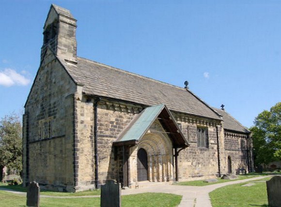
Church of St John the
Baptist, Adel, Leeds, West Yorkshire, England
174:
124:
109:
53° 51′ 30.84″ N, 1° 35′ 06.19″ W
149:
99:
61:
1105:
159:
53° 51′ 31″ N, 1° 35′ 06″ W
1125:
1095:
1085:
388:
Add a one-line explanation of what this file represents
1140:
1135:
1043:
Listed buildings in Leeds (Adel and
Wharfedale Ward)
200:
85:
Commons is a freely licensed media file repository.
1075:
1066:كنيسه القديس يوحنا المعمدان (ليدز, المملكه المتحده)
474:
Creative
Commons Attribution-ShareAlike 2.0 Generic
1115:
51:(580 × 428 pixels, file size: 50 KB, MIME type:
1038:List of places of worship in the City of Leeds
357:https://creativecommons.org/licenses/by-sa/2.0
66:
363:Creative Commons Attribution-Share Alike 2.0
281:
8:
973:cropped+corrected verticals, adjusted gamma
625:
561:
323:– to copy, distribute and transmit the work
1028:Grade I listed buildings in West Yorkshire
895:
384:
1058:The following other wikis use this file:
1033:Grade I listed churches in West Yorkshire
741:12fb9cd424ecae46c4f703b2e4512083fc369ad0
229:https://www.geograph.org.uk/photo/421410
1015:
868:
852:
831:
815:
794:
778:
739:
723:
705:
689:
649:
633:
585:
569:
541:
525:
507:
491:
471:
455:
435:
419:
402:
399:
380:
373:
152:
102:
181:View this and other nearby images on:
131:View this and other nearby images on:
7:
268:and is licensed for reuse under the
884:
304:Attribution-Share Alike 2.0 Generic
292:
287:
272:Attribution-ShareAlike 2.0 license.
393:
387:
278:
255:
98:
44:
392:
1048:St John the Baptist Church, Adel
572:coordinates of the point of view
378:
334:Under the following conditions:
299:This file is licensed under the
291:
286:
280:
248:
187:
173:
165:
137:
123:
115:
65:
31:
21:
375:
41:No higher resolution available.
14:
374:
256:This image was taken from the
26:
1:
636:coordinates of depicted place
587:53°51'30.841"N, 1°35'6.191"W
400:Items portrayed in this file
164:
114:
1102:Usage on it.wikivoyage.org
1072:Usage on en.wikivoyage.org
1062:Usage on arz.wikipedia.org
1159:
1132:Usage on www.wikidata.org
1122:Usage on sv.wikipedia.org
1112:Usage on la.wikipedia.org
1092:Usage on id.wikipedia.org
1082:Usage on ga.wikipedia.org
651:53°51'31.00"N, 1°35'6.00"W
348:same or compatible license
885:
16:
943:fix ratio (width:height)
377:
314:
72:This is a file from the
1002:
972:
942:
234:
224:
217:
214:
203:
76:. Information from its
981:09:24, 11 October 2007
262:this photograph's page
193:53.858610; -1.585000
143:53.858567; -1.585053
79:description page there
1023:Architecture of Leeds
951:10:10, 16 April 2021
921:10:18, 16 April 2021
753:determination method
329:– to adapt the work
1054:Global file usage
1006:
627:
563:
458:copyright license
386:
277:
276:
260:collection. See
242:
241:
198:
197:
148:
147:
94:
93:
74:Wikimedia Commons
32:Global file usage
1150:
993:
963:
933:
873:
836:
799:
762:
757:
673:
672:
667:
609:
608:
603:
422:copyright status
370:
367:
364:
361:
358:
350:as the original.
312:
301:Creative Commons
295:
294:
290:
289:
284:
283:
270:Creative Commons
258:Geograph project
252:
245:
220:
207:
201:
194:
191:
177:
176:
170:
169:
168:
162:
161:
150:
144:
141:
127:
126:
120:
119:
118:
112:
111:
100:
90:
69:
68:
62:
56:
54:
1158:
1157:
1153:
1152:
1151:
1149:
1148:
1147:
1106:Leeds nordovest
1052:
1014:
1007:
999:
991:
969:
961:
939:
931:
887:
886:
883:
882:
881:
880:
879:
878:
877:
876:
874:
871:
861:
860:
859:
857:
846:
845:
844:
843:
842:
841:
840:
839:
837:
834:
824:
823:
822:
820:
809:
808:
807:
806:
805:
804:
803:
802:
800:
797:
787:
786:
785:
783:
772:
771:
770:
769:
768:
767:
766:
765:
764:
763:
758:
755:
746:
745:
744:
742:
732:
731:
730:
728:
717:
716:
715:
714:
713:
712:
711:
710:
708:
698:
697:
696:
694:
683:
682:
681:
680:
679:
678:
677:
676:
675:
674:
670:
668:
665:
656:
655:
654:
652:
642:
641:
640:
638:
619:
618:
617:
616:
615:
614:
613:
612:
611:
610:
606:
604:
601:
592:
591:
590:
588:
578:
577:
576:
574:
555:
554:
553:
552:
551:
550:
549:
548:
546:
534:
533:
532:
530:
519:
518:
517:
516:
515:
514:
513:
512:
510:
500:
499:
498:
496:
485:
484:
483:
482:
481:
480:
479:
478:
476:
464:
463:
462:
460:
449:
448:
447:
446:
445:
444:
443:
442:
440:
428:
427:
426:
424:
413:
412:
411:
410:
409:
407:
391:
390:
389:
372:
371:
368:
365:
362:
359:
356:
355:
313:
310:
307:
296:
273:
243:
206:Adel Church.jpg
205:
192:
166:
157:
156:
153:Object location
142:
116:
107:
106:
103:Camera location
96:
95:
84:
83:
82:is shown below.
58:
52:
50:
47:Adel_Church.jpg
43:
42:
12:
11:
5:
1156:
1154:
1146:
1145:
1144:
1143:
1138:
1130:
1129:
1128:
1120:
1119:
1118:
1110:
1109:
1108:
1100:
1099:
1098:
1090:
1089:
1088:
1080:
1079:
1078:
1070:
1069:
1068:
1056:
1055:
1051:
1050:
1045:
1040:
1035:
1030:
1025:
1020:
1012:
1011:
1010:
1005:
1004:
1001:
997:
994:
988:
983:
978:
975:
974:
971:
967:
964:
958:
953:
948:
945:
944:
941:
937:
934:
928:
923:
918:
914:
913:
910:
907:
904:
901:
898:
891:
890:
875:
869:
867:
866:
865:
864:
863:
862:
858:
853:
851:
850:
849:
848:
847:
838:
832:
830:
829:
828:
827:
826:
825:
821:
816:
814:
813:
812:
811:
810:
801:
795:
793:
792:
791:
790:
789:
788:
784:
779:
777:
776:
775:
774:
773:
751:
750:
749:
748:
747:
743:
740:
738:
737:
736:
735:
734:
733:
729:
724:
722:
721:
720:
719:
718:
709:
706:
704:
703:
702:
701:
700:
699:
695:
690:
688:
687:
686:
685:
684:
661:
660:
659:
658:
657:
653:
650:
648:
647:
646:
645:
644:
643:
639:
634:
632:
631:
630:
629:
623:
597:
596:
595:
594:
593:
589:
586:
584:
583:
582:
581:
580:
579:
575:
570:
568:
567:
566:
565:
559:
547:
542:
540:
539:
538:
537:
536:
535:
531:
526:
524:
523:
522:
521:
520:
511:
508:
506:
505:
504:
503:
502:
501:
497:
492:
490:
489:
488:
487:
486:
477:
472:
470:
469:
468:
467:
466:
465:
461:
456:
454:
453:
452:
451:
450:
441:
436:
434:
433:
432:
431:
430:
429:
425:
420:
418:
417:
416:
415:
414:
408:
403:
401:
398:
397:
396:
395:
394:
383:
382:
379:
376:
354:
353:
352:
351:
341:
332:
331:
330:
324:
317:You are free:
311:Malcolm Morris
308:
298:
297:
279:
275:
274:
266:Malcolm Morris
253:
240:
239:
238:Malcolm Morris
236:
232:
231:
226:
222:
221:
216:
212:
211:
208:
199:
196:
195:
185:
179:
154:
146:
145:
135:
129:
104:
97:
92:
91:
70:
60:
59:
40:
36:
35:
34:
29:
24:
19:
13:
10:
9:
6:
4:
3:
2:
1155:
1142:
1139:
1137:
1134:
1133:
1131:
1127:
1124:
1123:
1121:
1117:
1114:
1113:
1111:
1107:
1104:
1103:
1101:
1097:
1094:
1093:
1091:
1087:
1084:
1083:
1081:
1077:
1074:
1073:
1071:
1067:
1064:
1063:
1061:
1060:
1059:
1053:
1049:
1046:
1044:
1041:
1039:
1036:
1034:
1031:
1029:
1026:
1024:
1021:
1019:
1016:
1008:
1000:
995:
989:
987:
984:
982:
979:
977:
976:
970:
965:
959:
957:
954:
952:
949:
947:
946:
940:
935:
929:
927:
924:
922:
919:
916:
915:
911:
908:
905:
902:
899:
897:
896:
894:
888:
856:
819:
782:
761:
754:
727:
693:
664:
637:
600:
573:
545:
529:
528:captured with
495:
475:
459:
439:
423:
406:
360:CC BY-SA 2.0
349:
345:
342:
339:
336:
335:
333:
328:
325:
322:
319:
318:
316:
315:
309:Attribution:
305:
302:
285:
271:
267:
263:
259:
254:
251:
247:
246:
237:
233:
230:
227:
223:
213:
209:
202:
190:
186:
184:
183:OpenStreetMap
180:
178:
160:
155:
151:
140:
136:
134:
133:OpenStreetMap
130:
128:
110:
105:
101:
88:
81:
80:
75:
71:
64:
63:
57:
48:
39:
33:
30:
28:
25:
23:
20:
18:
15:
1057:
892:
889:File history
343:
337:
326:
320:
265:
163:
113:
87:You can help
77:
45:
22:File history
1126:Adel, Leeds
1096:Adel, Leeds
1086:Adel, Leeds
1018:Adel, Leeds
438:copyrighted
344:share alike
338:attribution
204:Description
1009:File usage
990:640 × 433
960:542 × 428
930:580 × 428
906:Dimensions
707:image/jpeg
692:media type
509:1 May 2007
219:1 May 2007
53:image/jpeg
27:File usage
1141:Q17530532
968:Tony 1212
938:Tony 1212
903:Thumbnail
900:Date/Time
781:data size
544:Nikon D50
494:inception
1136:Q1227820
992:(119 KB)
726:checksum
381:Captions
327:to remix
321:to share
306:license.
962:(46 KB)
932:(50 KB)
917:current
912:Comment
796:51,515
663:heading
622:heading
599:heading
558:heading
405:depicts
385:English
49:
818:height
671:degree
626:degree
607:degree
562:degree
235:Author
225:Source
171:
121:
1076:Leeds
872:pixel
855:width
835:pixel
760:SHA-1
1116:Adel
998:PamD
909:User
870:580
833:428
798:byte
669:135
605:135
369:true
366:true
215:Date
17:File
756::
666::
602::
89:.
55:)
Text is available under the Creative Commons Attribution-ShareAlike License. Additional terms may apply.
_region:GB-ENG_heading:135.00&language=en)
