348:
281:
231:
273:
223:
295:
245:
316:
354:
359:
72:
824:"}},"text\/plain":{"en":{"":"heading"}}},"{\"value\":{\"amount\":\"+45\",\"unit\":\"http:\\\/\\\/www.wikidata.org\\\/entity\\\/Q28390\"},\"type\":\"quantity\"}":{"text\/html":{"en":{"P7787":"45
760:"}},"text\/plain":{"en":{"":"heading"}}},"{\"value\":{\"amount\":\"+45\",\"unit\":\"http:\\\/\\\/www.wikidata.org\\\/entity\\\/Q28390\"},\"type\":\"quantity\"}":{"text\/html":{"en":{"P7787":"45
1126:
820:
214:
43:
406:– You must give appropriate credit, provide a link to the license, and indicate if changes were made. You may do so in any reasonable manner, but not in any way that suggests the licensor endorses you or your use.
83:
51:
1143:== {{int:filedesc}} == {{Information |description={{en|1=Aerial photo of Bamburgh Castle Taken from 1000 ft agl.}} |date=2003-09-12 |source=From |author=[http://www.geograph.org.uk/profile/14176 Ne
821:
757:
1125:
1120:
959:
658:
622:
586:
288:
238:
42:
693:
323:
1268:
This file contains additional information, probably added from the digital camera or scanner used to create or digitize it.
413:
549:
1054:
1017:
980:
925:
891:
862:
835:
798:
771:
671:
642:
570:
542:
527:
514:
952:
729:
701:
686:
606:
487:
470:
310:
369:
1271:
If the file has been modified from its original state, some details may not fully reflect the modified file.
1153:
The following pages on the
English Knowledge (XXG) use this file (pages on other projects are not listed):
412:– If you remix, transform, or build upon the material, you must distribute your contributions under the
330:
on the
Geograph website for the photographer's contact details. The copyright on this image is owned by
1136:
366:
828:"}},"text\/plain":{"en":{"P7787":"45 degree"}}}}": -->
764:"}},"text\/plain":{"en":{"P7787":"45 degree"}}}}": -->
91:
183:
534:
708:
678:
167:
1157:
294:
244:
335:
78:
135:
278:
228:
156:
146:
315:
327:
1093:
Click on a date/time to view the file as it appeared at that time.
1245:
1235:
1215:
1175:
280:
230:
255:
205:
116:
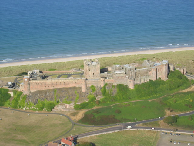
Aerial photo of
Bamburgh Castle - geograph.org.uk - 654112.jpg
66:
52:
Aerial_photo_of_Bamburgh_Castle_-_geograph.org.uk_-_654112.jpg
1205:
1195:
1185:
1255:
265:
55° 36′ 33″ N, 1° 42′ 41″ W
215:
55° 36′ 21″ N, 1° 43′ 07″ W
1225:
454:
Add a one-line explanation of what this file represents
126:
Aerial photo of
Bamburgh Castle Taken from 1000 ft agl.
110:
90:
Commons is a freely licensed media file repository.
623:
Creative
Commons Attribution-ShareAlike 2.0 Generic
56:(640 × 480 pixels, file size: 62 KB, MIME type:
423:https://creativecommons.org/licenses/by-sa/2.0
71:
429:Creative Commons Attribution-Share Alike 2.0
347:
8:
825:
761:
389:– to copy, distribute and transmit the work
1273:
1095:
450:
1168:The following other wikis use this file:
535:https://www.geograph.org.uk/profile/14176
941:556ca154796e48c8c0be7284653ad31dfa8876cc
709:https://www.geograph.org.uk/photo/654112
1275:
1155:
1068:
1052:
1031:
1015:
994:
978:
939:
923:
905:
889:
849:
833:
785:
769:
743:
727:
656:
640:
620:
604:
584:
568:
501:
485:
468:
465:
446:
439:
258:
208:
287:View this and other nearby images on:
237:View this and other nearby images on:
7:
334:and is licensed for reuse under the
1084:
370:Attribution-Share Alike 2.0 Generic
358:
353:
338:Attribution-ShareAlike 2.0 license.
1266:
459:
453:
344:
321:
120:
103:
49:
458:
772:coordinates of the point of view
444:
400:Under the following conditions:
365:This file is licensed under the
357:
352:
346:
314:
293:
279:
271:
243:
229:
221:
70:
31:
21:
441:
198:Aerial photo of Bamburgh Castle
179:Aerial photo of Bamburgh Castle
121:
46:No higher resolution available.
14:
659:file available on the internet
440:
322:This image was taken from the
26:
1:
836:coordinates of depicted place
36:
694:Geograph Britain and Ireland
543:object of statement has role
466:Items portrayed in this file
1222:Usage on es.wikivoyage.org
851:55°36'33.16"N, 1°42'40.68"W
270:
220:
1297:
1252:Usage on sl.wikipedia.org
1242:Usage on ms.wikipedia.org
1232:Usage on it.wikipedia.org
1212:Usage on es.wikipedia.org
1202:Usage on de.wikipedia.org
1192:Usage on da.wikipedia.org
1182:Usage on cs.wikipedia.org
1172:Usage on ca.wikipedia.org
414:same or compatible license
1085:
16:
787:55°36'21.2"N, 1°43'7.0"W
672:geograph.org.uk image ID
443:
380:
77:This is a file from the
1142:
168:required by the license
152:
141:
134:
131:
113:
81:. Information from its
1121:14:03, 7 February 2011
328:this photograph's page
299:55.609210; -1.711300
249:55.605900; -1.718600
196:Neil Reed /
177:Neil Reed /
84:description page there
1246:Istana Kota Bamburgh
1236:Castello di Bamburgh
1216:Castillo de Bamburgh
953:determination method
1176:Castell de Bamburgh
395:– to adapt the work
515:author name string
1284:
1283:
1164:Global file usage
1146:
827:
763:
745:12 September 2003
607:copyright license
452:
343:
342:
326:collection. See
304:
303:
254:
253:
203:
202:
171:
136:12 September 2003
99:
98:
79:Wikimedia Commons
32:Global file usage
1288:
1274:
1133:
1073:
1036:
999:
962:
957:
873:
872:
867:
809:
808:
803:
711:
706:
702:described at URL
696:
691:
681:
676:
571:copyright status
552:
547:
537:
532:
522:
519:
436:
433:
430:
427:
424:
416:as the original.
378:
367:Creative Commons
361:
360:
356:
355:
350:
349:
336:Creative Commons
324:Geograph project
318:
311:
300:
297:
283:
282:
276:
275:
274:
268:
267:
256:
250:
247:
233:
232:
226:
225:
224:
218:
217:
206:
165:
137:
125:
117:
111:
95:
74:
73:
67:
61:
59:
1296:
1295:
1291:
1290:
1289:
1287:
1286:
1285:
1262:
1206:Bamburgh Castle
1196:Bamburgh Castle
1186:Bamburgh (hrad)
1162:
1158:Bamburgh Castle
1154:
1147:
1139:
1131:
1087:
1086:
1083:
1082:
1081:
1080:
1079:
1078:
1077:
1076:
1074:
1071:
1061:
1060:
1059:
1057:
1046:
1045:
1044:
1043:
1042:
1041:
1040:
1039:
1037:
1034:
1024:
1023:
1022:
1020:
1009:
1008:
1007:
1006:
1005:
1004:
1003:
1002:
1000:
997:
987:
986:
985:
983:
972:
971:
970:
969:
968:
967:
966:
965:
964:
963:
958:
955:
946:
945:
944:
942:
932:
931:
930:
928:
917:
916:
915:
914:
913:
912:
911:
910:
908:
898:
897:
896:
894:
883:
882:
881:
880:
879:
878:
877:
876:
875:
874:
870:
868:
865:
856:
855:
854:
852:
842:
841:
840:
838:
819:
818:
817:
816:
815:
814:
813:
812:
811:
810:
806:
804:
801:
792:
791:
790:
788:
778:
777:
776:
774:
755:
754:
753:
752:
751:
750:
749:
748:
746:
736:
735:
734:
732:
721:
720:
719:
718:
717:
716:
715:
714:
713:
712:
707:
704:
698:
697:
692:
689:
683:
682:
677:
674:
665:
664:
663:
661:
649:
648:
647:
645:
634:
633:
632:
631:
630:
629:
628:
627:
625:
613:
612:
611:
609:
598:
597:
596:
595:
594:
593:
592:
591:
589:
577:
576:
575:
573:
562:
561:
560:
559:
558:
557:
556:
555:
554:
553:
548:
545:
539:
538:
533:
530:
524:
523:
520:
517:
508:
507:
506:
504:
494:
493:
492:
490:
479:
478:
477:
476:
475:
473:
457:
456:
455:
438:
437:
434:
431:
428:
425:
422:
421:
379:
376:
373:
362:
339:
309:
298:
272:
263:
262:
259:Object location
248:
222:
213:
212:
209:Camera location
204:
193:
186:
174:
147:geograph.org.uk
127:
115:
108:
101:
100:
89:
88:
87:is shown below.
63:
57:
55:
48:
47:
12:
11:
5:
1294:
1292:
1282:
1281:
1278:
1265:
1261:
1260:
1259:
1258:
1250:
1249:
1248:
1240:
1239:
1238:
1230:
1229:
1228:
1220:
1219:
1218:
1210:
1209:
1208:
1200:
1199:
1198:
1190:
1189:
1188:
1180:
1179:
1178:
1166:
1165:
1161:
1160:
1152:
1151:
1150:
1145:
1144:
1141:
1137:
1134:
1128:
1123:
1118:
1114:
1113:
1110:
1107:
1104:
1101:
1098:
1091:
1090:
1075:
1069:
1067:
1066:
1065:
1064:
1063:
1062:
1058:
1053:
1051:
1050:
1049:
1048:
1047:
1038:
1032:
1030:
1029:
1028:
1027:
1026:
1025:
1021:
1016:
1014:
1013:
1012:
1011:
1010:
1001:
995:
993:
992:
991:
990:
989:
988:
984:
979:
977:
976:
975:
974:
973:
951:
950:
949:
948:
947:
943:
940:
938:
937:
936:
935:
934:
933:
929:
924:
922:
921:
920:
919:
918:
909:
906:
904:
903:
902:
901:
900:
899:
895:
890:
888:
887:
886:
885:
884:
861:
860:
859:
858:
857:
853:
850:
848:
847:
846:
845:
844:
843:
839:
834:
832:
831:
830:
829:
823:
797:
796:
795:
794:
793:
789:
786:
784:
783:
782:
781:
780:
779:
775:
770:
768:
767:
766:
765:
759:
747:
744:
742:
741:
740:
739:
738:
737:
733:
728:
726:
725:
724:
723:
722:
700:
699:
685:
684:
670:
669:
668:
667:
666:
662:
657:
655:
654:
653:
652:
651:
650:
646:
643:source of file
641:
639:
638:
637:
636:
635:
626:
621:
619:
618:
617:
616:
615:
614:
610:
605:
603:
602:
601:
600:
599:
590:
585:
583:
582:
581:
580:
579:
578:
574:
569:
567:
566:
565:
564:
563:
541:
540:
526:
525:
513:
512:
511:
510:
509:
505:
502:
500:
499:
498:
497:
496:
495:
491:
486:
484:
483:
482:
481:
480:
474:
469:
467:
464:
463:
462:
461:
460:
449:
448:
445:
442:
420:
419:
418:
417:
407:
398:
397:
396:
390:
383:You are free:
374:
364:
363:
345:
341:
340:
319:
308:
305:
302:
301:
291:
285:
260:
252:
251:
241:
235:
210:
201:
200:
194:
191:
188:
187:
182:
175:
172:
160:
159:
154:
150:
149:
143:
139:
138:
133:
129:
128:
118:
109:
107:
104:
102:
97:
96:
75:
65:
64:
45:
41:
40:
39:
34:
29:
24:
19:
13:
10:
9:
6:
4:
3:
2:
1293:
1279:
1276:
1272:
1269:
1263:
1257:
1256:Grad Bamburgh
1254:
1253:
1251:
1247:
1244:
1243:
1241:
1237:
1234:
1233:
1231:
1227:
1224:
1223:
1221:
1217:
1214:
1213:
1211:
1207:
1204:
1203:
1201:
1197:
1194:
1193:
1191:
1187:
1184:
1183:
1181:
1177:
1174:
1173:
1171:
1170:
1169:
1163:
1159:
1156:
1148:
1140:
1135:
1129:
1127:
1124:
1122:
1119:
1116:
1115:
1111:
1108:
1105:
1102:
1099:
1097:
1096:
1094:
1088:
1056:
1019:
982:
961:
954:
927:
893:
864:
837:
800:
773:
731:
710:
703:
695:
688:
680:
673:
660:
644:
624:
608:
588:
572:
551:
544:
536:
529:
516:
489:
472:
426:CC BY-SA 2.0
415:
411:
408:
405:
402:
401:
399:
394:
391:
388:
385:
384:
382:
381:
375:Attribution:
371:
368:
351:
337:
333:
329:
325:
320:
317:
313:
312:
306:
296:
292:
290:
289:OpenStreetMap
286:
284:
266:
261:
257:
246:
242:
240:
239:OpenStreetMap
236:
234:
216:
211:
207:
199:
195:
190:
189:
185:
181: /
180:
176:
169:
164:
162:
161:
158:
155:
151:
148:
144:
140:
130:
124:
119:
112:
105:
93:
86:
85:
80:
76:
69:
68:
62:
53:
44:
38:
35:
33:
30:
28:
25:
23:
20:
18:
15:
1270:
1267:
1167:
1092:
1089:File history
550:photographer
409:
403:
392:
386:
331:
269:
219:
197:
184:CC BY-SA 2.0
178:
122:
92:You can help
82:
50:
22:File history
1138:GeographBot
587:copyrighted
410:share alike
404:attribution
163:Attribution
114:Description
1277:_error
1226:Inglaterra
1149:File usage
1130:640 × 480
1106:Dimensions
907:image/jpeg
892:media type
503:some value
58:image/jpeg
27:File usage
1103:Thumbnail
1100:Date/Time
981:data size
730:inception
521:Neil Reed
377:Neil Reed
332:Neil Reed
307:Licensing
192:InfoField
173:InfoField
157:Neil Reed
123:English:
1264:Metadata
926:checksum
687:operator
447:Captions
393:to remix
387:to share
372:license.
37:Metadata
1132:(62 KB)
1117:current
1112:Comment
996:63,646
863:heading
822:heading
799:heading
758:heading
488:creator
471:depicts
451:English
106:Summary
54:
1018:height
871:degree
826:degree
807:degree
762:degree
679:654112
277:
227:
153:Author
142:Source
1072:pixel
1055:width
1035:pixel
960:SHA-1
145:From
1109:User
1070:640
1033:480
998:byte
435:true
432:true
132:Date
17:File
869:45
805:45
528:URL
956::
866::
802::
705::
690::
675::
546::
531::
518::
1280:0
170:)
166:(
94:.
60:)
Text is available under the Creative Commons Attribution-ShareAlike License. Additional terms may apply.
_heading:45.00&language=en)
_heading:45.00&language=en)
