333:
263:
277:
301:
339:
344:
72:
1072:
254:
43:
51:
83:
391:– You must give appropriate credit, provide a link to the license, and indicate if changes were made. You may do so in any reasonable manner, but not in any way that suggests the licensor endorses you or your use.
1107:
1071:
1066:
42:
191:
905:
662:
626:
590:
471:
270:
712:
308:
1183:
This file contains additional information, probably added from the digital camera or scanner used to create or digitize it.
817:
398:
1082:
525:
1000:
963:
926:
871:
837:
801:
767:
690:
646:
574:
546:
533:
518:
898:
733:
705:
675:
610:
491:
455:
295:
354:
1186:
If the file has been modified from its original state, some details may not fully reflect the modified file.
1089:== Summary == {{Information |Description=All Saints Church, Mattishall, Norfolk |Source=From ; transferd by
397:– If you remix, transform, or build upon the material, you must distribute your contributions under the
315:
on the
Geograph website for the photographer's contact details. The copyright on this image is owned by
351:
115:
91:
223:
110:
697:
682:
553:
207:
1130:
276:
320:
78:
1090:
150:
1112:
260:
180:
165:
161:
1093:
using [http://toolserver.org/~magnus/geograph_org2commons.php geograph_org
300:
312:
138:
All Saints Church, Mattishall, Norfolk - geograph.org.uk - 807769.jpg
52:
All_Saints_Church,_Mattishall,_Norfolk_-_geograph.org.uk_-_807769.jpg
1039:
Click on a date/time to view the file as it appeared at that time.
262:
169:
245:
66:
760:
255:
52° 39′ 31″ N, 1° 02′ 04″ E
1170:
1160:
1150:
1140:
439:
Add a one-line explanation of what this file represents
198:
Creative
Commons Attribution Share-alike license 2.0
132:
104:
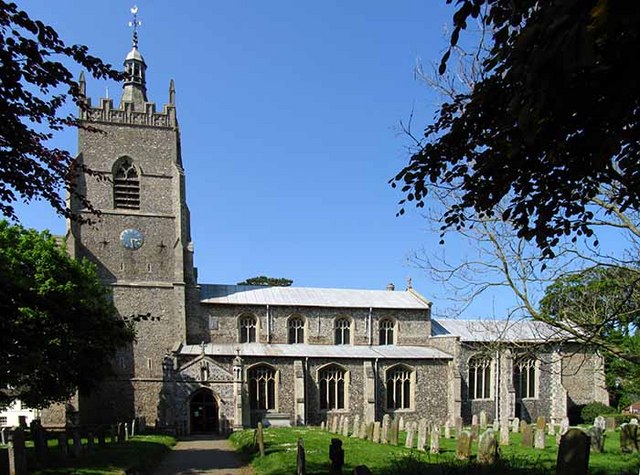
90:
Commons is a freely licensed media file repository.
627:
Creative
Commons Attribution-ShareAlike 2.0 Generic
56:(640 × 475 pixels, file size: 94 KB, MIME type:
408:https://creativecommons.org/licenses/by-sa/2.0
71:
414:Creative Commons Attribution-Share Alike 2.0
332:
8:
374:– to copy, distribute and transmit the work
1188:
1041:
435:
1123:The following other wikis use this file:
887:a2000405dfb66044aa6a2df905abe8004a1b8743
683:https://www.geograph.org.uk/photo/807769
554:https://www.geograph.org.uk/profile/9419
1190:
1105:
1014:
998:
977:
961:
940:
924:
885:
869:
851:
835:
815:
799:
781:
765:
747:
731:
660:
644:
624:
608:
588:
572:
505:
489:
469:
453:
450:
431:
424:
248:
269:View this and other nearby images on:
238:All Saints Church, Mattishall, Norfolk
219:All Saints Church, Mattishall, Norfolk
142:All Saints Church, Mattishall, Norfolk
1108:Grade I listed buildings in Breckland
1103:The following 2 pages use this file:
7:
319:and is licensed for reuse under the
1030:
355:Attribution-Share Alike 2.0 Generic
343:
338:
323:Attribution-ShareAlike 2.0 license.
1181:
444:
438:
329:
306:
108:
103:
49:
443:
429:
385:Under the following conditions:
350:This file is licensed under the
342:
337:
331:
299:
275:
261:
70:
31:
21:
1084:File Upload Bot (Magnus Manske)
426:
46:No higher resolution available.
14:
663:file available on the internet
425:
307:This image was taken from the
26:
1:
768:coordinates of depicted place
36:
713:Geograph Britain and Ireland
519:object of statement has role
451:Items portrayed in this file
1212:
1167:Usage on tr.wikipedia.org
1157:Usage on pl.wikipedia.org
1147:Usage on nl.wikipedia.org
1137:Usage on it.wikipedia.org
1127:Usage on fa.wikipedia.org
399:same or compatible license
1031:
783:52°39'30.92"N, 1°2'4.20"E
16:
691:geograph.org.uk image ID
428:
365:
236:John Salmon /
217:John Salmon /
77:This is a file from the
1088:
208:required by the license
186:
176:
156:
149:
146:
135:
81:. Information from its
1067:15:42, 24 October 2009
313:this photograph's page
281:52.658590; 1.034500
84:description page there
899:determination method
802:location of creation
472:Church of All Saints
170:geograph_org2commons
380:– to adapt the work
109:This is a photo of
534:author name string
1199:
1198:
1119:Global file usage
1096:
611:copyright license
437:
328:
327:
311:collection. See
286:
285:
243:
242:
211:
195:
192:Reusing this file
164:; transferred by
125:
124:
99:
98:
79:Wikimedia Commons
32:Global file usage
1203:
1189:
1079:
1019:
982:
945:
908:
903:
715:
710:
700:
695:
685:
680:
676:described at URL
575:copyright status
556:
551:
541:
538:
528:
523:
421:
418:
415:
412:
409:
401:as the original.
363:
352:Creative Commons
346:
345:
341:
340:
335:
334:
321:Creative Commons
309:Geograph project
303:
296:
282:
279:
265:
264:
258:
257:
246:
205:
189:
152:
139:
133:
118:
105:
95:
74:
73:
67:
61:
59:
1211:
1210:
1206:
1205:
1204:
1202:
1201:
1200:
1177:
1117:
1097:
1085:
1077:
1033:
1032:
1029:
1028:
1027:
1026:
1025:
1024:
1023:
1022:
1020:
1017:
1007:
1006:
1005:
1003:
992:
991:
990:
989:
988:
987:
986:
985:
983:
980:
970:
969:
968:
966:
955:
954:
953:
952:
951:
950:
949:
948:
946:
943:
933:
932:
931:
929:
918:
917:
916:
915:
914:
913:
912:
911:
910:
909:
904:
901:
892:
891:
890:
888:
878:
877:
876:
874:
863:
862:
861:
860:
859:
858:
857:
856:
854:
844:
843:
842:
840:
829:
828:
827:
826:
825:
824:
823:
822:
820:
808:
807:
806:
804:
793:
792:
791:
790:
789:
788:
787:
786:
784:
774:
773:
772:
770:
759:
758:
757:
756:
755:
754:
753:
752:
750:
740:
739:
738:
736:
725:
724:
723:
722:
721:
720:
719:
718:
717:
716:
711:
708:
702:
701:
696:
693:
687:
686:
681:
678:
669:
668:
667:
665:
653:
652:
651:
649:
638:
637:
636:
635:
634:
633:
632:
631:
629:
617:
616:
615:
613:
602:
601:
600:
599:
598:
597:
596:
595:
593:
581:
580:
579:
577:
566:
565:
564:
563:
562:
561:
560:
559:
558:
557:
552:
549:
543:
542:
539:
536:
530:
529:
524:
521:
512:
511:
510:
508:
498:
497:
496:
494:
483:
482:
481:
480:
479:
478:
477:
476:
474:
462:
461:
460:
458:
442:
441:
440:
423:
422:
419:
416:
413:
410:
407:
406:
364:
361:
358:
347:
324:
294:
280:
253:
252:
249:Object location
244:
233:
226:
214:
162:geograph.org.uk
137:
130:
120:
114:
111:listed building
101:
100:
89:
88:
87:is shown below.
63:
57:
55:
48:
47:
12:
11:
5:
1209:
1207:
1197:
1196:
1193:
1180:
1176:
1175:
1174:
1173:
1165:
1164:
1163:
1155:
1154:
1153:
1145:
1144:
1143:
1135:
1134:
1133:
1121:
1120:
1116:
1115:
1110:
1101:
1100:
1095:
1094:
1087:
1083:
1080:
1074:
1069:
1064:
1060:
1059:
1056:
1053:
1050:
1047:
1044:
1037:
1036:
1021:
1015:
1013:
1012:
1011:
1010:
1009:
1008:
1004:
999:
997:
996:
995:
994:
993:
984:
978:
976:
975:
974:
973:
972:
971:
967:
962:
960:
959:
958:
957:
956:
947:
941:
939:
938:
937:
936:
935:
934:
930:
925:
923:
922:
921:
920:
919:
897:
896:
895:
894:
893:
889:
886:
884:
883:
882:
881:
880:
879:
875:
870:
868:
867:
866:
865:
864:
855:
852:
850:
849:
848:
847:
846:
845:
841:
836:
834:
833:
832:
831:
830:
821:
816:
814:
813:
812:
811:
810:
809:
805:
800:
798:
797:
796:
795:
794:
785:
782:
780:
779:
778:
777:
776:
775:
771:
766:
764:
763:
762:
761:
751:
748:
746:
745:
744:
743:
742:
741:
737:
732:
730:
729:
728:
727:
726:
704:
703:
689:
688:
674:
673:
672:
671:
670:
666:
661:
659:
658:
657:
656:
655:
654:
650:
647:source of file
645:
643:
642:
641:
640:
639:
630:
625:
623:
622:
621:
620:
619:
618:
614:
609:
607:
606:
605:
604:
603:
594:
589:
587:
586:
585:
584:
583:
582:
578:
573:
571:
570:
569:
568:
567:
545:
544:
532:
531:
517:
516:
515:
514:
513:
509:
506:
504:
503:
502:
501:
500:
499:
495:
490:
488:
487:
486:
485:
484:
475:
470:
468:
467:
466:
465:
464:
463:
459:
454:
452:
449:
448:
447:
446:
445:
434:
433:
430:
427:
405:
404:
403:
402:
392:
383:
382:
381:
375:
368:You are free:
359:
349:
348:
330:
326:
325:
304:
293:
290:
284:
283:
273:
267:
250:
241:
240:
234:
231:
228:
227:
222:
215:
212:
200:
199:
196:
184:
183:
178:
174:
173:
158:
154:
153:
148:
144:
143:
140:
131:
129:
126:
123:
122:
102:
97:
96:
75:
65:
64:
45:
41:
40:
39:
34:
29:
24:
19:
13:
10:
9:
6:
4:
3:
2:
1208:
1194:
1191:
1187:
1184:
1178:
1172:
1169:
1168:
1166:
1162:
1159:
1158:
1156:
1152:
1149:
1148:
1146:
1142:
1139:
1138:
1136:
1132:
1129:
1128:
1126:
1125:
1124:
1118:
1114:
1111:
1109:
1106:
1104:
1098:
1092:
1086:
1081:
1075:
1073:
1070:
1068:
1065:
1062:
1061:
1057:
1054:
1051:
1048:
1045:
1043:
1042:
1040:
1034:
1002:
965:
928:
907:
900:
873:
839:
819:
803:
769:
735:
714:
707:
699:
692:
684:
677:
664:
648:
628:
612:
592:
576:
555:
548:
535:
527:
520:
493:
473:
457:
411:CC BY-SA 2.0
400:
396:
393:
390:
387:
386:
384:
379:
376:
373:
370:
369:
367:
366:
360:Attribution:
356:
353:
336:
322:
318:
314:
310:
305:
302:
298:
297:
291:
289:
288:
278:
274:
272:
271:OpenStreetMap
268:
266:
256:
251:
247:
239:
235:
230:
229:
225:
221: /
220:
216:
209:
204:
202:
201:
197:
193:
188:
185:
182:
179:
175:
171:
167:
163:
159:
155:
145:
141:
134:
127:
121:
117:
112:
107:
106:
93:
86:
85:
80:
76:
69:
68:
62:
53:
44:
38:
35:
33:
30:
28:
25:
23:
20:
18:
15:
1185:
1182:
1122:
1102:
1038:
1035:File history
526:photographer
394:
388:
377:
371:
316:
287:
237:
224:CC BY-SA 2.0
218:
92:You can help
82:
50:
22:File history
1091:User:oxyman
591:copyrighted
540:John Salmon
395:share alike
389:attribution
362:John Salmon
317:John Salmon
203:Attribution
181:John Salmon
166:User:oxyman
136:Description
1192:_error
1171:Mattishall
1161:Mattishall
1151:Mattishall
1141:Mattishall
1113:Mattishall
1099:File usage
1076:640 × 475
1052:Dimensions
853:image/jpeg
838:media type
818:Mattishall
749:9 May 2008
507:some value
187:Permission
151:9 May 2008
58:image/jpeg
27:File usage
1049:Thumbnail
1046:Date/Time
927:data size
734:inception
292:Licensing
232:InfoField
213:InfoField
1179:Metadata
872:checksum
706:operator
432:Captions
378:to remix
372:to share
357:license.
37:Metadata
1131:متیسهال
1078:(94 KB)
1063:current
1058:Comment
942:96,736
492:creator
456:depicts
436:English
128:Summary
116:1172400
113:number
54:
964:height
698:807769
259:
177:Author
168:using
157:Source
1018:pixel
1001:width
981:pixel
906:SHA-1
160:From
1055:User
1016:640
979:475
944:byte
420:true
417:true
147:Date
17:File
547:URL
902::
709::
694::
679::
550::
537::
522::
1195:0
210:)
206:(
194:)
190:(
172:.
119:.
94:.
60:)
Text is available under the Creative Commons Attribution-ShareAlike License. Additional terms may apply.
_region:GB-GBN_&language=en)
