293:
223:
237:
261:
299:
304:
72:
977:
214:
43:
351:– You must give appropriate credit, provide a link to the license, and indicate if changes were made. You may do so in any reasonable manner, but not in any way that suggests the licensor endorses you or your use.
51:
83:
1013:
994:== {{int:filedesc}} == {{Information |description={{en|1=All Saints, Brandon Parva, Norfolk}} |date=2008-05-09 |source=From |author= |permission
976:
971:
42:
810:
603:
567:
531:
230:
653:
268:
1044:
This file contains additional information, probably added from the digital camera or scanner used to create or digitize it.
358:
466:
905:
868:
831:
776:
742:
708:
631:
587:
515:
487:
474:
459:
803:
674:
646:
616:
551:
432:
415:
255:
314:
1047:
If the file has been modified from its original state, some details may not fully reflect the modified file.
357:– If you remix, transform, or build upon the material, you must distribute your contributions under the
275:
on the
Geograph website for the photographer's contact details. The copyright on this image is owned by
987:
311:
91:
183:
638:
623:
494:
167:
236:
1008:
280:
78:
135:
220:
156:
146:
260:
272:
944:
Click on a date/time to view the file as it appeared at that time.
116:
All Saints, Brandon Parva, Norfolk - geograph.org.uk - 807696.jpg
52:
All_Saints,_Brandon_Parva,_Norfolk_-_geograph.org.uk_-_807696.jpg
222:
701:
205:
66:
215:
52° 37′ 52″ N, 1° 03′ 28″ E
399:
Add a one-line explanation of what this file represents
1031:
110:
90:
Commons is a freely licensed media file repository.
568:
Creative
Commons Attribution-ShareAlike 2.0 Generic
56:(640 × 507 pixels, file size: 117 KB, MIME type:
368:https://creativecommons.org/licenses/by-sa/2.0
71:
374:Creative Commons Attribution-Share Alike 2.0
292:
8:
1014:Grade II* listed buildings in South Norfolk
334:– to copy, distribute and transmit the work
1049:
946:
395:
1024:The following other wikis use this file:
792:84819fe508615ca5f1da53aaefc18fbeafcc20df
624:https://www.geograph.org.uk/photo/807696
495:https://www.geograph.org.uk/profile/9419
1051:
1006:
919:
903:
882:
866:
845:
829:
790:
774:
756:
740:
722:
706:
688:
672:
601:
585:
565:
549:
529:
513:
446:
430:
413:
410:
391:
384:
208:
229:View this and other nearby images on:
1004:The following 2 pages use this file:
7:
279:and is licensed for reuse under the
935:
315:Attribution-Share Alike 2.0 Generic
303:
298:
283:Attribution-ShareAlike 2.0 license.
1042:
404:
398:
289:
266:
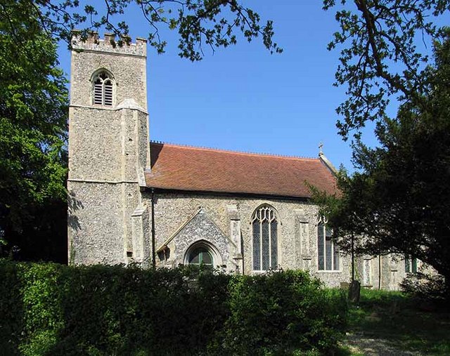
198:All Saints, Brandon Parva, Norfolk
179:All Saints, Brandon Parva, Norfolk
126:All Saints, Brandon Parva, Norfolk
120:
103:
49:
403:
389:
345:Under the following conditions:
310:This file is licensed under the
302:
297:
291:
259:
235:
221:
70:
31:
21:
386:
121:
46:No higher resolution available.
14:
604:file available on the internet
385:
267:This image was taken from the
26:
1:
709:coordinates of depicted place
36:
654:Geograph Britain and Ireland
460:object of statement has role
411:Items portrayed in this file
1073:
1028:Usage on www.wikidata.org
724:52°37'51.96"N, 1°3'28.08"E
359:same or compatible license
936:
16:
632:geograph.org.uk image ID
388:
325:
196:John Salmon /
177:John Salmon /
77:This is a file from the
993:
972:07:30, 20 February 2011
168:required by the license
152:
141:
134:
131:
113:
81:. Information from its
273:this photograph's page
241:52.631100; 1.057800
84:description page there
804:determination method
340:– to adapt the work
475:author name string
1060:
1059:
1020:Global file usage
997:
552:copyright license
397:
288:
287:
271:collection. See
246:
245:
203:
202:
171:
99:
98:
79:Wikimedia Commons
32:Global file usage
1064:
1050:
984:
924:
887:
850:
813:
808:
656:
651:
641:
636:
626:
621:
617:described at URL
516:copyright status
497:
492:
482:
479:
469:
464:
381:
378:
375:
372:
369:
361:as the original.
323:
312:Creative Commons
306:
305:
301:
300:
295:
294:
281:Creative Commons
269:Geograph project
263:
256:
242:
239:
225:
224:
218:
217:
206:
165:
137:
125:
117:
111:
95:
74:
73:
67:
61:
59:
1072:
1071:
1067:
1066:
1065:
1063:
1062:
1061:
1038:
1018:
998:
990:
982:
938:
937:
934:
933:
932:
931:
930:
929:
928:
927:
925:
922:
912:
911:
910:
908:
897:
896:
895:
894:
893:
892:
891:
890:
888:
885:
875:
874:
873:
871:
860:
859:
858:
857:
856:
855:
854:
853:
851:
848:
838:
837:
836:
834:
823:
822:
821:
820:
819:
818:
817:
816:
815:
814:
809:
806:
797:
796:
795:
793:
783:
782:
781:
779:
768:
767:
766:
765:
764:
763:
762:
761:
759:
749:
748:
747:
745:
734:
733:
732:
731:
730:
729:
728:
727:
725:
715:
714:
713:
711:
700:
699:
698:
697:
696:
695:
694:
693:
691:
681:
680:
679:
677:
666:
665:
664:
663:
662:
661:
660:
659:
658:
657:
652:
649:
643:
642:
637:
634:
628:
627:
622:
619:
610:
609:
608:
606:
594:
593:
592:
590:
579:
578:
577:
576:
575:
574:
573:
572:
570:
558:
557:
556:
554:
543:
542:
541:
540:
539:
538:
537:
536:
534:
522:
521:
520:
518:
507:
506:
505:
504:
503:
502:
501:
500:
499:
498:
493:
490:
484:
483:
480:
477:
471:
470:
465:
462:
453:
452:
451:
449:
439:
438:
437:
435:
424:
423:
422:
421:
420:
418:
402:
401:
400:
383:
382:
379:
376:
373:
370:
367:
366:
324:
321:
318:
307:
284:
254:
240:
213:
212:
209:Object location
204:
193:
186:
174:
147:geograph.org.uk
127:
115:
108:
101:
100:
89:
88:
87:is shown below.
63:
57:
55:
48:
47:
12:
11:
5:
1070:
1068:
1058:
1057:
1054:
1041:
1037:
1036:
1035:
1034:
1022:
1021:
1017:
1016:
1011:
1002:
1001:
996:
995:
992:
988:
985:
979:
974:
969:
965:
964:
961:
958:
955:
952:
949:
942:
941:
926:
920:
918:
917:
916:
915:
914:
913:
909:
904:
902:
901:
900:
899:
898:
889:
883:
881:
880:
879:
878:
877:
876:
872:
867:
865:
864:
863:
862:
861:
852:
846:
844:
843:
842:
841:
840:
839:
835:
830:
828:
827:
826:
825:
824:
802:
801:
800:
799:
798:
794:
791:
789:
788:
787:
786:
785:
784:
780:
775:
773:
772:
771:
770:
769:
760:
757:
755:
754:
753:
752:
751:
750:
746:
741:
739:
738:
737:
736:
735:
726:
723:
721:
720:
719:
718:
717:
716:
712:
707:
705:
704:
703:
702:
692:
689:
687:
686:
685:
684:
683:
682:
678:
673:
671:
670:
669:
668:
667:
645:
644:
630:
629:
615:
614:
613:
612:
611:
607:
602:
600:
599:
598:
597:
596:
595:
591:
588:source of file
586:
584:
583:
582:
581:
580:
571:
566:
564:
563:
562:
561:
560:
559:
555:
550:
548:
547:
546:
545:
544:
535:
530:
528:
527:
526:
525:
524:
523:
519:
514:
512:
511:
510:
509:
508:
486:
485:
473:
472:
458:
457:
456:
455:
454:
450:
447:
445:
444:
443:
442:
441:
440:
436:
431:
429:
428:
427:
426:
425:
419:
414:
412:
409:
408:
407:
406:
405:
394:
393:
390:
387:
365:
364:
363:
362:
352:
343:
342:
341:
335:
328:You are free:
319:
309:
308:
290:
286:
285:
264:
253:
250:
244:
243:
233:
227:
210:
201:
200:
194:
191:
188:
187:
182:
175:
172:
160:
159:
154:
150:
149:
143:
139:
138:
133:
129:
128:
118:
109:
107:
104:
102:
97:
96:
75:
65:
64:
45:
41:
40:
39:
34:
29:
24:
19:
13:
10:
9:
6:
4:
3:
2:
1069:
1055:
1052:
1048:
1045:
1039:
1033:
1030:
1029:
1027:
1026:
1025:
1019:
1015:
1012:
1010:
1009:Brandon Parva
1007:
1005:
999:
991:
986:
980:
978:
975:
973:
970:
967:
966:
962:
959:
956:
953:
950:
948:
947:
945:
939:
907:
870:
833:
812:
805:
778:
744:
710:
676:
655:
648:
640:
633:
625:
618:
605:
589:
569:
553:
533:
517:
496:
489:
476:
468:
461:
434:
417:
371:CC BY-SA 2.0
360:
356:
353:
350:
347:
346:
344:
339:
336:
333:
330:
329:
327:
326:
320:Attribution:
316:
313:
296:
282:
278:
274:
270:
265:
262:
258:
257:
251:
249:
248:
238:
234:
232:
231:OpenStreetMap
228:
226:
216:
211:
207:
199:
195:
190:
189:
185:
181: /
180:
176:
169:
164:
162:
161:
158:
155:
151:
148:
144:
140:
130:
124:
119:
112:
105:
93:
86:
85:
80:
76:
69:
68:
62:
53:
44:
38:
35:
33:
30:
28:
25:
23:
20:
18:
15:
1046:
1043:
1023:
1003:
943:
940:File history
467:photographer
354:
348:
337:
331:
276:
247:
197:
184:CC BY-SA 2.0
178:
122:
92:You can help
82:
50:
22:File history
989:GeographBot
532:copyrighted
481:John Salmon
355:share alike
349:attribution
322:John Salmon
277:John Salmon
163:Attribution
157:John Salmon
114:Description
1053:_error
1000:File usage
981:640 × 507
957:Dimensions
758:image/jpeg
743:media type
690:9 May 2008
448:some value
136:9 May 2008
58:image/jpeg
27:File usage
1032:Q17533016
954:Thumbnail
951:Date/Time
832:data size
675:inception
252:Licensing
192:InfoField
173:InfoField
123:English:
1040:Metadata
983:(117 KB)
847:119,846
777:checksum
647:operator
392:Captions
338:to remix
332:to share
317:license.
37:Metadata
968:current
963:Comment
433:creator
416:depicts
396:English
106:Summary
54:
869:height
639:807696
219:
153:Author
142:Source
923:pixel
906:width
886:pixel
811:SHA-1
145:From
960:User
921:640
884:507
849:byte
380:true
377:true
132:Date
17:File
488:URL
807::
650::
635::
620::
491::
478::
463::
1056:0
170:)
166:(
94:.
60:)
Text is available under the Creative Commons Attribution-ShareAlike License. Additional terms may apply.
_&language=en)
