188:
194:
38:
199:
90:
462:
240:– You must give appropriate credit, provide a link to the license, and indicate if changes were made. You may do so in any reasonable manner, but not in any way that suggests the licensor endorses you or your use.
373:
337:
56:
52:
48:
42:
101:
508:
This file contains additional information, probably added from the digital camera or scanner used to create or digitize it.
247:
69:
497:
479:{{Information |description=Athens 22 trolleybus route map. |source= Own work created on QGIS. |date=2024-02-10 |author=
321:
393:
357:
304:
209:
511:
If the file has been modified from its original state, some details may not fully reflect the modified file.
493:
The following pages on the
English Knowledge (XXG) use this file (pages on other projects are not listed):
246:– If you remix, transform, or build upon the material, you must distribute your contributions under the
206:
109:
483:|permission= |other_versions= |other_fields= }} =={{int:license-header}}== {{cc-by-sa-4.0}}
461:
456:
60:
37:
96:
171:
480:
472:
153:
429:
Click on a date/time to view the file as it appeared at that time.
84:
374:
Creative
Commons Attribution-ShareAlike 4.0 International
288:
Add a one-line explanation of what this file represents
128:
108:
Commons is a freely licensed media file repository.
74:(1,104 × 1,082 pixels, file size: 82 KB, MIME type:
257:https://creativecommons.org/licenses/by-sa/4.0
89:
263:Creative Commons Attribution-Share Alike 4.0
187:
8:
223:– to copy, distribute and transmit the work
513:
431:
284:
210:Attribution-Share Alike 4.0 International
523:
515:
495:
407:
391:
371:
355:
335:
319:
302:
299:
280:
273:
7:
420:
198:
193:
506:
293:
287:
184:
138:
121:
67:
292:
278:
234:Under the following conditions:
205:This file is licensed under the
197:
192:
186:
88:
21:
275:
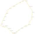
144:Athens 22 trolleybus route map.
139:
14:
274:
26:
1:
31:
498:List of bus routes in Athens
300:Items portrayed in this file
545:
248:same or compatible license
421:
163:Own work created on QGIS.
16:
277:
214:
134:Athens T22 route map.png
95:This is a file from the
478:
457:19:52, 10 February 2024
167:
159:
152:
149:
131:
99:. Information from its
102:description page there
41:Size of this preview:
517:Horizontal resolution
61:1,104 × 1,082 pixels
525:Vertical resolution
229:– to adapt the work
47:Other resolutions:
532:
531:
486:
358:copyright license
286:
177:
176:
117:
116:
97:Wikimedia Commons
536:
514:
469:
409:10 February 2024
322:copyright status
270:
267:
264:
261:
258:
250:as the original.
207:Creative Commons
201:
200:
196:
195:
190:
189:
155:
154:10 February 2024
143:
135:
129:
113:
92:
91:
85:
79:
77:
64:
57:784 × 768 pixels
53:490 × 480 pixels
49:245 × 240 pixels
43:612 × 600 pixels
544:
543:
539:
538:
537:
535:
534:
533:
502:
494:
487:
475:
467:
423:
422:
419:
418:
417:
416:
415:
414:
413:
412:
410:
400:
399:
398:
396:
385:
384:
383:
382:
381:
380:
379:
378:
376:
364:
363:
362:
360:
349:
348:
347:
346:
345:
344:
343:
342:
340:
328:
327:
326:
324:
313:
312:
311:
310:
309:
307:
291:
290:
289:
272:
271:
268:
265:
262:
259:
256:
255:
213:
202:
183:
178:
145:
133:
126:
119:
118:
107:
106:
105:is shown below.
81:
75:
73:
66:
65:
46:
12:
11:
5:
542:
540:
530:
529:
526:
522:
521:
518:
505:
501:
500:
492:
491:
490:
485:
484:
477:
473:
470:
466:1,104 × 1,082
464:
459:
454:
450:
449:
446:
443:
440:
437:
434:
427:
426:
411:
408:
406:
405:
404:
403:
402:
401:
397:
392:
390:
389:
388:
387:
386:
377:
372:
370:
369:
368:
367:
366:
365:
361:
356:
354:
353:
352:
351:
350:
341:
336:
334:
333:
332:
331:
330:
329:
325:
320:
318:
317:
316:
315:
314:
308:
303:
301:
298:
297:
296:
295:
294:
283:
282:
279:
276:
254:
253:
252:
251:
241:
232:
231:
230:
224:
217:You are free:
204:
203:
185:
182:
179:
175:
174:
169:
165:
164:
161:
157:
156:
151:
147:
146:
136:
127:
125:
122:
120:
115:
114:
93:
83:
82:
40:
36:
35:
34:
29:
24:
19:
13:
10:
9:
6:
4:
3:
2:
541:
527:
524:
519:
516:
512:
509:
503:
499:
496:
488:
482:
476:
471:
465:
463:
460:
458:
455:
452:
451:
447:
444:
441:
438:
435:
433:
432:
430:
424:
395:
375:
359:
339:
323:
306:
260:CC BY-SA 4.0
249:
245:
242:
239:
236:
235:
233:
228:
225:
222:
219:
218:
216:
215:
211:
208:
191:
180:
173:
170:
166:
162:
158:
148:
142:
137:
130:
123:
111:
104:
103:
98:
94:
87:
86:
80:
71:
70:Original file
62:
58:
54:
50:
44:
39:
33:
30:
28:
25:
23:
20:
18:
15:
510:
507:
428:
425:File history
243:
237:
226:
220:
140:
110:You can help
100:
68:
22:File history
338:copyrighted
244:share alike
238:attribution
132:Description
489:File usage
442:Dimensions
27:File usage
528:78.74 dpc
520:78.74 dpc
439:Thumbnail
436:Date/Time
394:inception
181:Licensing
141:English:
76:image/png
504:Metadata
281:Captions
227:to remix
221:to share
212:license.
32:Metadata
468:(82 KB)
453:current
448:Comment
305:depicts
285:English
124:Summary
72:
481:Argybz
474:Argybz
172:Argybz
168:Author
160:Source
445:User
269:true
266:true
150:Date
17:File
59:|
55:|
51:|
45:.
112:.
78:)
63:.
Text is available under the Creative Commons Attribution-ShareAlike License. Additional terms may apply.

