38:
374:
307:
257:
299:
249:
321:
271:
342:
380:
385:
98:
850:"}},"text\/plain":{"en":{"":"heading"}}},"{\"value\":{\"amount\":\"+90\",\"unit\":\"http:\\\/\\\/www.wikidata.org\\\/entity\\\/Q28390\"},\"type\":\"quantity\"}":{"text\/html":{"en":{"P7787":"90
699:"}},"text\/plain":{"en":{"":"heading"}}},"{\"value\":{\"amount\":\"+90\",\"unit\":\"http:\\\/\\\/www.wikidata.org\\\/entity\\\/Q28390\"},\"type\":\"quantity\"}":{"text\/html":{"en":{"P7787":"90
846:
290:
240:
432:– You must give appropriate credit, provide a link to the license, and indicate if changes were made. You may do so in any reasonable manner, but not in any way that suggests the licensor endorses you or your use.
64:
60:
56:
52:
48:
42:
1347:== {{int:filedesc}} == {{Information |description={{en|1=Bournemouth : Redhill Park A tree, bench, and path towards Redhill Park from Redhill Drive.}} |date=2010-02-11 |source=From |author=[http:/
109:
77:
847:
696:
1163:
782:
648:
612:
314:
264:
1329:
1324:
802:
68:
37:
1509:
349:
1372:
This file contains additional information, probably added from the digital camera or scanner used to create or digitize it.
1109:
439:
547:
1258:
1221:
1184:
1129:
1059:
1025:
988:
954:
917:
888:
861:
810:
766:
737:
710:
596:
568:
555:
540:
1156:
825:
795:
668:
632:
513:
496:
1093:
336:
395:
1375:
If the file has been modified from its original state, some details may not fully reflect the modified file.
1357:
The following pages on the
English Knowledge (XXG) use this file (pages on other projects are not listed):
1536:
438:– If you remix, transform, or build upon the material, you must distribute your contributions under the
356:
on the
Geograph website for the photographer's contact details. The copyright on this image is owned by
1340:
1361:
392:
1572:
854:"}},"text\/plain":{"en":{"P7787":"90 degree"}}}}": -->
703:"}},"text\/plain":{"en":{"P7787":"90 degree"}}}}": -->
117:
209:
152:
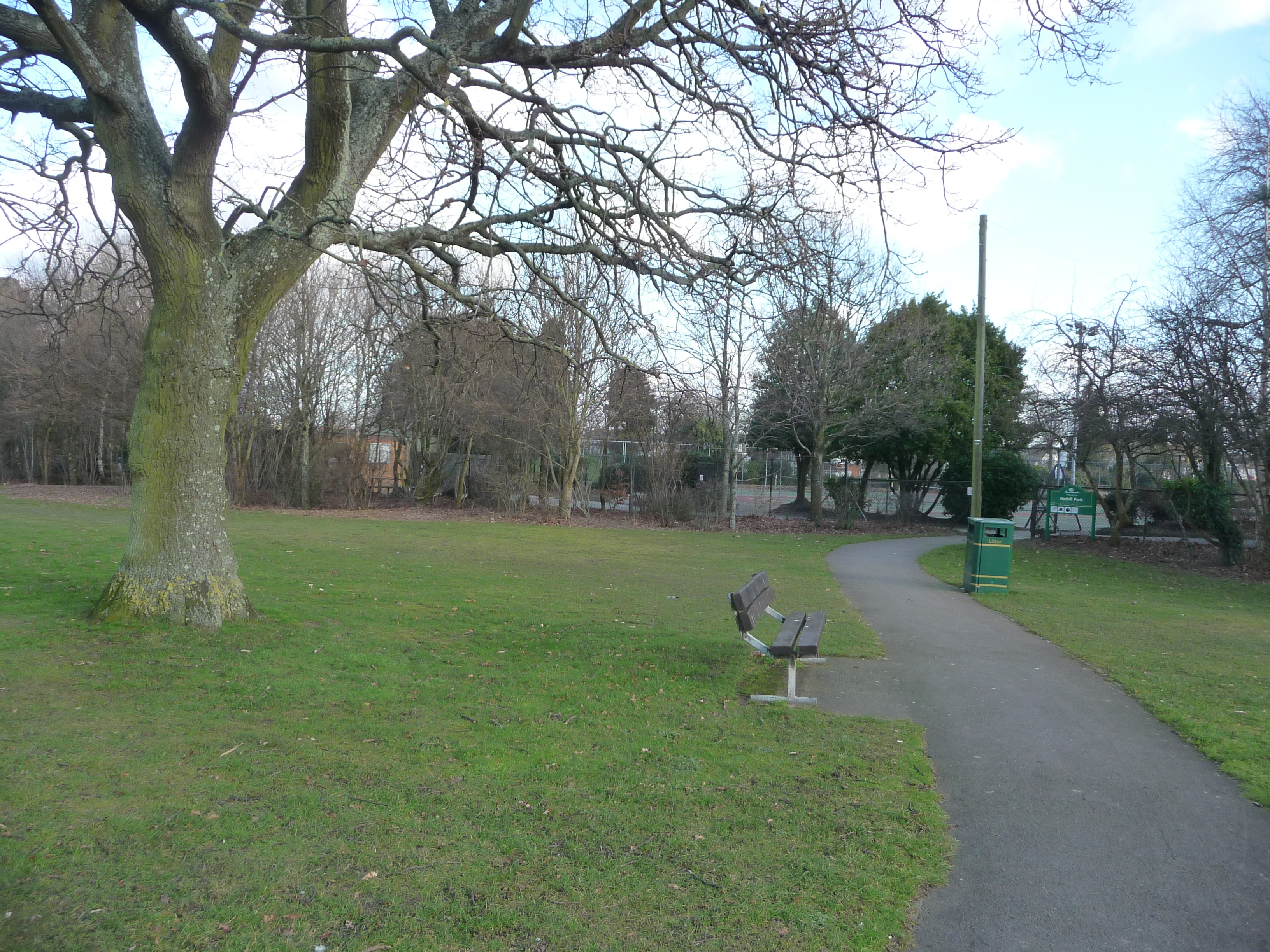
Bournemouth : Redhill Park A tree, bench, and path towards
Redhill Park from Redhill Drive.
1653:
1478:
832:
817:
575:
193:
320:
270:
1616:
1554:
1401:
361:
104:
1663:
1626:
1441:
1582:
304:
254:
161:
1421:
1384:
182:
172:
1673:
1411:
341:
1394:
353:
1297:
Click on a date/time to view the file as it appeared at that time.
306:
256:
281:
231:
92:
142:
Bournemouth , Redhill Park - geograph.org.uk - 1703887.jpg
291:
50° 45′ 14″ N, 1° 53′ 06″ W
241:
50° 45′ 14″ N, 1° 53′ 06″ W
480:
Add a one-line explanation of what this file represents
82:(3,264 × 2,448 pixels, file size: 4.04 MB, MIME type:
136:
116:
Commons is a freely licensed media file repository.
649:
Creative
Commons Attribution-ShareAlike 2.0 Generic
449:https://creativecommons.org/licenses/by-sa/2.0
97:
455:Creative Commons Attribution-Share Alike 2.0
373:
8:
851:
700:
415:– to copy, distribute and transmit the work
1377:
1299:
476:
833:https://www.geograph.org.uk/photo/1703887
576:https://www.geograph.org.uk/profile/11775
1145:97be29eca4e74a4e0884a4fa884ac5b774da32f3
1689:
1681:
1671:
1661:
1651:
1643:
1635:
1624:
1614:
1606:
1598:
1590:
1580:
1570:
1562:
1552:
1544:
1534:
1526:
1518:
1507:
1499:
1491:
1483:
1473:
1465:
1457:
1449:
1438:
1430:
1419:
1409:
1399:
1389:
1359:
1272:
1256:
1235:
1219:
1198:
1182:
1143:
1127:
1107:
1091:
1073:
1057:
1039:
1023:
1002:
986:
968:
952:
931:
915:
875:
859:
780:
764:
724:
708:
682:
666:
646:
630:
610:
594:
527:
511:
494:
491:
472:
465:
284:
234:
313:View this and other nearby images on:
263:View this and other nearby images on:
1379:
7:
360:and is licensed for reuse under the
1288:
396:Attribution-Share Alike 2.0 Generic
384:
379:
364:Attribution-ShareAlike 2.0 license.
1370:
485:
479:
370:
347:
146:
129:
75:
484:
1432:Date and time of data generation
711:coordinates of the point of view
470:
426:Under the following conditions:
391:This file is licensed under the
383:
378:
372:
340:
319:
305:
297:
269:
255:
247:
96:
21:
467:
224:Bournemouth : Redhill Park
205:Bournemouth : Redhill Park
147:
14:
783:file available on the internet
466:
348:This image was taken from the
26:
1:
1577:Flash did not fire, auto mode
862:coordinates of depicted place
31:
877:50°45'13.547"N, 1°53'5.964"W
803:Geograph Britain and Ireland
726:50°45'13.547"N, 1°53'5.964"W
541:object of statement has role
492:Items portrayed in this file
1520:Date and time of digitizing
296:
246:
1711:
1637:Focal length in 35 mm film
1595:One-chip color area sensor
440:same or compatible license
1485:File change date and time
1289:
222:Lewis Clarke /
203:Lewis Clarke /
16:
811:geograph.org.uk image ID
469:
406:
103:This is a file from the
1683:North or south latitude
1600:Custom image processing
1523:14:13, 11 February 2010
1488:14:13, 11 February 2010
1435:14:11, 11 February 2010
1346:
194:required by the license
178:
167:
160:
157:
139:
107:. Information from its
1691:East or west longitude
1528:Image compression mode
354:this photograph's page
325:50.753763; -1.884990
275:50.753763; -1.884990
110:description page there
41:Size of this preview:
1546:Maximum land aperture
1459:Horizontal resolution
1362:Redhill, Bournemouth
1157:determination method
69:3,264 × 2,448 pixels
65:2,560 × 1,920 pixels
1493:Y and C positioning
1467:Vertical resolution
1381:Camera manufacturer
1325:04:28, 5 March 2011
421:– to adapt the work
47:Other resolutions:
1645:Scene capture type
1621:Auto white balance
1549:3.44 APEX (f/3.29)
556:author name string
61:1,280 × 960 pixels
57:1,024 × 768 pixels
1698:
1697:
1406:1/250 sec (0.004)
1350:
853:
702:
633:copyright license
478:
369:
368:
352:collection. See
330:
329:
280:
279:
229:
228:
197:
125:
124:
105:Wikimedia Commons
1702:
1501:Exposure Program
1378:
1337:
1277:
1240:
1203:
1166:
1161:
1007:
936:
899:
898:
893:
835:
830:
826:described at URL
820:
815:
805:
800:
748:
747:
742:
684:11 February 2010
597:copyright status
578:
573:
563:
560:
550:
545:
462:
459:
456:
453:
450:
442:as the original.
404:
393:Creative Commons
387:
386:
382:
381:
376:
375:
362:Creative Commons
350:Geograph project
344:
337:
326:
323:
309:
308:
302:
301:
300:
294:
293:
282:
276:
273:
259:
258:
252:
251:
250:
244:
243:
232:
191:
163:
162:11 February 2010
151:
143:
137:
121:
100:
99:
93:
87:
85:
72:
53:640 × 480 pixels
49:320 × 240 pixels
43:800 × 600 pixels
1710:
1709:
1705:
1704:
1703:
1701:
1700:
1699:
1366:
1358:
1351:
1343:
1335:
1291:
1290:
1287:
1286:
1285:
1284:
1283:
1282:
1281:
1280:
1278:
1275:
1265:
1264:
1263:
1261:
1250:
1249:
1248:
1247:
1246:
1245:
1244:
1243:
1241:
1238:
1228:
1227:
1226:
1224:
1213:
1212:
1211:
1210:
1209:
1208:
1207:
1206:
1204:
1201:
1191:
1190:
1189:
1187:
1176:
1175:
1174:
1173:
1172:
1171:
1170:
1169:
1168:
1167:
1162:
1159:
1150:
1149:
1148:
1146:
1136:
1135:
1134:
1132:
1121:
1120:
1119:
1118:
1117:
1116:
1115:
1114:
1112:
1100:
1099:
1098:
1096:
1085:
1084:
1083:
1082:
1081:
1080:
1079:
1078:
1076:
1066:
1065:
1064:
1062:
1051:
1050:
1049:
1048:
1047:
1046:
1045:
1044:
1042:
1032:
1031:
1030:
1028:
1017:
1016:
1015:
1014:
1013:
1012:
1011:
1010:
1008:
1005:
995:
994:
993:
991:
980:
979:
978:
977:
976:
975:
974:
973:
971:
961:
960:
959:
957:
946:
945:
944:
943:
942:
941:
940:
939:
937:
934:
924:
923:
922:
920:
909:
908:
907:
906:
905:
904:
903:
902:
901:
900:
896:
894:
891:
882:
881:
880:
878:
868:
867:
866:
864:
845:
844:
843:
842:
841:
840:
839:
838:
837:
836:
831:
828:
822:
821:
816:
813:
807:
806:
801:
798:
789:
788:
787:
785:
773:
772:
771:
769:
758:
757:
756:
755:
754:
753:
752:
751:
750:
749:
745:
743:
740:
731:
730:
729:
727:
717:
716:
715:
713:
694:
693:
692:
691:
690:
689:
688:
687:
685:
675:
674:
673:
671:
660:
659:
658:
657:
656:
655:
654:
653:
651:
639:
638:
637:
635:
624:
623:
622:
621:
620:
619:
618:
617:
615:
603:
602:
601:
599:
588:
587:
586:
585:
584:
583:
582:
581:
580:
579:
574:
571:
565:
564:
561:
558:
552:
551:
546:
543:
534:
533:
532:
530:
520:
519:
518:
516:
505:
504:
503:
502:
501:
499:
483:
482:
481:
464:
463:
460:
457:
454:
451:
448:
447:
405:
402:
399:
388:
365:
335:
324:
298:
289:
288:
285:Object location
274:
248:
239:
238:
235:Camera location
230:
219:
212:
200:
173:geograph.org.uk
153:
141:
134:
127:
126:
115:
114:
113:is shown below.
89:
83:
81:
74:
73:
46:
12:
11:
5:
1708:
1706:
1696:
1695:
1694:West longitude
1692:
1688:
1687:
1686:North latitude
1684:
1680:
1679:
1676:
1670:
1669:
1666:
1660:
1659:
1656:
1650:
1649:
1646:
1642:
1641:
1638:
1634:
1633:
1630:
1623:
1622:
1619:
1613:
1612:
1609:
1605:
1604:
1603:Normal process
1601:
1597:
1596:
1593:
1592:Sensing method
1589:
1588:
1585:
1579:
1578:
1575:
1569:
1568:
1565:
1561:
1560:
1557:
1551:
1550:
1547:
1543:
1542:
1539:
1533:
1532:
1529:
1525:
1524:
1521:
1517:
1516:
1513:
1506:
1505:
1504:Normal program
1502:
1498:
1497:
1494:
1490:
1489:
1486:
1482:
1481:
1476:
1472:
1471:
1468:
1464:
1463:
1460:
1456:
1455:
1452:
1448:
1447:
1444:
1437:
1436:
1433:
1429:
1428:
1425:
1418:
1417:
1414:
1408:
1407:
1404:
1398:
1397:
1392:
1388:
1387:
1382:
1369:
1365:
1364:
1356:
1355:
1354:
1349:
1348:
1345:
1341:
1338:
1334:3,264 × 2,448
1332:
1327:
1322:
1318:
1317:
1314:
1311:
1308:
1305:
1302:
1295:
1294:
1279:
1273:
1271:
1270:
1269:
1268:
1267:
1266:
1262:
1257:
1255:
1254:
1253:
1252:
1251:
1242:
1236:
1234:
1233:
1232:
1231:
1230:
1229:
1225:
1220:
1218:
1217:
1216:
1215:
1214:
1205:
1199:
1197:
1196:
1195:
1194:
1193:
1192:
1188:
1183:
1181:
1180:
1179:
1178:
1177:
1155:
1154:
1153:
1152:
1151:
1147:
1144:
1142:
1141:
1140:
1139:
1138:
1137:
1133:
1128:
1126:
1125:
1124:
1123:
1122:
1113:
1108:
1106:
1105:
1104:
1103:
1102:
1101:
1097:
1092:
1090:
1089:
1088:
1087:
1086:
1077:
1074:
1072:
1071:
1070:
1069:
1068:
1067:
1063:
1058:
1056:
1055:
1054:
1053:
1052:
1043:
1040:
1038:
1037:
1036:
1035:
1034:
1033:
1029:
1024:
1022:
1021:
1020:
1019:
1018:
1009:
1003:
1001:
1000:
999:
998:
997:
996:
992:
987:
985:
984:
983:
982:
981:
972:
969:
967:
966:
965:
964:
963:
962:
958:
953:
951:
950:
949:
948:
947:
938:
932:
930:
929:
928:
927:
926:
925:
921:
916:
914:
913:
912:
911:
910:
887:
886:
885:
884:
883:
879:
876:
874:
873:
872:
871:
870:
869:
865:
860:
858:
857:
856:
855:
849:
824:
823:
809:
808:
794:
793:
792:
791:
790:
786:
781:
779:
778:
777:
776:
775:
774:
770:
767:source of file
765:
763:
762:
761:
760:
759:
736:
735:
734:
733:
732:
728:
725:
723:
722:
721:
720:
719:
718:
714:
709:
707:
706:
705:
704:
698:
686:
683:
681:
680:
679:
678:
677:
676:
672:
667:
665:
664:
663:
662:
661:
652:
647:
645:
644:
643:
642:
641:
640:
636:
631:
629:
628:
627:
626:
625:
616:
611:
609:
608:
607:
606:
605:
604:
600:
595:
593:
592:
591:
590:
589:
567:
566:
554:
553:
539:
538:
537:
536:
535:
531:
528:
526:
525:
524:
523:
522:
521:
517:
512:
510:
509:
508:
507:
506:
500:
495:
493:
490:
489:
488:
487:
486:
475:
474:
471:
468:
446:
445:
444:
443:
433:
424:
423:
422:
416:
409:You are free:
400:
390:
389:
371:
367:
366:
345:
334:
331:
328:
327:
317:
311:
286:
278:
277:
267:
261:
236:
227:
226:
220:
217:
214:
213:
208:
201:
198:
186:
185:
180:
176:
175:
169:
165:
164:
159:
155:
154:
144:
135:
133:
130:
128:
123:
122:
101:
91:
90:
40:
36:
35:
34:
29:
24:
19:
13:
10:
9:
6:
4:
3:
2:
1707:
1693:
1690:
1685:
1682:
1677:
1675:
1672:
1667:
1665:
1662:
1657:
1655:
1652:
1647:
1644:
1639:
1636:
1631:
1628:
1625:
1620:
1618:
1617:White balance
1615:
1611:Auto exposure
1610:
1608:Exposure mode
1607:
1602:
1599:
1594:
1591:
1586:
1584:
1581:
1576:
1574:
1571:
1566:
1563:
1558:
1556:
1555:Metering mode
1553:
1548:
1545:
1540:
1538:
1537:Exposure bias
1535:
1530:
1527:
1522:
1519:
1514:
1511:
1508:
1503:
1500:
1495:
1492:
1487:
1484:
1480:
1477:
1475:Software used
1474:
1469:
1466:
1461:
1458:
1453:
1450:
1445:
1443:
1439:
1434:
1431:
1426:
1423:
1420:
1415:
1413:
1410:
1405:
1403:
1402:Exposure time
1400:
1396:
1393:
1390:
1386:
1383:
1380:
1376:
1373:
1367:
1363:
1360:
1352:
1344:
1339:
1333:
1331:
1328:
1326:
1323:
1320:
1319:
1315:
1312:
1309:
1306:
1303:
1301:
1300:
1298:
1292:
1260:
1223:
1186:
1165:
1158:
1131:
1111:
1095:
1061:
1027:
990:
956:
919:
918:exposure time
890:
863:
834:
827:
819:
812:
804:
797:
784:
768:
739:
712:
670:
650:
634:
614:
598:
577:
570:
557:
549:
542:
515:
498:
452:CC BY-SA 2.0
441:
437:
434:
431:
428:
427:
425:
420:
417:
414:
411:
410:
408:
407:
401:Attribution:
397:
394:
377:
363:
359:
355:
351:
346:
343:
339:
338:
332:
322:
318:
316:
315:OpenStreetMap
312:
310:
292:
287:
283:
272:
268:
266:
265:OpenStreetMap
262:
260:
242:
237:
233:
225:
221:
216:
215:
211:
207: /
206:
202:
195:
190:
188:
187:
184:
181:
177:
174:
170:
166:
156:
150:
145:
138:
131:
119:
112:
111:
106:
102:
95:
94:
88:
79:
78:Original file
70:
66:
62:
58:
54:
50:
44:
39:
33:
30:
28:
25:
23:
20:
18:
15:
1627:Digital zoom
1564:Light source
1442:focal length
1391:Camera model
1374:
1371:
1296:
1293:File history
989:focal length
562:Lewis Clarke
548:photographer
435:
429:
418:
412:
403:Lewis Clarke
358:Lewis Clarke
357:
295:
245:
223:
210:CC BY-SA 2.0
204:
183:Lewis Clarke
148:
118:You can help
108:
76:
22:File history
1583:Color space
1451:Orientation
1342:GeographBot
1094:instance of
613:copyrighted
436:share alike
430:attribution
189:Attribution
140:Description
1664:Saturation
1353:File usage
1310:Dimensions
1200:4,231,722
1110:photograph
1075:image/jpeg
1060:media type
1006:millimetre
529:some value
84:image/jpeg
27:File usage
1674:Sharpness
1479:Ver.1.0
1422:ISO speed
1385:Panasonic
1336:(4.04 MB)
1307:Thumbnail
1304:Date/Time
1185:data size
1026:ISO speed
669:inception
333:Licensing
218:InfoField
199:InfoField
149:English:
1654:Contrast
1648:Standard
1496:Co-sited
1412:F-number
1368:Metadata
1130:checksum
955:f-number
796:operator
473:Captions
419:to remix
413:to share
398:license.
32:Metadata
1567:Unknown
1559:Pattern
1512:version
1470:180 dpi
1462:180 dpi
1395:DMC-TZ4
1321:current
1316:Comment
889:heading
848:heading
818:1703887
738:heading
697:heading
514:creator
497:depicts
477:English
132:Summary
80:
1678:Normal
1668:Normal
1658:Normal
1454:Normal
1446:4.7 mm
1424:rating
1274:3,264
1237:2,448
1222:height
935:second
933:0.004
897:degree
852:degree
746:degree
701:degree
303:
253:
179:Author
168:Source
1640:28 mm
1629:ratio
1573:Flash
1440:Lens
1416:f/3.3
1276:pixel
1259:width
1239:pixel
1164:SHA-1
171:From
1587:sRGB
1515:2.21
1510:Exif
1313:User
1202:byte
1004:4.7
461:true
458:true
158:Date
17:File
1427:160
1041:160
970:3.3
895:90
744:90
569:URL
1160::
892::
829::
814::
799::
741::
572::
559::
544::
67:|
63:|
59:|
55:|
51:|
45:.
1632:0
1541:0
1531:4
196:)
192:(
120:.
86:)
71:.
Text is available under the Creative Commons Attribution-ShareAlike License. Additional terms may apply.
_heading:90.00&language=en)
_heading:90.00&language=en)
