273:
206:
198:
220:
241:
279:
284:
72:
704:"}},"text\/plain":{"en":{"":"heading"}}},"{\"value\":{\"amount\":\"+225\",\"unit\":\"http:\\\/\\\/www.wikidata.org\\\/entity\\\/Q28390\"},\"type\":\"quantity\"}":{"text\/html":{"en":{"P7787":"225
700:
1006:
331:– You must give appropriate credit, provide a link to the license, and indicate if changes were made. You may do so in any reasonable manner, but not in any way that suggests the licensor endorses you or your use.
189:
43:
701:
1047:
1042:
1023:{{Information |Description=Packhorse bridge over the River Brue |Source=From |Date=2008-01-22 |Author= |Permission=Creative Commons Attribution
167:
839:
602:
566:
530:
213:
637:
411:
248:
1098:
This file contains additional information, probably added from the digital camera or scanner used to create or digitize it.
338:
493:
934:
897:
860:
805:
771:
742:
715:
615:
586:
514:
486:
471:
458:
83:
832:
673:
645:
630:
550:
431:
395:
51:
235:
294:
1101:
If the file has been modified from its original state, some details may not fully reflect the modified file.
1033:
The following pages on the
English Knowledge (XXG) use this file (pages on other projects are not listed):
337:– If you remix, transform, or build upon the material, you must distribute your contributions under the
255:
on the
Geograph website for the photographer's contact details. The copyright on this image is owned by
291:
708:"}},"text\/plain":{"en":{"P7787":"225 degree"}}}}": -->
91:
1052:
1037:
1063:
Knowledge (XXG):WikiProject
Historic sites/Images of listed buildings in England without ID
652:
622:
478:
1005:
1000:
219:
42:
260:
78:
203:
135:
1085:
1057:
1016:
156:
146:
240:
126:
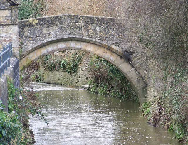
Bow Bridge, a packhorse bridge over the River Brue in Bruton, Somerset
252:
973:
Click on a date/time to view the file as it appeared at that time.
205:
190:
51° 06′ 43.43″ N, 2° 27′ 11.59″ W
180:
66:
379:
Add a one-line explanation of what this file represents
1080:
174:
Creative
Commons Attribution Share-alike license 2.0
110:
90:
Commons is a freely licensed media file repository.
567:
Creative
Commons Attribution-ShareAlike 2.0 Generic
56:(640 × 494 pixels, file size: 136 KB, MIME type:
348:https://creativecommons.org/licenses/by-sa/2.0
71:
1048:List of scheduled monuments in South Somerset
354:Creative Commons Attribution-Share Alike 2.0
272:
8:
705:
314:– to copy, distribute and transmit the work
1103:
1043:Grade I listed buildings in South Somerset
975:
375:
1073:The following other wikis use this file:
821:e3163d98a285a04f93961837a962249b4774ef12
653:https://www.geograph.org.uk/photo/666331
479:https://www.geograph.org.uk/profile/9274
1105:
1035:
948:
932:
911:
895:
874:
858:
819:
803:
785:
769:
729:
713:
687:
671:
600:
584:
564:
548:
528:
512:
445:
429:
409:
393:
390:
371:
364:
183:
212:View this and other nearby images on:
447:Jakaś wartość bez elementu Wikidanych
7:
391:Obiekty przedstawione na tym zdjęciu
259:and is licensed for reuse under the
964:
295:Attribution-Share Alike 2.0 Generic
283:
278:
263:Attribution-ShareAlike 2.0 license.
1096:
384:
378:
269:
246:
120:
103:
49:
1086:User:Jokulhlaup/packhorse bridges
383:
716:coordinates of the point of view
369:
325:Under the following conditions:
290:This file is licensed under the
282:
277:
271:
239:
218:
204:
196:
70:
31:
21:
366:
121:
46:No higher resolution available.
14:
603:file available on the internet
365:
247:This image was taken from the
26:
1:
36:
731:51°6'43.427"N, 2°27'11.592"W
638:Geograph Britain and Ireland
487:object of statement has role
195:
1127:
1077:Usage on www.wikidata.org
339:same or compatible license
965:
16:
616:geograph.org.uk image ID
368:
305:
77:This is a file from the
1022:
162:
152:
141:
134:
131:
113:
81:. Information from its
253:this photograph's page
224:51.112063; -2.453220
84:description page there
116:Bow Bridge Bruton.jpg
52:Bow_Bridge_Bruton.jpg
833:determination method
320:– to adapt the work
1001:10:50, 3 July 2009
459:author name string
1114:
1113:
1069:Global file usage
1026:
707:
551:copyright license
377:
268:
267:
251:collection. See
229:
228:
178:
177:
171:
168:Reusing this file
99:
98:
79:Wikimedia Commons
32:Global file usage
1118:
1104:
1053:Packhorse bridge
1038:Bow Bridge, Plox
1013:
953:
916:
879:
842:
837:
753:
752:
747:
655:
650:
646:described at URL
640:
635:
625:
620:
515:copyright status
496:
491:
481:
476:
466:
463:
361:
358:
355:
352:
349:
341:as the original.
303:
292:Creative Commons
286:
285:
281:
280:
275:
274:
261:Creative Commons
249:Geograph project
243:
236:
225:
222:
208:
207:
201:
200:
199:
193:
192:
181:
165:
137:
125:
117:
111:
95:
74:
73:
67:
61:
59:
1126:
1125:
1121:
1120:
1119:
1117:
1116:
1115:
1092:
1067:
1034:
1027:
1019:
1011:
967:
966:
963:
962:
961:
960:
959:
958:
957:
956:
954:
951:
941:
940:
939:
937:
926:
925:
924:
923:
922:
921:
920:
919:
917:
914:
904:
903:
902:
900:
889:
888:
887:
886:
885:
884:
883:
882:
880:
877:
867:
866:
865:
863:
852:
851:
850:
849:
848:
847:
846:
845:
844:
843:
838:
835:
826:
825:
824:
822:
812:
811:
810:
808:
797:
796:
795:
794:
793:
792:
791:
790:
788:
778:
777:
776:
774:
763:
762:
761:
760:
759:
758:
757:
756:
755:
754:
750:
748:
745:
736:
735:
734:
732:
722:
721:
720:
718:
699:
698:
697:
696:
695:
694:
693:
692:
690:
689:22 January 2008
680:
679:
678:
676:
665:
664:
663:
662:
661:
660:
659:
658:
657:
656:
651:
648:
642:
641:
636:
633:
627:
626:
621:
618:
609:
608:
607:
605:
593:
592:
591:
589:
578:
577:
576:
575:
574:
573:
572:
571:
569:
557:
556:
555:
553:
542:
541:
540:
539:
538:
537:
536:
535:
533:
521:
520:
519:
517:
506:
505:
504:
503:
502:
501:
500:
499:
498:
497:
492:
489:
483:
482:
477:
474:
468:
467:
464:
461:
452:
451:
450:
448:
438:
437:
436:
434:
423:
422:
421:
420:
419:
418:
417:
416:
414:
402:
401:
400:
398:
382:
381:
380:
363:
362:
359:
356:
353:
350:
347:
346:
304:
301:
298:
287:
264:
234:
223:
197:
188:
187:
184:Camera location
179:
147:geograph.org.uk
136:22 January 2008
127:
115:
108:
101:
100:
89:
88:
87:is shown below.
63:
57:
55:
48:
47:
12:
11:
5:
1124:
1122:
1112:
1111:
1108:
1095:
1091:
1090:
1089:
1088:
1083:
1071:
1070:
1066:
1065:
1060:
1055:
1050:
1045:
1040:
1032:
1031:
1030:
1025:
1024:
1021:
1017:
1014:
1008:
1003:
998:
994:
993:
990:
987:
984:
981:
978:
971:
970:
955:
949:
947:
946:
945:
944:
943:
942:
938:
933:
931:
930:
929:
928:
927:
918:
912:
910:
909:
908:
907:
906:
905:
901:
896:
894:
893:
892:
891:
890:
881:
875:
873:
872:
871:
870:
869:
868:
864:
859:
857:
856:
855:
854:
853:
831:
830:
829:
828:
827:
823:
820:
818:
817:
816:
815:
814:
813:
809:
804:
802:
801:
800:
799:
798:
789:
786:
784:
783:
782:
781:
780:
779:
775:
770:
768:
767:
766:
765:
764:
741:
740:
739:
738:
737:
733:
730:
728:
727:
726:
725:
724:
723:
719:
714:
712:
711:
710:
709:
703:
691:
688:
686:
685:
684:
683:
682:
681:
677:
672:
670:
669:
668:
667:
666:
644:
643:
629:
628:
614:
613:
612:
611:
610:
606:
601:
599:
598:
597:
596:
595:
594:
590:
587:source of file
585:
583:
582:
581:
580:
579:
570:
565:
563:
562:
561:
560:
559:
558:
554:
549:
547:
546:
545:
544:
543:
534:
529:
527:
526:
525:
524:
523:
522:
518:
513:
511:
510:
509:
508:
507:
485:
484:
470:
469:
457:
456:
455:
454:
453:
449:
446:
444:
443:
442:
441:
440:
439:
435:
430:
428:
427:
426:
425:
424:
415:
410:
408:
407:
406:
405:
404:
403:
399:
394:
392:
389:
388:
387:
386:
385:
374:
373:
370:
367:
345:
344:
343:
342:
332:
323:
322:
321:
315:
308:You are free:
299:
289:
288:
270:
266:
265:
244:
233:
230:
227:
226:
216:
210:
185:
176:
175:
172:
160:
159:
154:
150:
149:
143:
139:
138:
133:
129:
128:
118:
109:
107:
104:
102:
97:
96:
75:
65:
64:
45:
41:
40:
39:
34:
29:
24:
19:
13:
10:
9:
6:
4:
3:
2:
1123:
1109:
1106:
1102:
1099:
1093:
1087:
1084:
1082:
1079:
1078:
1076:
1075:
1074:
1068:
1064:
1061:
1059:
1056:
1054:
1051:
1049:
1046:
1044:
1041:
1039:
1036:
1028:
1020:
1015:
1009:
1007:
1004:
1002:
999:
996:
995:
991:
988:
985:
982:
979:
977:
976:
974:
968:
936:
899:
862:
841:
834:
807:
773:
744:
717:
675:
654:
647:
639:
632:
624:
617:
604:
588:
568:
552:
532:
516:
495:
488:
480:
473:
460:
433:
413:
397:
351:CC BY-SA 2.0
340:
336:
333:
330:
327:
326:
324:
319:
316:
313:
310:
309:
307:
306:
300:Attribution:
296:
293:
276:
262:
258:
254:
250:
245:
242:
238:
237:
231:
221:
217:
215:
214:OpenStreetMap
211:
209:
191:
186:
182:
173:
169:
164:
161:
158:
155:
151:
148:
144:
140:
130:
124:
119:
112:
105:
93:
86:
85:
80:
76:
69:
68:
62:
53:
44:
38:
35:
33:
30:
28:
25:
23:
20:
18:
15:
1100:
1097:
1072:
972:
969:File history
494:photographer
334:
328:
317:
311:
256:
194:
122:
92:You can help
82:
50:
22:File history
531:copyrighted
465:Trish Steel
335:share alike
329:attribution
302:Trish Steel
257:Trish Steel
157:Trish Steel
114:Description
1107:_error
1058:River Brue
1029:File usage
1010:640 × 494
986:Dimensions
787:image/jpeg
772:media type
412:Bow Bridge
163:Permission
58:image/jpeg
27:File usage
983:Thumbnail
980:Date/Time
861:data size
674:inception
232:Licensing
123:English:
1094:Metadata
1081:Q4950617
1012:(136 KB)
876:138,914
806:checksum
631:operator
372:Captions
318:to remix
312:to share
297:license.
37:Metadata
997:current
992:Comment
743:heading
702:heading
432:creator
396:depicts
376:English
106:Summary
54:
898:height
751:degree
706:degree
623:666331
202:
153:Author
142:Source
952:pixel
935:width
915:pixel
840:SHA-1
145:From
1018:Rodw
989:User
950:640
913:494
878:byte
749:225
360:true
357:true
132:Date
17:File
472:URL
836::
746::
649::
634::
619::
490::
475::
462::
1110:0
170:)
166:(
94:.
60:)
Text is available under the Creative Commons Attribution-ShareAlike License. Additional terms may apply.
