270:
203:
217:
238:
276:
281:
67:
973:
328:– You must give appropriate credit, provide a link to the license, and indicate if changes were made. You may do so in any reasonable manner, but not in any way that suggests the licensor endorses you or your use.
194:
38:
172:
408:
806:
633:
563:
527:
210:
653:
1150:
245:
1023:
This file contains additional information, probably added from the digital camera or scanner used to create or digitize it.
335:
78:
1119:
490:
46:
901:
864:
827:
772:
738:
704:
661:
617:
511:
483:
470:
455:
799:
676:
646:
583:
547:
428:
392:
131:
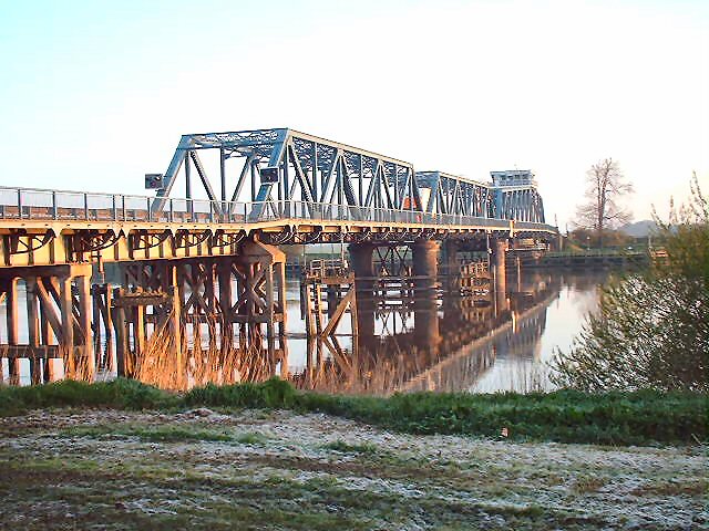
The Swing bridge built in 1927 over the river Ouse before the M62 Ouse bridge was built. It is still in constant use.
232:
126:
995:
291:
1026:
If the file has been modified from its original state, some details may not fully reflect the modified file.
1008:
The following pages on the
English Knowledge (XXG) use this file (pages on other projects are not listed):
998:
The Swing bridge built in 1927 over the river Ouse before the M62 Ouse bridge was built. It is still in c
1203:
334:– If you remix, transform, or build upon the material, you must distribute your contributions under the
252:
on the
Geograph website for the photographer's contact details. The copyright on this image is owned by
288:
1231:
1045:
86:
462:
683:
668:
972:
967:
37:
216:
1293:
1221:
1177:
257:
73:
1082:
983:
200:
122:
1241:
140:
1062:
1012:
991:
161:
151:
1283:
1052:
1035:
237:
249:
940:
Click on a date/time to view the file as it appeared at that time.
697:
202:
195:
53° 43′ 30.89″ N, 0° 53′ 20.54″ W
185:
61:
990:== Summary == {{Information |Description=Boothferry Bridge,
376:
Add a one-line explanation of what this file represents
179:
Creative
Commons Attribution Share-alike license 2.0
105:
85:
Commons is a freely licensed media file repository.
564:
Creative
Commons Attribution-ShareAlike 2.0 Generic
51:(640 × 480 pixels, file size: 147 KB, MIME type:
345:https://creativecommons.org/licenses/by-sa/2.0
66:
351:Creative Commons Attribution-Share Alike 2.0
269:
8:
311:– to copy, distribute and transmit the work
1028:
942:
372:
788:0757bfd21fbf6a79a3b443e027995a76da02aabb
463:https://www.geograph.org.uk/profile/3021
1291:
1281:
1273:
1265:
1257:
1249:
1239:
1229:
1219:
1211:
1201:
1193:
1185:
1175:
1167:
1159:
1148:
1140:
1132:
1124:
1114:
1106:
1098:
1090:
1079:
1071:
1060:
1050:
1040:
1010:
915:
899:
878:
862:
841:
825:
786:
770:
752:
736:
718:
702:
684:https://www.geograph.org.uk/photo/72441
631:
615:
597:
581:
561:
545:
525:
509:
442:
426:
406:
390:
387:
368:
361:
188:
209:View this and other nearby images on:
1030:
7:
256:and is licensed for reuse under the
931:
292:Attribution-Share Alike 2.0 Generic
280:
275:
260:Attribution-ShareAlike 2.0 license.
1120:Paint Shop Photo Album v4.0.4
1021:
381:
375:
266:
243:
115:
98:
44:
380:
1073:Date and time of data generation
705:coordinates of the point of view
366:
322:Under the following conditions:
287:This file is licensed under the
279:
274:
268:
236:
215:
201:
65:
21:
363:
116:
41:No higher resolution available.
14:
634:file available on the internet
362:
244:This image was taken from the
26:
1:
720:53°43'30.893"N, 0°53'20.540"W
31:
654:Geograph Britain and Ireland
484:object of statement has role
388:Items portrayed in this file
1267:Focal plane resolution unit
1161:Date and time of digitizing
1315:
1278:One-chip color area sensor
336:same or compatible license
1126:File change date and time
932:
16:
1259:Focal plane Y resolution
1251:Focal plane X resolution
996:East Riding of Yorkshire
662:geograph.org.uk image ID
365:
302:
127:East Riding of Yorkshire
72:This is a file from the
989:
968:19:40, 12 December 2009
167:
157:
146:
139:
136:
111:Boothferry Bridge 1.jpg
108:
76:. Information from its
47:Boothferry_Bridge_1.jpg
1169:Image compression mode
250:this photograph's page
221:53.725248; -0.889039
79:description page there
1213:Maximum land aperture
1100:Horizontal resolution
1164:18:29, 22 April 2005
1076:18:29, 22 April 2005
800:determination method
477:Gordon Kneale Brooke
299:Gordon Kneale Brooke
254:Gordon Kneale Brooke
162:Gordon Kneale Brooke
1134:Y and C positioning
1108:Vertical resolution
1032:Camera manufacturer
317:– to adapt the work
121:Boothferry Bridge,
1298:Auto white balance
1236:Flash did not fire
1129:19:21, 29 May 2005
471:author name string
1302:
1301:
1216:3.6 APEX (f/3.48)
1001:
548:copyright license
409:Boothferry Bridge
374:
265:
264:
248:collection. See
226:
225:
183:
182:
176:
173:Reusing this file
94:
93:
74:Wikimedia Commons
1306:
1142:Exposure Program
1029:
980:
920:
883:
846:
809:
804:
686:
681:
677:described at URL
671:
666:
656:
651:
512:copyright status
493:
488:
478:
475:
465:
460:
358:
355:
352:
349:
346:
338:as the original.
300:
289:Creative Commons
283:
282:
278:
277:
272:
271:
258:Creative Commons
246:Geograph project
240:
233:
222:
219:
205:
204:
198:
197:
186:
170:
142:
120:
112:
106:
90:
69:
68:
62:
56:
54:
1314:
1313:
1309:
1308:
1307:
1305:
1304:
1303:
1195:APEX brightness
1017:
1009:
1002:
986:
978:
934:
933:
930:
929:
928:
927:
926:
925:
924:
923:
921:
918:
908:
907:
906:
904:
893:
892:
891:
890:
889:
888:
887:
886:
884:
881:
871:
870:
869:
867:
856:
855:
854:
853:
852:
851:
850:
849:
847:
844:
834:
833:
832:
830:
819:
818:
817:
816:
815:
814:
813:
812:
811:
810:
805:
802:
793:
792:
791:
789:
779:
778:
777:
775:
764:
763:
762:
761:
760:
759:
758:
757:
755:
745:
744:
743:
741:
730:
729:
728:
727:
726:
725:
724:
723:
721:
711:
710:
709:
707:
696:
695:
694:
693:
692:
691:
690:
689:
688:
687:
682:
679:
673:
672:
667:
664:
658:
657:
652:
649:
640:
639:
638:
636:
624:
623:
622:
620:
609:
608:
607:
606:
605:
604:
603:
602:
600:
590:
589:
588:
586:
575:
574:
573:
572:
571:
570:
569:
568:
566:
554:
553:
552:
550:
539:
538:
537:
536:
535:
534:
533:
532:
530:
518:
517:
516:
514:
503:
502:
501:
500:
499:
498:
497:
496:
495:
494:
489:
486:
480:
479:
476:
473:
467:
466:
461:
458:
449:
448:
447:
445:
435:
434:
433:
431:
420:
419:
418:
417:
416:
415:
414:
413:
411:
399:
398:
397:
395:
379:
378:
377:
360:
359:
356:
353:
350:
347:
344:
343:
301:
298:
295:
284:
261:
231:
220:
193:
192:
189:Camera location
184:
152:geograph.org.uk
132:
110:
103:
96:
95:
84:
83:
82:is shown below.
58:
52:
50:
43:
42:
12:
11:
5:
1312:
1310:
1300:
1299:
1296:
1290:
1289:
1286:
1280:
1279:
1276:
1275:Sensing method
1272:
1271:
1268:
1264:
1263:
1260:
1256:
1255:
1252:
1248:
1247:
1244:
1238:
1237:
1234:
1228:
1227:
1224:
1218:
1217:
1214:
1210:
1209:
1206:
1200:
1199:
1196:
1192:
1191:
1188:
1184:
1183:
1180:
1174:
1173:
1170:
1166:
1165:
1162:
1158:
1157:
1154:
1147:
1146:
1145:Normal program
1143:
1139:
1138:
1135:
1131:
1130:
1127:
1123:
1122:
1117:
1113:
1112:
1109:
1105:
1104:
1101:
1097:
1096:
1093:
1089:
1088:
1085:
1078:
1077:
1074:
1070:
1069:
1066:
1059:
1058:
1055:
1049:
1048:
1043:
1039:
1038:
1033:
1020:
1016:
1015:
1007:
1006:
1005:
1000:
999:
988:
984:
981:
975:
970:
965:
961:
960:
957:
954:
951:
948:
945:
938:
937:
922:
916:
914:
913:
912:
911:
910:
909:
905:
900:
898:
897:
896:
895:
894:
885:
879:
877:
876:
875:
874:
873:
872:
868:
863:
861:
860:
859:
858:
857:
848:
842:
840:
839:
838:
837:
836:
835:
831:
826:
824:
823:
822:
821:
820:
798:
797:
796:
795:
794:
790:
787:
785:
784:
783:
782:
781:
780:
776:
771:
769:
768:
767:
766:
765:
756:
753:
751:
750:
749:
748:
747:
746:
742:
737:
735:
734:
733:
732:
731:
722:
719:
717:
716:
715:
714:
713:
712:
708:
703:
701:
700:
699:
698:
675:
674:
660:
659:
645:
644:
643:
642:
641:
637:
632:
630:
629:
628:
627:
626:
625:
621:
618:source of file
616:
614:
613:
612:
611:
610:
601:
598:
596:
595:
594:
593:
592:
591:
587:
582:
580:
579:
578:
577:
576:
567:
562:
560:
559:
558:
557:
556:
555:
551:
546:
544:
543:
542:
541:
540:
531:
526:
524:
523:
522:
521:
520:
519:
515:
510:
508:
507:
506:
505:
504:
482:
481:
469:
468:
454:
453:
452:
451:
450:
446:
443:
441:
440:
439:
438:
437:
436:
432:
427:
425:
424:
423:
422:
421:
412:
407:
405:
404:
403:
402:
401:
400:
396:
391:
389:
386:
385:
384:
383:
382:
371:
370:
367:
364:
342:
341:
340:
339:
329:
320:
319:
318:
312:
305:You are free:
296:
286:
285:
267:
263:
262:
241:
230:
227:
224:
223:
213:
207:
190:
181:
180:
177:
165:
164:
159:
155:
154:
148:
144:
143:
138:
134:
133:
113:
104:
102:
99:
97:
92:
91:
70:
60:
59:
40:
36:
35:
34:
29:
24:
19:
13:
10:
9:
6:
4:
3:
2:
1311:
1297:
1295:
1294:White balance
1292:
1287:
1285:
1282:
1277:
1274:
1269:
1266:
1261:
1258:
1253:
1250:
1245:
1243:
1240:
1235:
1233:
1230:
1225:
1223:
1222:Metering mode
1220:
1215:
1212:
1207:
1205:
1204:Exposure bias
1202:
1197:
1194:
1189:
1187:APEX aperture
1186:
1181:
1179:
1178:Shutter speed
1176:
1171:
1168:
1163:
1160:
1155:
1152:
1149:
1144:
1141:
1136:
1133:
1128:
1125:
1121:
1118:
1116:Software used
1115:
1110:
1107:
1102:
1099:
1094:
1091:
1086:
1084:
1080:
1075:
1072:
1067:
1064:
1061:
1056:
1054:
1051:
1047:
1044:
1041:
1037:
1034:
1031:
1027:
1024:
1018:
1014:
1011:
1003:
997:
993:
987:
982:
976:
974:
971:
969:
966:
963:
962:
958:
955:
952:
949:
946:
944:
943:
941:
935:
903:
866:
829:
808:
801:
774:
740:
706:
685:
678:
670:
663:
655:
648:
635:
619:
599:22 April 2005
585:
565:
549:
529:
513:
492:
485:
472:
464:
457:
430:
410:
394:
348:CC BY-SA 2.0
337:
333:
330:
327:
324:
323:
321:
316:
313:
310:
307:
306:
304:
303:
297:Attribution:
293:
290:
273:
259:
255:
251:
247:
242:
239:
235:
234:
228:
218:
214:
212:
211:OpenStreetMap
208:
206:
196:
191:
187:
178:
174:
169:
166:
163:
160:
156:
153:
149:
145:
141:22 April 2005
135:
130:
128:
124:
119:
114:
107:
100:
88:
81:
80:
75:
71:
64:
63:
57:
48:
39:
33:
30:
28:
25:
23:
20:
18:
15:
1083:focal length
1042:Camera model
1025:
1022:
939:
936:File history
491:photographer
331:
325:
314:
308:
253:
117:
87:You can help
77:
45:
22:File history
1242:Color space
1092:Orientation
1046:FinePix2200
528:copyrighted
332:share alike
326:attribution
109:Description
1013:Boothferry
1004:File usage
992:Boothferry
977:640 × 480
953:Dimensions
754:image/jpeg
739:media type
444:some value
168:Permission
129:, England.
123:Boothferry
53:image/jpeg
27:File usage
1284:Sharpness
1063:ISO speed
950:Thumbnail
947:Date/Time
828:data size
584:inception
229:Licensing
118:English:
1137:Co-sited
1053:F-number
1036:FUJIFILM
1019:Metadata
979:(147 KB)
843:150,066
773:checksum
647:operator
369:Captions
315:to remix
309:to share
294:license.
32:Metadata
1226:Pattern
1153:version
985:Keith D
964:current
959:Comment
429:creator
393:depicts
373:English
101:Summary
49:
1111:72 dpi
1103:72 dpi
1095:Normal
1087:5.8 mm
1065:rating
865:height
199:
158:Author
147:Source
1262:2,443
1254:2,443
1232:Flash
1081:Lens
1057:f/4.8
919:pixel
902:width
882:pixel
807:SHA-1
669:72441
150:From
1246:sRGB
1198:5.91
1151:Exif
956:User
917:640
880:480
845:byte
357:true
354:true
137:Date
17:File
1190:4.5
1182:6.3
1156:2.1
1068:100
456:URL
994:,
803::
680::
665::
650::
487::
474::
459::
125:,
1288:3
1270:3
1208:0
1172:2
175:)
171:(
89:.
55:)
Text is available under the Creative Commons Attribution-ShareAlike License. Additional terms may apply.
