257:
212:
226:
263:
43:
268:
103:
921:
309:– You must give appropriate credit, provide a link to the license, and indicate if changes were made. You may do so in any reasonable manner, but not in any way that suggests the licensor endorses you or your use.
1065:
952:
203:
1085:
186:
754:
562:
526:
490:
219:
666:
1251:
1098:
This file contains additional information, probably added from the digital camera or scanner used to create or digitize it.
316:
849:
812:
775:
720:
686:
650:
616:
546:
474:
446:
431:
418:
747:
582:
510:
391:
374:
69:
65:
61:
57:
53:
47:
114:
278:
438:
82:
1101:
If the file has been modified from its original state, some details may not fully reflect the modified file.
948:
The following pages on the
English Knowledge (XXG) use this file (pages on other projects are not listed):
1299:
315:– If you remix, transform, or build upon the material, you must distribute your contributions under the
275:
1335:
1010:
931:
122:
1448:
1220:
453:
166:
225:
1030:
1403:
1317:
1127:
109:
250:
I, the copyright holder of this work, hereby publish it under the following license:
1458:
1413:
1167:
920:
915:
73:
42:
1353:
1035:
1147:
209:
1110:
1468:
1137:
1020:
970:
1120:
1055:
888:
Click on a date/time to view the file as it appeared at that time.
211:
204:
12° 26′ 21.12″ N, 71° 41′ 16.44″ W
1045:
1005:
980:
975:
609:
194:
97:
990:
1000:
358:
Add a one-line explanation of what this file represents
1075:
87:(4,000 × 2,672 pixels, file size: 5.4 MB, MIME type:
527:
Creative
Commons Attribution-ShareAlike 3.0 Unported
141:
121:
Commons is a freely licensed media file repository.
1340:Flash did not fire, compulsory flash suppression
1011:Parque nacional natural Bahía Portete - Kaurrele
953:Bahía Portete – Kaurrele National Natural Park
326:https://creativecommons.org/licenses/by-sa/3.0
102:
332:Creative Commons Attribution-Share Alike 3.0
256:
8:
292:– to copy, distribute and transmit the work
1103:
890:
354:
1031:Portal:Colombia/Lugar de interese/Arquivo
963:The following other wikis use this file:
454:https://commons.wikimedia.org/user:Uhkabu
736:7daae1cacbd3ef5cb64b9136e3871b6177a82290
1492:
1484:
1476:
1466:
1456:
1446:
1438:
1430:
1422:
1411:
1401:
1393:
1385:
1377:
1369:
1361:
1351:
1343:
1333:
1325:
1315:
1307:
1297:
1289:
1268:
1260:
1249:
1241:
1233:
1225:
1215:
1207:
1199:
1191:
1183:
1175:
1164:
1156:
1145:
1135:
1125:
1115:
950:
863:
847:
826:
810:
789:
773:
734:
718:
700:
684:
664:
648:
630:
614:
596:
580:
560:
544:
524:
508:
488:
472:
405:
389:
372:
369:
350:
343:
197:
218:View this and other nearby images on:
1105:
7:
279:Attribution-Share Alike 3.0 Unported
1036:Portal:Colombia/Lugar de interese/4
938:User created page with UploadWizard
879:
267:
262:
1096:
363:
357:
253:
249:
151:
134:
80:
362:
1481:5e7f7b2aea917beb3ab0fe61c9930fee
1158:Date and time of data generation
617:coordinates of the point of view
348:
303:Under the following conditions:
274:This file is licensed under the
266:
261:
255:
224:
210:
101:
31:
21:
345:
152:
14:
344:
26:
1:
1382:A directly photographed image
563:original creation by uploader
36:
971:Parques Nacionales Naturales
370:Items portrayed in this file
1262:Date and time of digitizing
1066:Национальные парки Колумбии
1021:Parcs nationaux de Colombie
1017:Usage on fr.wikivoyage.org
987:Usage on en.wikivoyage.org
1514:
1424:Focal length in 35 mm film
1366:One-chip color area sensor
1345:Supported Flashpix version
1082:Usage on zh.wikipedia.org
1072:Usage on www.wikidata.org
1062:Usage on ru.wikipedia.org
1052:Usage on pl.wikipedia.org
1042:Usage on no.wikipedia.org
1027:Usage on gl.wikipedia.org
997:Usage on es.wikipedia.org
967:Usage on de.wikipedia.org
632:12°26'21.1"N, 71°41'16.4"W
317:same or compatible license
237:La Guajira Punta Gallinas
1270:Meaning of each component
1227:File change date and time
1056:Parki narodowe w Kolumbii
880:
176:
157:La Guajira Punta Gallinas
16:
1312:4.35546875 APEX (f/4.52)
347:
283:
108:This is a file from the
1387:Custom image processing
937:
667:Panasonic Lumix DMC-GF2
182:
172:
167:18 March 2014, 12:39:27
165:
162:
144:
112:. Information from its
1291:Image compression mode
230:12.439200; -71.687900
115:description page there
46:Size of this preview:
1309:Maximum land aperture
1201:Horizontal resolution
1374:Digital still camera
1265:19:39, 18 March 2014
1230:19:10, 11 April 2014
1161:12:39, 18 March 2014
916:13:08, 14 April 2014
748:determination method
74:4,000 × 2,672 pixels
70:2,560 × 1,710 pixels
1235:Y and C positioning
1209:Vertical resolution
1107:Camera manufacturer
298:– to adapt the work
52:Other resolutions:
1432:Scene capture type
1408:Auto white balance
1046:Colombias geografi
432:Wikimedia username
419:author name string
66:1,280 × 855 pixels
62:1,024 × 684 pixels
1501:
1500:
1132:1/500 sec (0.002)
959:Global file usage
941:
511:copyright license
356:
235:
234:
192:
191:
147:Bahia hondita.JPG
130:
129:
110:Wikimedia Commons
32:Global file usage
1505:
1243:Exposure Program
1188:72° 10′ 40.15″ W
1180:12° 12′ 37.96″ N
1104:
928:
868:
831:
794:
757:
752:
475:copyright status
456:
451:
441:
436:
426:
423:
339:
336:
333:
330:
327:
319:as the original.
276:Creative Commons
270:
269:
265:
264:
259:
258:
231:
228:
214:
213:
207:
206:
195:
178:
168:
156:
148:
142:
126:
105:
104:
98:
92:
90:
77:
58:640 × 428 pixels
54:320 × 214 pixels
48:800 × 534 pixels
1513:
1512:
1508:
1507:
1506:
1504:
1503:
1502:
1486:GPS tag version
1478:Unique image ID
1092:
957:
949:
942:
934:
926:
882:
881:
878:
877:
876:
875:
874:
873:
872:
871:
869:
866:
856:
855:
854:
852:
841:
840:
839:
838:
837:
836:
835:
834:
832:
829:
819:
818:
817:
815:
804:
803:
802:
801:
800:
799:
798:
797:
795:
792:
782:
781:
780:
778:
767:
766:
765:
764:
763:
762:
761:
760:
759:
758:
753:
750:
741:
740:
739:
737:
727:
726:
725:
723:
712:
711:
710:
709:
708:
707:
706:
705:
703:
693:
692:
691:
689:
678:
677:
676:
675:
674:
673:
672:
671:
669:
657:
656:
655:
653:
642:
641:
640:
639:
638:
637:
636:
635:
633:
623:
622:
621:
619:
608:
607:
606:
605:
604:
603:
602:
601:
599:
589:
588:
587:
585:
574:
573:
572:
571:
570:
569:
568:
567:
565:
553:
552:
551:
549:
538:
537:
536:
535:
534:
533:
532:
531:
529:
517:
516:
515:
513:
502:
501:
500:
499:
498:
497:
496:
495:
493:
481:
480:
479:
477:
466:
465:
464:
463:
462:
461:
460:
459:
458:
457:
452:
449:
443:
442:
437:
434:
428:
427:
424:
421:
412:
411:
410:
408:
398:
397:
396:
394:
383:
382:
381:
380:
379:
377:
361:
360:
359:
342:
341:
340:
337:
334:
331:
328:
325:
324:
282:
271:
252:
251:
246:
229:
202:
201:
198:Camera location
193:
158:
146:
139:
132:
131:
120:
119:
118:is shown below.
94:
88:
86:
79:
78:
51:
12:
11:
5:
1511:
1509:
1499:
1498:
1495:
1491:
1490:
1487:
1483:
1482:
1479:
1475:
1474:
1471:
1465:
1464:
1461:
1455:
1454:
1451:
1445:
1444:
1441:
1437:
1436:
1433:
1429:
1428:
1425:
1421:
1420:
1417:
1410:
1409:
1406:
1400:
1399:
1396:
1392:
1391:
1390:Normal process
1388:
1384:
1383:
1380:
1376:
1375:
1372:
1368:
1367:
1364:
1363:Sensing method
1360:
1359:
1356:
1350:
1349:
1346:
1342:
1341:
1338:
1332:
1331:
1328:
1324:
1323:
1320:
1314:
1313:
1310:
1306:
1305:
1302:
1296:
1295:
1292:
1288:
1287:
1286:
1285:
1284:does not exist
1282:
1279:
1276:
1271:
1267:
1266:
1263:
1259:
1258:
1255:
1248:
1247:
1246:Normal program
1244:
1240:
1239:
1236:
1232:
1231:
1228:
1224:
1223:
1218:
1214:
1213:
1210:
1206:
1205:
1202:
1198:
1197:
1194:
1190:
1189:
1186:
1182:
1181:
1178:
1174:
1173:
1170:
1163:
1162:
1159:
1155:
1154:
1151:
1144:
1143:
1140:
1134:
1133:
1130:
1124:
1123:
1118:
1114:
1113:
1108:
1095:
1091:
1090:
1089:
1088:
1086:巴哈蒂港-考雷勒國家自然公園
1080:
1079:
1078:
1070:
1069:
1068:
1060:
1059:
1058:
1050:
1049:
1048:
1040:
1039:
1038:
1033:
1025:
1024:
1023:
1015:
1014:
1013:
1008:
1003:
995:
994:
993:
991:Punta Gallinas
985:
984:
983:
978:
973:
961:
960:
956:
955:
947:
946:
945:
940:
939:
936:
932:
929:
925:4,000 × 2,672
923:
918:
913:
909:
908:
905:
902:
899:
896:
893:
886:
885:
870:
864:
862:
861:
860:
859:
858:
857:
853:
848:
846:
845:
844:
843:
842:
833:
827:
825:
824:
823:
822:
821:
820:
816:
811:
809:
808:
807:
806:
805:
796:
790:
788:
787:
786:
785:
784:
783:
779:
774:
772:
771:
770:
769:
768:
746:
745:
744:
743:
742:
738:
735:
733:
732:
731:
730:
729:
728:
724:
719:
717:
716:
715:
714:
713:
704:
701:
699:
698:
697:
696:
695:
694:
690:
685:
683:
682:
681:
680:
679:
670:
665:
663:
662:
661:
660:
659:
658:
654:
649:
647:
646:
645:
644:
643:
634:
631:
629:
628:
627:
626:
625:
624:
620:
615:
613:
612:
611:
610:
600:
597:
595:
594:
593:
592:
591:
590:
586:
581:
579:
578:
577:
576:
575:
566:
561:
559:
558:
557:
556:
555:
554:
550:
547:source of file
545:
543:
542:
541:
540:
539:
530:
525:
523:
522:
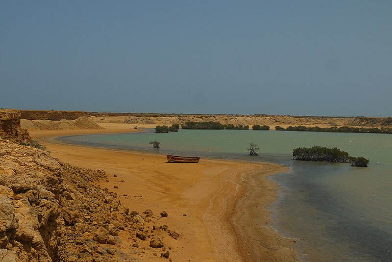
521:
520:
519:
518:
514:
509:
507:
506:
505:
504:
503:
494:
489:
487:
486:
485:
484:
483:
482:
478:
473:
471:
470:
469:
468:
467:
445:
444:
430:
429:
417:
416:
415:
414:
413:
409:
406:
404:
403:
402:
401:
400:
399:
395:
390:
388:
387:
386:
385:
384:
378:
373:
371:
368:
367:
366:
365:
364:
353:
352:
349:
346:
323:
322:
321:
320:
310:
301:
300:
299:
293:
286:You are free:
273:
272:
254:
248:
247:
245:
242:
233:
232:
222:
216:
199:
190:
189:
184:
180:
179:
174:
170:
169:
164:
160:
159:
149:
140:
138:
135:
133:
128:
127:
106:
96:
95:
45:
41:
40:
39:
34:
29:
24:
19:
13:
10:
9:
6:
4:
3:
2:
1510:
1496:
1493:
1488:
1485:
1480:
1477:
1472:
1470:
1467:
1462:
1460:
1457:
1452:
1450:
1447:
1442:
1440:Scene control
1439:
1434:
1431:
1426:
1423:
1418:
1415:
1412:
1407:
1405:
1404:White balance
1402:
1398:Auto exposure
1397:
1395:Exposure mode
1394:
1389:
1386:
1381:
1378:
1373:
1370:
1365:
1362:
1357:
1355:
1352:
1347:
1344:
1339:
1337:
1334:
1329:
1326:
1321:
1319:
1318:Metering mode
1316:
1311:
1308:
1303:
1301:
1300:Exposure bias
1298:
1293:
1290:
1283:
1280:
1277:
1274:
1273:
1272:
1269:
1264:
1261:
1256:
1253:
1250:
1245:
1242:
1237:
1234:
1229:
1226:
1222:
1219:
1217:Software used
1216:
1211:
1208:
1203:
1200:
1195:
1192:
1187:
1184:
1179:
1176:
1171:
1169:
1165:
1160:
1157:
1152:
1149:
1146:
1141:
1139:
1136:
1131:
1129:
1128:Exposure time
1126:
1122:
1119:
1116:
1112:
1109:
1106:
1102:
1099:
1093:
1087:
1084:
1083:
1081:
1077:
1074:
1073:
1071:
1067:
1064:
1063:
1061:
1057:
1054:
1053:
1051:
1047:
1044:
1043:
1041:
1037:
1034:
1032:
1029:
1028:
1026:
1022:
1019:
1018:
1016:
1012:
1009:
1007:
1006:Bahía Hondita
1004:
1002:
999:
998:
996:
992:
989:
988:
986:
982:
981:Región Caribe
979:
977:
976:Bahía Hondita
974:
972:
969:
968:
966:
965:
964:
958:
954:
951:
943:
935:
930:
924:
922:
919:
917:
914:
911:
910:
906:
903:
900:
897:
894:
892:
891:
889:
883:
851:
814:
777:
756:
749:
722:
688:
668:
652:
651:captured with
618:
598:18 March 2014
584:
564:
548:
528:
512:
492:
476:
455:
448:
440:
433:
420:
393:
376:
329:CC BY-SA 3.0
318:
314:
311:
308:
305:
304:
302:
297:
294:
291:
288:
287:
285:
284:
280:
277:
260:
243:
241:
240:
238:
227:
223:
221:
220:OpenStreetMap
217:
215:
205:
200:
196:
188:
185:
181:
175:
171:
161:
155:
150:
143:
136:
124:
117:
116:
111:
107:
100:
99:
93:
84:
83:Original file
75:
71:
67:
63:
59:
55:
49:
44:
38:
35:
33:
30:
28:
25:
23:
20:
18:
15:
1414:Digital zoom
1327:Light source
1168:focal length
1117:Camera model
1100:
1097:
962:
887:
884:File history
312:
306:
295:
289:
239:
236:
153:
123:You can help
113:
81:
22:File history
1494:IIM version
1371:File source
1354:Color space
1193:Orientation
491:copyrighted
313:share alike
307:attribution
145:Description
1459:Saturation
1379:Scene type
1001:La Guajira
944:File usage
901:Dimensions
791:5,660,345
702:image/jpeg
687:media type
407:some value
89:image/jpeg
27:File usage
1469:Sharpness
1221:Ver.1.0
1185:Longitude
1148:ISO speed
1111:Panasonic
898:Thumbnail
895:Date/Time
776:data size
583:inception
244:Licensing
154:English:
1449:Contrast
1435:Standard
1238:Co-sited
1177:Latitude
1138:F-number
1094:Metadata
1076:Q4843111
927:(5.4 MB)
721:checksum
351:Captions
296:to remix
290:to share
281:license.
177:Own work
37:Metadata
1489:0.0.2.2
1330:Unknown
1322:Pattern
1254:version
1212:180 dpi
1204:180 dpi
1121:DMC-GF2
912:current
907:Comment
392:creator
375:depicts
355:English
137:Summary
85:
1473:Normal
1463:Normal
1453:Normal
1196:Normal
1150:rating
933:Uhkabu
865:4,000
828:2,672
813:height
439:Uhkabu
425:Uhkabu
208:
187:Uhkabu
183:Author
173:Source
1427:49 mm
1416:ratio
1336:Flash
1172:24 mm
1166:Lens
867:pixel
850:width
830:pixel
755:SHA-1
1443:None
1358:sRGB
1252:Exif
1142:f/11
904:User
793:byte
338:true
335:true
163:Date
17:File
1257:2.3
1153:100
447:URL
1281:Cr
1278:Cb
751::
450::
435::
422::
72:|
68:|
64:|
60:|
56:|
50:.
1497:4
1419:0
1348:1
1304:0
1294:4
1275:Y
125:.
91:)
76:.
Text is available under the Creative Commons Attribution-ShareAlike License. Additional terms may apply.
