38:
192:
381:
336:
481:
350:
387:
392:
289:
255:
233:
94:
212:
1135:
1105:
441:– You must give appropriate credit, provide a link to the license, and indicate if changes were made. You may do so in any reasonable manner, but not in any way that suggests the licensor endorses you or your use.
493:
327:
223:
68:
64:
60:
56:
52:
48:
42:
105:
77:
1156:
zwischen
Herford und Altenbeken.}} |Source= {{own}} {{Adobe Illustrator}} *based on Open Street Map |Date=2009-08 |Author={{TUBS}} |
1170:
1153:
144:
938:
782:
746:
491:, if used outside Knowledge (XXG) or Commons. For use in publications such as books, newspapers, blogs, websites, please insert
343:
1134:
1129:
448:
1033:
996:
959:
904:
870:
836:
730:
931:
802:
766:
713:
402:
1166:
The following pages on the
English Knowledge (XXG) use this file (pages on other projects are not listed):
672:
447:– If you remix, transform, or build upon the material, you must distribute your contributions under the
399:
1104:
1099:
37:
113:
261:
246:
1145:
1115:
302:
508:
349:
1188:
374:, the copyright holder of this work, hereby publishes it under the following license:
100:
475:
191:
536:
333:
306:
662:
653:
480:
156:
581:
644:
635:
626:
617:
608:
599:
590:
572:
563:
554:
545:
527:
518:
410:
371:
271:
177:
218:
1072:
Click on a date/time to view the file as it appeared at that time.
288:
167:
829:
335:
298:
295:
267:
264:
242:
328:
51° 59′ 29.16″ N, 8° 48′ 06.74″ E
254:
1203:
487:
I'd greatly appreciate, that you attribute this media file to
318:
232:
88:
82:(SVG file, nominally 1,170 × 1,596 pixels, file size: 7.19 MB)
211:
537:
697:
Add a one-line explanation of what this file represents
663:
654:
1213:
1198:
127:
112:
Commons is a freely licensed media file repository.
783:
Creative
Commons Attribution-ShareAlike 2.0 Generic
582:
645:
636:
627:
618:
609:
600:
591:
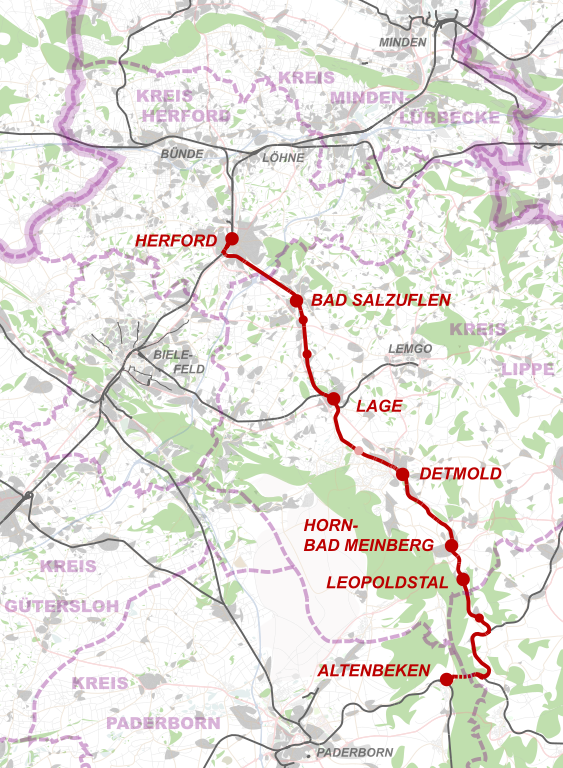
573:
564:
555:
546:
528:
519:
501:{{published|author= |date= |url= |title= |org= }}
458:https://creativecommons.org/licenses/by-sa/2.0
93:
1152:{{Information |Description= {{de|Strecke der
464:Creative Commons Attribution-Share Alike 2.0
380:
8:
424:– to copy, distribute and transmit the work
41:Size of this PNG preview of this SVG file:
1074:
693:
671:
1181:The following other wikis use this file:
920:f54f2675dbb685a63f6189ab19038abe3c1e4a46
513:. License terms given above still apply.
1168:
1047:
1031:
1010:
994:
973:
957:
918:
902:
884:
868:
850:
834:
816:
800:
780:
764:
744:
728:
711:
708:
689:
682:
321:
187:
342:View this and other nearby images on:
7:
1063:
403:Attribution-Share Alike 2.0 Generic
391:
386:
702:
696:
486:
377:
370:
293:
270:is very large because its creator
259:
237:
216:
137:
133:Bahnstrecke Herford-Altenbeken.svg
125:
75:
701:
1189:Bahnstrecke Herford–Himmighausen
1154:Bahnstrecke Herford–Himmighausen
687:
505:and fill the applicable fields.
479:
435:Under the following conditions:
398:This file is licensed under the
390:
385:
379:
348:
334:
287:
253:
231:
210:
190:
147:zwischen Herford und Altenbeken.
145:Bahnstrecke Herford–Himmighausen
92:
31:
21:
684:
14:
683:
138:
26:
1:
837:coordinates of depicted place
166:Own work based on: *based on
1171:Herford–Himmighausen railway
852:51°59'29.159"N, 8°48'6.739"E
709:Items portrayed in this file
274:kept the superfluous Adobe
1232:
1210:Usage on www.wikidata.org
1195:Usage on nl.wikipedia.org
1185:Usage on de.wikipedia.org
449:same or compatible license
1064:
16:
686:
415:
99:This is a file from the
1151:
1122:simpliefied - lower res
1121:
183:
173:
162:
155:
152:
130:
103:. Information from its
354:51.991433; 8.801872
106:description page there
1130:21:23, 27 August 2009
1100:21:42, 27 August 2009
932:determination method
497:the following line:
202:SVG development
69:1,170 × 1,596 pixels
65:1,501 × 2,048 pixels
430:– to adapt the work
47:Other resolutions:
538:Deutsch (Sie-Form)
61:751 × 1,024 pixels
1204:Horn-Bad Meinberg
1177:Global file usage
1159:
767:copyright license
695:
681:
680:
675:
512:
489:Wikimedia Commons
359:
358:
316:
315:
247:Adobe Illustrator
245:was created with
121:
120:
101:Wikimedia Commons
32:Global file usage
1223:
1142:
1112:
1052:
1015:
978:
941:
936:
731:copyright status
676:
592:Bahasa Indonesia
506:
502:
483:
476:
471:
468:
465:
462:
459:
451:as the original.
413:
400:Creative Commons
394:
393:
389:
388:
383:
382:
355:
352:
338:
337:
331:
330:
319:
291:
281:
277:
257:
235:
226:
214:
194:
158:
142:
134:
128:
117:
96:
95:
89:
83:
72:
57:563 × 768 pixels
53:352 × 480 pixels
49:176 × 240 pixels
43:439 × 599 pixels
1231:
1230:
1226:
1225:
1224:
1222:
1221:
1220:
1175:
1167:
1160:
1148:
1140:
1118:
1110:
1066:
1065:
1062:
1061:
1060:
1059:
1058:
1057:
1056:
1055:
1053:
1050:
1040:
1039:
1038:
1036:
1025:
1024:
1023:
1022:
1021:
1020:
1019:
1018:
1016:
1013:
1003:
1002:
1001:
999:
988:
987:
986:
985:
984:
983:
982:
981:
979:
976:
966:
965:
964:
962:
951:
950:
949:
948:
947:
946:
945:
944:
943:
942:
937:
934:
925:
924:
923:
921:
911:
910:
909:
907:
896:
895:
894:
893:
892:
891:
890:
889:
887:
877:
876:
875:
873:
862:
861:
860:
859:
858:
857:
856:
855:
853:
843:
842:
841:
839:
828:
827:
826:
825:
824:
823:
822:
821:
819:
809:
808:
807:
805:
794:
793:
792:
791:
790:
789:
788:
787:
785:
773:
772:
771:
769:
758:
757:
756:
755:
754:
753:
752:
751:
749:
737:
736:
735:
733:
722:
721:
720:
719:
718:
716:
700:
699:
698:
665:
656:
647:
638:
629:
620:
611:
602:
593:
584:
583:Ἀρχαία ἑλληνικὴ
575:
566:
557:
548:
539:
530:
521:
517:
514:
500:
474:
473:
472:
469:
466:
463:
460:
457:
456:
414:
409:
406:
395:
376:
375:
367:
353:
326:
325:
322:Object location
317:
312:
311:
310:
303:raster graphics
285:
283:
279:
275:
251:
250:
229:
228:
222:
205:
195:
168:Open Street Map
148:
132:
123:
122:
111:
110:
109:is shown below.
85:
81:
74:
73:
46:
12:
11:
5:
1229:
1227:
1219:
1218:
1217:
1216:
1208:
1207:
1206:
1201:
1193:
1192:
1191:
1179:
1178:
1174:
1173:
1165:
1164:
1163:
1158:
1157:
1150:
1146:
1143:
1139:1,170 × 1,596
1137:
1132:
1127:
1124:
1123:
1120:
1116:
1113:
1109:1,170 × 1,596
1107:
1102:
1097:
1093:
1092:
1089:
1086:
1083:
1080:
1077:
1070:
1069:
1054:
1048:
1046:
1045:
1044:
1043:
1042:
1041:
1037:
1032:
1030:
1029:
1028:
1027:
1026:
1017:
1011:
1009:
1008:
1007:
1006:
1005:
1004:
1000:
995:
993:
992:
991:
990:
989:
980:
974:
972:
971:
970:
969:
968:
967:
963:
958:
956:
955:
954:
953:
952:
930:
929:
928:
927:
926:
922:
919:
917:
916:
915:
914:
913:
912:
908:
903:
901:
900:
899:
898:
897:
888:
885:
883:
882:
881:
880:
879:
878:
874:
869:
867:
866:
865:
864:
863:
854:
851:
849:
848:
847:
846:
845:
844:
840:
835:
833:
832:
831:
830:
820:
817:
815:
814:
813:
812:
811:
810:
806:
801:
799:
798:
797:
796:
795:
786:
781:
779:
778:
777:
776:
775:
774:
770:
765:
763:
762:
761:
760:
759:
750:
745:
743:
742:
741:
740:
739:
738:
734:
729:
727:
726:
725:
724:
723:
717:
712:
710:
707:
706:
705:
704:
703:
692:
691:
688:
685:
679:
678:
504:
503:
484:
455:
454:
453:
452:
442:
433:
432:
431:
425:
418:You are free:
407:
397:
396:
378:
369:
368:
366:
363:
357:
356:
346:
340:
323:
314:
313:
301:uses embedded
286:
252:
230:
209:
208:
206:
203:
199:
198:
197:
196:
189:
185:
184:Other versions
181:
180:
175:
171:
170:
164:
160:
159:
154:
150:
149:
135:
126:
124:
119:
118:
97:
87:
86:
40:
36:
35:
34:
29:
24:
19:
13:
10:
9:
6:
4:
3:
2:
1228:
1215:
1212:
1211:
1209:
1205:
1202:
1200:
1197:
1196:
1194:
1190:
1187:
1186:
1184:
1183:
1182:
1176:
1172:
1169:
1161:
1155:
1149:
1144:
1138:
1136:
1133:
1131:
1128:
1126:
1125:
1119:
1114:
1108:
1106:
1103:
1101:
1098:
1095:
1094:
1090:
1087:
1084:
1081:
1078:
1076:
1075:
1073:
1067:
1035:
998:
961:
940:
933:
906:
886:image/svg+xml
872:
838:
804:
784:
768:
748:
732:
715:
677:
674:
670:
666:
661:
657:
652:
648:
643:
639:
634:
630:
625:
621:
616:
612:
607:
603:
598:
594:
589:
585:
580:
576:
571:
567:
562:
558:
553:
549:
544:
540:
535:
531:
526:
522:
515:
510:
499:
498:
496:
495:
490:
485:
482:
478:
477:
461:CC BY-SA 2.0
450:
446:
443:
440:
437:
436:
434:
429:
426:
423:
420:
419:
417:
416:
412:
408:Attribution:
404:
401:
384:
373:
364:
362:
361:
351:
347:
345:
344:OpenStreetMap
341:
339:
329:
324:
320:
308:
304:
300:
297:
290:
273:
269:
266:
263:
256:
248:
244:
241:
234:
225:
220:
213:
207:
201:
200:
193:
188:
186:
182:
179:
176:
172:
169:
165:
161:
151:
146:
141:
136:
129:
115:
108:
107:
102:
98:
91:
90:
84:
79:
78:Original file
70:
66:
62:
58:
54:
50:
44:
39:
33:
30:
28:
25:
23:
20:
18:
15:
1180:
1071:
1068:File history
668:
659:
650:
641:
632:
623:
614:
605:
596:
587:
578:
569:
560:
551:
542:
533:
524:
516:
492:
488:
444:
438:
427:
421:
360:
305:to show its
294: This
239:
143:Strecke der
139:
114:You can help
104:
76:
22:File history
818:August 2009
747:copyrighted
445:share alike
439:attribution
309:structures.
307:topographic
157:August 2009
131:Description
1162:File usage
1141:(14.99 MB)
1085:Dimensions
975:7,536,675
871:media type
619:Nederlands
610:македонски
27:File usage
1111:(7.19 MB)
1082:Thumbnail
1079:Date/Time
960:data size
803:inception
628:português
365:Licensing
278:or other
240:oversized
204:InfoField
140:Deutsch:
905:checksum
690:Captions
574:français
547:Ελληνικά
428:to remix
422:to share
405:license.
221:code is
1214:Q802424
1199:Detmold
1096:current
1091:Comment
714:depicts
694:English
637:русский
565:español
556:English
529:Deutsch
509:Example
282:garbage
80:
1049:1,170
1012:1,596
997:height
667:
658:
649:
646:Türkçe
640:
631:
622:
613:
604:
595:
586:
577:
568:
559:
550:
541:
532:
523:
332:
292:
260:This
258:
236:
215:
174:Author
163:Source
1051:pixel
1034:width
1014:pixel
939:SHA-1
520:বাংলা
280:CDATA
262:Adobe
238:This
224:valid
1147:TUBS
1117:TUBS
1088:User
977:byte
664:繁體中文
655:简体中文
494:here
470:true
467:true
411:TUBS
372:TUBS
272:TUBS
217:The
178:TUBS
153:Date
17:File
673:+/−
601:日本語
299:map
296:SVG
276:PGF
268:map
265:SVG
243:map
219:SVG
935::
67:|
63:|
59:|
55:|
51:|
45:.
669:∙
660:∙
651:∙
642:∙
633:∙
624:∙
615:∙
606:∙
597:∙
588:∙
579:∙
570:∙
561:∙
552:∙
543:∙
534:∙
525:∙
511:)
507:(
284:.
249:.
227:.
116:.
71:.
Text is available under the Creative Commons Attribution-ShareAlike License. Additional terms may apply.

