307:
240:
190:
232:
182:
254:
204:
275:
313:
318:
72:
783:"}},"text\/plain":{"en":{"":"heading"}}},"{\"value\":{\"amount\":\"+292\",\"unit\":\"http:\\\/\\\/www.wikidata.org\\\/entity\\\/Q28390\"},\"type\":\"quantity\"}":{"text\/html":{"en":{"P7787":"292
598:"}},"text\/plain":{"en":{"":"heading"}}},"{\"value\":{\"amount\":\"+292\",\"unit\":\"http:\\\/\\\/www.wikidata.org\\\/entity\\\/Q28390\"},\"type\":\"quantity\"}":{"text\/html":{"en":{"P7787":"292
1085:
594:
173:
43:
365:– You must give appropriate credit, provide a link to the license, and indicate if changes were made. You may do so in any reasonable manner, but not in any way that suggests the licensor endorses you or your use.
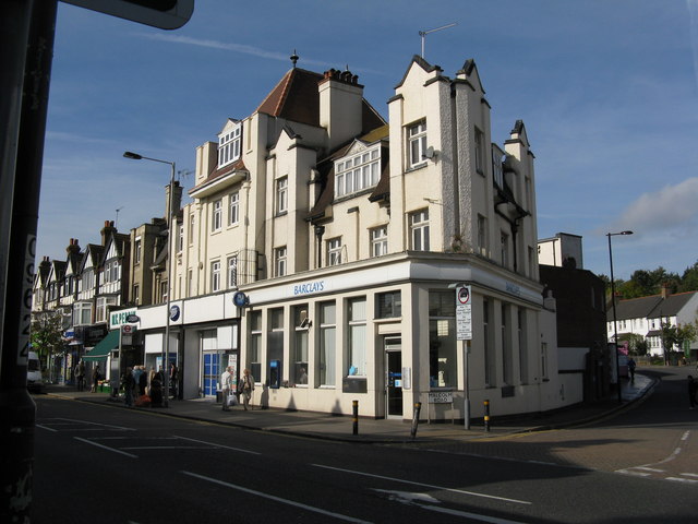
1102:== {{int:filedesc}} == {{Information |description={{en|1=Barclay's Bank, Coulsdon At the corner of Malcolm Road and Brighton Road.}} |date=2008-10-10 |source=From |author=[http://www.geograph.org.
83:
51:
780:
595:
918:
715:
581:
545:
247:
197:
1084:
1079:
750:
42:
282:
1257:
This file contains additional information, probably added from the digital camera or scanner used to create or digitize it.
372:
493:
1013:
976:
939:
884:
850:
821:
794:
728:
699:
636:
609:
529:
501:
486:
473:
911:
758:
743:
665:
565:
446:
429:
269:
328:
1260:
If the file has been modified from its original state, some details may not fully reflect the modified file.
371:– If you remix, transform, or build upon the material, you must distribute your contributions under the
289:
on the
Geograph website for the photographer's contact details. The copyright on this image is owned by
1095:
325:
787:"}},"text\/plain":{"en":{"P7787":"292 degree"}}}}": -->
602:"}},"text\/plain":{"en":{"P7787":"292 degree"}}}}": -->
91:
765:
735:
508:
1134:
1224:
1174:
253:
203:
294:
78:
135:
187:
237:
146:
156:
1116:
274:
126:
Barclay's Bank, Coulsdon At the corner of
Malcolm Road and Brighton Road.
1244:
286:
1052:
Click on a date/time to view the file as it appeared at that time.
239:
189:
214:
164:
66:
52:
Barclay's_Bank,_Coulsdon_-_geograph.org.uk_-_1000058.jpg
224:
51° 19′ 16″ N, 0° 08′ 17″ W
174:
51° 19′ 15″ N, 0° 08′ 14″ W
116:
Barclay's Bank, Coulsdon - geograph.org.uk - 1000058.jpg
413:
Add a one-line explanation of what this file represents
1214:
1144:
1234:
1204:
1194:
1184:
1164:
1154:
110:
90:
Commons is a freely licensed media file repository.
582:
Creative
Commons Attribution-ShareAlike 2.0 Generic
56:(640 × 480 pixels, file size: 70 KB, MIME type:
382:https://creativecommons.org/licenses/by-sa/2.0
71:
388:Creative Commons Attribution-Share Alike 2.0
306:
8:
784:
599:
348:– to copy, distribute and transmit the work
1262:
1054:
409:
1127:The following other wikis use this file:
766:https://www.geograph.org.uk/photo/1000058
900:d722332c2ca74816bb0c61b2c0d49499a9f00e4f
1264:
1114:
1027:
1011:
990:
974:
953:
937:
898:
882:
864:
848:
808:
792:
713:
697:
679:
663:
623:
607:
579:
563:
543:
527:
509:https://www.geograph.org.uk/profile/796
460:
444:
427:
424:
405:
398:
217:
167:
246:View this and other nearby images on:
196:View this and other nearby images on:
7:
293:and is licensed for reuse under the
1112:The following page uses this file:
1043:
329:Attribution-Share Alike 2.0 Generic
317:
312:
297:Attribution-ShareAlike 2.0 license.
1255:
418:
412:
303:
280:
120:
103:
49:
417:
610:coordinates of the point of view
403:
359:Under the following conditions:
324:This file is licensed under the
316:
311:
305:
273:
252:
238:
230:
202:
188:
180:
70:
31:
21:
400:
121:
46:No higher resolution available.
14:
716:file available on the internet
399:
281:This image was taken from the
26:
1:
795:coordinates of depicted place
36:
751:Geograph Britain and Ireland
487:object of statement has role
425:Items portrayed in this file
229:
179:
1211:Usage on lld.wikipedia.org
1141:Usage on ceb.wikipedia.org
1131:Usage on azb.wikipedia.org
1286:
1241:Usage on zh.wikipedia.org
1231:Usage on www.wikidata.org
1221:Usage on ur.wikipedia.org
1201:Usage on it.wikipedia.org
1191:Usage on ga.wikipedia.org
1181:Usage on fr.wikipedia.org
1171:Usage on fa.wikipedia.org
1161:Usage on eu.wikipedia.org
1151:Usage on es.wikipedia.org
625:51°19'14.95"N, 0°8'13.92"W
373:same or compatible license
1044:
16:
810:51°19'16.0"N, 0°8'16.8"W
729:geograph.org.uk image ID
402:
339:
77:This is a file from the
1101:
1080:06:43, 23 February 2011
152:
141:
134:
131:
113:
81:. Information from its
287:this photograph's page
258:51.321100; -0.138000
208:51.320820; -0.137200
84:description page there
912:determination method
354:– to adapt the work
474:author name string
1273:
1272:
1123:Global file usage
1105:
786:
601:
566:copyright license
411:
302:
301:
285:collection. See
263:
262:
213:
212:
162:
161:
99:
98:
79:Wikimedia Commons
32:Global file usage
1277:
1263:
1092:
1032:
995:
958:
921:
916:
832:
831:
826:
768:
763:
759:described at URL
753:
748:
738:
733:
647:
646:
641:
530:copyright status
511:
506:
496:
491:
481:
478:
395:
392:
389:
386:
383:
375:as the original.
337:
326:Creative Commons
320:
319:
315:
314:
309:
308:
295:Creative Commons
283:Geograph project
277:
270:
259:
256:
242:
241:
235:
234:
233:
227:
226:
215:
209:
206:
192:
191:
185:
184:
183:
177:
176:
165:
137:
125:
117:
111:
95:
74:
73:
67:
61:
59:
1285:
1284:
1280:
1279:
1278:
1276:
1275:
1274:
1251:
1121:
1106:
1098:
1090:
1046:
1045:
1042:
1041:
1040:
1039:
1038:
1037:
1036:
1035:
1033:
1030:
1020:
1019:
1018:
1016:
1005:
1004:
1003:
1002:
1001:
1000:
999:
998:
996:
993:
983:
982:
981:
979:
968:
967:
966:
965:
964:
963:
962:
961:
959:
956:
946:
945:
944:
942:
931:
930:
929:
928:
927:
926:
925:
924:
923:
922:
917:
914:
905:
904:
903:
901:
891:
890:
889:
887:
876:
875:
874:
873:
872:
871:
870:
869:
867:
857:
856:
855:
853:
842:
841:
840:
839:
838:
837:
836:
835:
834:
833:
829:
827:
824:
815:
814:
813:
811:
801:
800:
799:
797:
778:
777:
776:
775:
774:
773:
772:
771:
770:
769:
764:
761:
755:
754:
749:
746:
740:
739:
734:
731:
722:
721:
720:
718:
706:
705:
704:
702:
691:
690:
689:
688:
687:
686:
685:
684:
682:
681:10 October 2008
672:
671:
670:
668:
657:
656:
655:
654:
653:
652:
651:
650:
649:
648:
644:
642:
639:
630:
629:
628:
626:
616:
615:
614:
612:
593:
592:
591:
590:
589:
588:
587:
586:
584:
572:
571:
570:
568:
557:
556:
555:
554:
553:
552:
551:
550:
548:
536:
535:
534:
532:
521:
520:
519:
518:
517:
516:
515:
514:
513:
512:
507:
504:
498:
497:
492:
489:
483:
482:
480:Dr Neil Clifton
479:
476:
467:
466:
465:
463:
453:
452:
451:
449:
438:
437:
436:
435:
434:
432:
416:
415:
414:
397:
396:
393:
390:
387:
384:
381:
380:
338:
336:Dr Neil Clifton
335:
332:
321:
298:
291:Dr Neil Clifton
268:
257:
231:
222:
221:
218:Object location
207:
181:
172:
171:
168:Camera location
163:
157:Dr Neil Clifton
147:geograph.org.uk
136:10 October 2008
127:
115:
108:
101:
100:
89:
88:
87:is shown below.
63:
57:
55:
48:
47:
12:
11:
5:
1283:
1281:
1271:
1270:
1267:
1254:
1250:
1249:
1248:
1247:
1239:
1238:
1237:
1229:
1228:
1227:
1219:
1218:
1217:
1209:
1208:
1207:
1199:
1198:
1197:
1189:
1188:
1187:
1179:
1178:
1177:
1169:
1168:
1167:
1159:
1158:
1157:
1149:
1148:
1147:
1139:
1138:
1137:
1125:
1124:
1120:
1119:
1110:
1109:
1104:
1103:
1100:
1096:
1093:
1087:
1082:
1077:
1073:
1072:
1069:
1066:
1063:
1060:
1057:
1050:
1049:
1034:
1028:
1026:
1025:
1024:
1023:
1022:
1021:
1017:
1012:
1010:
1009:
1008:
1007:
1006:
997:
991:
989:
988:
987:
986:
985:
984:
980:
975:
973:
972:
971:
970:
969:
960:
954:
952:
951:
950:
949:
948:
947:
943:
938:
936:
935:
934:
933:
932:
910:
909:
908:
907:
906:
902:
899:
897:
896:
895:
894:
893:
892:
888:
883:
881:
880:
879:
878:
877:
868:
865:
863:
862:
861:
860:
859:
858:
854:
849:
847:
846:
845:
844:
843:
820:
819:
818:
817:
816:
812:
809:
807:
806:
805:
804:
803:
802:
798:
793:
791:
790:
789:
788:
782:
757:
756:
742:
741:
727:
726:
725:
724:
723:
719:
714:
712:
711:
710:
709:
708:
707:
703:
700:source of file
698:
696:
695:
694:
693:
692:
683:
680:
678:
677:
676:
675:
674:
673:
669:
664:
662:
661:
660:
659:
658:
635:
634:
633:
632:
631:
627:
624:
622:
621:
620:
619:
618:
617:
613:
608:
606:
605:
604:
603:
597:
585:
580:
578:
577:
576:
575:
574:
573:
569:
564:
562:
561:
560:
559:
558:
549:
544:
542:
541:
540:
539:
538:
537:
533:
528:
526:
525:
524:
523:
522:
500:
499:
485:
484:
472:
471:
470:
469:
468:
464:
461:
459:
458:
457:
456:
455:
454:
450:
445:
443:
442:
441:
440:
439:
433:
428:
426:
423:
422:
421:
420:
419:
408:
407:
404:
401:
379:
378:
377:
376:
366:
357:
356:
355:
349:
342:You are free:
333:
323:
322:
304:
300:
299:
278:
267:
264:
261:
260:
250:
244:
219:
211:
210:
200:
194:
169:
160:
159:
154:
150:
149:
143:
139:
138:
133:
129:
128:
118:
109:
107:
104:
102:
97:
96:
75:
65:
64:
45:
41:
40:
39:
34:
29:
24:
19:
13:
10:
9:
6:
4:
3:
2:
1282:
1268:
1265:
1261:
1258:
1252:
1246:
1243:
1242:
1240:
1236:
1233:
1232:
1230:
1226:
1223:
1222:
1220:
1216:
1213:
1212:
1210:
1206:
1203:
1202:
1200:
1196:
1193:
1192:
1190:
1186:
1183:
1182:
1180:
1176:
1173:
1172:
1170:
1166:
1163:
1162:
1160:
1156:
1153:
1152:
1150:
1146:
1143:
1142:
1140:
1136:
1133:
1132:
1130:
1129:
1128:
1122:
1118:
1115:
1113:
1107:
1099:
1094:
1088:
1086:
1083:
1081:
1078:
1075:
1074:
1070:
1067:
1064:
1061:
1058:
1056:
1055:
1053:
1047:
1015:
978:
941:
920:
913:
886:
852:
823:
796:
767:
760:
752:
745:
737:
730:
717:
701:
667:
638:
611:
583:
567:
547:
531:
510:
503:
495:
488:
475:
448:
431:
385:CC BY-SA 2.0
374:
370:
367:
364:
361:
360:
358:
353:
350:
347:
344:
343:
341:
340:
334:Attribution:
330:
327:
310:
296:
292:
288:
284:
279:
276:
272:
271:
265:
255:
251:
249:
248:OpenStreetMap
245:
243:
225:
220:
216:
205:
201:
199:
198:OpenStreetMap
195:
193:
175:
170:
166:
158:
155:
151:
148:
144:
140:
130:
124:
119:
112:
105:
93:
86:
85:
80:
76:
69:
68:
62:
53:
44:
38:
35:
33:
30:
28:
25:
23:
20:
18:
15:
1259:
1256:
1126:
1111:
1051:
1048:File history
494:photographer
368:
362:
351:
345:
290:
228:
178:
122:
92:You can help
82:
50:
22:File history
1097:GeographBot
546:copyrighted
369:share alike
363:attribution
114:Description
1266:_error
1108:File usage
1089:640 × 480
1065:Dimensions
866:image/jpeg
851:media type
462:some value
58:image/jpeg
27:File usage
1062:Thumbnail
1059:Date/Time
940:data size
666:inception
266:Licensing
123:English:
1253:Metadata
1235:Q2463831
1215:Coulsdon
1205:Coulsdon
1195:Coulsdon
1185:Coulsdon
1165:Coulsdon
1155:Coulsdon
1145:Coulsdon
1117:Coulsdon
885:checksum
744:operator
406:Captions
352:to remix
346:to share
331:license.
37:Metadata
1225:کؤلسڈوم
1175:کولسدون
1135:کولسدون
1091:(70 KB)
1076:current
1071:Comment
955:71,501
822:heading
781:heading
736:1000058
637:heading
596:heading
447:creator
430:depicts
410:English
106:Summary
54:
977:height
830:degree
785:degree
645:degree
600:degree
236:
186:
153:Author
142:Source
1031:pixel
1014:width
994:pixel
919:SHA-1
145:From
1068:User
1029:640
992:480
957:byte
828:292
643:292
394:true
391:true
132:Date
17:File
1245:寇斯頓
502:URL
915::
825::
762::
747::
732::
640::
505::
490::
477::
1269:0
94:.
60:)
Text is available under the Creative Commons Attribution-ShareAlike License. Additional terms may apply.
_heading:292.00&language=en)
_heading:292.00&language=en)
