38:
227:
233:
238:
94:
822:
985:
285:– You must give appropriate credit, provide a link to the license, and indicate if changes were made. You may do so in any reasonable manner, but not in any way that suggests the licensor endorses you or your use.
1015:
932:
990:
68:
64:
60:
56:
52:
48:
42:
927:
105:
77:
1010:
1000:
843:, showing electoral wards. Equirectangular map projection on WGS 84 datum, with N/S stretched 160% Geographic limits: *West: 0.32W *East: 0.12W *North: 51
1005:
892:
1135:
1120:
1035:
1030:
340:
335:
330:
216:
907:
655:
533:
497:
1025:
955:
292:
922:
750:
713:
676:
621:
587:
481:
455:
440:
425:
648:
553:
517:
398:
381:
902:
867:
821:
816:
37:
139:
447:
960:
840:
248:
897:
872:
980:
887:
853:
The following pages on the
English Knowledge (XXG) use this file (pages on other projects are not listed):
912:
862:
291:– If you remix, transform, or build upon the material, you must distribute your contributions under the
1165:
245:
950:
1160:
185:
113:
432:
882:
182:
877:
857:
832:
917:
100:
1136:
Cerkiew św. Cyryla
Turowskiego i Wszystkich Patronów Narodu Białoruskiego w Londynie
995:
970:
205:
171:
1115:
1080:
1150:
1145:
1130:
1125:
145:
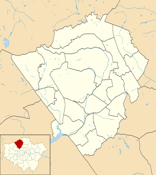
Equirectangular map projection on WGS 84 datum, with N/S stretched 160%
1110:
1055:
1100:
1095:
1060:
1090:
789:
Click on a date/time to view the file as it appeared at that time.
1121:
Katedra greckoprawosławna Świętego Krzyża i św. Michała w
Londynie
256:
Contains
Ordnance Survey data © Crown copyright and database right
1045:
88:
1075:
82:(SVG file, nominally 1,131 × 1,266 pixels, file size: 651 KB)
1105:
1085:
1070:
1065:
1166:
Module:Location map/data/United
Kingdom London Barnet/doc
933:
Module:Location map/data/United
Kingdom London Barnet/doc
1050:
1036:モジュール:Location map/data/United Kingdom London Barnet/doc
365:
Add a one-line explanation of what this file represents
1161:
Module:Location map/data/United
Kingdom London Barnet
928:
Module:Location map/data/United
Kingdom London Barnet
1031:モジュール:Location map/data/United Kingdom London Barnet
534:
Creative
Commons Attribution-ShareAlike 3.0 Unported
127:
112:
Commons is a freely licensed media file repository.
956:پودمان:Location map United Kingdom London Barnet
133:Barnet London UK blank ward map 2002 to 2022.svg
961:الگو:Location map United Kingdom London Barnet
302:https://creativecommons.org/licenses/by-sa/3.0
93:
308:Creative Commons Attribution-Share Alike 3.0
226:
8:
839:{{Information |Description=Blank map of the
433:https://commons.wikimedia.org/user:Nilfanion
268:– to copy, distribute and transmit the work
195:Water data from VectorMap District product.
41:Size of this PNG preview of this SVG file:
791:
361:
943:The following other wikis use this file:
893:List of electoral wards in Greater London
637:c9b3ff7da289e4ac73aeb93395fcb4bf99b7799c
855:
764:
748:
727:
711:
690:
674:
635:
619:
601:
585:
567:
551:
531:
515:
495:
479:
412:
396:
379:
376:
357:
350:
341:Barnet UK local election 2010 map.svg
336:Barnet UK local election 2006 map.svg
331:Barnet UK local election 2002 map.svg
192:Ward data from Boundary-Line product.
7:
249:Attribution-Share Alike 3.0 Unported
780:
237:
232:
370:
364:
223:
125:
75:
986:המוזיאון לעיצוב ביתי ולארכיטקטורה
908:North London Coroner's Court
369:
1016:בית הספר ללימודי יהדות של לונדון
355:
279:Under the following conditions:
244:This file is licensed under the
236:
231:
225:
92:
31:
21:
352:
326:Derivative works of this file:
14:
351:
26:
1:
971:Modèle:Géolocalisation/Barnet
923:The Red Lion, Chipping Barnet
1116:Golders Green (stacja metra)
1081:East Finchley (stacja metra)
377:Items portrayed in this file
142:, showing electoral wards.
1184:
1157:Usage on si.wikipedia.org
1142:Usage on pl.wikibooks.org
1111:Brent Cross (stacja metra)
1056:High Barnet (stacja metra)
1042:Usage on pl.wikipedia.org
1022:Usage on ja.wikipedia.org
991:מוזיאון חיל האוויר המלכותי
977:Usage on he.wikipedia.org
967:Usage on fr.wikipedia.org
947:Usage on fa.wikipedia.org
903:Mitre Inn, Chipping Barnet
868:Finchley Memorial Hospital
293:same or compatible license
781:
16:
1101:Colindale (stacja metra)
1096:Burnt Oak (stacja metra)
1061:Totteridge and Whetstone
841:London Borough of Barnet
354:
259:
140:London Borough of Barnet
99:This is a file from the
898:London Gateway services
873:Friern Barnet Town Hall
838:
321:
211:
201:
177:
170:
167:
130:
103:. Information from its
1151:Moduł:Mapa/dane/GB-BNE
1146:Moduł:Mapa/dane/Barnet
1131:Moduł:Mapa/dane/GB-BNE
1126:Moduł:Mapa/dane/Barnet
1091:Edgware (stacja metra)
1006:ישיבת עץ חיים (לונדון)
888:Jewish Military Museum
106:description page there
1011:בית הכנסת בגבעת דוליס
1001:תבנית:מפת מיקום/בארנט
913:Rising Sun, Mill Hill
863:East Barnet Town Hall
649:determination method
69:1,131 × 1,266 pixels
65:1,830 × 2,048 pixels
817:21:50, 28 July 2011
274:– to adapt the work
148:Geographic limits:
47:Other resolutions:
456:author name string
441:Wikimedia username
61:915 × 1,024 pixels
1046:Underhill Stadium
939:Global file usage
846:
518:copyright license
363:
348:
347:
220:
217:Reusing this file
138:Blank map of the
121:
120:
101:Wikimedia Commons
32:Global file usage
1175:
1076:Finchley Central
883:Hendon Town Hall
829:
769:
732:
695:
658:
653:
482:copyright status
463:
460:
450:
445:
435:
430:
315:
312:
309:
306:
303:
295:as the original.
257:
246:Creative Commons
240:
239:
235:
234:
229:
228:
214:
173:
134:
128:
117:
96:
95:
89:
83:
72:
57:686 × 768 pixels
53:429 × 480 pixels
49:214 × 240 pixels
43:536 × 600 pixels
1183:
1182:
1178:
1177:
1176:
1174:
1173:
1172:
937:
878:Friern Hospital
858:Barnet Hospital
854:
847:
835:
827:
783:
782:
779:
778:
777:
776:
775:
774:
773:
772:
770:
767:
757:
756:
755:
753:
742:
741:
740:
739:
738:
737:
736:
735:
733:
730:
720:
719:
718:
716:
705:
704:
703:
702:
701:
700:
699:
698:
696:
693:
683:
682:
681:
679:
668:
667:
666:
665:
664:
663:
662:
661:
660:
659:
654:
651:
642:
641:
640:
638:
628:
627:
626:
624:
613:
612:
611:
610:
609:
608:
607:
606:
604:
594:
593:
592:
590:
579:
578:
577:
576:
575:
574:
573:
572:
570:
560:
559:
558:
556:
545:
544:
543:
542:
541:
540:
539:
538:
536:
524:
523:
522:
520:
509:
508:
507:
506:
505:
504:
503:
502:
500:
488:
487:
486:
484:
473:
472:
471:
470:
469:
468:
467:
466:
465:
464:
461:
458:
452:
451:
446:
443:
437:
436:
431:
428:
419:
418:
417:
415:
405:
404:
403:
401:
390:
389:
388:
387:
386:
384:
368:
367:
366:
349:
317:
316:
313:
310:
307:
304:
301:
300:
258:
255:
252:
241:
183:Ordnance Survey
132:
123:
122:
111:
110:
109:is shown below.
85:
81:
74:
73:
46:
12:
11:
5:
1181:
1179:
1171:
1170:
1169:
1168:
1163:
1155:
1154:
1153:
1148:
1140:
1139:
1138:
1133:
1128:
1123:
1118:
1113:
1108:
1106:Hendon Central
1103:
1098:
1093:
1088:
1086:Mill Hill East
1083:
1078:
1073:
1068:
1063:
1058:
1053:
1048:
1040:
1039:
1038:
1033:
1028:
1020:
1019:
1018:
1013:
1008:
1003:
998:
993:
988:
983:
975:
974:
973:
965:
964:
963:
958:
953:
941:
940:
936:
935:
930:
925:
920:
915:
910:
905:
900:
895:
890:
885:
880:
875:
870:
865:
860:
852:
851:
850:
845:
844:
837:
833:
830:
826:1,131 × 1,266
824:
819:
814:
810:
809:
806:
803:
800:
797:
794:
787:
786:
771:
765:
763:
762:
761:
760:
759:
758:
754:
749:
747:
746:
745:
744:
743:
734:
728:
726:
725:
724:
723:
722:
721:
717:
712:
710:
709:
708:
707:
706:
697:
691:
689:
688:
687:
686:
685:
684:
680:
675:
673:
672:
671:
670:
669:
647:
646:
645:
644:
643:
639:
636:
634:
633:
632:
631:
630:
629:
625:
620:
618:
617:
616:
615:
614:
605:
602:
600:
599:
598:
597:
596:
595:
591:
586:
584:
583:
582:
581:
580:
571:
568:
566:
565:
564:
563:
562:
561:
557:
552:
550:
549:
548:
547:
546:
537:
532:
530:
529:
528:
527:
526:
525:
521:
516:
514:
513:
512:
511:
510:
501:
496:
494:
493:
492:
491:
490:
489:
485:
480:
478:
477:
476:
475:
474:
454:
453:
439:
438:
424:
423:
422:
421:
420:
416:
413:
411:
410:
409:
408:
407:
406:
402:
397:
395:
394:
393:
392:
391:
385:
380:
378:
375:
374:
373:
372:
371:
360:
359:
356:
353:
346:
345:
344:
343:
338:
333:
323:
322:Other versions
319:
318:
299:
298:
297:
296:
286:
277:
276:
275:
269:
262:You are free:
253:
243:
242:
224:
221:
209:
208:
203:
199:
198:
197:
196:
193:
179:
175:
174:
169:
165:
164:
163:
162:
159:
156:
153:
135:
126:
124:
119:
118:
97:
87:
86:
40:
36:
35:
34:
29:
24:
19:
13:
10:
9:
6:
4:
3:
2:
1180:
1167:
1164:
1162:
1159:
1158:
1156:
1152:
1149:
1147:
1144:
1143:
1141:
1137:
1134:
1132:
1129:
1127:
1124:
1122:
1119:
1117:
1114:
1112:
1109:
1107:
1104:
1102:
1099:
1097:
1094:
1092:
1089:
1087:
1084:
1082:
1079:
1077:
1074:
1072:
1071:West Finchley
1069:
1067:
1066:Woodside Park
1064:
1062:
1059:
1057:
1054:
1052:
1049:
1047:
1044:
1043:
1041:
1037:
1034:
1032:
1029:
1027:
1024:
1023:
1021:
1017:
1014:
1012:
1009:
1007:
1004:
1002:
999:
997:
994:
992:
989:
987:
984:
982:
979:
978:
976:
972:
969:
968:
966:
962:
959:
957:
954:
952:
949:
948:
946:
945:
944:
938:
934:
931:
929:
926:
924:
921:
919:
918:Spaniards Inn
916:
914:
911:
909:
906:
904:
901:
899:
896:
894:
891:
889:
886:
884:
881:
879:
876:
874:
871:
869:
866:
864:
861:
859:
856:
848:
842:
836:
831:
825:
823:
820:
818:
815:
812:
811:
807:
804:
801:
798:
795:
793:
792:
790:
784:
752:
715:
678:
657:
650:
623:
603:image/svg+xml
589:
555:
535:
519:
499:
483:
457:
449:
442:
434:
427:
400:
383:
342:
339:
337:
334:
332:
329:
328:
327:
324:
320:
305:CC BY-SA 3.0
294:
290:
287:
284:
281:
280:
278:
273:
270:
267:
264:
263:
261:
260:
254:Attribution:
250:
247:
230:
222:
218:
213:
210:
207:
204:
200:
194:
191:
190:
189:
187:
184:
180:
176:
166:
161:South: 51.54N
160:
158:North: 51.68N
157:
154:
151:
150:
149:
146:
143:
141:
136:
129:
115:
108:
107:
102:
98:
91:
90:
84:
79:
78:Original file
70:
66:
62:
58:
54:
50:
44:
39:
33:
30:
28:
25:
23:
20:
18:
15:
996:פינצ'לי
942:
788:
785:File history
569:28 July 2011
325:
288:
282:
271:
265:
181:
172:28 July 2011
147:
144:
137:
114:You can help
104:
76:
22:File history
1051:Brent Cross
981:גולדרס גרין
498:copyrighted
289:share alike
283:attribution
155:East: 0.12W
152:West: 0.32W
131:Description
951:کنوود هاوس
849:File usage
802:Dimensions
588:media type
414:some value
212:Permission
27:File usage
1026:ウエスト・ヘンドン
834:Nilfanion
799:Thumbnail
796:Date/Time
677:data size
554:inception
462:Nilfanion
448:Nilfanion
206:Nilfanion
828:(651 KB)
692:666,381
622:checksum
358:Captions
272:to remix
266:to share
251:license.
186:OpenData
813:current
808:Comment
399:creator
382:depicts
362:English
80:
766:1,131
729:1,266
714:height
202:Author
178:Source
768:pixel
751:width
731:pixel
656:SHA-1
805:User
694:byte
314:true
311:true
168:Date
17:File
426:URL
652::
459::
444::
429::
188:.
67:|
63:|
59:|
55:|
51:|
45:.
219:)
215:(
116:.
71:.
Text is available under the Creative Commons Attribution-ShareAlike License. Additional terms may apply.
