272:
205:
197:
219:
240:
278:
283:
67:
597:"}},"text\/plain":{"en":{"":"heading"}}},"{\"value\":{\"amount\":\"+67\",\"unit\":\"http:\\\/\\\/www.wikidata.org\\\/entity\\\/Q28390\"},\"type\":\"quantity\"}":{"text\/html":{"en":{"P7787":"67
593:
330:– You must give appropriate credit, provide a link to the license, and indicate if changes were made. You may do so in any reasonable manner, but not in any way that suggests the licensor endorses you or your use.
1003:== {{int:filedesc}} == {{Information |Description={{en|1=Barrhead Station View NE, towards Glasgow, on the Glasgow - Kilmarnock main line (formerly G&SW & Caledonian Joint).}} |Source=From |Date=1
188:
38:
594:
78:
46:
1072:
166:
819:
680:
546:
510:
212:
700:
247:
1028:
This file contains additional information, probably added from the digital camera or scanner used to create or digitize it.
337:
473:
914:
877:
840:
785:
751:
708:
664:
635:
608:
494:
466:
451:
438:
812:
723:
693:
566:
530:
411:
394:
234:
1017:
293:
1031:
If the file has been modified from its original state, some details may not fully reflect the modified file.
125:
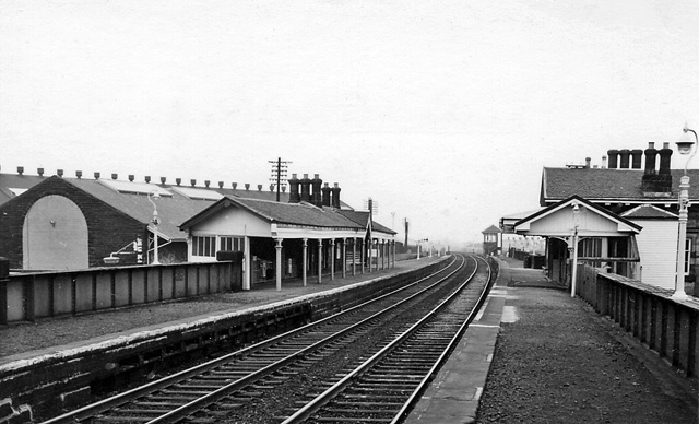
View NE, towards
Glasgow, on the Glasgow - Kilmarnock main line (formerly G&SW & Caledonian Joint).
1013:
The following pages on the
English Knowledge (XXG) use this file (pages on other projects are not listed):
336:– If you remix, transform, or build upon the material, you must distribute your contributions under the
254:
on the
Geograph website for the photographer's contact details. The copyright on this image is owned by
985:
980:
37:
290:
601:"}},"text\/plain":{"en":{"P7787":"67 degree"}}}}": -->
86:
730:
715:
458:
218:
259:
73:
202:
1087:
996:
134:
155:
145:
239:
251:
953:
Click on a date/time to view the file as it appeared at that time.
204:
189:
55° 48′ 15.42″ N, 4° 23′ 51.49″ W
179:
61:
378:
Add a one-line explanation of what this file represents
173:
Creative
Commons Attribution Share-alike license 2.0
105:
85:
Commons is a freely licensed media file repository.
547:
Creative
Commons Attribution-ShareAlike 2.0 Generic
51:(640 × 388 pixels, file size: 110 KB, MIME type:
347:https://creativecommons.org/licenses/by-sa/2.0
66:
353:Creative Commons Attribution-Share Alike 2.0
271:
8:
598:
313:– to copy, distribute and transmit the work
1033:
955:
374:
731:https://www.geograph.org.uk/photo/1764550
459:https://www.geograph.org.uk/profile/44502
801:04c953cc91d494ffb14f5a737e16b587bd95b6a0
1085:
1077:
1067:
1059:
1051:
1043:
1035:
1015:
928:
912:
891:
875:
854:
838:
799:
783:
765:
749:
678:
662:
622:
606:
580:
564:
544:
528:
508:
492:
425:
409:
392:
389:
370:
363:
182:
211:View this and other nearby images on:
7:
1073:Adobe Photoshop Elements 3.0 Windows
258:and is licensed for reuse under the
111:Barrhead railway station 1764550.jpg
47:Barrhead_railway_station_1764550.jpg
944:
294:Attribution-Share Alike 2.0 Generic
282:
277:
262:Attribution-ShareAlike 2.0 license.
1026:
383:
377:
268:
245:
115:
98:
44:
382:
609:coordinates of the point of view
368:
324:Under the following conditions:
289:This file is licensed under the
281:
276:
270:
238:
217:
203:
195:
65:
21:
365:
116:
41:No higher resolution available.
14:
681:file available on the internet
364:
246:This image was taken from the
26:
1:
624:55°48'15.422"N, 4°23'51.486"W
31:
701:Geograph Britain and Ireland
467:object of statement has role
390:Items portrayed in this file
194:
1109:
338:same or compatible license
1079:File change date and time
945:
16:
1018:Barrhead railway station
709:geograph.org.uk image ID
367:
304:
72:This is a file from the
1002:
161:
151:
140:
133:
130:
108:
76:. Information from its
981:13:36, 10 January 2011
252:this photograph's page
223:55.804284; -4.397635
79:description page there
1053:Horizontal resolution
1082:19:41, 21 March 2010
813:determination method
1061:Vertical resolution
1040:EPSON scanner image
319:– to adapt the work
439:author name string
1096:
1095:
1006:
600:
531:copyright license
376:
267:
266:
250:collection. See
228:
227:
177:
176:
170:
167:Reusing this file
122:Barrhead Station.
94:
93:
74:Wikimedia Commons
1100:
1034:
993:
933:
896:
859:
822:
817:
733:
728:
724:described at URL
718:
713:
703:
698:
646:
645:
640:
495:copyright status
476:
471:
461:
456:
446:
443:
360:
357:
354:
351:
348:
340:as the original.
302:
291:Creative Commons
285:
284:
280:
279:
274:
273:
260:Creative Commons
248:Geograph project
242:
235:
224:
221:
207:
206:
200:
199:
198:
192:
191:
180:
164:
136:
120:
112:
106:
90:
69:
68:
62:
56:
54:
1108:
1107:
1103:
1102:
1101:
1099:
1098:
1097:
1022:
1014:
1007:
999:
991:
947:
946:
943:
942:
941:
940:
939:
938:
937:
936:
934:
931:
921:
920:
919:
917:
906:
905:
904:
903:
902:
901:
900:
899:
897:
894:
884:
883:
882:
880:
869:
868:
867:
866:
865:
864:
863:
862:
860:
857:
847:
846:
845:
843:
832:
831:
830:
829:
828:
827:
826:
825:
824:
823:
818:
815:
806:
805:
804:
802:
792:
791:
790:
788:
777:
776:
775:
774:
773:
772:
771:
770:
768:
758:
757:
756:
754:
743:
742:
741:
740:
739:
738:
737:
736:
735:
734:
729:
726:
720:
719:
714:
711:
705:
704:
699:
696:
687:
686:
685:
683:
671:
670:
669:
667:
656:
655:
654:
653:
652:
651:
650:
649:
648:
647:
643:
641:
638:
629:
628:
627:
625:
615:
614:
613:
611:
592:
591:
590:
589:
588:
587:
586:
585:
583:
573:
572:
571:
569:
558:
557:
556:
555:
554:
553:
552:
551:
549:
537:
536:
535:
533:
522:
521:
520:
519:
518:
517:
516:
515:
513:
501:
500:
499:
497:
486:
485:
484:
483:
482:
481:
480:
479:
478:
477:
472:
469:
463:
462:
457:
454:
448:
447:
444:
441:
432:
431:
430:
428:
418:
417:
416:
414:
403:
402:
401:
400:
399:
397:
381:
380:
379:
362:
361:
358:
355:
352:
349:
346:
345:
303:
300:
297:
286:
263:
233:
222:
196:
187:
186:
183:Camera location
178:
146:geograph.org.uk
126:
110:
103:
96:
95:
84:
83:
82:is shown below.
58:
52:
50:
43:
42:
12:
11:
5:
1106:
1104:
1094:
1093:
1090:
1084:
1083:
1080:
1076:
1075:
1070:
1066:
1065:
1062:
1058:
1057:
1054:
1050:
1049:
1046:
1042:
1041:
1038:
1025:
1021:
1020:
1012:
1011:
1010:
1005:
1004:
1001:
997:
994:
988:
983:
978:
974:
973:
970:
967:
964:
961:
958:
951:
950:
935:
929:
927:
926:
925:
924:
923:
922:
918:
913:
911:
910:
909:
908:
907:
898:
892:
890:
889:
888:
887:
886:
885:
881:
876:
874:
873:
872:
871:
870:
861:
855:
853:
852:
851:
850:
849:
848:
844:
839:
837:
836:
835:
834:
833:
811:
810:
809:
808:
807:
803:
800:
798:
797:
796:
795:
794:
793:
789:
784:
782:
781:
780:
779:
778:
769:
766:
764:
763:
762:
761:
760:
759:
755:
750:
748:
747:
746:
745:
744:
722:
721:
707:
706:
692:
691:
690:
689:
688:
684:
679:
677:
676:
675:
674:
673:
672:
668:
665:source of file
663:
661:
660:
659:
658:
657:
634:
633:
632:
631:
630:
626:
623:
621:
620:
619:
618:
617:
616:
612:
607:
605:
604:
603:
602:
596:
584:
581:
579:
578:
577:
576:
575:
574:
570:
565:
563:
562:
561:
560:
559:
550:
545:
543:
542:
541:
540:
539:
538:
534:
529:
527:
526:
525:
524:
523:
514:
509:
507:
506:
505:
504:
503:
502:
498:
493:
491:
490:
489:
488:
487:
465:
464:
450:
449:
445:Ben Brooksbank
437:
436:
435:
434:
433:
429:
426:
424:
423:
422:
421:
420:
419:
415:
410:
408:
407:
406:
405:
404:
398:
393:
391:
388:
387:
386:
385:
384:
373:
372:
369:
366:
344:
343:
342:
341:
331:
322:
321:
320:
314:
307:You are free:
301:Ben Brooksbank
298:
288:
287:
269:
265:
264:
256:Ben Brooksbank
243:
232:
229:
226:
225:
215:
209:
184:
175:
174:
171:
159:
158:
156:Ben Brooksbank
153:
149:
148:
142:
138:
137:
132:
128:
127:
113:
104:
102:
99:
97:
92:
91:
70:
60:
59:
40:
36:
35:
34:
29:
24:
19:
13:
10:
9:
6:
4:
3:
2:
1105:
1091:
1089:
1086:
1081:
1078:
1074:
1071:
1069:Software used
1068:
1063:
1060:
1055:
1052:
1047:
1044:
1039:
1036:
1032:
1029:
1023:
1019:
1016:
1008:
1000:
995:
989:
987:
984:
982:
979:
976:
975:
971:
968:
965:
962:
959:
957:
956:
954:
948:
916:
879:
842:
821:
814:
787:
753:
732:
725:
717:
710:
702:
695:
682:
666:
637:
610:
582:21 March 1970
568:
548:
532:
512:
496:
475:
468:
460:
453:
440:
413:
396:
350:CC BY-SA 2.0
339:
335:
332:
329:
326:
325:
323:
318:
315:
312:
309:
308:
306:
305:
299:Attribution:
295:
292:
275:
261:
257:
253:
249:
244:
241:
237:
236:
230:
220:
216:
214:
213:OpenStreetMap
210:
208:
190:
185:
181:
172:
168:
163:
160:
157:
154:
150:
147:
143:
139:
135:21 March 1970
129:
124:
123:
119:
114:
107:
100:
88:
81:
80:
75:
71:
64:
63:
57:
48:
39:
33:
30:
28:
25:
23:
20:
18:
15:
1092:Uncalibrated
1030:
1027:
952:
949:File history
474:photographer
333:
327:
316:
310:
255:
193:
121:
117:
87:You can help
77:
45:
22:File history
1088:Color space
1045:Orientation
1037:Image title
511:copyrighted
334:share alike
328:attribution
109:Description
1009:File usage
990:640 × 388
966:Dimensions
767:image/jpeg
752:media type
427:some value
162:Permission
53:image/jpeg
27:File usage
963:Thumbnail
960:Date/Time
841:data size
567:inception
231:Licensing
118:English:
1024:Metadata
992:(110 KB)
856:112,592
786:checksum
694:operator
371:Captions
317:to remix
311:to share
296:license.
32:Metadata
977:current
972:Comment
716:1764550
636:heading
595:heading
412:creator
395:depicts
375:English
101:Summary
49:
1064:78 dpc
1056:78 dpc
1048:Normal
998:Chevin
878:height
644:degree
599:degree
201:
152:Author
141:Source
932:pixel
915:width
895:pixel
820:SHA-1
144:From
969:User
930:640
893:388
858:byte
359:true
356:true
131:Date
17:File
642:67
452:URL
816::
727::
712::
697::
639::
470::
455::
442::
169:)
165:(
89:.
55:)
Text is available under the Creative Commons Attribution-ShareAlike License. Additional terms may apply.
