352:
285:
235:
277:
227:
299:
249:
320:
358:
363:
72:
847:"}},"text\/plain":{"en":{"":"heading"}}},"{\"value\":{\"amount\":\"+0\",\"unit\":\"http:\\\/\\\/www.wikidata.org\\\/entity\\\/Q28390\"},\"type\":\"quantity\"}":{"text\/html":{"en":{"P7787":"0
662:"}},"text\/plain":{"en":{"":"heading"}}},"{\"value\":{\"amount\":\"+0\",\"unit\":\"http:\\\/\\\/www.wikidata.org\\\/entity\\\/Q28390\"},\"type\":\"quantity\"}":{"text\/html":{"en":{"P7787":"0
1149:
843:
218:
43:
410:– You must give appropriate credit, provide a link to the license, and indicate if changes were made. You may do so in any reasonable manner, but not in any way that suggests the licensor endorses you or your use.
51:
83:
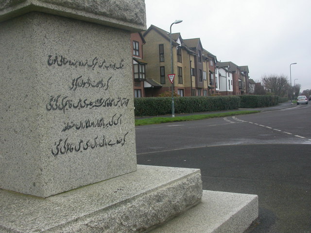
1166:== {{int:filedesc}} == {{Information |description={{en|1=Barton on Sea, obelisk, Urdu detail How many inscriptions can there be in Barton that are written in Urdu? This appears on obelisk
127:
844:
659:
1148:
1143:
42:
126:
Barton on Sea, obelisk, Urdu detail. How many inscriptions can there be in Barton that are written in Urdu? This appears on obelisk
982:
779:
645:
609:
490:
292:
242:
814:
327:
1225:
This file contains additional information, probably added from the digital camera or scanner used to create or digitize it.
417:
557:
1077:
1040:
1003:
948:
914:
885:
858:
792:
763:
700:
673:
593:
565:
550:
537:
975:
822:
807:
729:
629:
510:
474:
1189:
314:
373:
1228:
If the file has been modified from its original state, some details may not fully reflect the modified file.
416:– If you remix, transform, or build upon the material, you must distribute your contributions under the
334:
on the
Geograph website for the photographer's contact details. The copyright on this image is owned by
1159:
370:
851:"}},"text\/plain":{"en":{"P7787":"0 degree"}}}}": -->
666:"}},"text\/plain":{"en":{"P7787":"0 degree"}}}}": -->
91:
187:
1167:
829:
799:
572:
171:
298:
248:
1184:
339:
78:
282:
232:
139:
160:
150:
319:
331:
1116:
Click on a date/time to view the file as it appeared at that time.
116:
Barton on Sea, obelisk, Urdu detail - geograph.org.uk - 1088453.jpg
52:
Barton_on_Sea,_obelisk,_Urdu_detail_-_geograph.org.uk_-_1088453.jpg
284:
234:
259:
209:
66:
269:
50° 44′ 11.46″ N, 1° 39′ 48″ W
219:
50° 44′ 11.43″ N, 1° 39′ 48″ W
1212:
1170:, and is on the east face.}} |date=2008-12-22 |source=Fr
458:
Add a one-line explanation of what this file represents
110:
90:
Commons is a freely licensed media file repository.
1207:
646:
Creative
Commons Attribution-ShareAlike 2.0 Generic
56:(640 × 480 pixels, file size: 78 KB, MIME type:
427:https://creativecommons.org/licenses/by-sa/2.0
71:
433:Creative Commons Attribution-Share Alike 2.0
351:
8:
848:
663:
393:– to copy, distribute and transmit the work
1230:
1118:
491:Obelisk (At Southern End Where Road Forks)
454:
1200:The following other wikis use this file:
830:https://www.geograph.org.uk/photo/1088453
573:https://www.geograph.org.uk/profile/30470
964:d5341ba0deddedff39fdd597562fef6a26897f6c
1232:
1182:
1091:
1075:
1054:
1038:
1017:
1001:
962:
946:
928:
912:
872:
856:
777:
761:
743:
727:
687:
671:
643:
627:
607:
591:
524:
508:
488:
472:
469:
450:
443:
262:
212:
291:View this and other nearby images on:
241:View this and other nearby images on:
1180:The following 2 pages use this file:
7:
338:and is licensed for reuse under the
1107:
374:Attribution-Share Alike 2.0 Generic
362:
357:
342:Attribution-ShareAlike 2.0 license.
202:Barton on Sea, obelisk, Urdu detail
183:Barton on Sea, obelisk, Urdu detail
1223:
463:
457:
348:
325:
120:
103:
49:
462:
674:coordinates of the point of view
448:
404:Under the following conditions:
369:This file is licensed under the
361:
356:
350:
318:
297:
283:
275:
247:
233:
225:
70:
31:
21:
445:
121:
46:No higher resolution available.
14:
780:file available on the internet
444:
326:This image was taken from the
26:
1:
874:50°44'11.465"N, 1°39'48.024"W
859:coordinates of depicted place
689:50°44'11.432"N, 1°39'48.024"W
36:
815:Geograph Britain and Ireland
551:object of statement has role
470:Items portrayed in this file
1254:
1204:Usage on fr.wikipedia.org
1190:Urdu in the United Kingdom
418:same or compatible license
274:
224:
130:, and is on the east face.
1108:
200:Mike Faherty /
181:Mike Faherty /
16:
793:geograph.org.uk image ID
447:
384:
77:This is a file from the
1165:
1144:10:03, 24 February 2011
172:required by the license
156:
145:
138:
135:
113:
81:. Information from its
332:this photograph's page
303:50.736518; -1.663340
253:50.736509; -1.663340
84:description page there
976:determination method
399:– to adapt the work
538:author name string
1241:
1240:
1196:Global file usage
1173:
850:
665:
630:copyright license
456:
347:
346:
330:collection. See
308:
307:
258:
257:
207:
206:
175:
99:
98:
79:Wikimedia Commons
32:Global file usage
1245:
1231:
1156:
1096:
1059:
1022:
985:
980:
896:
895:
890:
832:
827:
823:described at URL
817:
812:
802:
797:
745:22 December 2008
711:
710:
705:
594:copyright status
575:
570:
560:
555:
545:
542:
440:
437:
434:
431:
428:
420:as the original.
382:
371:Creative Commons
365:
364:
360:
359:
354:
353:
340:Creative Commons
328:Geograph project
322:
315:
304:
301:
287:
286:
280:
279:
278:
272:
271:
260:
254:
251:
237:
236:
230:
229:
228:
222:
221:
210:
169:
141:
140:22 December 2008
125:
117:
111:
95:
74:
73:
67:
61:
59:
1253:
1252:
1248:
1247:
1246:
1244:
1243:
1242:
1219:
1194:
1174:
1162:
1154:
1110:
1109:
1106:
1105:
1104:
1103:
1102:
1101:
1100:
1099:
1097:
1094:
1084:
1083:
1082:
1080:
1069:
1068:
1067:
1066:
1065:
1064:
1063:
1062:
1060:
1057:
1047:
1046:
1045:
1043:
1032:
1031:
1030:
1029:
1028:
1027:
1026:
1025:
1023:
1020:
1010:
1009:
1008:
1006:
995:
994:
993:
992:
991:
990:
989:
988:
987:
986:
981:
978:
969:
968:
967:
965:
955:
954:
953:
951:
940:
939:
938:
937:
936:
935:
934:
933:
931:
921:
920:
919:
917:
906:
905:
904:
903:
902:
901:
900:
899:
898:
897:
893:
891:
888:
879:
878:
877:
875:
865:
864:
863:
861:
842:
841:
840:
839:
838:
837:
836:
835:
834:
833:
828:
825:
819:
818:
813:
810:
804:
803:
798:
795:
786:
785:
784:
782:
770:
769:
768:
766:
755:
754:
753:
752:
751:
750:
749:
748:
746:
736:
735:
734:
732:
721:
720:
719:
718:
717:
716:
715:
714:
713:
712:
708:
706:
703:
694:
693:
692:
690:
680:
679:
678:
676:
657:
656:
655:
654:
653:
652:
651:
650:
648:
636:
635:
634:
632:
621:
620:
619:
618:
617:
616:
615:
614:
612:
600:
599:
598:
596:
585:
584:
583:
582:
581:
580:
579:
578:
577:
576:
571:
568:
562:
561:
556:
553:
547:
546:
543:
540:
531:
530:
529:
527:
517:
516:
515:
513:
502:
501:
500:
499:
498:
497:
496:
495:
493:
481:
480:
479:
477:
461:
460:
459:
442:
441:
438:
435:
432:
429:
426:
425:
383:
380:
377:
366:
343:
313:
302:
276:
267:
266:
263:Object location
252:
226:
217:
216:
213:Camera location
208:
197:
190:
178:
151:geograph.org.uk
131:
115:
108:
101:
100:
89:
88:
87:is shown below.
63:
57:
55:
48:
47:
12:
11:
5:
1251:
1249:
1239:
1238:
1235:
1222:
1218:
1217:
1216:
1215:
1210:
1198:
1197:
1193:
1192:
1187:
1178:
1177:
1172:
1171:
1164:
1160:
1157:
1151:
1146:
1141:
1137:
1136:
1133:
1130:
1127:
1124:
1121:
1114:
1113:
1098:
1092:
1090:
1089:
1088:
1087:
1086:
1085:
1081:
1076:
1074:
1073:
1072:
1071:
1070:
1061:
1055:
1053:
1052:
1051:
1050:
1049:
1048:
1044:
1039:
1037:
1036:
1035:
1034:
1033:
1024:
1018:
1016:
1015:
1014:
1013:
1012:
1011:
1007:
1002:
1000:
999:
998:
997:
996:
974:
973:
972:
971:
970:
966:
963:
961:
960:
959:
958:
957:
956:
952:
947:
945:
944:
943:
942:
941:
932:
929:
927:
926:
925:
924:
923:
922:
918:
913:
911:
910:
909:
908:
907:
884:
883:
882:
881:
880:
876:
873:
871:
870:
869:
868:
867:
866:
862:
857:
855:
854:
853:
852:
846:
821:
820:
806:
805:
791:
790:
789:
788:
787:
783:
778:
776:
775:
774:
773:
772:
771:
767:
764:source of file
762:
760:
759:
758:
757:
756:
747:
744:
742:
741:
740:
739:
738:
737:
733:
728:
726:
725:
724:
723:
722:
699:
698:
697:
696:
695:
691:
688:
686:
685:
684:
683:
682:
681:
677:
672:
670:
669:
668:
667:
661:
649:
644:
642:
641:
640:
639:
638:
637:
633:
628:
626:
625:
624:
623:
622:
613:
608:
606:
605:
604:
603:
602:
601:
597:
592:
590:
589:
588:
587:
586:
564:
563:
549:
548:
536:
535:
534:
533:
532:
528:
525:
523:
522:
521:
520:
519:
518:
514:
509:
507:
506:
505:
504:
503:
494:
489:
487:
486:
485:
484:
483:
482:
478:
473:
471:
468:
467:
466:
465:
464:
453:
452:
449:
446:
424:
423:
422:
421:
411:
402:
401:
400:
394:
387:You are free:
378:
368:
367:
349:
345:
344:
323:
312:
309:
306:
305:
295:
289:
264:
256:
255:
245:
239:
214:
205:
204:
198:
195:
192:
191:
186:
179:
176:
164:
163:
158:
154:
153:
147:
143:
142:
137:
133:
132:
118:
109:
107:
104:
102:
97:
96:
75:
65:
64:
45:
41:
40:
39:
34:
29:
24:
19:
13:
10:
9:
6:
4:
3:
2:
1250:
1236:
1233:
1229:
1226:
1220:
1214:
1213:Barton on Sea
1211:
1209:
1206:
1205:
1203:
1202:
1201:
1195:
1191:
1188:
1186:
1185:Barton on Sea
1183:
1181:
1175:
1169:
1163:
1158:
1152:
1150:
1147:
1145:
1142:
1139:
1138:
1134:
1131:
1128:
1125:
1122:
1120:
1119:
1117:
1111:
1079:
1042:
1005:
984:
977:
950:
916:
887:
860:
831:
824:
816:
809:
801:
794:
781:
765:
731:
702:
675:
647:
631:
611:
595:
574:
567:
559:
552:
539:
512:
492:
476:
430:CC BY-SA 2.0
419:
415:
412:
409:
406:
405:
403:
398:
395:
392:
389:
388:
386:
385:
379:Attribution:
375:
372:
355:
341:
337:
333:
329:
324:
321:
317:
316:
310:
300:
296:
294:
293:OpenStreetMap
290:
288:
270:
265:
261:
250:
246:
244:
243:OpenStreetMap
240:
238:
220:
215:
211:
203:
199:
194:
193:
189:
185: /
184:
180:
173:
168:
166:
165:
162:
159:
155:
152:
148:
144:
134:
129:
124:
119:
112:
105:
93:
86:
85:
80:
76:
69:
68:
62:
53:
44:
38:
35:
33:
30:
28:
25:
23:
20:
18:
15:
1227:
1224:
1199:
1179:
1115:
1112:File history
558:photographer
544:Mike Faherty
413:
407:
396:
390:
381:Mike Faherty
336:Mike Faherty
335:
273:
223:
201:
188:CC BY-SA 2.0
182:
161:Mike Faherty
122:
92:You can help
82:
50:
22:File history
1161:GeographBot
610:copyrighted
414:share alike
408:attribution
167:Attribution
114:Description
1234:_error
1176:File usage
1153:640 × 480
1129:Dimensions
930:image/jpeg
915:media type
526:some value
58:image/jpeg
27:File usage
1126:Thumbnail
1123:Date/Time
1004:data size
730:inception
311:Licensing
196:InfoField
177:InfoField
123:English:
1221:Metadata
949:checksum
808:operator
451:Captions
397:to remix
391:to share
376:license.
37:Metadata
1168:1088436
1155:(78 KB)
1140:current
1135:Comment
1019:80,071
886:heading
845:heading
800:1088453
701:heading
660:heading
511:creator
475:depicts
455:English
128:1088436
106:Summary
54:
1208:Ourdou
1041:height
894:degree
849:degree
709:degree
664:degree
281:
231:
157:Author
146:Source
1095:pixel
1078:width
1058:pixel
983:SHA-1
149:From
1132:User
1093:640
1056:480
1021:byte
439:true
436:true
136:Date
17:File
566:URL
979::
892:0
889::
826::
811::
796::
707:0
704::
569::
554::
541::
1237:0
174:)
170:(
94:.
60:)
Text is available under the Creative Commons Attribution-ShareAlike License. Additional terms may apply.
_heading:0.00&language=en)
_heading:0.00&language=en)
