348:
281:
231:
273:
223:
295:
245:
316:
354:
359:
72:
824:"}},"text\/plain":{"en":{"":"heading"}}},"{\"value\":{\"amount\":\"+180\",\"unit\":\"http:\\\/\\\/www.wikidata.org\\\/entity\\\/Q28390\"},\"type\":\"quantity\"}":{"text\/html":{"en":{"P7787":"180
760:"}},"text\/plain":{"en":{"":"heading"}}},"{\"value\":{\"amount\":\"+180\",\"unit\":\"http:\\\/\\\/www.wikidata.org\\\/entity\\\/Q28390\"},\"type\":\"quantity\"}":{"text\/html":{"en":{"P7787":"180
756:
264:
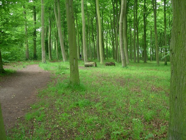
1143:== {{int:filedesc}} == {{Information |description={{en|1=Beechwoods A high density of maturing beech trees similar ages leads to a close canopy and little light reaching the ground, hence the lack of understorey.}} |date=2008-06-01 |source=From [http://ww
214:
1162:
406:– You must give appropriate credit, provide a link to the license, and indicate if changes were made. You may do so in any reasonable manner, but not in any way that suggests the licensor endorses you or your use.
43:
821:
757:
83:
51:
126:
Beechwoods A high density of maturing beech trees similar ages leads to a close canopy and little light reaching the ground, hence the lack of understorey.
959:
658:
622:
586:
288:
238:
708:
1234:
323:
1193:
This file contains additional information, probably added from the digital camera or scanner used to create or digitize it.
413:
521:
1054:
1017:
980:
925:
891:
862:
835:
798:
771:
686:
642:
570:
542:
529:
514:
952:
729:
701:
671:
606:
487:
470:
310:
369:
1196:
If the file has been modified from its original state, some details may not fully reflect the modified file.
1125:
1120:
42:
412:– If you remix, transform, or build upon the material, you must distribute your contributions under the
330:
on the
Geograph website for the photographer's contact details. The copyright on this image is owned by
1136:
366:
828:"}},"text\/plain":{"en":{"P7787":"180 degree"}}}}": -->
764:"}},"text\/plain":{"en":{"P7787":"180 degree"}}}}": -->
91:
183:
693:
678:
549:
167:
294:
244:
335:
78:
1245:
135:
1157:
278:
228:
156:
146:
315:
327:
1163:
Wildlife Trust for
Bedfordshire, Cambridgeshire and Northamptonshire
1093:
Click on a date/time to view the file as it appeared at that time.
280:
230:
255:
205:
66:
265:
52° 10′ 09″ N, 0° 10′ 14″ E
215:
52° 10′ 10″ N, 0° 10′ 14″ E
454:
Add a one-line explanation of what this file represents
1180:
110:
90:
Commons is a freely licensed media file repository.
623:
Creative
Commons Attribution-ShareAlike 2.0 Generic
56:(640 × 480 pixels, file size: 131 KB, MIME type:
423:https://creativecommons.org/licenses/by-sa/2.0
71:
429:Creative Commons Attribution-Share Alike 2.0
347:
8:
825:
761:
389:– to copy, distribute and transmit the work
1198:
1095:
450:
1173:The following other wikis use this file:
116:Beechwoods - geograph.org.uk - 826879.jpg
52:Beechwoods_-_geograph.org.uk_-_826879.jpg
941:937059bd5fdbc7d004d77065624d191d90a104ee
679:https://www.geograph.org.uk/photo/826879
550:https://www.geograph.org.uk/profile/3176
1243:
1232:
1224:
1216:
1208:
1200:
1155:
1068:
1052:
1031:
1015:
994:
978:
939:
923:
905:
889:
849:
833:
785:
769:
743:
727:
656:
640:
620:
604:
584:
568:
501:
485:
468:
465:
446:
439:
258:
208:
287:View this and other nearby images on:
237:View this and other nearby images on:
1153:The following 2 pages use this file:
7:
334:and is licensed for reuse under the
1084:
370:Attribution-Share Alike 2.0 Generic
358:
353:
338:Attribution-ShareAlike 2.0 license.
1191:
459:
453:
344:
321:
120:
103:
49:
458:
772:coordinates of the point of view
444:
400:Under the following conditions:
365:This file is licensed under the
357:
352:
346:
314:
293:
279:
271:
243:
229:
221:
70:
31:
21:
441:
121:
46:No higher resolution available.
14:
659:file available on the internet
440:
322:This image was taken from the
26:
1:
836:coordinates of depicted place
36:
709:Geograph Britain and Ireland
515:object of statement has role
466:Items portrayed in this file
270:
220:
787:52°10'10.34"N, 0°10'13.80"E
1267:
1177:Usage on www.wikidata.org
851:52°10'8.72"N, 0°10'13.80"E
414:same or compatible license
196:Hugh Venables /
177:Hugh Venables /
1085:
16:
687:geograph.org.uk image ID
443:
380:
77:This is a file from the
1142:
1121:15:00, 20 February 2011
168:required by the license
152:
141:
134:
131:
113:
81:. Information from its
328:this photograph's page
299:52.169090; 0.170500
249:52.169540; 0.170500
84:description page there
1210:Horizontal resolution
953:determination method
1226:Y and C positioning
1218:Vertical resolution
395:– to adapt the work
530:author name string
1254:
1253:
1169:Global file usage
1146:
827:
763:
607:copyright license
452:
343:
342:
326:collection. See
304:
303:
254:
253:
203:
202:
171:
99:
98:
79:Wikimedia Commons
32:Global file usage
1258:
1199:
1133:
1073:
1036:
999:
962:
957:
873:
872:
867:
809:
808:
803:
711:
706:
696:
691:
681:
676:
672:described at URL
571:copyright status
552:
547:
537:
534:
524:
519:
436:
433:
430:
427:
424:
416:as the original.
378:
367:Creative Commons
361:
360:
356:
355:
350:
349:
336:Creative Commons
324:Geograph project
318:
311:
300:
297:
283:
282:
276:
275:
274:
268:
267:
256:
250:
247:
233:
232:
226:
225:
224:
218:
217:
206:
165:
137:
125:
117:
111:
95:
74:
73:
67:
61:
59:
1266:
1265:
1261:
1260:
1259:
1257:
1256:
1255:
1187:
1167:
1147:
1139:
1131:
1087:
1086:
1083:
1082:
1081:
1080:
1079:
1078:
1077:
1076:
1074:
1071:
1061:
1060:
1059:
1057:
1046:
1045:
1044:
1043:
1042:
1041:
1040:
1039:
1037:
1034:
1024:
1023:
1022:
1020:
1009:
1008:
1007:
1006:
1005:
1004:
1003:
1002:
1000:
997:
987:
986:
985:
983:
972:
971:
970:
969:
968:
967:
966:
965:
964:
963:
958:
955:
946:
945:
944:
942:
932:
931:
930:
928:
917:
916:
915:
914:
913:
912:
911:
910:
908:
898:
897:
896:
894:
883:
882:
881:
880:
879:
878:
877:
876:
875:
874:
870:
868:
865:
856:
855:
854:
852:
842:
841:
840:
838:
819:
818:
817:
816:
815:
814:
813:
812:
811:
810:
806:
804:
801:
792:
791:
790:
788:
778:
777:
776:
774:
755:
754:
753:
752:
751:
750:
749:
748:
746:
736:
735:
734:
732:
721:
720:
719:
718:
717:
716:
715:
714:
713:
712:
707:
704:
698:
697:
692:
689:
683:
682:
677:
674:
665:
664:
663:
661:
649:
648:
647:
645:
634:
633:
632:
631:
630:
629:
628:
627:
625:
613:
612:
611:
609:
598:
597:
596:
595:
594:
593:
592:
591:
589:
577:
576:
575:
573:
562:
561:
560:
559:
558:
557:
556:
555:
554:
553:
548:
545:
539:
538:
535:
532:
526:
525:
520:
517:
508:
507:
506:
504:
494:
493:
492:
490:
479:
478:
477:
476:
475:
473:
457:
456:
455:
438:
437:
434:
431:
428:
425:
422:
421:
379:
376:
373:
362:
339:
309:
298:
272:
263:
262:
259:Object location
248:
222:
213:
212:
209:Camera location
204:
193:
186:
174:
147:geograph.org.uk
127:
115:
108:
101:
100:
89:
88:
87:is shown below.
63:
57:
55:
48:
47:
12:
11:
5:
1264:
1262:
1252:
1251:
1248:
1242:
1241:
1238:
1231:
1230:
1227:
1223:
1222:
1219:
1215:
1214:
1211:
1207:
1206:
1203:
1190:
1186:
1185:
1184:
1183:
1171:
1170:
1166:
1165:
1160:
1151:
1150:
1145:
1144:
1141:
1137:
1134:
1128:
1123:
1118:
1114:
1113:
1110:
1107:
1104:
1101:
1098:
1091:
1090:
1075:
1069:
1067:
1066:
1065:
1064:
1063:
1062:
1058:
1053:
1051:
1050:
1049:
1048:
1047:
1038:
1032:
1030:
1029:
1028:
1027:
1026:
1025:
1021:
1016:
1014:
1013:
1012:
1011:
1010:
1001:
995:
993:
992:
991:
990:
989:
988:
984:
979:
977:
976:
975:
974:
973:
951:
950:
949:
948:
947:
943:
940:
938:
937:
936:
935:
934:
933:
929:
924:
922:
921:
920:
919:
918:
909:
906:
904:
903:
902:
901:
900:
899:
895:
890:
888:
887:
886:
885:
884:
861:
860:
859:
858:
857:
853:
850:
848:
847:
846:
845:
844:
843:
839:
834:
832:
831:
830:
829:
823:
797:
796:
795:
794:
793:
789:
786:
784:
783:
782:
781:
780:
779:
775:
770:
768:
767:
766:
765:
759:
747:
744:
742:
741:
740:
739:
738:
737:
733:
728:
726:
725:
724:
723:
722:
700:
699:
685:
684:
670:
669:
668:
667:
666:
662:
657:
655:
654:
653:
652:
651:
650:
646:
643:source of file
641:
639:
638:
637:
636:
635:
626:
621:
619:
618:
617:
616:
615:
614:
610:
605:
603:
602:
601:
600:
599:
590:
585:
583:
582:
581:
580:
579:
578:
574:
569:
567:
566:
565:
564:
563:
541:
540:
528:
527:
513:
512:
511:
510:
509:
505:
502:
500:
499:
498:
497:
496:
495:
491:
486:
484:
483:
482:
481:
480:
474:
469:
467:
464:
463:
462:
461:
460:
449:
448:
445:
442:
420:
419:
418:
417:
407:
398:
397:
396:
390:
383:You are free:
374:
364:
363:
345:
341:
340:
319:
308:
305:
302:
301:
291:
285:
260:
252:
251:
241:
235:
210:
201:
200:
194:
191:
188:
187:
182:
175:
172:
160:
159:
154:
150:
149:
143:
139:
138:
133:
129:
128:
118:
109:
107:
104:
102:
97:
96:
75:
65:
64:
45:
41:
40:
39:
34:
29:
24:
19:
13:
10:
9:
6:
4:
3:
2:
1263:
1249:
1247:
1244:
1239:
1236:
1233:
1228:
1225:
1220:
1217:
1212:
1209:
1204:
1201:
1197:
1194:
1188:
1182:
1179:
1178:
1176:
1175:
1174:
1168:
1164:
1161:
1159:
1156:
1154:
1148:
1140:
1135:
1129:
1127:
1124:
1122:
1119:
1116:
1115:
1111:
1108:
1105:
1102:
1099:
1097:
1096:
1094:
1088:
1056:
1019:
982:
961:
954:
927:
893:
864:
837:
800:
773:
731:
710:
703:
695:
688:
680:
673:
660:
644:
624:
608:
588:
572:
551:
544:
536:Hugh Venables
531:
523:
516:
489:
472:
426:CC BY-SA 2.0
415:
411:
408:
405:
402:
401:
399:
394:
391:
388:
385:
384:
382:
381:
377:Hugh Venables
375:Attribution:
371:
368:
351:
337:
333:
332:Hugh Venables
329:
325:
320:
317:
313:
312:
306:
296:
292:
290:
289:OpenStreetMap
286:
284:
266:
261:
257:
246:
242:
240:
239:OpenStreetMap
236:
234:
216:
211:
207:
199:
195:
190:
189:
185:
181: /
180:
176:
169:
164:
162:
161:
158:
157:Hugh Venables
155:
151:
148:
144:
140:
130:
124:
119:
112:
105:
93:
86:
85:
80:
76:
69:
68:
62:
53:
44:
38:
35:
33:
30:
28:
25:
23:
20:
18:
15:
1195:
1192:
1172:
1152:
1092:
1089:File history
522:photographer
409:
403:
392:
386:
331:
269:
219:
197:
184:CC BY-SA 2.0
178:
122:
92:You can help
82:
50:
22:File history
1246:Color space
1202:Orientation
1138:GeographBot
745:1 June 2008
587:copyrighted
410:share alike
404:attribution
163:Attribution
136:1 June 2008
114:Description
1158:Beechwoods
1149:File usage
1130:640 × 480
1106:Dimensions
907:image/jpeg
892:media type
503:some value
198:Beechwoods
179:Beechwoods
58:image/jpeg
27:File usage
1181:Q28035342
1103:Thumbnail
1100:Date/Time
981:data size
730:inception
307:Licensing
192:InfoField
173:InfoField
123:English:
1229:Centered
1189:Metadata
1132:(131 KB)
996:134,221
926:checksum
702:operator
447:Captions
393:to remix
387:to share
372:license.
37:Metadata
1237:version
1117:current
1112:Comment
863:heading
822:heading
799:heading
758:heading
488:creator
471:depicts
451:English
106:Summary
54:
1221:72 dpi
1213:72 dpi
1205:Normal
1018:height
871:degree
826:degree
807:degree
762:degree
694:826879
277:
227:
153:Author
142:Source
1072:pixel
1055:width
1035:pixel
960:SHA-1
145:From
1250:sRGB
1235:Exif
1109:User
1070:640
1033:480
998:byte
869:180
805:180
435:true
432:true
132:Date
17:File
543:URL
956::
866::
802::
705::
690::
675::
546::
533::
518::
1240:2
170:)
166:(
94:.
60:)
Text is available under the Creative Commons Attribution-ShareAlike License. Additional terms may apply.
_heading:180.00&language=en)
_heading:180.00&language=en)
