379:
312:
262:
304:
254:
326:
276:
347:
385:
390:
43:
87:
670:"}},"text\/plain":{"en":{"":"heading"}}},"{\"value\":{\"amount\":\"+45\",\"unit\":\"http:\\\/\\\/www.wikidata.org\\\/entity\\\/Q28390\"},\"type\":\"quantity\"}":{"text\/html":{"en":{"P7787":"45
606:"}},"text\/plain":{"en":{"":"heading"}}},"{\"value\":{\"amount\":\"+45\",\"unit\":\"http:\\\/\\\/www.wikidata.org\\\/entity\\\/Q28390\"},\"type\":\"quantity\"}":{"text\/html":{"en":{"P7787":"45
1237:== {{int:filedesc}} == {{Information |Description={{en|1=Binnhill Tower (2)}} |Source=From |Date=2017-11-26 |Author= |Permission=Creative Commons Attribution Share-alike license 2.0 |Other fields={{Credit line |Author=Anne Burgess |License= |Other=''Binnhill Tower (2)'' }} }} {{Location|56.388303|-3.367311|source:ge...
602:
1271:
295:
245:
437:– You must give appropriate credit, provide a link to the license, and indicate if changes were made. You may do so in any reasonable manner, but not in any way that suggests the licensor endorses you or your use.
1261:
53:
47:
667:
603:
66:
98:
1451:
182:
1053:
753:
589:
553:
517:
319:
269:
1474:
354:
1337:
This file contains additional information, probably added from the digital camera or scanner used to create or digitize it.
931:
444:
1256:
1148:
1111:
1074:
1019:
985:
881:
844:
810:
773:
737:
708:
681:
644:
617:
537:
1266:
1046:
951:
573:
501:
915:
1219:
1214:
57:
42:
341:
400:
1340:
If the file has been modified from its original state, some details may not fully reflect the modified file.
1247:
The following pages on the
English Knowledge (XXG) use this file (pages on other projects are not listed):
1540:
443:– If you remix, transform, or build upon the material, you must distribute your contributions under the
361:
on the
Geograph website for the photographer's contact details. The copyright on this image is owned by
1359:
397:
1568:
674:"}},"text\/plain":{"en":{"P7787":"45 degree"}}}}": -->
610:"}},"text\/plain":{"en":{"P7787":"45 degree"}}}}": -->
106:
1299:
1272:
Knowledge (XXG):WikiProject
Historic sites/Images of listed buildings in Scotland without ID
198:
1349:
1230:
1251:
325:
275:
1652:
1558:
1522:
1374:
366:
93:
1662:
1414:
214:
259:
1586:
309:
150:
1394:
1309:
161:
1314:
171:
1384:
1289:
346:
358:
1187:
Click on a date/time to view the file as it appeared at that time.
311:
261:
286:
236:
81:
296:
56° 23′ 18.2″ N, 3° 22′ 02″ W
246:
56° 23′ 17.9″ N, 3° 22′ 02″ W
1262:
List of listed buildings in
Kinfauns, Perth and Kinross
485:
Add a one-line explanation of what this file represents
1324:
189:
Creative
Commons Attribution Share-alike license 2.0
125:
105:
Commons is a freely licensed media file repository.
590:
Creative
Commons Attribution-ShareAlike 2.0 Generic
71:(480 × 640 pixels, file size: 449 KB, MIME type:
1573:Flash did not fire, compulsory flash suppression
1300:Utente:ValterVB/Sandbox/Osservatori astronomici
454:https://creativecommons.org/licenses/by-sa/2.0
86:
460:Creative Commons Attribution-Share Alike 2.0
378:
8:
671:
607:
420:– to copy, distribute and transmit the work
1342:
1189:
481:
1282:The following other wikis use this file:
131:Binnhill Tower (2) (geograph 5611335).jpg
1732:xmp.did:900B1B28DDD2E711917B875DFD917AE6
1035:26baedb801b6b9b0459b7552fecf5d7d841297b4
1735:
1727:
1719:
1711:
1703:
1695:
1687:
1679:
1671:
1660:
1650:
1642:
1634:
1626:
1618:
1610:
1602:
1594:
1584:
1576:
1566:
1556:
1548:
1538:
1530:
1520:
1512:
1491:
1483:
1472:
1464:
1456:
1446:
1438:
1430:
1422:
1411:
1403:
1392:
1382:
1372:
1364:
1354:
1249:
1162:
1146:
1125:
1109:
1088:
1072:
1033:
1017:
999:
983:
965:
949:
929:
913:
895:
879:
858:
842:
824:
808:
787:
771:
751:
735:
695:
679:
631:
615:
587:
571:
551:
535:
515:
499:
496:
477:
470:
289:
239:
318:View this and other nearby images on:
268:View this and other nearby images on:
1344:
7:
1452:Adobe Photoshop Elements 8.0 Windows
365:and is licensed for reuse under the
1178:
401:Attribution-Share Alike 2.0 Generic
389:
384:
369:Attribution-ShareAlike 2.0 license.
1335:
490:
484:
375:
352:
135:
118:
64:
489:
1405:Date and time of data generation
1310:Wikipedysta:Masti/Lista Wikidata
618:coordinates of the point of view
475:
431:Under the following conditions:
396:This file is licensed under the
388:
383:
377:
345:
324:
310:
302:
274:
260:
252:
85:
31:
21:
1721:Date metadata was last modified
472:
136:
14:
1729:Unique ID of original document
1315:Wikipedysta:Masti/Obserwatoria
471:
353:This image was taken from the
26:
1:
682:coordinates of depicted place
36:
1290:Francis Gray (14e Lord Gray)
1257:Francis Gray, 14th Lord Gray
633:56°23'17.891"N, 3°22'2.320"W
497:Items portrayed in this file
1612:Focal plane resolution unit
1485:Date and time of digitizing
1267:William Macdonald Mackenzie
301:
251:
1757:
1689:Supported Flashpix version
1623:One-chip color area sensor
1578:Supported Flashpix version
1321:Usage on www.wikidata.org
1306:Usage on pl.wikipedia.org
1296:Usage on it.wikipedia.org
1286:Usage on fr.wikipedia.org
697:56°23'18.20"N, 3°22'1.74"W
445:same or compatible license
1493:Meaning of each component
1458:File change date and time
1179:
227:Anne Burgess /
208:Anne Burgess /
16:
1604:Focal plane Y resolution
1596:Focal plane X resolution
1215:15:10, 30 September 2021
474:
411:
92:This is a file from the
1724:20:14, 26 November 2017
1636:Custom image processing
1488:12:46, 26 November 2017
1461:20:14, 26 November 2017
1408:12:46, 26 November 2017
1236:
199:required by the license
177:
167:
156:
149:
146:
128:
96:. Information from its
1514:Image compression mode
359:this photograph's page
330:56.388390; -3.367150
280:56.388303; -3.367311
99:description page there
46:Size of this preview:
1550:Maximum land aperture
1432:Horizontal resolution
1631:Digital still camera
1553:1.6875 APEX (f/1.79)
1379:1/2,000 sec (0.0005)
1360:Canon PowerShot S120
1047:determination method
754:Canon PowerShot S120
1466:Y and C positioning
1440:Vertical resolution
1346:Camera manufacturer
426:– to adapt the work
52:Other resolutions:
1673:Scene capture type
1657:Auto white balance
229:Binnhill Tower (2)
210:Binnhill Tower (2)
141:Binnhill Tower (2)
1744:
1743:
1713:Rating (out of 5)
1278:Global file usage
1240:
673:
609:
574:copyright license
483:
374:
373:
357:collection. See
335:
334:
285:
284:
234:
233:
202:
186:
183:Reusing this file
114:
113:
94:Wikimedia Commons
32:Global file usage
1748:
1607:13,698.630136986
1599:13,745.704467354
1343:
1227:
1167:
1130:
1093:
1056:
1051:
967:26 November 2017
863:
792:
719:
718:
713:
655:
654:
649:
538:copyright status
467:
464:
461:
458:
455:
447:as the original.
409:
398:Creative Commons
392:
391:
387:
386:
381:
380:
367:Creative Commons
355:Geograph project
349:
342:
331:
328:
314:
313:
307:
306:
305:
299:
298:
287:
281:
278:
264:
263:
257:
256:
255:
249:
248:
237:
196:
180:
152:
151:26 November 2017
140:
132:
126:
110:
89:
88:
82:
76:
74:
61:
58:480 × 640 pixels
54:180 × 240 pixels
48:450 × 600 pixels
1756:
1755:
1751:
1750:
1749:
1747:
1746:
1745:
1681:GPS tag version
1331:
1276:
1248:
1241:
1233:
1225:
1181:
1180:
1177:
1176:
1175:
1174:
1173:
1172:
1171:
1170:
1168:
1165:
1155:
1154:
1153:
1151:
1140:
1139:
1138:
1137:
1136:
1135:
1134:
1133:
1131:
1128:
1118:
1117:
1116:
1114:
1103:
1102:
1101:
1100:
1099:
1098:
1097:
1096:
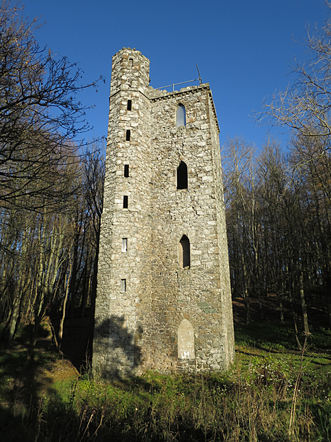
1094:
1091:
1081:
1080:
1079:
1077:
1066:
1065:
1064:
1063:
1062:
1061:
1060:
1059:
1058:
1057:
1052:
1049:
1040:
1039:
1038:
1036:
1026:
1025:
1024:
1022:
1011:
1010:
1009:
1008:
1007:
1006:
1005:
1004:
1002:
992:
991:
990:
988:
977:
976:
975:
974:
973:
972:
971:
970:
968:
958:
957:
956:
954:
943:
942:
941:
940:
939:
938:
937:
936:
934:
922:
921:
920:
918:
907:
906:
905:
904:
903:
902:
901:
900:
898:
888:
887:
886:
884:
873:
872:
871:
870:
869:
868:
867:
866:
864:
861:
851:
850:
849:
847:
836:
835:
834:
833:
832:
831:
830:
829:
827:
817:
816:
815:
813:
802:
801:
800:
799:
798:
797:
796:
795:
793:
790:
780:
779:
778:
776:
765:
764:
763:
762:
761:
760:
759:
758:
756:
744:
743:
742:
740:
729:
728:
727:
726:
725:
724:
723:
722:
721:
720:
716:
714:
711:
702:
701:
700:
698:
688:
687:
686:
684:
665:
664:
663:
662:
661:
660:
659:
658:
657:
656:
652:
650:
647:
638:
637:
636:
634:
624:
623:
622:
620:
601:
600:
599:
598:
597:
596:
595:
594:
592:
580:
579:
578:
576:
565:
564:
563:
562:
561:
560:
559:
558:
556:
544:
543:
542:
540:
529:
528:
527:
526:
525:
524:
523:
522:
520:
508:
507:
506:
504:
488:
487:
486:
469:
468:
465:
462:
459:
456:
453:
452:
410:
407:
404:
393:
370:
340:
329:
303:
294:
293:
290:Object location
279:
253:
244:
243:
240:Camera location
235:
224:
217:
205:
162:geograph.org.uk
142:
130:
123:
116:
115:
104:
103:
102:is shown below.
78:
72:
70:
63:
62:
51:
12:
11:
5:
1754:
1752:
1742:
1741:
1738:
1734:
1733:
1730:
1726:
1725:
1722:
1718:
1717:
1714:
1710:
1709:
1706:
1702:
1701:
1698:
1694:
1693:
1690:
1686:
1685:
1682:
1678:
1677:
1674:
1670:
1669:
1666:
1659:
1658:
1655:
1649:
1648:
1645:
1641:
1640:
1639:Normal process
1637:
1633:
1632:
1629:
1625:
1624:
1621:
1620:Sensing method
1617:
1616:
1613:
1609:
1608:
1605:
1601:
1600:
1597:
1593:
1592:
1589:
1583:
1582:
1579:
1575:
1574:
1571:
1565:
1564:
1561:
1555:
1554:
1551:
1547:
1546:
1543:
1537:
1536:
1533:
1529:
1528:
1525:
1519:
1518:
1515:
1511:
1510:
1509:
1508:
1507:does not exist
1505:
1502:
1499:
1494:
1490:
1489:
1486:
1482:
1481:
1478:
1471:
1470:
1467:
1463:
1462:
1459:
1455:
1454:
1449:
1445:
1444:
1441:
1437:
1436:
1433:
1429:
1428:
1425:
1421:
1420:
1417:
1410:
1409:
1406:
1402:
1401:
1398:
1391:
1390:
1387:
1381:
1380:
1377:
1371:
1370:
1367:
1363:
1362:
1357:
1353:
1352:
1347:
1334:
1330:
1329:
1328:
1327:
1319:
1318:
1317:
1312:
1304:
1303:
1302:
1294:
1293:
1292:
1280:
1279:
1275:
1274:
1269:
1264:
1259:
1254:
1252:Binnhill Tower
1246:
1245:
1244:
1239:
1238:
1235:
1231:
1228:
1222:
1217:
1212:
1208:
1207:
1204:
1201:
1198:
1195:
1192:
1185:
1184:
1169:
1163:
1161:
1160:
1159:
1158:
1157:
1156:
1152:
1147:
1145:
1144:
1143:
1142:
1141:
1132:
1126:
1124:
1123:
1122:
1121:
1120:
1119:
1115:
1110:
1108:
1107:
1106:
1105:
1104:
1095:
1089:
1087:
1086:
1085:
1084:
1083:
1082:
1078:
1073:
1071:
1070:
1069:
1068:
1067:
1045:
1044:
1043:
1042:
1041:
1037:
1034:
1032:
1031:
1030:
1029:
1028:
1027:
1023:
1018:
1016:
1015:
1014:
1013:
1012:
1003:
1000:
998:
997:
996:
995:
994:
993:
989:
984:
982:
981:
980:
979:
978:
969:
966:
964:
963:
962:
961:
960:
959:
955:
950:
948:
947:
946:
945:
944:
935:
930:
928:
927:
926:
925:
924:
923:
919:
914:
912:
911:
910:
909:
908:
899:
896:
894:
893:
892:
891:
890:
889:
885:
880:
878:
877:
876:
875:
874:
865:
859:
857:
856:
855:
854:
853:
852:
848:
843:
841:
840:
839:
838:
837:
828:
825:
823:
822:
821:
820:
819:
818:
814:
809:
807:
806:
805:
804:
803:
794:
788:
786:
785:
784:
783:
782:
781:
777:
772:
770:
769:
768:
767:
766:
757:
752:
750:
749:
748:
747:
746:
745:
741:
736:
734:
733:
732:
731:
730:
707:
706:
705:
704:
703:
699:
696:
694:
693:
692:
691:
690:
689:
685:
680:
678:
677:
676:
675:
669:
643:
642:
641:
640:
639:
635:
632:
630:
629:
628:
627:
626:
625:
621:
616:
614:
613:
612:
611:
605:
593:
588:
586:
585:
584:
583:
582:
581:
577:
572:
570:
569:
568:
567:
566:
557:
552:
550:
549:
548:
547:
546:
545:
541:
536:
534:
533:
532:
531:
530:
521:
518:Binnhill Tower
516:
514:
513:
512:
511:
510:
509:
505:
500:
498:
495:
494:
493:
492:
491:
480:
479:
476:
473:
451:
450:
449:
448:
438:
429:
428:
427:
421:
414:You are free:
405:
395:
394:
376:
372:
371:
350:
339:
336:
333:
332:
322:
316:
291:
283:
282:
272:
266:
241:
232:
231:
225:
222:
219:
218:
213:
206:
203:
191:
190:
187:
175:
174:
169:
165:
164:
158:
154:
153:
148:
144:
143:
133:
124:
122:
119:
117:
112:
111:
90:
80:
79:
45:
41:
40:
39:
34:
29:
24:
19:
13:
10:
9:
6:
4:
3:
2:
1753:
1739:
1736:
1731:
1728:
1723:
1720:
1715:
1712:
1707:
1704:
1699:
1696:
1691:
1688:
1683:
1680:
1675:
1672:
1667:
1664:
1661:
1656:
1654:
1653:White balance
1651:
1647:Auto exposure
1646:
1644:Exposure mode
1643:
1638:
1635:
1630:
1627:
1622:
1619:
1614:
1611:
1606:
1603:
1598:
1595:
1590:
1588:
1585:
1580:
1577:
1572:
1570:
1567:
1562:
1560:
1559:Metering mode
1557:
1552:
1549:
1544:
1542:
1541:Exposure bias
1539:
1534:
1532:APEX aperture
1531:
1526:
1524:
1523:Shutter speed
1521:
1516:
1513:
1506:
1503:
1500:
1497:
1496:
1495:
1492:
1487:
1484:
1479:
1476:
1473:
1468:
1465:
1460:
1457:
1453:
1450:
1448:Software used
1447:
1442:
1439:
1434:
1431:
1426:
1423:
1418:
1416:
1412:
1407:
1404:
1399:
1396:
1393:
1388:
1386:
1383:
1378:
1376:
1375:Exposure time
1373:
1368:
1365:
1361:
1358:
1355:
1351:
1348:
1345:
1341:
1338:
1332:
1326:
1323:
1322:
1320:
1316:
1313:
1311:
1308:
1307:
1305:
1301:
1298:
1297:
1295:
1291:
1288:
1287:
1285:
1284:
1283:
1277:
1273:
1270:
1268:
1265:
1263:
1260:
1258:
1255:
1253:
1250:
1242:
1234:
1229:
1223:
1221:
1218:
1216:
1213:
1210:
1209:
1205:
1202:
1199:
1196:
1193:
1191:
1190:
1188:
1182:
1150:
1113:
1076:
1055:
1048:
1021:
987:
953:
933:
917:
883:
846:
812:
775:
774:exposure time
755:
739:
738:captured with
710:
683:
646:
619:
591:
575:
555:
539:
519:
503:
457:CC BY-SA 2.0
446:
442:
439:
436:
433:
432:
430:
425:
422:
419:
416:
415:
413:
412:
406:Attribution:
402:
399:
382:
368:
364:
360:
356:
351:
348:
344:
343:
337:
327:
323:
321:
320:OpenStreetMap
317:
315:
297:
292:
288:
277:
273:
271:
270:OpenStreetMap
267:
265:
247:
242:
238:
230:
226:
221:
220:
216:
212: /
211:
207:
200:
195:
193:
192:
188:
184:
179:
176:
173:
170:
166:
163:
159:
155:
145:
139:
134:
127:
120:
108:
101:
100:
95:
91:
84:
83:
77:
68:
67:Original file
59:
55:
49:
44:
38:
35:
33:
30:
28:
25:
23:
20:
18:
15:
1705:Image height
1663:Digital zoom
1415:focal length
1369:Anne Burgess
1356:Camera model
1339:
1336:
1281:
1186:
1183:File history
845:focal length
440:
434:
423:
417:
408:Anne Burgess
363:Anne Burgess
362:
300:
250:
228:
215:CC BY-SA 2.0
209:
172:Anne Burgess
137:
107:You can help
97:
65:
22:File history
1737:IIM version
1697:Image width
1628:File source
1587:Color space
1424:Orientation
916:instance of
554:copyrighted
441:share alike
435:attribution
194:Attribution
129:Description
1243:File usage
1232:Seasider53
1224:480 × 640
1200:Dimensions
1001:image/jpeg
986:media type
932:photograph
862:millimetre
178:Permission
73:image/jpeg
27:File usage
1395:ISO speed
1325:Q17844558
1197:Thumbnail
1194:Date/Time
1075:data size
952:inception
882:ISO speed
338:Licensing
223:InfoField
204:InfoField
138:English:
1676:Portrait
1527:10.96875
1469:Co-sited
1385:F-number
1333:Metadata
1226:(449 KB)
1090:459,823
1020:checksum
811:f-number
478:Captions
424:to remix
418:to share
403:license.
37:Metadata
1684:0.0.3.2
1563:Pattern
1477:version
1443:180 dpi
1435:180 dpi
1211:current
1206:Comment
789:0.0005
709:heading
668:heading
645:heading
604:heading
502:depicts
482:English
121:Summary
69:
1708:640 px
1700:480 px
1615:inches
1427:Normal
1419:5.2 mm
1397:rating
1366:Author
1112:height
791:second
717:degree
672:degree
653:degree
608:degree
308:
258:
168:Author
157:Source
1665:ratio
1569:Flash
1413:Lens
1350:Canon
1166:pixel
1149:width
1129:pixel
1054:SHA-1
160:From
1591:sRGB
1475:Exif
1203:User
1164:480
1127:640
1092:byte
860:5.2
466:true
463:true
147:Date
17:File
1480:2.3
1389:f/2
715:45
651:45
1740:99
1504:Cr
1501:Cb
1400:80
1050::
897:80
712::
648::
56:|
50:.
1716:0
1692:1
1668:1
1581:1
1545:0
1535:2
1517:3
1498:Y
826:2
201:)
197:(
185:)
181:(
109:.
75:)
60:.
Text is available under the Creative Commons Attribution-ShareAlike License. Additional terms may apply.
_(geograph_5611335).jpg)
_(geograph_5611335).jpg¶ms=056.388303_N_-003.367311_E_globe:Earth_type:camera_source:geograph-osgb36(NO15682262)_heading:45.00&language=en)
_(geograph_5611335).jpg¶ms=056.388390_N_-003.367150_E_globe:Earth_class:object_type:object_source:geograph-osgb36(NO15692263)_heading:45.00&language=en)
