349:
282:
232:
274:
224:
296:
246:
317:
355:
360:
1127:
72:
825:"}},"text\/plain":{"en":{"":"heading"}}},"{\"value\":{\"amount\":\"+67\",\"unit\":\"http:\\\/\\\/www.wikidata.org\\\/entity\\\/Q28390\"},\"type\":\"quantity\"}":{"text\/html":{"en":{"P7787":"67
761:"}},"text\/plain":{"en":{"":"heading"}}},"{\"value\":{\"amount\":\"+67\",\"unit\":\"http:\\\/\\\/www.wikidata.org\\\/entity\\\/Q28390\"},\"type\":\"quantity\"}":{"text\/html":{"en":{"P7787":"67
821:
43:
215:
1144:== {{int:filedesc}} == {{Information |description={{en|1=Binniehill Farm and hamlet, Slamannan near Falkirk. This farm has been completed redeveloped as private housing. To the right runs a disused railway which once served the many coal mines that once o
83:
51:
126:
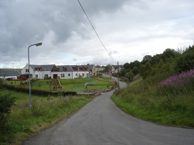
Binniehill Farm and hamlet, Slamannan near
Falkirk. This farm has been completed redeveloped as private housing. To the right runs a disused railway which once served the many coal mines that once operated in this
407:– You must give appropriate credit, provide a link to the license, and indicate if changes were made. You may do so in any reasonable manner, but not in any way that suggests the licensor endorses you or your use.
822:
758:
1126:
1121:
42:
960:
693:
623:
587:
289:
239:
713:
1336:
324:
1209:
This file contains additional information, probably added from the digital camera or scanner used to create or digitize it.
414:
550:
1055:
1018:
981:
926:
892:
863:
836:
799:
772:
721:
677:
571:
543:
530:
515:
953:
736:
706:
643:
607:
488:
471:
311:
370:
1212:
If the file has been modified from its original state, some details may not fully reflect the modified file.
1154:
The following pages on the
English Knowledge (XXG) use this file (pages on other projects are not listed):
1363:
413:– If you remix, transform, or build upon the material, you must distribute your contributions under the
331:
on the
Geograph website for the photographer's contact details. The copyright on this image is owned by
1137:
367:
1399:
829:"}},"text\/plain":{"en":{"P7787":"67 degree"}}}}": -->
765:"}},"text\/plain":{"en":{"P7787":"67 degree"}}}}": -->
91:
184:
1453:
743:
728:
168:
522:
295:
245:
1435:
1381:
1238:
336:
78:
1463:
1278:
116:
Binniehill Farm and hamlet, Slamannan near
Falkirk - geograph.org.uk - 213157.jpg
52:
Binniehill_Farm_and_hamlet,_Slamannan_near_Falkirk_-_geograph.org.uk_-_213157.jpg
1409:
136:
1258:
1158:
279:
229:
147:
157:
1473:
1248:
1231:
316:
328:
1094:
Click on a date/time to view the file as it appeared at that time.
1221:
281:
231:
256:
206:
66:
266:
55° 55′ 50″ N, 3° 49′ 55″ W
216:
55° 55′ 47″ N, 3° 50′ 06″ W
1186:
1176:
455:
Add a one-line explanation of what this file represents
1196:
110:
90:
Commons is a freely licensed media file repository.
624:
Creative
Commons Attribution-ShareAlike 2.0 Generic
199:Binniehill Farm and hamlet, Slamannan near Falkirk
180:Binniehill Farm and hamlet, Slamannan near Falkirk
56:(640 × 480 pixels, file size: 73 KB, MIME type:
424:https://creativecommons.org/licenses/by-sa/2.0
71:
430:Creative Commons Attribution-Share Alike 2.0
348:
8:
826:
762:
390:– to copy, distribute and transmit the work
1214:
1096:
451:
1169:The following other wikis use this file:
942:ab0c59f290f4ad00c65f2a7dd5c23f05e964ef3d
744:https://www.geograph.org.uk/photo/213157
1471:
1461:
1451:
1443:
1433:
1425:
1417:
1407:
1397:
1389:
1379:
1371:
1361:
1353:
1345:
1334:
1326:
1318:
1310:
1302:
1294:
1286:
1275:
1267:
1256:
1246:
1236:
1226:
1156:
1069:
1053:
1032:
1016:
995:
979:
940:
924:
906:
890:
850:
834:
786:
770:
691:
675:
657:
641:
621:
605:
585:
569:
523:https://www.geograph.org.uk/profile/322
502:
486:
469:
466:
447:
440:
259:
209:
288:View this and other nearby images on:
238:View this and other nearby images on:
1216:
7:
335:and is licensed for reuse under the
1085:
371:Attribution-Share Alike 2.0 Generic
359:
354:
339:Attribution-ShareAlike 2.0 license.
1207:
460:
454:
345:
322:
120:
103:
49:
459:
1269:Date and time of data generation
773:coordinates of the point of view
445:
401:Under the following conditions:
366:This file is licensed under the
358:
353:
347:
315:
294:
280:
272:
244:
230:
222:
70:
31:
21:
442:
121:
46:No higher resolution available.
14:
694:file available on the internet
441:
323:This image was taken from the
26:
1:
1404:Flash did not fire, auto mode
837:coordinates of depicted place
36:
714:Geograph Britain and Ireland
544:object of statement has role
467:Items portrayed in this file
1347:Date and time of digitizing
271:
221:
1495:
1193:Usage on www.wikidata.org
1183:Usage on ga.wikipedia.org
1173:Usage on eu.wikipedia.org
415:same or compatible license
1312:File change date and time
1086:
852:55°55'50.2"N, 3°49'55.2"W
197:paul birrell /
178:paul birrell /
16:
788:55°55'46.6"N, 3°50'6.0"W
722:geograph.org.uk image ID
444:
381:
77:This is a file from the
1419:Custom image processing
1143:
169:required by the license
153:
142:
135:
132:
113:
81:. Information from its
1355:Image compression mode
1122:20:18, 31 January 2010
329:this photograph's page
300:55.930600; -3.832000
250:55.929600; -3.835000
84:description page there
1373:Maximum land aperture
1296:Horizontal resolution
1350:15:33, 1 August 2006
1315:15:33, 1 August 2006
1272:15:33, 1 August 2006
954:determination method
1320:Y and C positioning
1304:Vertical resolution
1218:Camera manufacturer
396:– to adapt the work
1445:Scene capture type
1440:Auto white balance
531:author name string
1482:
1481:
1243:1/250 sec (0.004)
1165:Global file usage
1147:
828:
764:
608:copyright license
453:
344:
343:
327:collection. See
305:
304:
255:
254:
204:
203:
172:
99:
98:
79:Wikimedia Commons
32:Global file usage
1486:
1328:Exposure Program
1215:
1134:
1074:
1037:
1000:
963:
958:
874:
873:
868:
810:
809:
804:
746:
741:
737:described at URL
731:
726:
716:
711:
572:copyright status
553:
548:
538:
535:
525:
520:
437:
434:
431:
428:
425:
417:as the original.
379:
368:Creative Commons
362:
361:
357:
356:
351:
350:
337:Creative Commons
325:Geograph project
319:
312:
301:
298:
284:
283:
277:
276:
275:
269:
268:
257:
251:
248:
234:
233:
227:
226:
225:
219:
218:
207:
166:
138:
125:
117:
111:
95:
74:
73:
67:
61:
59:
1494:
1493:
1489:
1488:
1487:
1485:
1484:
1483:
1376:3 APEX (f/2.83)
1203:
1163:
1155:
1148:
1140:
1132:
1088:
1087:
1084:
1083:
1082:
1081:
1080:
1079:
1078:
1077:
1075:
1072:
1062:
1061:
1060:
1058:
1047:
1046:
1045:
1044:
1043:
1042:
1041:
1040:
1038:
1035:
1025:
1024:
1023:
1021:
1010:
1009:
1008:
1007:
1006:
1005:
1004:
1003:
1001:
998:
988:
987:
986:
984:
973:
972:
971:
970:
969:
968:
967:
966:
965:
964:
959:
956:
947:
946:
945:
943:
933:
932:
931:
929:
918:
917:
916:
915:
914:
913:
912:
911:
909:
899:
898:
897:
895:
884:
883:
882:
881:
880:
879:
878:
877:
876:
875:
871:
869:
866:
857:
856:
855:
853:
843:
842:
841:
839:
820:
819:
818:
817:
816:
815:
814:
813:
812:
811:
807:
805:
802:
793:
792:
791:
789:
779:
778:
777:
775:
756:
755:
754:
753:
752:
751:
750:
749:
748:
747:
742:
739:
733:
732:
727:
724:
718:
717:
712:
709:
700:
699:
698:
696:
684:
683:
682:
680:
669:
668:
667:
666:
665:
664:
663:
662:
660:
650:
649:
648:
646:
635:
634:
633:
632:
631:
630:
629:
628:
626:
614:
613:
612:
610:
599:
598:
597:
596:
595:
594:
593:
592:
590:
578:
577:
576:
574:
563:
562:
561:
560:
559:
558:
557:
556:
555:
554:
549:
546:
540:
539:
536:
533:
527:
526:
521:
518:
509:
508:
507:
505:
495:
494:
493:
491:
480:
479:
478:
477:
476:
474:
458:
457:
456:
439:
438:
435:
432:
429:
426:
423:
422:
380:
377:
374:
363:
340:
310:
299:
273:
264:
263:
260:Object location
249:
223:
214:
213:
210:Camera location
205:
194:
187:
175:
148:geograph.org.uk
128:
115:
108:
101:
100:
89:
88:
87:is shown below.
63:
57:
55:
48:
47:
12:
11:
5:
1492:
1490:
1480:
1479:
1476:
1470:
1469:
1466:
1460:
1459:
1456:
1450:
1449:
1446:
1442:
1441:
1438:
1432:
1431:
1428:
1424:
1423:
1422:Normal process
1420:
1416:
1415:
1412:
1406:
1405:
1402:
1396:
1395:
1392:
1388:
1387:
1384:
1378:
1377:
1374:
1370:
1369:
1366:
1360:
1359:
1356:
1352:
1351:
1348:
1344:
1343:
1340:
1333:
1332:
1331:Normal program
1329:
1325:
1324:
1321:
1317:
1316:
1313:
1309:
1308:
1305:
1301:
1300:
1297:
1293:
1292:
1289:
1285:
1284:
1281:
1274:
1273:
1270:
1266:
1265:
1262:
1255:
1254:
1251:
1245:
1244:
1241:
1235:
1234:
1229:
1225:
1224:
1219:
1206:
1202:
1201:
1200:
1199:
1191:
1190:
1189:
1181:
1180:
1179:
1167:
1166:
1162:
1161:
1153:
1152:
1151:
1146:
1145:
1142:
1138:
1135:
1129:
1124:
1119:
1115:
1114:
1111:
1108:
1105:
1102:
1099:
1092:
1091:
1076:
1070:
1068:
1067:
1066:
1065:
1064:
1063:
1059:
1054:
1052:
1051:
1050:
1049:
1048:
1039:
1033:
1031:
1030:
1029:
1028:
1027:
1026:
1022:
1017:
1015:
1014:
1013:
1012:
1011:
1002:
996:
994:
993:
992:
991:
990:
989:
985:
980:
978:
977:
976:
975:
974:
952:
951:
950:
949:
948:
944:
941:
939:
938:
937:
936:
935:
934:
930:
925:
923:
922:
921:
920:
919:
910:
907:
905:
904:
903:
902:
901:
900:
896:
891:
889:
888:
887:
886:
885:
862:
861:
860:
859:
858:
854:
851:
849:
848:
847:
846:
845:
844:
840:
835:
833:
832:
831:
830:
824:
798:
797:
796:
795:
794:
790:
787:
785:
784:
783:
782:
781:
780:
776:
771:
769:
768:
767:
766:
760:
735:
734:
720:
719:
705:
704:
703:
702:
701:
697:
692:
690:
689:
688:
687:
686:
685:
681:
678:source of file
676:
674:
673:
672:
671:
670:
661:
658:
656:
655:
654:
653:
652:
651:
647:
642:
640:
639:
638:
637:
636:
627:
622:
620:
619:
618:
617:
616:
615:
611:
606:
604:
603:
602:
601:
600:
591:
586:
584:
583:
582:
581:
580:
579:
575:
570:
568:
567:
566:
565:
564:
542:
541:
529:
528:
514:
513:
512:
511:
510:
506:
503:
501:
500:
499:
498:
497:
496:
492:
487:
485:
484:
483:
482:
481:
475:
470:
468:
465:
464:
463:
462:
461:
450:
449:
446:
443:
421:
420:
419:
418:
408:
399:
398:
397:
391:
384:You are free:
375:
365:
364:
346:
342:
341:
320:
309:
306:
303:
302:
292:
286:
261:
253:
252:
242:
236:
211:
202:
201:
195:
192:
189:
188:
183:
176:
173:
161:
160:
155:
151:
150:
144:
140:
139:
134:
130:
129:
118:
109:
107:
104:
102:
97:
96:
75:
65:
64:
45:
41:
40:
39:
34:
29:
24:
19:
13:
10:
9:
6:
4:
3:
2:
1491:
1477:
1475:
1472:
1467:
1465:
1462:
1457:
1455:
1452:
1447:
1444:
1439:
1437:
1436:White balance
1434:
1430:Auto exposure
1429:
1427:Exposure mode
1426:
1421:
1418:
1413:
1411:
1408:
1403:
1401:
1398:
1393:
1390:
1385:
1383:
1382:Metering mode
1380:
1375:
1372:
1367:
1365:
1364:Exposure bias
1362:
1357:
1354:
1349:
1346:
1341:
1338:
1335:
1330:
1327:
1322:
1319:
1314:
1311:
1306:
1303:
1298:
1295:
1290:
1287:
1282:
1280:
1276:
1271:
1268:
1263:
1260:
1257:
1252:
1250:
1247:
1242:
1240:
1239:Exposure time
1237:
1233:
1230:
1227:
1223:
1220:
1217:
1213:
1210:
1204:
1198:
1195:
1194:
1192:
1188:
1185:
1184:
1182:
1178:
1175:
1174:
1172:
1171:
1170:
1164:
1160:
1157:
1149:
1141:
1136:
1130:
1128:
1125:
1123:
1120:
1117:
1116:
1112:
1109:
1106:
1103:
1100:
1098:
1097:
1095:
1089:
1057:
1020:
983:
962:
955:
928:
894:
865:
838:
801:
774:
745:
738:
730:
723:
715:
708:
695:
679:
659:1 August 2006
645:
625:
609:
589:
573:
552:
545:
532:
524:
517:
490:
473:
427:CC BY-SA 2.0
416:
412:
409:
406:
403:
402:
400:
395:
392:
389:
386:
385:
383:
382:
376:Attribution:
372:
369:
352:
338:
334:
330:
326:
321:
318:
314:
313:
307:
297:
293:
291:
290:OpenStreetMap
287:
285:
267:
262:
258:
247:
243:
241:
240:OpenStreetMap
237:
235:
217:
212:
208:
200:
196:
191:
190:
186:
182: /
181:
177:
170:
165:
163:
162:
159:
156:
152:
149:
145:
141:
137:1 August 2006
131:
124:
119:
112:
105:
93:
86:
85:
80:
76:
69:
68:
62:
53:
44:
38:
35:
33:
30:
28:
25:
23:
20:
18:
15:
1391:Light source
1279:focal length
1228:Camera model
1211:
1208:
1168:
1093:
1090:File history
551:photographer
537:paul birrell
410:
404:
393:
387:
378:paul birrell
333:paul birrell
332:
270:
220:
198:
185:CC BY-SA 2.0
179:
158:paul birrell
122:
92:You can help
82:
50:
22:File history
1410:Color space
1288:Orientation
1139:GeographBot
588:copyrighted
411:share alike
405:attribution
164:Attribution
114:Description
1464:Saturation
1187:Am Binnean
1177:Binniehill
1159:Binniehill
1150:File usage
1131:640 × 480
1107:Dimensions
908:image/jpeg
893:media type
504:some value
58:image/jpeg
27:File usage
1474:Sharpness
1259:ISO speed
1104:Thumbnail
1101:Date/Time
982:data size
644:inception
308:Licensing
193:InfoField
174:InfoField
123:English:
1454:Contrast
1448:Standard
1323:Co-sited
1249:F-number
1232:DSC-P100
1205:Metadata
1197:Q4914447
927:checksum
707:operator
448:Captions
394:to remix
388:to share
373:license.
37:Metadata
1394:Unknown
1386:Pattern
1339:version
1133:(73 KB)
1118:current
1113:Comment
997:74,763
864:heading
823:heading
800:heading
759:heading
489:creator
472:depicts
452:English
106:Summary
54:
1478:Normal
1468:Normal
1458:Normal
1307:72 dpi
1299:72 dpi
1291:Normal
1283:7.9 mm
1261:rating
1019:height
872:degree
827:degree
808:degree
763:degree
729:213157
278:
228:
154:Author
143:Source
1400:Flash
1277:Lens
1253:f/5.6
1073:pixel
1056:width
1036:pixel
961:SHA-1
146:From
127:area.
1414:sRGB
1337:Exif
1222:SONY
1110:User
1071:640
1034:480
999:byte
436:true
433:true
133:Date
17:File
1342:2.2
1264:100
870:67
806:67
516:URL
957::
867::
803::
740::
725::
710::
547::
534::
519::
1368:0
1358:8
171:)
167:(
94:.
60:)
Text is available under the Creative Commons Attribution-ShareAlike License. Additional terms may apply.
_heading:67.00&language=en)
_heading:67.00&language=en)
