417:
351:
295:
231:
210:
194:
178:
162:
145:
435:
358:
310:
302:
372:
324:
395:
441:
446:
38:
86:
976:"}},"text\/plain":{"en":{"":"heading"}}},"{\"value\":{\"amount\":\"+135\",\"unit\":\"http:\\\/\\\/www.wikidata.org\\\/entity\\\/Q28390\"},\"type\":\"quantity\"}":{"text\/html":{"en":{"P7787":"135
972:
287:
343:
496:– You must give appropriate credit, provide a link to the license, and indicate if changes were made. You may do so in any reasonable manner, but not in any way that suggests the licensor endorses you or your use.
52:
48:
42:
973:
97:
65:
144:
350:
294:
230:
193:
416:
209:
177:
161:
1181:
874:
765:
729:
365:
317:
1093:
909:
610:
402:
838:
503:
692:
576:
1276:
1239:
1202:
1147:
1113:
1077:
1043:
1014:
987:
917:
858:
791:
778:
713:
685:
670:
657:
593:
1174:
945:
902:
887:
749:
630:
560:
243:
822:
389:
1347:
1342:
56:
37:
456:
254:
502:– If you remix, transform, or build upon the material, you must distribute your contributions under the
409:
on the
Geograph website for the photographer's contact details. The copyright on this image is owned by
242:
1358:
453:
980:"}},"text\/plain":{"en":{"P7787":"135 degree"}}}}": -->
105:
266:
924:
894:
677:
371:
323:
236:
223:
1379:
422:
92:
355:
307:
261:
260:
255:
172:
1365:
Uploading geograph.org.uk image from https://www.geograph.org.uk/photo/2991337
248:
188:
411:
204:
237:
224:
394:
406:
1315:
Click on a date/time to view the file as it appeared at that time.
249:
357:
309:
334:
278:
80:
1036:
344:
50° 38′ 01.3″ N, 2° 20′ 17″ W
288:
50° 38′ 02.6″ N, 2° 20′ 19″ W
1397:
267:
126:
104:
Commons is a freely licensed media file repository.
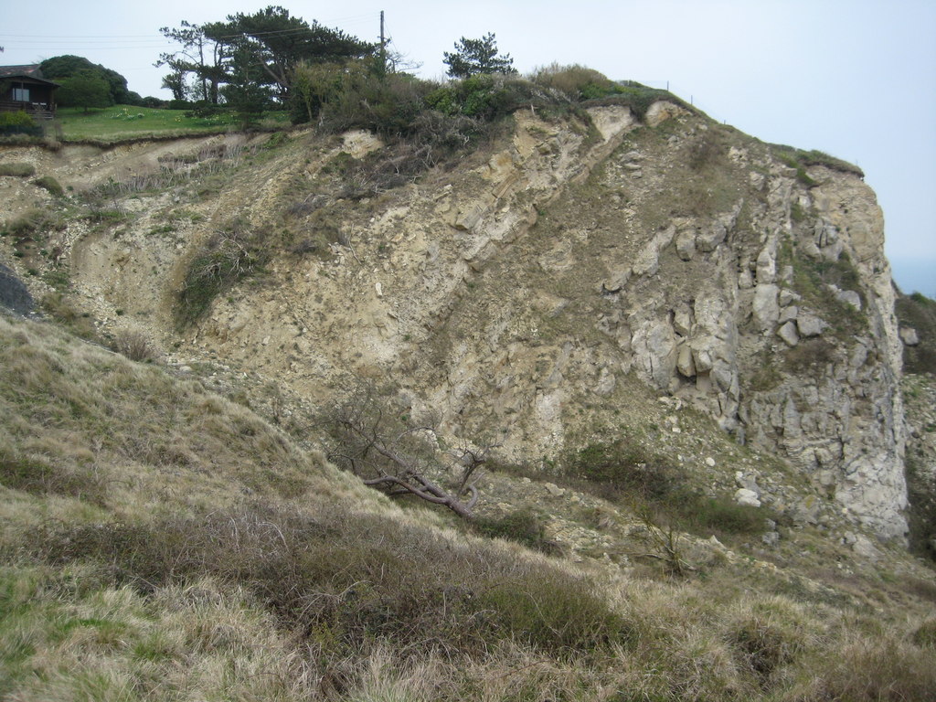
766:
Creative
Commons Attribution-ShareAlike 2.0 Generic
70:(1,024 × 768 pixels, file size: 252 KB, MIME type:
513:https://creativecommons.org/licenses/by-sa/2.0
85:
519:Creative Commons Attribution-Share Alike 2.0
434:
132:Burning Cliff - geograph.org.uk - 2991337.jpg
8:
977:
479:– to copy, distribute and transmit the work
1317:
540:
415:
349:
293:
229:
208:
192:
176:
160:
143:
1390:The following other wikis use this file:
895:https://www.geograph.org.uk/photo/2991337
1163:9aae917b08ca6665c687c9c16f0ada1c7594fd12
678:https://www.geograph.org.uk/profile/1837
1377:
1290:
1274:
1253:
1237:
1216:
1200:
1161:
1145:
1127:
1111:
1091:
1075:
1057:
1041:
1001:
985:
959:
943:
872:
856:
836:
820:
763:
747:
727:
711:
644:
628:
608:
591:
574:
558:
555:
536:
529:
337:
281:
364:View this and other nearby images on:
316:View this and other nearby images on:
7:
421:and is licensed for reuse under the
1375:The following page uses this file:
1306:
457:Attribution-Share Alike 2.0 Generic
445:
440:
425:Attribution-ShareAlike 2.0 license.
549:
543:
431:
400:
136:
117:
63:
548:
988:coordinates of the point of view
534:
490:Under the following conditions:
452:This file is licensed under the
444:
439:
433:
393:
370:
356:
322:
308:
300:
84:
31:
21:
531:
14:
875:file available on the internet
530:
401:This image was taken from the
26:
1:
1044:coordinates of depicted place
299:
159:coast, rock, Owermoigne
910:Geograph Britain and Ireland
686:object of statement has role
556:Items portrayed in this file
189:Geograph Britain and Ireland
1416:
1394:Usage on www.wikidata.org
801:
504:same or compatible license
1307:
798:
16:
1059:50°38'1.3"N, 2°20'16.8"W
1003:50°38'2.8"N, 2°20'19.0"W
918:geograph.org.uk image ID
533:
470:
91:This is a file from the
1364:
200:
184:
171:
168:
129:
95:. Information from its
467:by Philip Halling
407:this photograph's page
376:50.633695; -2.338029
328:50.634054; -2.338597
98:description page there
41:Size of this preview:
1343:09:24, 3 January 2022
1175:determination method
1078:location of creation
485:– to adapt the work
142:Burning Cliff
47:Other resolutions:
779:author name string
658:author name string
256:South West England
57:1,024 × 768 pixels
1386:Global file usage
1368:
979:
750:copyright license
542:
430:
429:
405:collection. See
381:
380:
333:
332:
276:
275:
271:
217:Place of creation
113:
112:
93:Wikimedia Commons
32:Global file usage
1407:
1355:
1295:
1258:
1221:
1184:
1179:
1025:
1024:
1019:
927:
922:
912:
907:
897:
892:
888:described at URL
804:
803:
800:
796:
786:
783:
714:copyright status
695:
690:
680:
675:
665:
662:
526:
523:
520:
517:
514:
506:as the original.
468:
454:Creative Commons
448:
447:
443:
442:
437:
436:
423:Creative Commons
419:
403:Geograph project
397:
390:
386:
377:
374:
360:
359:
353:
347:
346:
335:
329:
326:
312:
311:
305:
304:
303:
297:
291:
290:
279:
269:
263:
257:
251:
245:
239:
235:
233:
226:
212:
196:
180:
174:
164:
147:
141:
133:
127:
122:
109:
88:
87:
81:
75:
73:
60:
53:640 × 480 pixels
49:320 × 240 pixels
43:800 × 600 pixels
1415:
1414:
1410:
1409:
1408:
1406:
1405:
1404:
1384:
1369:
1361:
1353:
1309:
1308:
1305:
1304:
1303:
1302:
1301:
1300:
1299:
1298:
1296:
1293:
1283:
1282:
1281:
1279:
1268:
1267:
1266:
1265:
1264:
1263:
1262:
1261:
1259:
1256:
1246:
1245:
1244:
1242:
1231:
1230:
1229:
1228:
1227:
1226:
1225:
1224:
1222:
1219:
1209:
1208:
1207:
1205:
1194:
1193:
1192:
1191:
1190:
1189:
1188:
1187:
1186:
1185:
1180:
1177:
1168:
1167:
1166:
1164:
1154:
1153:
1152:
1150:
1139:
1138:
1137:
1136:
1135:
1134:
1133:
1132:
1130:
1120:
1119:
1118:
1116:
1105:
1104:
1103:
1102:
1101:
1100:
1099:
1098:
1096:
1084:
1083:
1082:
1080:
1069:
1068:
1067:
1066:
1065:
1064:
1063:
1062:
1060:
1050:
1049:
1048:
1046:
1035:
1034:
1033:
1032:
1031:
1030:
1029:
1028:
1027:
1026:
1022:
1020:
1017:
1008:
1007:
1006:
1004:
994:
993:
992:
990:
971:
970:
969:
968:
967:
966:
965:
964:
962:
952:
951:
950:
948:
937:
936:
935:
934:
933:
932:
931:
930:
929:
928:
923:
920:
914:
913:
908:
905:
899:
898:
893:
890:
881:
880:
879:
877:
865:
864:
863:
861:
850:
849:
848:
847:
846:
845:
844:
843:
841:
829:
828:
827:
825:
814:
813:
812:
811:
810:
809:
808:
807:
806:
805:
797:
794:
788:
787:
784:
781:
772:
771:
770:
768:
756:
755:
754:
752:
741:
740:
739:
738:
737:
736:
735:
734:
732:
720:
719:
718:
716:
705:
704:
703:
702:
701:
700:
699:
698:
697:
696:
691:
688:
682:
681:
676:
673:
667:
666:
663:
660:
651:
650:
649:
647:
637:
636:
635:
633:
622:
621:
620:
619:
618:
617:
616:
615:
613:
602:
601:
600:
599:
598:
596:
585:
584:
583:
582:
581:
579:
567:
566:
565:
563:
547:
546:
545:
528:
527:
524:
521:
518:
515:
512:
511:
469:
463:
460:
449:
426:
388:
384:
375:
342:
341:
338:Object location
327:
301:
286:
285:
282:Camera location
277:
220:
156:
148:
137:
131:
124:
120:
115:
114:
103:
102:
101:is shown below.
77:
71:
69:
62:
61:
46:
12:
11:
5:
1413:
1411:
1403:
1402:
1401:
1400:
1388:
1387:
1383:
1382:
1373:
1372:
1367:
1366:
1363:
1359:
1356:
1350:
1345:
1340:
1336:
1335:
1332:
1329:
1326:
1323:
1320:
1313:
1312:
1297:
1291:
1289:
1288:
1287:
1286:
1285:
1284:
1280:
1275:
1273:
1272:
1271:
1270:
1269:
1260:
1254:
1252:
1251:
1250:
1249:
1248:
1247:
1243:
1238:
1236:
1235:
1234:
1233:
1232:
1223:
1217:
1215:
1214:
1213:
1212:
1211:
1210:
1206:
1201:
1199:
1198:
1197:
1196:
1195:
1173:
1172:
1171:
1170:
1169:
1165:
1162:
1160:
1159:
1158:
1157:
1156:
1155:
1151:
1146:
1144:
1143:
1142:
1141:
1140:
1131:
1128:
1126:
1125:
1124:
1123:
1122:
1121:
1117:
1112:
1110:
1109:
1108:
1107:
1106:
1097:
1092:
1090:
1089:
1088:
1087:
1086:
1085:
1081:
1076:
1074:
1073:
1072:
1071:
1070:
1061:
1058:
1056:
1055:
1054:
1053:
1052:
1051:
1047:
1042:
1040:
1039:
1038:
1037:
1013:
1012:
1011:
1010:
1009:
1005:
1002:
1000:
999:
998:
997:
996:
995:
991:
986:
984:
983:
982:
981:
975:
963:
960:
958:
957:
956:
955:
954:
953:
949:
944:
942:
941:
940:
939:
938:
916:
915:
901:
900:
886:
885:
884:
883:
882:
878:
873:
871:
870:
869:
868:
867:
866:
862:
859:source of file
857:
855:
854:
853:
852:
851:
842:
837:
835:
834:
833:
832:
831:
830:
826:
821:
819:
818:
817:
816:
815:
790:
789:
785:Philip Halling
777:
776:
775:
774:
773:
769:
764:
762:
761:
760:
759:
758:
757:
753:
748:
746:
745:
744:
743:
742:
733:
728:
726:
725:
724:
723:
722:
721:
717:
712:
710:
709:
708:
707:
706:
684:
683:
669:
668:
664:Philip Halling
656:
655:
654:
653:
652:
648:
645:
643:
642:
641:
640:
639:
638:
634:
629:
627:
626:
625:
624:
623:
614:
609:
607:
606:
605:
604:
603:
597:
592:
590:
589:
588:
587:
586:
580:
575:
573:
572:
571:
570:
569:
568:
564:
559:
557:
554:
553:
552:
551:
550:
539:
538:
535:
532:
510:
509:
508:
507:
497:
488:
487:
486:
480:
473:You are free:
461:
451:
450:
432:
428:
427:
412:Philip Halling
398:
387:
382:
379:
378:
368:
362:
339:
331:
330:
320:
314:
283:
274:
273:
268:United Kingdom
221:
218:
214:
213:
205:Philip Halling
202:
198:
197:
186:
182:
181:
170:
166:
165:
157:
154:
150:
149:
134:
125:
123:
118:
116:
111:
110:
89:
79:
78:
40:
36:
35:
34:
29:
24:
19:
13:
10:
9:
6:
4:
3:
2:
1412:
1399:
1396:
1395:
1393:
1392:
1391:
1385:
1381:
1380:Burning Cliff
1378:
1376:
1370:
1362:
1357:
1351:
1349:
1346:
1344:
1341:
1338:
1337:
1333:
1330:
1327:
1324:
1321:
1319:
1318:
1316:
1310:
1278:
1241:
1204:
1183:
1176:
1149:
1115:
1095:
1079:
1045:
1016:
989:
947:
926:
919:
911:
904:
896:
889:
876:
860:
840:
824:
799:Burning Cliff
793:
780:
767:
751:
731:
715:
694:
687:
679:
672:
659:
632:
612:
595:
578:
562:
544:Burning Cliff
516:CC BY-SA 2.0
505:
501:
498:
495:
492:
491:
489:
484:
481:
478:
475:
474:
472:
471:
466:
465:Burning Cliff
462:Attribution:
458:
455:
438:
424:
420:
418:
413:
408:
404:
399:
396:
392:
391:
383:
373:
369:
367:
366:OpenStreetMap
363:
361:
352:
345:
340:
336:
325:
321:
319:
318:OpenStreetMap
315:
313:
296:
289:
284:
280:
270:
264:
258:
252:
246:
240:
232:
227:
222:
216:
215:
211:
206:
203:
199:
195:
190:
187:
183:
179:
167:
163:
158:
152:
151:
146:
140:
135:
128:
119:
107:
100:
99:
94:
90:
83:
82:
76:
67:
66:Original file
58:
54:
50:
44:
39:
33:
30:
28:
25:
23:
20:
18:
15:
1389:
1374:
1352:1,024 × 768
1314:
1311:File history
961:5 April 2012
693:photographer
499:
493:
482:
476:
464:
410:
298:
173:5 April 2012
138:
106:You can help
96:
64:
22:File history
1360:GeographBot
823:instance of
730:copyrighted
500:share alike
494:attribution
130:Description
1398:Q110639250
1371:File usage
1328:Dimensions
1129:image/jpeg
1114:media type
1094:Owermoigne
839:photograph
646:some value
611:Owermoigne
238:Owermoigne
225:Owermoigne
72:image/jpeg
27:File usage
1325:Thumbnail
1322:Date/Time
1203:data size
946:inception
802:(English)
385:Licensing
219:InfoField
155:InfoField
1354:(252 KB)
1218:258,548
1148:checksum
903:operator
537:Captions
483:to remix
477:to share
459:license.
139:English:
1339:current
1334:Comment
1015:heading
974:heading
925:2991337
631:creator
561:depicts
541:English
262:England
153:Depicts
121:Summary
68:
1292:1,024
1240:height
1023:degree
978:degree
414:
354:
348:
306:
292:
250:Dorset
244:Dorset
228:
207:
201:Author
191:
185:Source
175:
1294:pixel
1277:width
1257:pixel
1182:SHA-1
792:title
577:coast
1331:User
1255:768
1220:byte
1021:135
594:rock
525:true
522:true
169:Date
17:File
671:URL
1178::
1018::
921::
906::
891::
795::
782::
689::
674::
661::
55:|
51:|
45:.
272:)
265:→
259:→
253:→
247:→
241:→
234:(
108:.
74:)
59:.
Text is available under the Creative Commons Attribution-ShareAlike License. Additional terms may apply.