38:
283:
241:
255:
289:
294:
94:
759:
343:– You must give appropriate credit, provide a link to the license, and indicate if changes were made. You may do so in any reasonable manner, but not in any way that suggests the licensor endorses you or your use.
232:
434:
60:
56:
52:
48:
42:
105:
73:
600:
564:
528:
248:
430:
704:
492:
908:
801:
This file contains additional information, probably added from the digital camera or scanner used to create or digitize it.
350:
688:
620:
584:
512:
654:
548:
476:
426:
304:
312:
273:
215:
804:
If the file has been modified from its original state, some details may not fully reflect the modified file.
786:
The following pages on the
English Knowledge (XXG) use this file (pages on other projects are not listed):
349:– If you remix, transform, or build upon the material, you must distribute your contributions under the
301:
173:
113:
758:
753:
64:
37:
168:
823:
149:
790:
254:
276:, the copyright holder of this work, hereby publishes it under the following license:
100:
850:
157:
238:
956:
830:
769:
153:
390:
440:
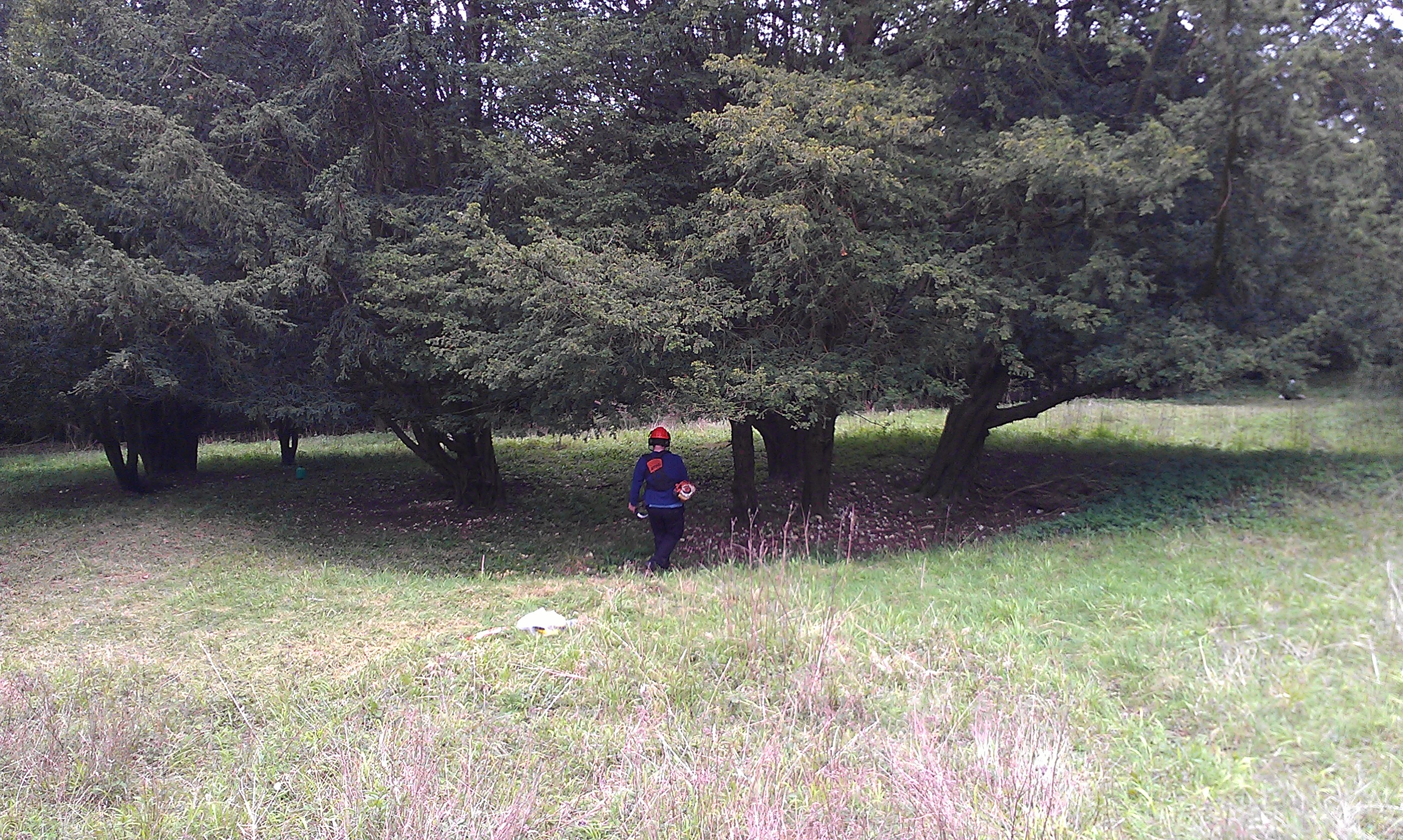
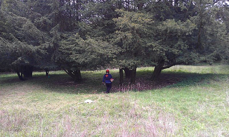
A late prehistoric site at ] on ] in ]. Photograph taken in Summer 2012.
726:
Click on a date/time to view the file as it appeared at that time.
193:
613:
240:
233:
50° 54′ 26.72″ N, 0° 49′ 17.49″ W
813:
223:
88:
776:
Transferred from en.wikipedia: see original upload log above
460:
Add a one-line explanation of what this file represents
397:
78:(2,592 × 1,552 pixels, file size: 1.52 MB, MIME type:
565:
Creative
Commons Attribution-ShareAlike 3.0 Unported
162:
132:
112:
Commons is a freely licensed media file repository.
400:. All following user names refer to en.wikipedia.
385:
360:https://creativecommons.org/licenses/by-sa/3.0
93:
366:Creative Commons Attribution-Share Alike 3.0
282:
8:
326:– to copy, distribute and transmit the work
806:
728:
456:
402:
988:
980:
972:
964:
954:
946:
925:
917:
906:
898:
890:
882:
874:
866:
858:
847:
839:
828:
818:
788:
702:
686:
668:
652:
634:
618:
598:
582:
562:
546:
526:
510:
490:
474:
471:
452:
445:
226:
247:View this and other nearby images on:
808:
7:
305:Attribution-Share Alike 3.0 Unported
717:
293:
288:
192:
799:
465:
459:
396:The original description page was
395:
279:
272:
166:
160:. Photograph taken in Summer 2012.
142:
125:
71:
464:
206:Own work by the original uploader
841:Date and time of data generation
621:coordinates of the point of view
450:
337:Under the following conditions:
300:This file is licensed under the
292:
287:
281:
253:
239:
92:
21:
447:
423:2,592 × 1,552 (1,590,092 bytes)
191:14 May 2012 (according to
143:
14:
446:
26:
1:
636:50°54'26.719"N, 0°49'17.490"W
601:original creation by uploader
31:
472:Items portrayed in this file
138:Goosehill Camp, Bow Hill.jpg
919:Date and time of digitizing
148:A late prehistoric site at
1010:
948:Supported Flashpix version
879:202 meters above sea level
351:same or compatible license
974:Geodetic survey data used
927:Meaning of each component
718:
16:
449:
317:
99:This is a file from the
966:GPS time (atomic clock)
775:
211:
205:
201:
190:
187:
135:
103:. Information from its
754:14:46, 24 October 2015
427:w:en:Ethan Doyle White
259:50.907422; -0.821525
106:description page there
41:Size of this preview:
884:Horizontal resolution
689:location of creation
420:22:18, 30 April 2013
65:2,592 × 1,552 pixels
900:Y and C positioning
892:Vertical resolution
810:Camera manufacturer
391:For the Common Good
379:Original upload log
332:– to adapt the work
167:This is a photo of
47:Other resolutions:
922:11:25, 14 May 2012
844:11:25, 14 May 2012
61:1,280 × 766 pixels
57:1,024 × 613 pixels
997:
996:
779:
549:copyright license
458:
444:
443:
389:to Commons using
383:Transferred from
313:Ethan Doyle White
274:Ethan Doyle White
264:
263:
221:
220:
216:Ethan Doyle White
183:
182:
121:
120:
101:Wikimedia Commons
1001:
863:50° 54′ 26.72″ N
807:
766:
513:copyright status
403:
388:
373:
370:
367:
364:
361:
353:as the original.
315:
302:Creative Commons
296:
295:
291:
290:
285:
284:
260:
257:
243:
242:
236:
235:
224:
207:
196:
176:
163:
147:
139:
133:
117:
96:
95:
89:
83:
81:
68:
53:640 × 383 pixels
49:320 × 192 pixels
43:800 × 479 pixels
1009:
1008:
1004:
1003:
1002:
1000:
999:
998:
990:GPS tag version
871:0° 49′ 17.49″ W
824:HTC Rhyme S510b
795:
787:
780:
772:
764:
720:
719:
716:
715:
714:
713:
712:
711:
710:
709:
707:
695:
694:
693:
691:
680:
679:
678:
677:
676:
675:
674:
673:
671:
661:
660:
659:
657:
646:
645:
644:
643:
642:
641:
640:
639:
637:
627:
626:
625:
623:
612:
611:
610:
609:
608:
607:
606:
605:
603:
591:
590:
589:
587:
576:
575:
574:
573:
572:
571:
570:
569:
567:
555:
554:
553:
551:
540:
539:
538:
537:
536:
535:
534:
533:
531:
519:
518:
517:
515:
504:
503:
502:
501:
500:
499:
498:
497:
495:
483:
482:
481:
479:
463:
462:
461:
401:
384:
381:
376:
375:
374:
371:
368:
365:
362:
359:
358:
316:
311:
308:
297:
278:
277:
269:
258:
231:
230:
227:Camera location
222:
178:
172:
169:listed building
161:
137:
130:
123:
122:
111:
110:
109:is shown below.
85:
79:
77:
70:
69:
46:
12:
11:
5:
1007:
1005:
995:
994:
991:
987:
986:
983:
979:
978:
975:
971:
970:
967:
963:
962:
959:
953:
952:
949:
945:
944:
943:
942:
941:does not exist
939:
936:
933:
928:
924:
923:
920:
916:
915:
912:
905:
904:
901:
897:
896:
893:
889:
888:
885:
881:
880:
877:
873:
872:
869:
865:
864:
861:
857:
856:
853:
846:
845:
842:
838:
837:
834:
827:
826:
821:
817:
816:
811:
798:
794:
793:
791:Goosehill Camp
785:
784:
783:
778:
777:
774:
770:
767:
763:2,592 × 1,552
761:
756:
751:
747:
746:
743:
740:
737:
734:
731:
724:
723:
708:
703:
701:
700:
699:
698:
697:
696:
692:
687:
685:
684:
683:
682:
681:
672:
669:
667:
666:
665:
664:
663:
662:
658:
653:
651:
650:
649:
648:
647:
638:
635:
633:
632:
631:
630:
629:
628:
624:
619:
617:
616:
615:
614:
604:
599:
597:
596:
595:
594:
593:
592:
588:
585:source of file
583:
581:
580:
579:
578:
577:
568:
563:
561:
560:
559:
558:
557:
556:
552:
547:
545:
544:
543:
542:
541:
532:
527:
525:
524:
523:
522:
521:
520:
516:
511:
509:
508:
507:
506:
505:
496:
493:Goosehill Camp
491:
489:
488:
487:
486:
485:
484:
480:
475:
473:
470:
469:
468:
467:
466:
455:
454:
451:
448:
442:
441:
438:
424:
421:
417:
416:
413:
410:
407:
380:
377:
357:
356:
355:
354:
344:
335:
334:
333:
327:
320:You are free:
309:
299:
298:
280:
271:
270:
268:
265:
262:
261:
251:
245:
228:
219:
218:
213:
209:
208:
203:
199:
198:
189:
185:
184:
181:
180:
150:Goosehill Camp
140:
131:
129:
126:
124:
119:
118:
97:
87:
86:
40:
36:
35:
34:
29:
24:
19:
13:
10:
9:
6:
4:
3:
2:
1006:
992:
989:
984:
981:
976:
973:
968:
965:
960:
958:
955:
950:
947:
940:
937:
934:
931:
930:
929:
926:
921:
918:
913:
910:
907:
902:
899:
894:
891:
886:
883:
878:
875:
870:
867:
862:
859:
854:
852:
848:
843:
840:
835:
832:
829:
825:
822:
819:
815:
812:
809:
805:
802:
796:
792:
789:
781:
773:
768:
762:
760:
757:
755:
752:
749:
748:
744:
741:
738:
735:
732:
730:
729:
727:
721:
706:
690:
656:
622:
602:
586:
566:
550:
530:
514:
494:
478:
439:
436:
432:
428:
425:
422:
419:
418:
414:
411:
408:
405:
404:
399:
394:
392:
387:
378:
363:CC BY-SA 3.0
352:
348:
345:
342:
339:
338:
336:
331:
328:
325:
322:
321:
319:
318:
314:
310:Attribution:
306:
303:
286:
275:
266:
256:
252:
250:
249:OpenStreetMap
246:
244:
234:
229:
225:
217:
214:
210:
204:
200:
195:
186:
179:
175:
170:
165:
164:
159:
155:
151:
146:
141:
134:
127:
115:
108:
107:
102:
98:
91:
90:
84:
75:
74:Original file
66:
62:
58:
54:
50:
44:
39:
33:
30:
28:
25:
23:
20:
18:
15:
851:focal length
820:Camera model
803:
800:
725:
722:File history
386:en.wikipedia
382:
346:
340:
329:
323:
144:
114:You can help
104:
72:
22:File history
985:14 May 2012
957:Color space
670:14 May 2012
529:copyrighted
347:share alike
341:attribution
158:West Sussex
136:Description
782:File usage
739:Dimensions
409:Dimensions
80:image/jpeg
27:File usage
868:Longitude
831:ISO speed
765:(1.52 MB)
736:Thumbnail
733:Date/Time
705:West Dean
655:inception
406:Date/Time
267:Licensing
145:English:
982:GPS date
903:Centered
876:Altitude
860:Latitude
797:Metadata
453:Captions
435:contribs
415:Comment
330:to remix
324:to share
307:license.
154:Bow Hill
32:Metadata
911:version
855:3.03 mm
750:current
745:Comment
477:depicts
457:English
174:1008375
171:number
128:Summary
76:
977:WGS-84
895:72 dpi
887:72 dpi
833:rating
237:
212:Author
202:Source
993:2.2.0
969:10:25
849:Lens
771:Kelly
197:data)
961:sRGB
909:Exif
742:User
431:talk
412:User
398:here
372:true
369:true
194:Exif
188:Date
17:File
914:2.2
814:HTC
156:in
152:on
938:Cr
935:Cb
836:75
433:|
393:.
63:|
59:|
55:|
51:|
45:.
951:1
932:Y
437:)
429:(
177:.
116:.
82:)
67:.
Text is available under the Creative Commons Attribution-ShareAlike License. Additional terms may apply.