228:
324:
43:
234:
239:
99:
658:
625:
592:
722:
675:{{BotMoveToCommons|wts.oldwikivoyage|year={{subst:CURRENTYEAR}}|month={{subst:CURRENTMONTHNAME}}|day={{subst:CURRENTDAY}}}} == {{int:filedesc}} == {{Information |description=Map of Ghana. Map of Ghana, Ghana * Map of: Ghana¤ |date=February 2nd 2010 |s...
562:
280:– You must give appropriate credit, provide a link to the license, and indicate if changes were made. You may do so in any reasonable manner, but not in any way that suggests the licensor endorses you or your use.
842:
323:
782:
689:
473:
437:
935:
This file contains additional information, probably added from the digital camera or scanner used to create or digitize it.
287:
65:
61:
57:
53:
47:
421:
110:
493:
457:
404:
78:
643:
610:
209:
204:
657:
652:
624:
619:
591:
586:
249:
938:
If the file has been modified from its original state, some details may not fully reflect the modified file.
642:(BOT): Uploading old version of file from wts.wikivoyage-old; originally uploaded on 2010-02-02 09:09:17 by
609:(BOT): Uploading old version of file from wts.wikivoyage-old; originally uploaded on 2010-04-25 08:44:25 by
183:
336:
199:
286:– If you remix, transform, or build upon the material, you must distribute your contributions under the
246:
187:
354:
344:
118:
364:
966:
892:
797:
668:
561:
556:
69:
42:
105:
635:
602:
572:
822:
159:
173:
802:
762:
872:
902:
832:
757:
148:
529:
Click on a date/time to view the file as it appeared at that time.
694:
922:
852:
349:{{Imagecredit|credit=], |ca (Import from wikitravel.org/shared)
847:
93:
772:
369:
Fixed minor misspellings (Import from wikitravel.org/shared)
792:
579:(BOT): Reverting to most recent version before archival
388:
Add a one-line explanation of what this file represents
339:. All following user names refer to wts.wikivoyage-old.
83:(1,495 × 2,233 pixels, file size: 1.03 MB, MIME type:
474:
Creative
Commons Attribution-ShareAlike 3.0 Unported
137:
117:
Commons is a freely licensed media file repository.
912:
862:
807:
752:
742:
732:
712:
318:
882:
329:This file was imported from Wikivoyage WTS.
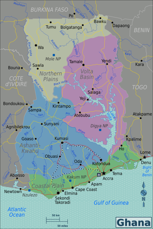
174:Perry-Castañeda Library Map Collection Ghana Maps
812:
297:https://creativecommons.org/licenses/by-sa/3.0
98:
303:Creative Commons Attribution-Share Alike 3.0
227:
8:
798:Template:About Ghanaian Pidgin Knowledge/new
263:– to copy, distribute and transmit the work
940:
531:
384:
705:The following other wikis use this file:
963:
958:
950:
942:
687:
507:
491:
471:
455:
435:
419:
402:
399:
380:
373:
685:The following 2 pages use this file:
7:
250:Attribution-Share Alike 3.0 Unported
520:
359:(Import from wikitravel.org/shared)
238:
233:
933:
393:
387:
335:The original description page was
334:
224:
130:
76:
839:Usage on incubator.wikimedia.org
690:Administrative divisions of Ghana
392:
378:
322:
274:Under the following conditions:
245:This file is licensed under the
237:
232:
226:
97:
31:
21:
375:
14:
374:
26:
1:
803:Template:Feature Articles All
763:User:(WT-en) Burmesedays/Maps
36:
400:Items portrayed in this file
919:Usage on zh.wikivoyage.org
909:Usage on vi.wikivoyage.org
899:Usage on uk.wikivoyage.org
869:Usage on ja.wikivoyage.org
859:Usage on it.wikivoyage.org
829:Usage on he.wikivoyage.org
789:Usage on gpe.wikipedia.org
749:Usage on en.wikivoyage.org
739:Usage on de.wikivoyage.org
729:Usage on cs.wikivoyage.org
709:Usage on bar.wikipedia.org
988:
889:Usage on si.wikipedia.org
879:Usage on ku.wikipedia.org
819:Usage on gu.wikipedia.org
779:Usage on fa.wikipedia.org
769:Usage on es.wikipedia.org
719:Usage on bn.wikipedia.org
367:1495×2233 (1082693 bytes)
357:1500×2241 (1085999 bytes)
347:1500×2241 (1063131 bytes)
288:same or compatible license
723:ঘানার প্রশাসনিক বিভাগসমূহ
521:
169:
16:
758:User:(WT-en) Burmesedays
377:
254:
147:Map of Ghana for use on
104:This is a file from the
674:
653:23:50, 17 November 2012
644:(WT-shared) Burmesedays
641:
620:15:32, 23 November 2012
611:(WT-shared) Burmesedays
608:
587:15:32, 23 November 2012
578:
557:15:32, 23 November 2012
355:(WT-shared) Burmesedays
345:(WT-shared) Burmesedays
200:multilingual SVG source
193:
179:
165:
158:
155:
140:
108:. Information from its
186:, minor amendments by
111:description page there
46:Size of this preview:
944:Horizontal resolution
143:Ghana Regions map.png
70:1,495 × 2,233 pixels
952:Vertical resolution
315:Original upload log
269:– to adapt the work
52:Other resolutions:
66:685 × 1,024 pixels
975:
974:
783:تقسیمات کشوری غنا
701:Global file usage
678:
458:copyright license
386:
365:(WT-shared) Joelf
363:2012-03-05 00:52
353:2010-04-25 08:44
343:2010-02-02 09:09
333:
332:
217:
216:
151:, English version
126:
125:
106:Wikimedia Commons
32:Global file usage
979:
969:
967:www.inkscape.org
941:
843:Wy/th/ประเทศกานา
665:
632:
599:
569:
422:copyright status
326:
319:
310:
307:
304:
301:
298:
290:as the original.
247:Creative Commons
241:
240:
236:
235:
230:
229:
171:
161:
144:
138:
122:
101:
100:
94:
88:
86:
73:
62:514 × 768 pixels
58:321 × 480 pixels
54:161 × 240 pixels
48:401 × 599 pixels
987:
986:
982:
981:
980:
978:
977:
976:
965:
929:
773:Etnias de Ghana
699:
679:
671:
663:
638:
630:
605:
597:
575:
567:
523:
522:
519:
518:
517:
516:
515:
514:
513:
512:
510:
509:2 February 2010
500:
499:
498:
496:
485:
484:
483:
482:
481:
480:
479:
478:
476:
464:
463:
462:
460:
449:
448:
447:
446:
445:
444:
443:
442:
440:
428:
427:
426:
424:
413:
412:
411:
410:
409:
407:
391:
390:
389:
340:
317:
312:
311:
308:
305:
302:
299:
296:
295:
253:
242:
223:
218:
160:2 February 2010
142:
135:
128:
127:
116:
115:
114:is shown below.
90:
84:
82:
75:
74:
51:
12:
11:
5:
985:
983:
973:
972:
971:
970:
961:
957:
956:
953:
949:
948:
945:
932:
928:
927:
926:
925:
917:
916:
915:
907:
906:
905:
897:
896:
895:
887:
886:
885:
877:
876:
875:
867:
866:
865:
857:
856:
855:
850:
845:
837:
836:
835:
827:
826:
825:
817:
816:
815:
810:
805:
800:
795:
787:
786:
785:
777:
776:
775:
767:
766:
765:
760:
755:
747:
746:
745:
737:
736:
735:
727:
726:
725:
717:
716:
715:
703:
702:
698:
697:
692:
683:
682:
677:
676:
673:
669:
666:
662:1,495 × 2,233
660:
655:
650:
647:
646:
640:
636:
633:
629:1,500 × 2,241
627:
622:
617:
614:
613:
607:
603:
600:
596:1,500 × 2,241
594:
589:
584:
581:
580:
577:
573:
570:
566:1,495 × 2,233
564:
559:
554:
550:
549:
546:
543:
540:
537:
534:
527:
526:
511:
508:
506:
505:
504:
503:
502:
501:
497:
492:
490:
489:
488:
487:
486:
477:
472:
470:
469:
468:
467:
466:
465:
461:
456:
454:
453:
452:
451:
450:
441:
436:
434:
433:
432:
431:
430:
429:
425:
420:
418:
417:
416:
415:
414:
408:
403:
401:
398:
397:
396:
395:
394:
383:
382:
379:
376:
372:
371:
361:
351:
331:
330:
327:
316:
313:
294:
293:
292:
291:
281:
272:
271:
270:
264:
257:You are free:
244:
243:
225:
222:
219:
215:
214:
213:
212:
207:
202:
195:
194:Other versions
191:
190:
181:
177:
176:
167:
163:
162:
157:
153:
152:
145:
136:
134:
131:
129:
124:
123:
102:
92:
91:
45:
41:
40:
39:
34:
29:
24:
19:
13:
10:
9:
6:
4:
3:
2:
984:
968:
964:
962:
960:Software used
959:
954:
951:
946:
943:
939:
936:
930:
924:
921:
920:
918:
914:
911:
910:
908:
904:
901:
900:
898:
894:
891:
890:
888:
884:
881:
880:
878:
874:
871:
870:
868:
864:
861:
860:
858:
854:
851:
849:
846:
844:
841:
840:
838:
834:
831:
830:
828:
824:
821:
820:
818:
814:
811:
809:
806:
804:
801:
799:
796:
794:
791:
790:
788:
784:
781:
780:
778:
774:
771:
770:
768:
764:
761:
759:
756:
754:
751:
750:
748:
744:
741:
740:
738:
734:
731:
730:
728:
724:
721:
720:
718:
714:
711:
710:
708:
707:
706:
700:
696:
693:
691:
688:
686:
680:
672:
667:
661:
659:
656:
654:
651:
649:
648:
645:
639:
634:
628:
626:
623:
621:
618:
616:
615:
612:
606:
601:
595:
593:
590:
588:
585:
583:
582:
576:
571:
565:
563:
560:
558:
555:
552:
551:
547:
544:
541:
538:
535:
533:
532:
530:
524:
495:
475:
459:
439:
423:
406:
370:
366:
362:
360:
356:
352:
350:
346:
342:
341:
338:
328:
325:
321:
320:
314:
300:CC BY-SA 3.0
289:
285:
282:
279:
276:
275:
273:
268:
265:
262:
259:
258:
256:
255:
251:
248:
231:
220:
211:
208:
206:
203:
201:
198:
197:
196:
192:
189:
185:
182:
178:
175:
168:
164:
154:
150:
146:
139:
132:
120:
113:
112:
107:
103:
96:
95:
89:
80:
79:Original file
71:
67:
63:
59:
55:
49:
44:
38:
35:
33:
30:
28:
25:
23:
20:
18:
15:
937:
934:
704:
684:
528:
525:File history
368:
358:
348:
283:
277:
266:
260:
119:You can help
109:
77:
22:File history
853:Wy/cs/Ghana
438:copyrighted
284:share alike
278:attribution
184:Burmesedays
141:Description
848:Wy/lv/Gana
681:File usage
542:Dimensions
210:Portuguese
149:Wikivoyage
27:File usage
955:40.55 dpc
947:40.55 dpc
793:Main Page
670:MGA73bot2
664:(1.03 MB)
631:(1.01 MB)
598:(1.04 MB)
568:(1.03 MB)
539:Thumbnail
536:Date/Time
494:inception
221:Licensing
172:based on
85:image/png
931:Metadata
381:Captions
267:to remix
261:to share
252:license.
170:Own work
37:Metadata
637:OgreBot
604:OgreBot
574:OgreBot
553:current
548:Comment
405:depicts
385:English
133:Summary
81:
205:French
180:Author
166:Source
913:Ghana
893:ඝානාව
863:Ghana
808:Ghana
753:Ghana
743:Ghana
733:Ghana
713:Ghana
695:Ghana
188:Joelf
903:Гана
883:Gana
833:גאנה
823:ઘાના
545:User
337:here
309:true
306:true
156:Date
17:File
873:ガーナ
923:加纳
68:|
64:|
60:|
56:|
50:.
813:J
121:.
87:)
72:.
Text is available under the Creative Commons Attribution-ShareAlike License. Additional terms may apply.

.png)
.png)