239:
146:
160:
245:
250:
91:
43:
703:
291:– You must give appropriate credit, provide a link to the license, and indicate if changes were made. You may do so in any reasonable manner, but not in any way that suggests the licensor endorses you or your use.
137:
614:
544:
508:
472:
153:
916:
789:
This file contains additional information, probably added from the digital camera or scanner used to create or digitize it.
298:
738:
598:
564:
528:
456:
428:
415:
400:
634:
492:
373:
356:
435:
811:
260:
792:
If the file has been modified from its original state, some details may not fully reflect the modified file.
57:
53:
47:
102:
982:
297:– If you remix, transform, or build upon the material, you must distribute your contributions under the
70:
257:
713:
1010:
110:
407:
733:
801:
159:
1110:
1000:
964:
818:
97:
756:
232:
I, the copyright holder of this work, hereby publish it under the following license:
1120:
858:
143:
216:
1044:
702:
697:
61:
42:
196:
838:
766:
828:
557:
670:
Click on a date/time to view the file as it appeared at that time.
145:
138:
43° 58′ 09.38″ N, 88° 33′ 29.88″ W
128:
85:
340:
Add a one-line explanation of what this file represents
776:
509:
Creative
Commons Attribution-ShareAlike 3.0 Unported
171:
109:
Commons is a freely licensed media file repository.
75:(1,024 × 711 pixels, file size: 201 KB, MIME type:
1015:Flash did not fire, compulsory flash suppression
308:https://creativecommons.org/licenses/by-sa/3.0
90:
314:Creative Commons Attribution-Share Alike 3.0
238:
8:
408:https://commons.wikimedia.org/user:FlugKerl2
274:– to copy, distribute and transmit the work
794:
672:
336:
749:The following other wikis use this file:
1185:
1177:
1169:
1161:
1153:
1145:
1137:
1129:
1118:
1108:
1100:
1092:
1084:
1076:
1068:
1060:
1052:
1042:
1034:
1026:
1018:
1008:
998:
990:
980:
972:
962:
954:
933:
925:
914:
906:
898:
890:
882:
874:
866:
855:
847:
836:
826:
816:
806:
757:Benutzer:Frank Murmann/Glasair Aviation
731:
648:
632:
612:
596:
578:
562:
542:
526:
506:
490:
470:
454:
387:
371:
354:
351:
332:
325:
131:
152:View this and other nearby images on:
796:
729:The following 2 pages use this file:
7:
261:Attribution-Share Alike 3.0 Unported
661:
249:
244:
787:
345:
339:
235:
231:
181:
122:
68:
580:43°58'9.38302"N, 88°33'29.88292"W
344:
849:Date and time of data generation
767:Bruker:Paaln/Forekomster av q197
565:coordinates of the point of view
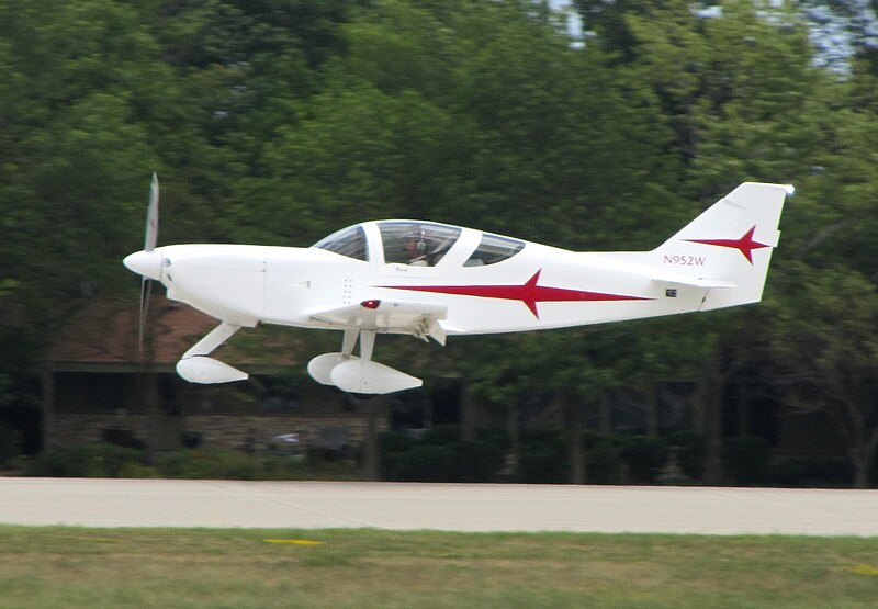
330:
285:Under the following conditions:
256:This file is licensed under the
248:
243:
237:
158:
144:
89:
31:
21:
327:
182:
14:
326:
26:
1:
887:246.88 meters above sea level
545:original creation by uploader
36:
1028:DateTimeDigitized subseconds
739:Stoddard-Hamilton Glasair II
352:Items portrayed in this file
1070:Focal plane resolution unit
1020:DateTimeOriginal subseconds
927:Date and time of digitizing
1207:
1081:One-chip color area sensor
1036:Supported Flashpix version
773:Usage on www.wikidata.org
763:Usage on no.wikipedia.org
753:Usage on de.wikipedia.org
299:same or compatible license
1155:Geodetic survey data used
935:Meaning of each component
900:File change date and time
662:
206:
16:
1062:Focal plane Y resolution
1054:Focal plane X resolution
812:Canon PowerShot SX230 HS
615:Canon PowerShot SX230 HS
329:
265:
96:This is a file from the
1150:Measurement in progress
1139:GPS time (atomic clock)
1094:Custom image processing
719:
212:
202:
195:
192:
174:
100:. Information from its
956:Image compression mode
164:43.969273; -88.558301
103:description page there
46:Size of this preview:
992:Maximum land aperture
1089:Digital still camera
995:5.125 APEX (f/5.91)
930:16:06, 22 July 2012
908:Y and C positioning
903:16:06, 22 July 2012
852:16:06, 22 July 2012
798:Camera manufacturer
698:03:07, 31 July 2012
280:– to adapt the work
187:Glassair II Landing
52:Other resolutions:
1131:Scene capture type
1115:Auto white balance
823:1/400 sec (0.0025)
429:Wikimedia username
416:author name string
62:1,024 × 711 pixels
1194:
1193:
1179:Rating (out of 5)
745:Global file usage
722:
493:copyright license
338:
222:
221:
169:
168:
118:
117:
98:Wikimedia Commons
32:Global file usage
1198:
1065:16,393.442622951
1057:16,393.442622951
879:88° 33′ 29.88″ W
795:
734:Glasair Aviation
710:
457:copyright status
438:
433:
423:
420:
410:
405:
321:
318:
315:
312:
309:
301:as the original.
258:Creative Commons
252:
251:
247:
246:
241:
240:
208:
198:
186:
178:
172:
165:
162:
148:
147:
141:
140:
129:
114:
93:
92:
86:
80:
78:
65:
58:640 × 444 pixels
54:320 × 222 pixels
48:800 × 555 pixels
1206:
1205:
1201:
1200:
1199:
1197:
1196:
1195:
1171:GPS tag version
1147:Receiver status
871:43° 58′ 9.38″ N
783:
743:
723:
716:
708:
664:
663:
660:
659:
658:
657:
656:
655:
654:
653:
651:
641:
640:
639:
637:
626:
625:
624:
623:
622:
621:
620:
619:
617:
605:
604:
603:
601:
590:
589:
588:
587:
586:
585:
584:
583:
581:
571:
570:
569:
567:
556:
555:
554:
553:
552:
551:
550:
549:
547:
535:
534:
533:
531:
520:
519:
518:
517:
516:
515:
514:
513:
511:
499:
498:
497:
495:
484:
483:
482:
481:
480:
479:
478:
477:
475:
463:
462:
461:
459:
448:
447:
446:
445:
444:
443:
442:
441:
440:
439:
434:
431:
425:
424:
421:
418:
412:
411:
406:
403:
394:
393:
392:
390:
380:
379:
378:
376:
365:
364:
363:
362:
361:
359:
343:
342:
341:
324:
323:
322:
319:
316:
313:
310:
307:
306:
264:
253:
234:
233:
228:
223:
188:
176:
163:
136:
135:
132:Camera location
127:
120:
119:
108:
107:
106:is shown below.
82:
76:
74:
67:
66:
51:
12:
11:
5:
1204:
1202:
1192:
1191:
1188:
1184:
1183:
1180:
1176:
1175:
1172:
1168:
1167:
1164:
1160:
1159:
1156:
1152:
1151:
1148:
1144:
1143:
1140:
1136:
1135:
1132:
1128:
1127:
1124:
1117:
1116:
1113:
1107:
1106:
1103:
1099:
1098:
1097:Normal process
1095:
1091:
1090:
1087:
1083:
1082:
1079:
1078:Sensing method
1075:
1074:
1071:
1067:
1066:
1063:
1059:
1058:
1055:
1051:
1050:
1047:
1041:
1040:
1037:
1033:
1032:
1029:
1025:
1024:
1021:
1017:
1016:
1013:
1007:
1006:
1003:
997:
996:
993:
989:
988:
985:
979:
978:
975:
971:
970:
967:
961:
960:
957:
953:
952:
951:
950:
949:does not exist
947:
944:
941:
936:
932:
931:
928:
924:
923:
920:
913:
912:
909:
905:
904:
901:
897:
896:
893:
889:
888:
885:
881:
880:
877:
873:
872:
869:
865:
864:
861:
854:
853:
850:
846:
845:
842:
835:
834:
831:
825:
824:
821:
815:
814:
809:
805:
804:
799:
786:
782:
781:
780:
779:
771:
770:
769:
761:
760:
759:
747:
746:
742:
741:
736:
727:
726:
721:
720:
718:
714:
711:
705:
700:
695:
691:
690:
687:
684:
681:
678:
675:
668:
667:
652:
649:
647:
646:
645:
644:
643:
642:
638:
633:
631:
630:
629:
628:
627:
618:
613:
611:
610:
609:
608:
607:
606:
602:
597:
595:
594:
593:
592:
591:
582:
579:
577:
576:
575:
574:
573:
572:
568:
563:
561:
560:
559:
558:
548:
543:
541:
540:
539:
538:
537:
536:
532:
529:source of file
527:
525:
524:
523:
522:
521:
512:
507:
505:
504:
503:
502:
501:
500:
496:
491:
489:
488:
487:
486:
485:
476:
471:
469:
468:
467:
466:
465:
464:
460:
455:
453:
452:
451:
450:
449:
427:
426:
414:
413:
399:
398:
397:
396:
395:
391:
388:
386:
385:
384:
383:
382:
381:
377:
372:
370:
369:
368:
367:
366:
360:
355:
353:
350:
349:
348:
347:
346:
335:
334:
331:
328:
305:
304:
303:
302:
292:
283:
282:
281:
275:
268:You are free:
255:
254:
236:
230:
229:
227:
224:
220:
219:
214:
210:
209:
204:
200:
199:
194:
190:
189:
179:
177:GlassairII.jpg
170:
167:
166:
156:
150:
133:
126:
123:
121:
116:
115:
94:
84:
83:
45:
41:
40:
39:
34:
29:
24:
19:
13:
10:
9:
6:
4:
3:
2:
1203:
1189:
1186:
1181:
1178:
1173:
1170:
1165:
1162:
1157:
1154:
1149:
1146:
1141:
1138:
1133:
1130:
1125:
1122:
1119:
1114:
1112:
1111:White balance
1109:
1105:Auto exposure
1104:
1102:Exposure mode
1101:
1096:
1093:
1088:
1085:
1080:
1077:
1072:
1069:
1064:
1061:
1056:
1053:
1048:
1046:
1043:
1038:
1035:
1030:
1027:
1022:
1019:
1014:
1012:
1009:
1004:
1002:
1001:Metering mode
999:
994:
991:
986:
984:
983:Exposure bias
981:
976:
974:APEX aperture
973:
968:
966:
965:Shutter speed
963:
958:
955:
948:
945:
942:
939:
938:
937:
934:
929:
926:
921:
918:
915:
910:
907:
902:
899:
894:
891:
886:
883:
878:
875:
870:
867:
862:
860:
856:
851:
848:
843:
840:
837:
832:
830:
827:
822:
820:
819:Exposure time
817:
813:
810:
807:
803:
800:
797:
793:
790:
784:
778:
775:
774:
772:
768:
765:
764:
762:
758:
755:
754:
752:
751:
750:
744:
740:
737:
735:
732:
730:
724:
717:
712:
706:
704:
701:
699:
696:
693:
692:
688:
685:
682:
679:
676:
674:
673:
671:
665:
636:
616:
600:
599:captured with
566:
546:
530:
510:
494:
474:
458:
437:
430:
417:
409:
402:
375:
358:
311:CC BY-SA 3.0
300:
296:
293:
290:
287:
286:
284:
279:
276:
273:
270:
269:
267:
266:
262:
259:
242:
225:
218:
215:
211:
205:
201:
191:
185:
180:
173:
161:
157:
155:
154:OpenStreetMap
151:
149:
139:
134:
130:
124:
112:
105:
104:
99:
95:
88:
87:
81:
72:
71:Original file
63:
59:
55:
49:
44:
38:
35:
33:
30:
28:
25:
23:
20:
18:
15:
1166:22 July 2012
1121:Digital zoom
859:focal length
808:Camera model
791:
788:
748:
728:
707:1,024 × 711
669:
666:File history
650:22 July 2012
294:
288:
277:
271:
197:22 July 2012
183:
111:You can help
101:
69:
22:File history
1190:Oshkosh2012
1086:File source
1045:Color space
892:Orientation
473:copyrighted
295:share alike
289:attribution
175:Description
725:File usage
683:Dimensions
389:some value
77:image/jpeg
27:File usage
876:Longitude
839:ISO speed
715:FlugKerl2
680:Thumbnail
677:Date/Time
635:inception
436:FlugKerl2
422:FlugKerl2
226:Licensing
217:FlugKerl2
184:English:
1187:Keywords
1163:GPS date
1134:Standard
911:Co-sited
884:Altitude
868:Latitude
829:F-number
785:Metadata
777:Q7618303
709:(201 KB)
333:Captions
278:to remix
272:to share
263:license.
207:Own work
37:Metadata
1174:2.3.0.0
1005:Pattern
969:8.65625
919:version
694:current
689:Comment
374:creator
357:depicts
337:English
125:Summary
73:
1158:WGS-84
1073:inches
895:Normal
841:rating
213:Author
203:Source
142:
1142:19:10
1123:ratio
1011:Flash
977:5.125
863:70 mm
857:Lens
833:f/5.9
802:Canon
1049:sRGB
917:Exif
686:User
320:true
317:true
193:Date
17:File
922:2.3
844:160
401:URL
1031:00
1023:00
946:Cr
943:Cb
432::
419::
404::
60:|
56:|
50:.
1182:0
1126:1
1039:1
987:0
959:3
940:Y
113:.
79:)
64:.
Text is available under the Creative Commons Attribution-ShareAlike License. Additional terms may apply.
