314:
247:
239:
261:
282:
320:
325:
72:
726:"}},"text\/plain":{"en":{"":"heading"}}},"{\"value\":{\"amount\":\"+247\",\"unit\":\"http:\\\/\\\/www.wikidata.org\\\/entity\\\/Q28390\"},\"type\":\"quantity\"}":{"text\/html":{"en":{"P7787":"247
722:
372:– You must give appropriate credit, provide a link to the license, and indicate if changes were made. You may do so in any reasonable manner, but not in any way that suggests the licensor endorses you or your use.
230:
43:
723:
892:
845:== {{int:filedesc}} == {{Information |Description={{en|1=Gwinear Church}} |Source=From |Date=2008-09-11 |Author= |Permission=Creative Commons At
859:
167:
83:
51:
874:
658:
588:
552:
254:
708:
289:
1015:
This file contains additional information, probably added from the digital camera or scanner used to create or digitize it.
379:
487:
764:
737:
686:
642:
536:
510:
495:
480:
701:
671:
608:
572:
453:
436:
276:
335:
1018:
If the file has been modified from its original state, some details may not fully reflect the modified file.
855:
The following pages on the
English Knowledge (XXG) use this file (pages on other projects are not listed):
378:– If you remix, transform, or build upon the material, you must distribute your contributions under the
296:
on the
Geograph website for the photographer's contact details. The copyright on this image is owned by
869:
332:
730:"}},"text\/plain":{"en":{"P7787":"247 degree"}}}}": -->
91:
199:
864:
827:
822:
42:
502:
693:
678:
183:
260:
952:
301:
78:
927:
912:
244:
838:
135:
156:
146:
281:
937:
293:
795:
Click on a date/time to view the file as it appeared at that time.
942:
246:
231:
50° 11′ 15.05″ N, 5° 22′ 11.83″ W
221:
66:
982:
922:
902:
420:
Add a one-line explanation of what this file represents
1002:
997:
962:
987:
972:
174:
Creative
Commons Attribution Share-alike license 2.0
110:
90:
Commons is a freely licensed media file repository.
589:
Creative
Commons Attribution-ShareAlike 2.0 Generic
56:(640 × 480 pixels, file size: 99 KB, MIME type:
389:https://creativecommons.org/licenses/by-sa/2.0
71:
395:Creative Commons Attribution-Share Alike 2.0
313:
8:
727:
355:– to copy, distribute and transmit the work
1020:
797:
416:
885:The following other wikis use this file:
503:https://www.geograph.org.uk/profile/29571
679:https://www.geograph.org.uk/photo/972186
1022:
857:
751:
735:
656:
640:
622:
606:
586:
570:
550:
534:
467:
451:
434:
431:
412:
405:
224:
928:Liste der Grade-I-Bauwerke in Cornwall
253:View this and other nearby images on:
7:
913:Grade I listed buildings in Cornwall
860:Grade I listed buildings in Cornwall
300:and is licensed for reuse under the
786:
336:Attribution-Share Alike 2.0 Generic
324:
319:
304:Attribution-ShareAlike 2.0 license.
1013:
425:
419:
310:
287:
120:
103:
49:
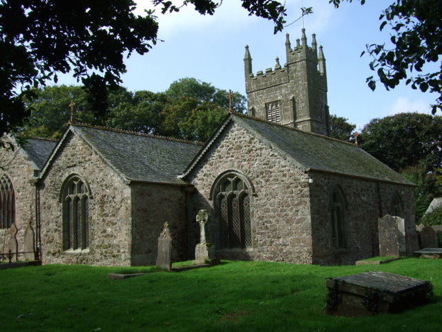
875:St Gwinear's Church, Gwinear
424:
738:coordinates of the point of view
410:
366:Under the following conditions:
331:This file is licensed under the
323:
318:
312:
280:
259:
245:
237:
70:
31:
21:
953:Église Saint-Éguiner de Gwinear
407:
121:
46:No higher resolution available.
14:
659:file available on the internet
406:
288:This image was taken from the
26:
1:
753:50°11'15.054"N, 5°22'11.831"W
36:
709:Geograph Britain and Ireland
481:object of statement has role
432:Items portrayed in this file
236:
909:Usage on dag.wikipedia.org
889:Usage on arz.wikipedia.org
116:GwinearChurchCornwallUK.jpg
52:GwinearChurchCornwallUK.jpg
1044:
994:Usage on www.wikidata.org
979:Usage on sv.wikipedia.org
969:Usage on pl.wikipedia.org
959:Usage on kw.wikipedia.org
949:Usage on fr.wikipedia.org
934:Usage on eu.wikipedia.org
919:Usage on de.wikipedia.org
899:Usage on cy.wikipedia.org
380:same or compatible license
787:
16:
687:geograph.org.uk image ID
409:
346:
77:This is a file from the
844:
212:Jill Floyd /
193:Jill Floyd /
184:required by the license
162:
152:
141:
134:
131:
113:
81:. Information from its
294:this photograph's page
265:50.187515; -5.369953
84:description page there
943:Gwinear (Kornualles)
893:كنيسه القديس وينقرب
361:– to adapt the work
823:07:10, 22 May 2010
511:author name string
1031:
1030:
881:Global file usage
865:Gwinear, Cornwall
848:
729:
624:11 September 2008
573:copyright license
418:
309:
308:
292:collection. See
270:
269:
219:
218:
187:
171:
168:Reusing this file
136:11 September 2008
99:
98:
79:Wikimedia Commons
32:Global file usage
1035:
1021:
983:Gwinear-Gwithian
938:Gwinear–Gwithian
923:Gwinear-Gwithian
870:Gwinear–Gwithian
835:
775:
774:
769:
711:
706:
696:
691:
681:
676:
672:described at URL
537:copyright status
518:
515:
505:
500:
490:
485:
402:
399:
396:
393:
390:
382:as the original.
344:
333:Creative Commons
327:
326:
322:
321:
316:
315:
302:Creative Commons
290:Geograph project
284:
277:
266:
263:
249:
248:
242:
241:
240:
234:
233:
222:
181:
165:
137:
125:
117:
111:
95:
74:
73:
67:
61:
59:
1043:
1042:
1038:
1037:
1036:
1034:
1033:
1032:
1009:
903:Gwinear, Cernyw
879:
856:
849:
841:
833:
789:
788:
785:
784:
783:
782:
781:
780:
779:
778:
777:
776:
772:
770:
767:
758:
757:
756:
754:
744:
743:
742:
740:
721:
720:
719:
718:
717:
716:
715:
714:
713:
712:
707:
704:
698:
697:
692:
689:
683:
682:
677:
674:
665:
664:
663:
661:
649:
648:
647:
645:
634:
633:
632:
631:
630:
629:
628:
627:
625:
615:
614:
613:
611:
600:
599:
598:
597:
596:
595:
594:
593:
591:
579:
578:
577:
575:
564:
563:
562:
561:
560:
559:
558:
557:
555:
543:
542:
541:
539:
528:
527:
526:
525:
524:
523:
522:
521:
520:
519:
516:
513:
507:
506:
501:
498:
492:
491:
486:
483:
474:
473:
472:
470:
460:
459:
458:
456:
445:
444:
443:
442:
441:
439:
423:
422:
421:
404:
403:
400:
397:
394:
391:
388:
387:
345:
342:
339:
328:
305:
275:
264:
238:
229:
228:
225:Camera location
220:
209:
202:
190:
147:geograph.org.uk
127:
115:
108:
101:
100:
89:
88:
87:is shown below.
63:
57:
55:
48:
47:
12:
11:
5:
1041:
1039:
1029:
1028:
1025:
1012:
1008:
1007:
1006:
1005:
1000:
992:
991:
990:
985:
977:
976:
975:
967:
966:
965:
957:
956:
955:
947:
946:
945:
940:
932:
931:
930:
925:
917:
916:
915:
907:
906:
905:
897:
896:
895:
883:
882:
878:
877:
872:
867:
862:
854:
853:
852:
847:
846:
843:
839:
836:
830:
825:
820:
816:
815:
812:
809:
806:
803:
800:
793:
792:
763:
762:
761:
760:
759:
755:
752:
750:
749:
748:
747:
746:
745:
741:
736:
734:
733:
732:
731:
725:
700:
699:
685:
684:
670:
669:
668:
667:
666:
662:
657:
655:
654:
653:
652:
651:
650:
646:
643:source of file
641:
639:
638:
637:
636:
635:
626:
623:
621:
620:
619:
618:
617:
616:
612:
607:
605:
604:
603:
602:
601:
592:
587:
585:
584:
583:
582:
581:
580:
576:
571:
569:
568:
567:
566:
565:
556:
551:
549:
548:
547:
546:
545:
544:
540:
535:
533:
532:
531:
530:
529:
509:
508:
494:
493:
479:
478:
477:
476:
475:
471:
468:
466:
465:
464:
463:
462:
461:
457:
452:
450:
449:
448:
447:
446:
440:
435:
433:
430:
429:
428:
427:
426:
415:
414:
411:
408:
386:
385:
384:
383:
373:
364:
363:
362:
356:
349:You are free:
340:
330:
329:
311:
307:
306:
285:
274:
271:
268:
267:
257:
251:
226:
217:
216:
214:Gwinear Church
210:
207:
204:
203:
198:
195:Gwinear Church
191:
188:
176:
175:
172:
160:
159:
154:
150:
149:
143:
139:
138:
133:
129:
128:
126:Gwinear Church
118:
109:
107:
104:
102:
97:
96:
75:
65:
64:
45:
41:
40:
39:
34:
29:
24:
19:
13:
10:
9:
6:
4:
3:
2:
1040:
1026:
1023:
1019:
1016:
1010:
1004:
1001:
999:
996:
995:
993:
989:
986:
984:
981:
980:
978:
974:
971:
970:
968:
964:
961:
960:
958:
954:
951:
950:
948:
944:
941:
939:
936:
935:
933:
929:
926:
924:
921:
920:
918:
914:
911:
910:
908:
904:
901:
900:
898:
894:
891:
890:
888:
887:
886:
880:
876:
873:
871:
868:
866:
863:
861:
858:
850:
842:
837:
831:
829:
826:
824:
821:
818:
817:
813:
810:
807:
804:
801:
799:
798:
796:
790:
766:
739:
710:
703:
695:
688:
680:
673:
660:
644:
610:
590:
574:
554:
538:
512:
504:
497:
489:
482:
455:
438:
392:CC BY-SA 2.0
381:
377:
374:
371:
368:
367:
365:
360:
357:
354:
351:
350:
348:
347:
341:Attribution:
337:
334:
317:
303:
299:
295:
291:
286:
283:
279:
278:
272:
262:
258:
256:
255:OpenStreetMap
252:
250:
232:
227:
223:
215:
211:
206:
205:
201:
197: /
196:
192:
185:
180:
178:
177:
173:
169:
164:
161:
158:
155:
151:
148:
144:
140:
130:
124:
119:
112:
105:
93:
86:
85:
80:
76:
69:
68:
62:
53:
44:
38:
35:
33:
30:
28:
25:
23:
20:
18:
15:
1017:
1014:
884:
794:
791:File history
488:photographer
375:
369:
358:
352:
297:
235:
213:
200:CC BY-SA 2.0
194:
122:
92:You can help
82:
50:
22:File history
553:copyrighted
376:share alike
370:attribution
179:Attribution
114:Description
1024:_error
851:File usage
832:640 × 480
808:Dimensions
517:Jill Floyd
469:some value
343:Jill Floyd
298:Jill Floyd
163:Permission
157:Jill Floyd
58:image/jpeg
27:File usage
1003:Q17529370
805:Thumbnail
802:Date/Time
609:inception
273:Licensing
208:InfoField
189:InfoField
123:English:
1011:Metadata
998:Q5623651
963:Gwynnyer
702:operator
413:Captions
359:to remix
353:to share
338:license.
37:Metadata
988:Gwinear
973:Gwinear
834:(99 KB)
819:current
814:Comment
765:heading
724:heading
454:creator
437:depicts
417:English
106:Summary
54:
840:Andy F
773:degree
728:degree
694:972186
243:
153:Author
142:Source
145:From
811:User
771:247
401:true
398:true
132:Date
17:File
496:URL
768::
705::
690::
675::
514::
499::
484::
1027:0
186:)
182:(
170:)
166:(
94:.
60:)
Text is available under the Creative Commons Attribution-ShareAlike License. Additional terms may apply.
