257:
43:
263:
268:
99:
751:
309:– You must give appropriate credit, provide a link to the license, and indicate if changes were made. You may do so in any reasonable manner, but not in any way that suggests the licensor endorses you or your use.
219:
153:
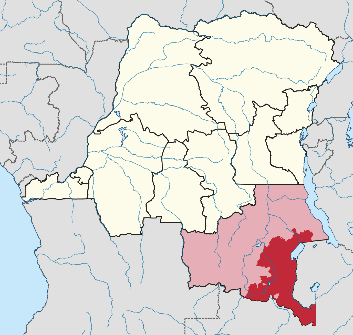
Highlight Haut-Katanga district within
Katanga province on map of DR Congo provinces in 2014. Note that the cities of Lubumbashi and Likasi are not part of the district.
234:
65:
61:
57:
53:
47:
110:
78:
584:
462:
426:
390:
813:
This file contains additional information, probably added from the digital camera or scanner used to create or digitize it.
316:
679:
642:
605:
550:
516:
410:
577:
482:
446:
374:
200:
278:
816:
If the file has been modified from its original state, some details may not fully reflect the modified file.
191:
778:
The following pages on the
English Knowledge (XXG) use this file (pages on other projects are not listed):
782:
315:– If you remix, transform, or build upon the material, you must distribute your contributions under the
275:
761:
207:
118:
750:
745:
69:
42:
199:
International boundaries from U.S. Department of State - Humanitarian
Information Unit,
105:
250:
I, the copyright holder of this work, hereby publish it under the following license:
194:
162:
180:
718:
Click on a date/time to view the file as it appeared at that time.
190:
Former provinces and district boundaries constructed from OCHA
93:
463:
Creative
Commons Attribution-ShareAlike 4.0 International
83:(1,378 × 1,308 pixels, file size: 462 KB, MIME type:
800:
358:
Haut-Katanga district within
Katanga province (2014)
137:
117:
Commons is a freely licensed media file repository.
326:https://creativecommons.org/licenses/by-sa/4.0
201:Africa and Americas - Simplified LSIB Polygons
98:
332:Creative Commons Attribution-Share Alike 4.0
256:
8:
292:– to copy, distribute and transmit the work
818:
720:
354:
793:The following other wikis use this file:
279:Attribution-Share Alike 4.0 International
566:6e17b18dbf45e98ffdce61b665ff586ecf698fc2
828:
820:
780:
693:
677:
656:
640:
619:
603:
564:
548:
530:
514:
496:
480:
460:
444:
424:
408:
388:
372:
369:
350:
343:
7:
768:Uploaded own work with UploadWizard
709:
267:
262:
220:Annuaire statistique 2014 de la RDC
811:
363:
357:
253:
249:
147:
130:
76:
362:
192:province and territory boundaries
348:
303:Under the following conditions:
274:This file is licensed under the
266:
261:
255:
97:
31:
21:
345:
148:
14:
344:
206:Rivers, lakes, and ocean from
26:
1:
36:
370:Items portrayed in this file
143:DRC Katanga Haut-Katanga.png
850:
797:Usage on co.wikipedia.org
317:same or compatible license
710:
16:
347:
283:
104:This is a file from the
767:
230:
168:
161:
158:
140:
108:. Information from its
111:description page there
46:Size of this preview:
822:Horizontal resolution
783:Haut-Katanga District
746:16:53, 16 August 2021
391:Haut-Katanga District
578:determination method
70:1,378 × 1,308 pixels
66:1,079 × 1,024 pixels
830:Vertical resolution
298:– to adapt the work
52:Other resolutions:
837:
836:
789:Global file usage
771:
447:copyright license
356:
240:
239:
126:
125:
106:Wikimedia Commons
32:Global file usage
841:
819:
758:
698:
661:
624:
587:
582:
411:copyright status
339:
336:
333:
330:
327:
319:as the original.
276:Creative Commons
270:
269:
265:
264:
259:
258:
164:
152:
144:
138:
122:
101:
100:
94:
88:
86:
73:
62:809 × 768 pixels
58:506 × 480 pixels
54:253 × 240 pixels
48:632 × 600 pixels
849:
848:
844:
843:
842:
840:
839:
838:
807:
787:
779:
772:
764:
756:
712:
711:
708:
707:
706:
705:
704:
703:
702:
701:
699:
696:
686:
685:
684:
682:
671:
670:
669:
668:
667:
666:
665:
664:
662:
659:
649:
648:
647:
645:
634:
633:
632:
631:
630:
629:
628:
627:
625:
622:
612:
611:
610:
608:
597:
596:
595:
594:
593:
592:
591:
590:
589:
588:
583:
580:
571:
570:
569:
567:
557:
556:
555:
553:
542:
541:
540:
539:
538:
537:
536:
535:
533:
523:
522:
521:
519:
508:
507:
506:
505:
504:
503:
502:
501:
499:
489:
488:
487:
485:
474:
473:
472:
471:
470:
469:
468:
467:
465:
453:
452:
451:
449:
438:
437:
436:
435:
434:
433:
432:
431:
429:
417:
416:
415:
413:
402:
401:
400:
399:
398:
397:
396:
395:
393:
381:
380:
379:
377:
361:
360:
359:
342:
341:
340:
337:
334:
331:
328:
325:
324:
282:
271:
252:
251:
246:
241:
210:(Public Domain)
203:(Public Domain)
195:(CC BY 3.0 IGO)
173:Own work using
154:
142:
135:
128:
127:
116:
115:
114:is shown below.
90:
84:
82:
75:
74:
51:
12:
11:
5:
847:
845:
835:
834:
831:
827:
826:
823:
810:
806:
805:
804:
803:
791:
790:
786:
785:
777:
776:
775:
770:
769:
766:
762:
759:
755:1,378 × 1,308
753:
748:
743:
739:
738:
735:
732:
729:
726:
723:
716:
715:
700:
694:
692:
691:
690:
689:
688:
687:
683:
678:
676:
675:
674:
673:
672:
663:
657:
655:
654:
653:
652:
651:
650:
646:
641:
639:
638:
637:
636:
635:
626:
620:
618:
617:
616:
615:
614:
613:
609:
604:
602:
601:
600:
599:
598:
576:
575:
574:
573:
572:
568:
565:
563:
562:
561:
560:
559:
558:
554:
549:
547:
546:
545:
544:
543:
534:
531:
529:
528:
527:
526:
525:
524:
520:
515:
513:
512:
511:
510:
509:
500:
498:16 August 2021
497:
495:
494:
493:
492:
491:
490:
486:
481:
479:
478:
477:
476:
475:
466:
461:
459:
458:
457:
456:
455:
454:
450:
445:
443:
442:
441:
440:
439:
430:
425:
423:
422:
421:
420:
419:
418:
414:
409:
407:
406:
405:
404:
403:
394:
389:
387:
386:
385:
384:
383:
382:
378:
373:
371:
368:
367:
366:
365:
364:
353:
352:
349:
346:
323:
322:
321:
320:
310:
301:
300:
299:
293:
286:You are free:
273:
272:
254:
248:
247:
245:
242:
238:
237:
232:
228:
227:
226:
225:
224:
223:
213:
212:
211:
204:
197:
185:
184:
183:
170:
166:
165:
163:16 August 2021
160:
156:
155:
145:
136:
134:
131:
129:
124:
123:
102:
92:
91:
45:
41:
40:
39:
34:
29:
24:
19:
13:
10:
9:
6:
4:
3:
2:
846:
832:
829:
824:
821:
817:
814:
808:
802:
799:
798:
796:
795:
794:
788:
784:
781:
773:
765:
760:
754:
752:
749:
747:
744:
741:
740:
736:
733:
730:
727:
724:
722:
721:
719:
713:
681:
644:
607:
586:
579:
552:
518:
484:
464:
448:
428:
412:
392:
376:
329:CC BY-SA 4.0
318:
314:
311:
308:
305:
304:
302:
297:
294:
291:
288:
287:
285:
284:
280:
277:
260:
243:
236:
233:
229:
222:
221:
217:
216:
214:
209:
208:Natural Earth
205:
202:
198:
196:
193:
189:
188:
186:
182:
179:
178:
176:
175:
174:
171:
167:
157:
151:
146:
139:
132:
120:
113:
112:
107:
103:
96:
95:
89:
80:
79:Original file
71:
67:
63:
59:
55:
49:
44:
38:
35:
33:
30:
28:
25:
23:
20:
18:
15:
815:
812:
792:
717:
714:File history
312:
306:
295:
289:
218:
172:
149:
119:You can help
109:
77:
22:File history
427:copyrighted
313:share alike
307:attribution
141:Description
774:File usage
731:Dimensions
517:media type
215:Reference
27:File usage
833:78.74 dpc
825:78.74 dpc
728:Thumbnail
725:Date/Time
606:data size
532:image/png
483:inception
244:Licensing
187:Datasets
177:Software
150:English:
85:image/png
809:Metadata
763:Zoocat56
757:(462 KB)
621:472,716
551:checksum
351:Captions
296:to remix
290:to share
281:license.
235:Zoocat56
37:Metadata
801:Catanga
742:current
737:Comment
375:depicts
355:English
133:Summary
81:
695:1,378
658:1,308
643:height
231:Author
169:Source
697:pixel
680:width
660:pixel
585:SHA-1
734:User
623:byte
338:true
335:true
181:QGIS
159:Date
17:File
581::
68:|
64:|
60:|
56:|
50:.
121:.
87:)
72:.
Text is available under the Creative Commons Attribution-ShareAlike License. Additional terms may apply.