43:
301:
262:
254:
276:
307:
312:
623:"}},"text\/plain":{"en":{"":"heading"}}},"{\"value\":{\"amount\":\"+292.296296\",\"unit\":\"http:\\\/\\\/www.wikidata.org\\\/entity\\\/Q28390\"},\"type\":\"quantity\"}":{"text\/html":{"en":{"P7787":"292.296296
99:
619:
245:
353:– You must give appropriate credit, provide a link to the license, and indicate if changes were made. You may do so in any reasonable manner, but not in any way that suggests the licensor endorses you or your use.
776:{{Information |Description ={{en|1=Dortmund U, perspective Hoher Wall}} {{de|1=Dortmunder U, Blickrichtung Hoher Wall}} |Source =Lucas Kaufmann |Author =
620:
65:
61:
57:
53:
47:
110:
78:
842:
570:
534:
269:
1016:
855:
This file contains additional information, probably added from the digital camera or scanner used to create or digitize it.
606:
360:
469:
661:
634:
590:
518:
492:
477:
462:
690:
554:
435:
418:
812:
777:
322:
858:
If the file has been modified from its original state, some details may not fully reflect the modified file.
627:"}},"text\/plain":{"en":{"P7787":"292.296296 degree"}}}}": -->
484:
359:– If you remix, transform, or build upon the material, you must distribute your contributions under the
758:
753:
319:
228:
69:
42:
1092:
832:
822:
769:
118:
794:
985:
275:
1136:
1082:
1056:
884:
105:
294:
I, the copyright holder of this work, hereby publish it under the following license:
924:
185:
1110:
192:
210:
904:
867:
877:
259:
166:
It is on the list of cultural monuments of
Dortmund, no. A 0662.
1162:
894:
726:
Click on a date/time to view the file as it appeared at that time.
261:
186:
236:
93:
246:
51° 30′ 48.6″ N, 7° 27′ 21.6″ E
402:
Add a one-line explanation of what this file represents
485:
https://commons.wikimedia.org/user:DortmunderWestfront
83:(2,490 × 1,875 pixels, file size: 2.29 MB, MIME type:
571:
Creative
Commons Attribution-ShareAlike 3.0 Unported
137:
117:
Commons is a freely licensed media file repository.
164:This is a photograph of an architectural monument.
193:
1097:Flash did not fire, compulsory flash suppression
370:https://creativecommons.org/licenses/by-sa/3.0
98:
376:Creative Commons Attribution-Share Alike 3.0
300:
8:
823:Liste der 30 höchsten Gebäude im Ruhrgebiet
624:
336:– to copy, distribute and transmit the work
860:
728:
398:
805:The following other wikis use this file:
1194:
1186:
1178:
1170:
1160:
1152:
1144:
1134:
1126:
1118:
1108:
1100:
1090:
1080:
1072:
1064:
1054:
1033:
1025:
1014:
1006:
998:
990:
980:
972:
964:
956:
948:
940:
932:
921:
913:
902:
892:
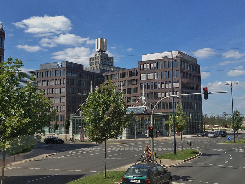
882:
872:
792:
780:|Date =15.08.2012 |Permiss...
704:
688:
648:
632:
604:
588:
568:
552:
532:
516:
449:
433:
416:
413:
394:
387:
239:
153:Dortmunder U, Blickrichtung Hoher Wall.
268:View this and other nearby images on:
862:
7:
323:Attribution-Share Alike 3.0 Unported
790:The following page uses this file:
717:
311:
306:
251:
161:Dortmund U, perspective Hoher Wall.
143:Dortmunder U und Verwaltungsbau.JPG
853:
407:
401:
297:
293:
182:Brinkhoffstraße/Rheinische Straße
163:
155:
147:
130:
76:
889:1/1,255 sec (0.00079681274900398)
406:
1188:Reference for direction of image
1175:0F410B2527EF4B8086122EC9047871C0
915:Date and time of data generation
635:coordinates of the point of view
392:
347:Under the following conditions:
318:This file is licensed under the
310:
305:
299:
274:
260:
252:
97:
31:
21:
389:
156:
14:
388:
148:
26:
1:
180:
36:
414:Items portrayed in this file
1027:Date and time of digitizing
1216:
1146:Focal length in 35 mm film
1123:One-chip color area sensor
1102:Supported Flashpix version
953:100 meters above sea level
839:Usage on mk.wikipedia.org
829:Usage on ja.wikipedia.org
819:Usage on de.wikipedia.org
809:Usage on ar.wikipedia.org
361:same or compatible license
1035:Meaning of each component
992:File change date and time
718:
650:51°30'48.6"N, 7°27'21.6"E
16:
391:
327:
190:, North Rhine-Westphalia
104:This is a file from the
1180:GPS time (atomic clock)
775:
224:
216:
209:
206:
140:
108:. Information from its
280:51.513500; 7.456000
111:description page there
46:Size of this preview:
1030:14:49, 12 August 2012
995:14:36, 26 August 2012
966:Horizontal resolution
918:14:49, 12 August 2012
754:12:40, 26 August 2012
70:2,490 × 1,875 pixels
1000:Y and C positioning
974:Vertical resolution
864:Camera manufacturer
470:DortmunderWestfront
342:– to adapt the work
52:Other resolutions:
1196:Direction of image
1154:Scene capture type
1141:Auto white balance
843:Дортмундска U-кула
493:author name string
463:Wikimedia username
66:1,280 × 964 pixels
62:1,020 × 768 pixels
1203:
1202:
801:Global file usage
783:
626:
555:copyright license
400:
285:
284:
234:
233:
202:
201:
126:
125:
106:Wikimedia Commons
32:Global file usage
1207:
1008:Exposure Program
861:
813:برج U (دورتموند)
795:Dortmund U-Tower
766:
672:
671:
666:
519:copyright status
500:
497:
487:
482:
472:
467:
383:
380:
377:
374:
371:
363:as the original.
320:Creative Commons
314:
313:
309:
308:
303:
302:
281:
278:
264:
263:
257:
256:
255:
249:
248:
237:
212:
195:
188:
179:
178:
160:
152:
144:
138:
122:
101:
100:
94:
88:
86:
73:
58:638 × 480 pixels
54:319 × 240 pixels
48:796 × 599 pixels
1215:
1214:
1210:
1209:
1208:
1206:
1205:
1204:
1172:Unique image ID
1077:9.6060473269062
1074:APEX brightness
1069:2.5260688216893
1061:10.293132328308
937:51° 30′ 48.6″ N
849:
799:
784:
772:
764:
720:
719:
716:
715:
714:
713:
712:
711:
710:
709:
707:
697:
696:
695:
693:
682:
681:
680:
679:
678:
677:
676:
675:
674:
673:
669:
667:
664:
655:
654:
653:
651:
641:
640:
639:
637:
618:
617:
616:
615:
614:
613:
612:
611:
609:
597:
596:
595:
593:
582:
581:
580:
579:
578:
577:
576:
575:
573:
561:
560:
559:
557:
546:
545:
544:
543:
542:
541:
540:
539:
537:
525:
524:
523:
521:
510:
509:
508:
507:
506:
505:
504:
503:
502:
501:
498:
495:
489:
488:
483:
480:
474:
473:
468:
465:
456:
455:
454:
452:
442:
441:
440:
438:
427:
426:
425:
424:
423:
421:
405:
404:
403:
386:
385:
384:
381:
378:
375:
372:
369:
368:
326:
315:
296:
295:
290:
279:
253:
244:
243:
240:Camera location
235:
175:
167:
162:
154:
142:
135:
128:
127:
116:
115:
114:is shown below.
90:
84:
82:
75:
74:
51:
12:
11:
5:
1213:
1211:
1201:
1200:
1199:292.2962962963
1197:
1193:
1192:
1191:True direction
1189:
1185:
1184:
1181:
1177:
1176:
1173:
1169:
1168:
1165:
1159:
1158:
1155:
1151:
1150:
1147:
1143:
1142:
1139:
1133:
1132:
1129:
1125:
1124:
1121:
1120:Sensing method
1117:
1116:
1113:
1107:
1106:
1103:
1099:
1098:
1095:
1089:
1088:
1085:
1079:
1078:
1075:
1071:
1070:
1067:
1063:
1062:
1059:
1053:
1052:
1051:
1050:
1049:does not exist
1047:
1044:
1041:
1036:
1032:
1031:
1028:
1024:
1023:
1020:
1013:
1012:
1011:Normal program
1009:
1005:
1004:
1001:
997:
996:
993:
989:
988:
983:
979:
978:
975:
971:
970:
967:
963:
962:
959:
955:
954:
951:
947:
946:
945:7° 27′ 21.6″ E
943:
939:
938:
935:
931:
930:
927:
920:
919:
916:
912:
911:
908:
901:
900:
897:
891:
890:
887:
881:
880:
875:
871:
870:
865:
852:
848:
847:
846:
845:
837:
836:
835:
827:
826:
825:
817:
816:
815:
803:
802:
798:
797:
788:
787:
782:
781:
778:Lucas Kaufmann
774:
770:
767:
763:2,490 × 1,875
761:
756:
751:
747:
746:
743:
740:
737:
734:
731:
724:
723:
708:
706:15 August 2012
705:
703:
702:
701:
700:
699:
698:
694:
689:
687:
686:
685:
684:
683:
660:
659:
658:
657:
656:
652:
649:
647:
646:
645:
644:
643:
642:
638:
633:
631:
630:
629:
628:
622:
610:
605:
603:
602:
601:
600:
599:
598:
594:
589:
587:
586:
585:
584:
583:
574:
569:
567:
566:
565:
564:
563:
562:
558:
553:
551:
550:
549:
548:
547:
538:
533:
531:
530:
529:
528:
527:
526:
522:
517:
515:
514:
513:
512:
511:
499:Lucas Kaufmann
491:
490:
476:
475:
461:
460:
459:
458:
457:
453:
450:
448:
447:
446:
445:
444:
443:
439:
434:
432:
431:
430:
429:
428:
422:
417:
415:
412:
411:
410:
409:
408:
397:
396:
393:
390:
367:
366:
365:
364:
354:
345:
344:
343:
337:
330:You are free:
317:
316:
298:
292:
291:
289:
286:
283:
282:
272:
266:
241:
232:
231:
229:Lucas Kaufmann
226:
222:
221:
220:Lucas Kaufmann
218:
214:
213:
211:15 August 2012
208:
204:
203:
200:
199:
197:
176:
173:
169:
168:
145:
136:
134:
131:
129:
124:
123:
102:
92:
91:
45:
41:
40:
39:
34:
29:
24:
19:
13:
10:
9:
6:
4:
3:
2:
1212:
1198:
1195:
1190:
1187:
1182:
1179:
1174:
1171:
1166:
1164:
1161:
1156:
1153:
1148:
1145:
1140:
1138:
1137:White balance
1135:
1131:Auto exposure
1130:
1128:Exposure mode
1127:
1122:
1119:
1114:
1112:
1109:
1104:
1101:
1096:
1094:
1091:
1086:
1084:
1083:Metering mode
1081:
1076:
1073:
1068:
1066:APEX aperture
1065:
1060:
1058:
1057:Shutter speed
1055:
1048:
1045:
1042:
1039:
1038:
1037:
1034:
1029:
1026:
1021:
1018:
1015:
1010:
1007:
1002:
999:
994:
991:
987:
984:
982:Software used
981:
976:
973:
968:
965:
960:
957:
952:
949:
944:
941:
936:
933:
928:
926:
922:
917:
914:
909:
906:
903:
898:
896:
893:
888:
886:
885:Exposure time
883:
879:
876:
873:
869:
866:
863:
859:
856:
850:
844:
841:
840:
838:
834:
831:
830:
828:
824:
821:
820:
818:
814:
811:
810:
808:
807:
806:
800:
796:
793:
791:
785:
779:
773:
768:
762:
760:
757:
755:
752:
749:
748:
744:
741:
738:
735:
732:
730:
729:
727:
721:
692:
663:
636:
608:
592:
591:captured with
572:
556:
536:
520:
494:
486:
479:
471:
464:
437:
420:
373:CC BY-SA 3.0
362:
358:
355:
352:
349:
348:
346:
341:
338:
335:
332:
331:
329:
328:
324:
321:
304:
287:
277:
273:
271:
270:OpenStreetMap
267:
265:
247:
242:
238:
230:
227:
223:
219:
215:
205:
198:
196:
191:
189:
183:
181:
177:
171:
170:
165:
159:
151:
146:
139:
132:
120:
113:
112:
107:
103:
96:
95:
89:
80:
79:Original file
71:
67:
63:
59:
55:
49:
44:
38:
35:
33:
30:
28:
25:
23:
20:
18:
15:
925:focal length
874:Camera model
857:
854:
804:
789:
725:
722:File history
356:
350:
339:
333:
250:
157:
149:
119:You can help
109:
77:
22:File history
1183:12:49:57.36
1111:Color space
958:Orientation
668:292.296296
535:copyrighted
357:share alike
351:attribution
141:Description
786:File usage
739:Dimensions
451:some value
85:image/jpeg
27:File usage
1163:Sharpness
942:Longitude
905:ISO speed
878:iPhone 4S
765:(2.29 MB)
736:Thumbnail
733:Date/Time
691:inception
607:iPhone 4S
288:Licensing
174:InfoField
158:English:
150:Deutsch:
1157:Standard
1003:Centered
950:Altitude
934:Latitude
895:F-number
851:Metadata
395:Captions
340:to remix
334:to share
325:license.
187:Dortmund
37:Metadata
1087:Pattern
1019:version
929:4.28 mm
750:current
745:Comment
662:heading
621:heading
436:creator
419:depicts
399:English
194:Germany
172:Address
133:Summary
81:
1167:Normal
977:72 dpi
969:72 dpi
961:Normal
907:rating
833:ドルトムント
771:LuKaDo
670:degree
625:degree
258:
225:Author
217:Source
184:44137
1149:35 mm
1093:Flash
986:5.1.1
923:Lens
899:f/2.4
868:Apple
1115:sRGB
1022:2.21
1017:Exif
742:User
382:true
379:true
207:Date
17:File
478:URL
1046:Cr
1043:Cb
910:64
665::
496::
481::
466::
68:|
64:|
60:|
56:|
50:.
1105:1
1040:Y
121:.
87:)
72:.
Text is available under the Creative Commons Attribution-ShareAlike License. Additional terms may apply.
