38:
234:
201:
325:
215:
240:
245:
94:
1008:
1025:{{Information |Description= Aufgenommen auf einer Wanderung von der Darmstädter Rosenhöhe zum Steinbrücker Teich und dem Oberwaldhaus.. Näheres zur Route findet sich auf der Webseite [http://www.froutes.de/RO00000073_Rosenhoehe_Oberwaldhaus froutes Wa
286:– You must give appropriate credit, provide a link to the license, and indicate if changes were made. You may do so in any reasonable manner, but not in any way that suggests the licensor endorses you or your use.
192:
1184:
Aufgenommen auf einer
Wanderung von der Darmstädter Rosenhöhe zum Steinbrücker Teich und dem Oberwaldhaus.. Näheres zur Route findet sich auf der Webseite <a href="
1148:
Aufgenommen auf einer
Wanderung von der Darmstädter Rosenhöhe zum Steinbrücker Teich und dem Oberwaldhaus.. Näheres zur Route findet sich auf der Webseite <a href="
142:
Aufgenommen auf einer
Wanderung von der Darmstädter Rosenhöhe zum Steinbrücker Teich und dem Oberwaldhaus.. Näheres zur Route findet sich auf der Webseite
60:
56:
52:
48:
42:
105:
73:
805:
681:
611:
541:
505:
208:
1251:
1050:
This file contains additional information, probably added from the digital camera or scanner used to create or digitize it.
716:
293:
937:
900:
863:
826:
771:
737:
665:
631:
595:
489:
461:
448:
433:
798:
709:
694:
561:
525:
406:
389:
255:
1053:
If the file has been modified from its original state, some details may not fully reflect the modified file.
1035:
The following pages on the
English Knowledge (XXG) use this file (pages on other projects are not listed):
1299:
701:
292:– If you remix, transform, or build upon the material, you must distribute your contributions under the
1007:
1002:
64:
37:
1220:
252:
1335:
113:
953:
468:
1424:
1185:
1149:
440:
143:
164:
1062:
343:
337:
214:
1379:
1317:
1095:
154:
100:
1510:
1434:
1389:
1135:
1515:
1353:
1115:
1018:
198:
174:
1072:
1039:
1444:
1105:
332:
348:
and was confirmed to be licensed under the terms of the cc-by-sa-2.0.
975:
Click on a date/time to view the file as it appeared at that time.
1246:
Landscape mode (for landscape photos with the background in focus)
200:
624:
193:
49° 52′ 36.12″ N, 8° 40′ 22.48″ E
183:
88:
1186:
http://www.froutes.de/RO00000073_Rosenhoehe_Oberwaldhaus%22
1150:
http://www.froutes.de/RO00000073_Rosenhoehe_Oberwaldhaus%22
1082:
Camera owner, www.froutes.de; Photographer, Michael
Mertens
1188:>froutes Wanderung Rosenhöhe Oberwaldhaus</a>.
1152:>froutes Wanderung Rosenhöhe Oberwaldhaus</a>.
373:
Add a one-line explanation of what this file represents
1340:
Flash did not fire, auto mode, red-eye reduction mode
702:
https://www.flickr.com/photos/91601939@N00/577733573/
78:(2,560 × 1,920 pixels, file size: 728 KB, MIME type:
338:
https://www.flickr.com/photos/91601939@N00/577733573
132:
112:
Commons is a freely licensed media file repository.
542:
Creative
Commons Attribution-ShareAlike 2.0 Generic
303:https://creativecommons.org/licenses/by-sa/2.0
93:
309:Creative Commons Attribution-Share Alike 2.0
233:
8:
269:– to copy, distribute and transmit the work
1055:
977:
441:https://www.flickr.com/people/91601939@N00
369:
340:. It was reviewed on 30 November 2007 by
1090:Creative Commons Attribution Share-Alike
787:21812413e175039e965b8e392d0f75be074c662b
144:froutes Wanderung Rosenhöhe Oberwaldhaus
1585:
1564:
1556:
1548:
1540:
1500:
1492:
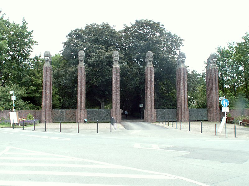
1484:
1476:
1468:
1460:
1452:
1442:
1432:
1422:
1414:
1406:
1398:
1387:
1377:
1369:
1361:
1351:
1343:
1333:
1325:
1315:
1307:
1297:
1289:
1268:
1260:
1249:
1241:
1233:
1225:
1215:
1207:
1199:
1191:
1179:
1171:
1163:
1155:
1143:
1132:
1124:
1113:
1103:
1093:
1085:
1077:
1067:
1037:
951:
935:
914:
898:
877:
861:
840:
824:
785:
769:
751:
735:
679:
663:
645:
629:
609:
593:
575:
559:
539:
523:
503:
487:
420:
404:
387:
384:
365:
358:
186:
207:View this and other nearby images on:
1057:
7:
330:This image was originally posted to
319:
966:
256:Attribution-Share Alike 2.0 Generic
244:
239:
1048:
378:
372:
230:
125:
71:
377:
1126:Date and time of data generation
632:coordinates of the point of view
363:
323:
280:Under the following conditions:
251:This file is licensed under the
243:
238:
232:
213:
199:
92:
21:
1587:Date metadata was last modified
360:
138:Darmstadt Eingang Rosenhöhe.jpg
14:
682:file available on the internet
359:
26:
1:
31:
385:Items portrayed in this file
1262:Date and time of digitizing
1176:Darmstadt Eingang Rosenhöhe
647:49°52'36.12"N, 8°40'22.48"E
165:Darmstadt Eingang Rosenhöhe
1607:
1542:Supported Flashpix version
1400:Focal length in 35 mm film
1345:Supported Flashpix version
294:same or compatible license
1470:Geodetic survey data used
1270:Meaning of each component
1227:File change date and time
967:
16:
612:Konica Minolta Dimage Z5
362:
260:
99:This is a file from the
1462:GPS time (atomic clock)
1363:Custom image processing
1024:
1003:23:05, 29 November 2007
177:from Darmstadt, Germany
170:
160:
153:
150:
135:
103:. Information from its
1454:Subject distance range
219:49.876700; 8.672910
106:description page there
41:Size of this preview:
1309:Maximum land aperture
1201:Horizontal resolution
799:determination method
65:2,560 × 1,920 pixels
1590:02:43, 21 June 2007
1265:13:37, 19 June 2007
1235:Y and C positioning
1230:00:43, 21 June 2007
1209:Vertical resolution
1129:13:37, 19 June 2007
1059:Camera manufacturer
275:– to adapt the work
155:19 June 2007, 13:37
47:Other resolutions:
1408:Scene capture type
1384:Auto white balance
449:author name string
61:1,280 × 960 pixels
57:1,024 × 768 pixels
1594:
1593:
1511:geo:lat=49.876571
1028:
526:copyright license
371:
352:
351:
224:
223:
181:
180:
121:
120:
101:Wikimedia Commons
1598:
1516:geo:lon=8.672863
1243:Exposure Program
1087:Copyright holder
1056:
1015:
938:Flickr photo ID
919:
882:
845:
808:
803:
719:
714:
704:
699:
695:described at URL
490:copyright status
471:
466:
456:
453:
443:
438:
356:
355:30 November 2007
346:
327:
326:
320:
316:
313:
310:
307:
304:
296:as the original.
253:Creative Commons
247:
246:
242:
241:
236:
235:
220:
217:
203:
202:
196:
195:
184:
156:
139:
133:
117:
96:
95:
89:
83:
81:
68:
53:640 × 480 pixels
49:320 × 240 pixels
43:800 × 600 pixels
1606:
1605:
1601:
1600:
1599:
1597:
1596:
1595:
1486:GPS tag version
1312:3 APEX (f/2.83)
1291:APEX brightness
1221:RoboGEO v5.0.12
1160:49° 52′ 35.4″ N
1100:1/25 sec (0.04)
1044:
1036:
1029:
1021:
1013:
969:
968:
965:
964:
963:
962:
961:
960:
959:
958:
956:
944:
943:
942:
940:
929:
928:
927:
926:
925:
924:
923:
922:
920:
917:
907:
906:
905:
903:
892:
891:
890:
889:
888:
887:
886:
885:
883:
880:
870:
869:
868:
866:
855:
854:
853:
852:
851:
850:
849:
848:
846:
843:
833:
832:
831:
829:
818:
817:
816:
815:
814:
813:
812:
811:
810:
809:
804:
801:
792:
791:
790:
788:
778:
777:
776:
774:
763:
762:
761:
760:
759:
758:
757:
756:
754:
744:
743:
742:
740:
729:
728:
727:
726:
725:
724:
723:
722:
721:
720:
715:
712:
706:
705:
700:
697:
688:
687:
686:
684:
672:
671:
670:
668:
657:
656:
655:
654:
653:
652:
651:
650:
648:
638:
637:
636:
634:
623:
622:
621:
620:
619:
618:
617:
616:
614:
602:
601:
600:
598:
587:
586:
585:
584:
583:
582:
581:
580:
578:
568:
567:
566:
564:
553:
552:
551:
550:
549:
548:
547:
546:
544:
532:
531:
530:
528:
517:
516:
515:
514:
513:
512:
511:
510:
508:
496:
495:
494:
492:
481:
480:
479:
478:
477:
476:
475:
474:
473:
472:
467:
464:
458:
457:
455:Michael Mertens
454:
451:
445:
444:
439:
436:
427:
426:
425:
423:
413:
412:
411:
409:
398:
397:
396:
395:
394:
392:
376:
375:
374:
354:
342:
324:
318:
317:
314:
311:
308:
305:
302:
301:
259:
248:
229:
218:
191:
190:
187:Camera location
182:
175:Michael Mertens
137:
130:
123:
122:
111:
110:
109:is shown below.
85:
79:
77:
70:
69:
46:
12:
11:
5:
1604:
1602:
1592:
1591:
1588:
1584:
1583:
1582:
1581:
1578:
1575:
1572:
1567:
1563:
1562:
1559:
1555:
1554:
1551:
1547:
1546:
1543:
1539:
1538:
1537:
1536:
1533:
1530:
1527:
1524:
1521:
1518:
1513:
1508:
1503:
1499:
1498:
1495:
1491:
1490:
1487:
1483:
1482:
1479:
1475:
1474:
1471:
1467:
1466:
1463:
1459:
1458:
1455:
1451:
1450:
1447:
1441:
1440:
1437:
1431:
1430:
1427:
1421:
1420:
1417:
1413:
1412:
1409:
1405:
1404:
1401:
1397:
1396:
1393:
1386:
1385:
1382:
1376:
1375:
1372:
1368:
1367:
1366:Normal process
1364:
1360:
1359:
1356:
1350:
1349:
1346:
1342:
1341:
1338:
1332:
1331:
1328:
1324:
1323:
1320:
1314:
1313:
1310:
1306:
1305:
1302:
1296:
1295:
1292:
1288:
1287:
1286:
1285:
1284:does not exist
1282:
1279:
1276:
1271:
1267:
1266:
1263:
1259:
1258:
1255:
1248:
1247:
1244:
1240:
1239:
1236:
1232:
1231:
1228:
1224:
1223:
1218:
1214:
1213:
1210:
1206:
1205:
1202:
1198:
1197:
1194:
1190:
1189:
1182:
1178:
1177:
1174:
1170:
1169:
1168:8° 40′ 22.2″ E
1166:
1162:
1161:
1158:
1154:
1153:
1146:
1142:
1141:
1138:
1131:
1130:
1127:
1123:
1122:
1119:
1112:
1111:
1108:
1102:
1101:
1098:
1092:
1091:
1088:
1084:
1083:
1080:
1076:
1075:
1070:
1066:
1065:
1063:KONICA MINOLTA
1060:
1047:
1043:
1042:
1034:
1033:
1032:
1027:
1026:
1023:
1019:
1016:
1012:2,560 × 1,920
1010:
1005:
1000:
996:
995:
992:
989:
986:
983:
980:
973:
972:
957:
952:
950:
949:
948:
947:
946:
945:
941:
936:
934:
933:
932:
931:
930:
921:
915:
913:
912:
911:
910:
909:
908:
904:
899:
897:
896:
895:
894:
893:
884:
878:
876:
875:
874:
873:
872:
871:
867:
862:
860:
859:
858:
857:
856:
847:
841:
839:
838:
837:
836:
835:
834:
830:
825:
823:
822:
821:
820:
819:
797:
796:
795:
794:
793:
789:
786:
784:
783:
782:
781:
780:
779:
775:
770:
768:
767:
766:
765:
764:
755:
752:
750:
749:
748:
747:
746:
745:
741:
736:
734:
733:
732:
731:
730:
708:
707:
693:
692:
691:
690:
689:
685:
680:
678:
677:
676:
675:
674:
673:
669:
666:source of file
664:
662:
661:
660:
659:
658:
649:
646:
644:
643:
642:
641:
640:
639:
635:
630:
628:
627:
626:
625:
615:
610:
608:
607:
606:
605:
604:
603:
599:
594:
592:
591:
590:
589:
588:
579:
576:
574:
573:
572:
571:
570:
569:
565:
560:
558:
557:
556:
555:
554:
545:
540:
538:
537:
536:
535:
534:
533:
529:
524:
522:
521:
520:
519:
518:
509:
504:
502:
501:
500:
499:
498:
497:
493:
488:
486:
485:
484:
483:
482:
462:Flickr user ID
460:
459:
447:
446:
432:
431:
430:
429:
428:
424:
421:
419:
418:
417:
416:
415:
414:
410:
405:
403:
402:
401:
400:
399:
393:
388:
386:
383:
382:
381:
380:
379:
368:
367:
364:
361:
350:
349:
336:by froutes at
328:
300:
299:
298:
297:
287:
278:
277:
276:
270:
263:You are free:
250:
249:
231:
228:
225:
222:
221:
211:
205:
188:
179:
178:
172:
168:
167:
162:
158:
157:
152:
148:
147:
140:
131:
129:
126:
124:
119:
118:
97:
87:
86:
40:
36:
35:
34:
29:
24:
19:
13:
10:
9:
6:
4:
3:
2:
1603:
1589:
1586:
1579:
1576:
1573:
1570:
1569:
1568:
1565:
1560:
1557:
1552:
1549:
1544:
1541:
1534:
1531:
1528:
1525:
1522:
1519:
1517:
1514:
1512:
1509:
1506:
1505:
1504:
1501:
1496:
1493:
1488:
1485:
1480:
1477:
1472:
1469:
1464:
1461:
1456:
1453:
1448:
1446:
1443:
1438:
1436:
1433:
1428:
1426:
1423:
1418:
1416:Scene control
1415:
1410:
1407:
1402:
1399:
1394:
1391:
1388:
1383:
1381:
1380:White balance
1378:
1374:Auto exposure
1373:
1371:Exposure mode
1370:
1365:
1362:
1357:
1355:
1352:
1347:
1344:
1339:
1337:
1334:
1329:
1326:
1321:
1319:
1318:Metering mode
1316:
1311:
1308:
1303:
1301:
1300:Exposure bias
1298:
1293:
1290:
1283:
1280:
1277:
1274:
1273:
1272:
1269:
1264:
1261:
1256:
1253:
1250:
1245:
1242:
1237:
1234:
1229:
1226:
1222:
1219:
1217:Software used
1216:
1211:
1208:
1203:
1200:
1195:
1192:
1187:
1183:
1180:
1175:
1172:
1167:
1164:
1159:
1156:
1151:
1147:
1145:User comments
1144:
1139:
1137:
1133:
1128:
1125:
1120:
1117:
1114:
1109:
1107:
1104:
1099:
1097:
1096:Exposure time
1094:
1089:
1086:
1081:
1078:
1074:
1071:
1068:
1064:
1061:
1058:
1054:
1051:
1045:
1041:
1038:
1030:
1022:
1017:
1011:
1009:
1006:
1004:
1001:
998:
997:
993:
990:
987:
984:
981:
979:
978:
976:
970:
955:
939:
902:
865:
828:
807:
800:
773:
739:
718:
711:
703:
696:
683:
667:
633:
613:
597:
596:captured with
563:
543:
527:
507:
491:
470:
463:
450:
442:
435:
408:
391:
357:
347:
345:
339:
335:
334:
329:
322:
321:
306:CC BY-SA 2.0
295:
291:
288:
285:
282:
281:
279:
274:
271:
268:
265:
264:
262:
261:
257:
254:
237:
226:
216:
212:
210:
209:OpenStreetMap
206:
204:
194:
189:
185:
176:
173:
169:
166:
163:
159:
149:
145:
141:
134:
127:
115:
108:
107:
102:
98:
91:
90:
84:
75:
74:Original file
66:
62:
58:
54:
50:
44:
39:
33:
30:
28:
25:
23:
20:
18:
15:
1566:Subject area
1558:Image height
1481:19 June 2007
1457:Distant view
1390:Digital zoom
1327:Light source
1136:focal length
1069:Camera model
1052:
1049:
974:
971:File history
577:19 June 2007
469:91601939@N00
353:
344:FlickreviewR
341:
331:
289:
283:
272:
266:
114:You can help
104:
72:
22:File history
1550:Image width
1494:IIM version
1354:Color space
1193:Orientation
1181:Image title
1140:5.859375 mm
506:copyrighted
290:share alike
284:attribution
136:Description
1435:Saturation
1031:File usage
988:Dimensions
753:image/jpeg
738:media type
422:some value
80:image/jpeg
27:File usage
1535:Darmstadt
1526:Rosenhöhe
1520:Wanderung
1507:geotagged
1445:Sharpness
1411:Landscape
1165:Longitude
1116:ISO speed
1073:DiMAGE Z5
1040:Darmstadt
985:Thumbnail
982:Date/Time
954:577733573
827:data size
562:inception
227:Licensing
1561:1,920 px
1553:2,560 px
1523:Oberfeld
1502:Keywords
1478:GPS date
1473:WGS 1984
1425:Contrast
1238:Centered
1173:Headline
1157:Latitude
1106:F-number
1046:Metadata
1014:(728 KB)
842:745,438
772:checksum
710:operator
366:Captions
273:to remix
267:to share
258:license.
32:Metadata
1489:2.2.0.0
1330:Unknown
1322:Pattern
1254:version
999:current
994:Comment
407:creator
390:depicts
370:English
128:Summary
76:
1532:Blumen
1449:Normal
1439:Normal
1429:Normal
1212:72 dpi
1204:72 dpi
1196:Normal
1118:rating
1079:Author
916:2,560
879:1,920
864:height
717:Flickr
333:Flickr
197:
171:Author
161:Source
1571:1,120
1529:Rosen
1465:11:37
1403:35 mm
1392:ratio
1336:Flash
1134:Lens
1110:f/7.1
1020:LSDSL
918:pixel
901:width
881:pixel
806:SHA-1
1419:None
1358:sRGB
1257:2.21
1252:Exif
991:User
844:byte
315:true
312:true
151:Date
17:File
1580:320
1577:320
1574:960
1294:6.2
434:URL
1281:Cr
1278:Cb
1121:50
802::
713::
698::
465::
452::
437::
63:|
59:|
55:|
51:|
45:.
1545:1
1497:4
1395:0
1348:1
1304:0
1275:Y
146:.
116:.
82:)
67:.
Text is available under the Creative Commons Attribution-ShareAlike License. Additional terms may apply.
