307:
240:
190:
232:
182:
254:
204:
275:
313:
318:
72:
783:"}},"text\/plain":{"en":{"":"heading"}}},"{\"value\":{\"amount\":\"+67\",\"unit\":\"http:\\\/\\\/www.wikidata.org\\\/entity\\\/Q28390\"},\"type\":\"quantity\"}":{"text\/html":{"en":{"P7787":"67
719:"}},"text\/plain":{"en":{"":"heading"}}},"{\"value\":{\"amount\":\"+67\",\"unit\":\"http:\\\/\\\/www.wikidata.org\\\/entity\\\/Q28390\"},\"type\":\"quantity\"}":{"text\/html":{"en":{"P7787":"67
779:
223:
173:
43:
365:– You must give appropriate credit, provide a link to the license, and indicate if changes were made. You may do so in any reasonable manner, but not in any way that suggests the licensor endorses you or your use.
902:== {{int:filedesc}} == {{Information |description={{en|1=Dearne Valley Sunrise Sun rising over Little Houghton and the golf course.}} |date=2008-05-03 |source=From |author=[http://www.geograph.org.
83:
51:
780:
716:
916:
617:
581:
545:
247:
197:
667:
282:
947:
This file contains additional information, probably added from the digital camera or scanner used to create or digitize it.
372:
480:
821:
794:
757:
730:
645:
601:
529:
501:
488:
473:
884:
879:
688:
660:
630:
565:
446:
429:
42:
269:
328:
950:
If the file has been modified from its original state, some details may not fully reflect the modified file.
912:
The following pages on the
English Knowledge (XXG) use this file (pages on other projects are not listed):
371:– If you remix, transform, or build upon the material, you must distribute your contributions under the
289:
on the
Geograph website for the photographer's contact details. The copyright on this image is owned by
895:
325:
787:"}},"text\/plain":{"en":{"P7787":"67 degree"}}}}": -->
723:"}},"text\/plain":{"en":{"P7787":"67 degree"}}}}": -->
91:
508:
652:
637:
253:
203:
294:
78:
135:
237:
187:
934:
156:
146:
126:
Dearne Valley
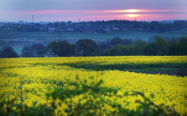
Sunrise Sun rising over Little Houghton and the golf course.
274:
286:
852:
Click on a date/time to view the file as it appeared at that time.
239:
189:
214:
164:
66:
224:
53° 32′ 38″ N, 1° 21′ 40″ W
174:
53° 32′ 21″ N, 1° 22′ 24″ W
413:
Add a one-line explanation of what this file represents
116:
Dearne Valley
Sunrise - geograph.org.uk - 786102.jpg
110:
90:
Commons is a freely licensed media file repository.
52:
Dearne_Valley_Sunrise_-_geograph.org.uk_-_786102.jpg
582:
Creative
Commons Attribution-ShareAlike 2.0 Generic
56:(640 × 398 pixels, file size: 72 KB, MIME type:
382:https://creativecommons.org/licenses/by-sa/2.0
71:
388:Creative Commons Attribution-Share Alike 2.0
306:
8:
784:
720:
348:– to copy, distribute and transmit the work
952:
854:
409:
927:The following other wikis use this file:
509:https://www.geograph.org.uk/profile/15341
638:https://www.geograph.org.uk/photo/786102
954:
914:
808:
792:
744:
728:
702:
686:
615:
599:
579:
563:
543:
527:
460:
444:
427:
424:
405:
398:
217:
167:
246:View this and other nearby images on:
196:View this and other nearby images on:
7:
293:and is licensed for reuse under the
843:
329:Attribution-Share Alike 2.0 Generic
317:
312:
297:Attribution-ShareAlike 2.0 license.
945:
418:
412:
303:
280:
120:
103:
49:
417:
935:Little Houghton, South Yorkshire
917:Little Houghton, South Yorkshire
731:coordinates of the point of view
403:
359:Under the following conditions:
324:This file is licensed under the
316:
311:
305:
273:
252:
238:
230:
202:
188:
180:
70:
31:
21:
400:
121:
46:No higher resolution available.
14:
618:file available on the internet
399:
281:This image was taken from the
26:
1:
795:coordinates of depicted place
36:
668:Geograph Britain and Ireland
474:object of statement has role
425:Items portrayed in this file
810:53°32'37.54"N, 1°21'39.96"W
746:53°32'20.62"N, 1°22'24.24"W
229:
179:
976:
931:Usage on tr.wikipedia.org
373:same or compatible license
844:
16:
646:geograph.org.uk image ID
402:
339:
77:This is a file from the
901:
880:01:04, 20 February 2011
152:
141:
134:
131:
113:
81:. Information from its
287:this photograph's page
258:53.543760; -1.361100
208:53.539060; -1.373400
84:description page there
354:– to adapt the work
489:author name string
963:
962:
923:Global file usage
905:
786:
722:
566:copyright license
411:
302:
301:
285:collection. See
263:
262:
213:
212:
162:
161:
99:
98:
79:Wikimedia Commons
32:Global file usage
967:
953:
892:
832:
831:
826:
768:
767:
762:
670:
665:
655:
650:
640:
635:
631:described at URL
530:copyright status
511:
506:
496:
493:
483:
478:
395:
392:
389:
386:
383:
375:as the original.
337:
326:Creative Commons
320:
319:
315:
314:
309:
308:
295:Creative Commons
283:Geograph project
277:
270:
259:
256:
242:
241:
235:
234:
233:
227:
226:
215:
209:
206:
192:
191:
185:
184:
183:
177:
176:
165:
137:
125:
117:
111:
95:
74:
73:
67:
61:
59:
975:
974:
970:
969:
968:
966:
965:
964:
941:
921:
913:
906:
898:
890:
846:
845:
842:
841:
840:
839:
838:
837:
836:
835:
834:
833:
829:
827:
824:
815:
814:
813:
811:
801:
800:
799:
797:
778:
777:
776:
775:
774:
773:
772:
771:
770:
769:
765:
763:
760:
751:
750:
749:
747:
737:
736:
735:
733:
714:
713:
712:
711:
710:
709:
708:
707:
705:
695:
694:
693:
691:
680:
679:
678:
677:
676:
675:
674:
673:
672:
671:
666:
663:
657:
656:
651:
648:
642:
641:
636:
633:
624:
623:
622:
620:
608:
607:
606:
604:
593:
592:
591:
590:
589:
588:
587:
586:
584:
572:
571:
570:
568:
557:
556:
555:
554:
553:
552:
551:
550:
548:
536:
535:
534:
532:
521:
520:
519:
518:
517:
516:
515:
514:
513:
512:
507:
504:
498:
497:
494:
491:
485:
484:
479:
476:
467:
466:
465:
463:
453:
452:
451:
449:
438:
437:
436:
435:
434:
432:
416:
415:
414:
397:
396:
393:
390:
387:
384:
381:
380:
338:
335:
332:
321:
298:
268:
257:
231:
222:
221:
218:Object location
207:
181:
172:
171:
168:Camera location
163:
147:geograph.org.uk
127:
115:
108:
101:
100:
89:
88:
87:is shown below.
63:
57:
55:
48:
47:
12:
11:
5:
973:
971:
961:
960:
957:
944:
940:
939:
938:
937:
925:
924:
920:
919:
911:
910:
909:
904:
903:
900:
896:
893:
887:
882:
877:
873:
872:
869:
866:
863:
860:
857:
850:
849:
820:
819:
818:
817:
816:
812:
809:
807:
806:
805:
804:
803:
802:
798:
793:
791:
790:
789:
788:
782:
756:
755:
754:
753:
752:
748:
745:
743:
742:
741:
740:
739:
738:
734:
729:
727:
726:
725:
724:
718:
706:
703:
701:
700:
699:
698:
697:
696:
692:
687:
685:
684:
683:
682:
681:
659:
658:
644:
643:
629:
628:
627:
626:
625:
621:
616:
614:
613:
612:
611:
610:
609:
605:
602:source of file
600:
598:
597:
596:
595:
594:
585:
580:
578:
577:
576:
575:
574:
573:
569:
564:
562:
561:
560:
559:
558:
549:
544:
542:
541:
540:
539:
538:
537:
533:
528:
526:
525:
524:
523:
522:
500:
499:
487:
486:
472:
471:
470:
469:
468:
464:
461:
459:
458:
457:
456:
455:
454:
450:
445:
443:
442:
441:
440:
439:
433:
428:
426:
423:
422:
421:
420:
419:
408:
407:
404:
401:
379:
378:
377:
376:
366:
357:
356:
355:
349:
342:You are free:
333:
323:
322:
304:
300:
299:
278:
267:
264:
261:
260:
250:
244:
219:
211:
210:
200:
194:
169:
160:
159:
154:
150:
149:
143:
139:
138:
133:
129:
128:
118:
109:
107:
104:
102:
97:
96:
75:
65:
64:
45:
41:
40:
39:
34:
29:
24:
19:
13:
10:
9:
6:
4:
3:
2:
972:
958:
955:
951:
948:
942:
936:
933:
932:
930:
929:
928:
922:
918:
915:
907:
899:
894:
888:
886:
883:
881:
878:
875:
874:
870:
867:
864:
861:
858:
856:
855:
853:
847:
823:
796:
759:
732:
690:
669:
662:
654:
647:
639:
632:
619:
603:
583:
567:
547:
531:
510:
503:
490:
482:
475:
448:
431:
385:CC BY-SA 2.0
374:
370:
367:
364:
361:
360:
358:
353:
350:
347:
344:
343:
341:
340:
334:Attribution:
330:
327:
310:
296:
292:
288:
284:
279:
276:
272:
271:
265:
255:
251:
249:
248:OpenStreetMap
245:
243:
225:
220:
216:
205:
201:
199:
198:OpenStreetMap
195:
193:
175:
170:
166:
158:
155:
151:
148:
144:
140:
130:
124:
119:
112:
105:
93:
86:
85:
80:
76:
69:
68:
62:
53:
44:
38:
35:
33:
30:
28:
25:
23:
20:
18:
15:
949:
946:
926:
851:
848:File history
481:photographer
368:
362:
351:
345:
290:
228:
178:
122:
92:You can help
82:
50:
22:File history
897:GeographBot
546:copyrighted
369:share alike
363:attribution
114:Description
956:_error
908:File usage
889:640 × 398
865:Dimensions
704:3 May 2008
462:some value
136:3 May 2008
58:image/jpeg
27:File usage
862:Thumbnail
859:Date/Time
689:inception
266:Licensing
123:English:
943:Metadata
661:operator
495:Steve F
406:Captions
352:to remix
346:to share
336:Steve F
331:license.
291:Steve F
157:Steve F
37:Metadata
891:(72 KB)
876:current
871:Comment
822:heading
781:heading
758:heading
717:heading
447:creator
430:depicts
410:English
106:Summary
54:
830:degree
785:degree
766:degree
721:degree
653:786102
236:
186:
153:Author
142:Source
145:From
868:User
394:true
391:true
132:Date
17:File
828:67
764:67
502:URL
825::
761::
664::
649::
634::
505::
492::
477::
959:0
94:.
60:)
Text is available under the Creative Commons Attribution-ShareAlike License. Additional terms may apply.
_heading:67.00&language=en)
_heading:67.00&language=en)
