348:
281:
231:
273:
223:
295:
245:
316:
354:
359:
72:
824:"}},"text\/plain":{"en":{"":"heading"}}},"{\"value\":{\"amount\":\"+270\",\"unit\":\"http:\\\/\\\/www.wikidata.org\\\/entity\\\/Q28390\"},\"type\":\"quantity\"}":{"text\/html":{"en":{"P7787":"270
639:"}},"text\/plain":{"en":{"":"heading"}}},"{\"value\":{\"amount\":\"+270\",\"unit\":\"http:\\\/\\\/www.wikidata.org\\\/entity\\\/Q28390\"},\"type\":\"quantity\"}":{"text\/html":{"en":{"P7787":"270
960:
820:
214:
977:== {{int:filedesc}} == {{Information |description={{en|1=Dual use path, Richmond Park The path between Roehampton Gate and East Sheen Gate crosses Beverley Brook amid willows.}} |date=2009-08-01 |source=From [http://www.geograph.org.uk/photo/1453370 geogr
43:
406:– You must give appropriate credit, provide a link to the license, and indicate if changes were made. You may do so in any reasonable manner, but not in any way that suggests the licensor endorses you or your use.
83:
51:
821:
636:
1019:
959:
954:
756:
622:
586:
288:
238:
42:
791:
323:
1032:
This file contains additional information, probably added from the digital camera or scanner used to create or digitize it.
413:
536:
891:
862:
835:
799:
740:
677:
650:
570:
544:
529:
514:
784:
769:
706:
606:
487:
470:
126:
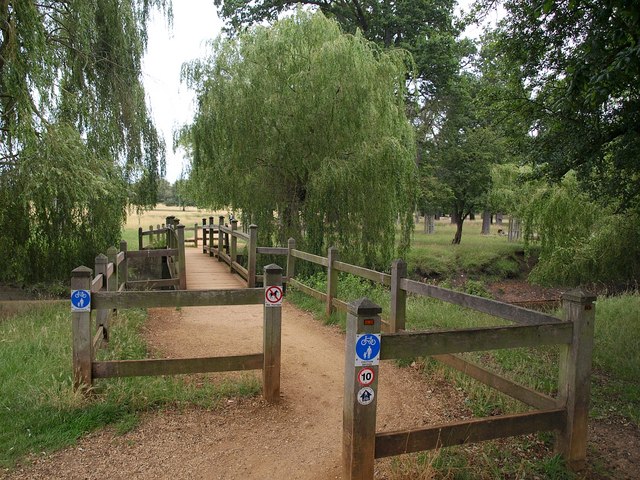
Dual use path, Richmond Park The path between
Roehampton Gate and East Sheen Gate crosses Beverley Brook amid willows.
310:
1009:
369:
1035:
If the file has been modified from its original state, some details may not fully reflect the modified file.
987:
The following pages on the
English Knowledge (XXG) use this file (pages on other projects are not listed):
412:– If you remix, transform, or build upon the material, you must distribute your contributions under the
330:
on the
Geograph website for the photographer's contact details. The copyright on this image is owned by
970:
366:
828:"}},"text\/plain":{"en":{"P7787":"270 degree"}}}}": -->
643:"}},"text\/plain":{"en":{"P7787":"270 degree"}}}}": -->
91:
806:
776:
521:
167:
294:
244:
991:
335:
78:
183:
135:
278:
228:
146:
156:
315:
327:
927:
Click on a date/time to view the file as it appeared at that time.
280:
230:
255:
205:
66:
116:
Dual use path, Richmond Park - geograph.org.uk - 1453370.jpg
52:
Dual_use_path,_Richmond_Park_-_geograph.org.uk_-_1453370.jpg
265:
51° 27′ 15.3″ N, 0° 15′ 34″ W
215:
51° 27′ 15.3″ N, 0° 15′ 33″ W
454:
Add a one-line explanation of what this file represents
110:
90:
Commons is a freely licensed media file repository.
623:
Creative
Commons Attribution-ShareAlike 2.0 Generic
56:(640 × 480 pixels, file size: 119 KB, MIME type:
423:https://creativecommons.org/licenses/by-sa/2.0
71:
429:Creative Commons Attribution-Share Alike 2.0
347:
8:
825:
640:
389:– to copy, distribute and transmit the work
1037:
929:
450:
1002:The following other wikis use this file:
777:https://www.geograph.org.uk/photo/1453370
522:https://www.geograph.org.uk/profile/5089
1039:
989:
905:
889:
849:
833:
754:
738:
720:
704:
664:
648:
620:
604:
584:
568:
501:
485:
468:
465:
446:
439:
258:
208:
287:View this and other nearby images on:
237:View this and other nearby images on:
7:
1020:Մասնակից:Anna Chilingaryan/Ավազարկղ1
334:and is licensed for reuse under the
918:
370:Attribution-Share Alike 2.0 Generic
358:
353:
338:Attribution-ShareAlike 2.0 license.
1030:
459:
453:
344:
321:
120:
103:
49:
458:
651:coordinates of the point of view
444:
400:Under the following conditions:
365:This file is licensed under the
357:
352:
346:
314:
293:
279:
271:
243:
229:
221:
70:
31:
21:
441:
121:
46:No higher resolution available.
14:
757:file available on the internet
440:
322:This image was taken from the
26:
1:
836:coordinates of depicted place
36:
792:Geograph Britain and Ireland
530:object of statement has role
466:Items portrayed in this file
270:
220:
198:Dual use path, Richmond Park
179:Dual use path, Richmond Park
851:51°27'15.34"N, 0°15'33.84"W
666:51°27'15.34"N, 0°15'33.48"W
1061:
1016:Usage on hy.wikipedia.org
1006:Usage on fa.wikipedia.org
414:same or compatible license
919:
196:Derek Harper /
177:Derek Harper /
16:
800:geograph.org.uk image ID
443:
380:
77:This is a file from the
976:
168:required by the license
152:
141:
134:
131:
113:
81:. Information from its
328:this photograph's page
299:51.454260; -0.259400
249:51.454260; -0.259300
84:description page there
955:05:03, 2 March 2011
395:– to adapt the work
545:author name string
1048:
1047:
998:Global file usage
980:
827:
642:
607:copyright license
452:
343:
342:
326:collection. See
304:
303:
254:
253:
203:
202:
171:
99:
98:
79:Wikimedia Commons
32:Global file usage
1052:
1038:
967:
873:
872:
867:
809:
804:
794:
789:
779:
774:
770:described at URL
688:
687:
682:
571:copyright status
552:
549:
539:
534:
524:
519:
436:
433:
430:
427:
424:
416:as the original.
378:
367:Creative Commons
361:
360:
356:
355:
350:
349:
336:Creative Commons
324:Geograph project
318:
311:
300:
297:
283:
282:
276:
275:
274:
268:
267:
256:
250:
247:
233:
232:
226:
225:
224:
218:
217:
206:
165:
137:
125:
117:
111:
95:
74:
73:
67:
61:
59:
1060:
1059:
1055:
1054:
1053:
1051:
1050:
1049:
1026:
996:
988:
981:
973:
965:
921:
920:
917:
916:
915:
914:
913:
912:
911:
910:
908:
898:
897:
896:
894:
883:
882:
881:
880:
879:
878:
877:
876:
875:
874:
870:
868:
865:
856:
855:
854:
852:
842:
841:
840:
838:
819:
818:
817:
816:
815:
814:
813:
812:
811:
810:
805:
802:
796:
795:
790:
787:
781:
780:
775:
772:
763:
762:
761:
759:
747:
746:
745:
743:
732:
731:
730:
729:
728:
727:
726:
725:
723:
713:
712:
711:
709:
698:
697:
696:
695:
694:
693:
692:
691:
690:
689:
685:
683:
680:
671:
670:
669:
667:
657:
656:
655:
653:
634:
633:
632:
631:
630:
629:
628:
627:
625:
613:
612:
611:
609:
598:
597:
596:
595:
594:
593:
592:
591:
589:
577:
576:
575:
573:
562:
561:
560:
559:
558:
557:
556:
555:
554:
553:
550:
547:
541:
540:
535:
532:
526:
525:
520:
517:
508:
507:
506:
504:
494:
493:
492:
490:
479:
478:
477:
476:
475:
473:
457:
456:
455:
438:
437:
434:
431:
428:
425:
422:
421:
379:
376:
373:
362:
339:
309:
298:
272:
263:
262:
259:Object location
248:
222:
213:
212:
209:Camera location
204:
193:
186:
174:
147:geograph.org.uk
127:
115:
108:
101:
100:
89:
88:
87:is shown below.
63:
57:
55:
48:
47:
12:
11:
5:
1058:
1056:
1046:
1045:
1042:
1029:
1025:
1024:
1023:
1022:
1014:
1013:
1012:
1000:
999:
995:
994:
986:
985:
984:
979:
978:
975:
971:
968:
962:
957:
952:
948:
947:
944:
941:
938:
935:
932:
925:
924:
909:
906:
904:
903:
902:
901:
900:
899:
895:
890:
888:
887:
886:
885:
884:
861:
860:
859:
858:
857:
853:
850:
848:
847:
846:
845:
844:
843:
839:
834:
832:
831:
830:
829:
823:
798:
797:
783:
782:
768:
767:
766:
765:
764:
760:
755:
753:
752:
751:
750:
749:
748:
744:
741:source of file
739:
737:
736:
735:
734:
733:
724:
721:
719:
718:
717:
716:
715:
714:
710:
705:
703:
702:
701:
700:
699:
676:
675:
674:
673:
672:
668:
665:
663:
662:
661:
660:
659:
658:
654:
649:
647:
646:
645:
644:
638:
626:
621:
619:
618:
617:
616:
615:
614:
610:
605:
603:
602:
601:
600:
599:
590:
585:
583:
582:
581:
580:
579:
578:
574:
569:
567:
566:
565:
564:
563:
543:
542:
528:
527:
513:
512:
511:
510:
509:
505:
502:
500:
499:
498:
497:
496:
495:
491:
486:
484:
483:
482:
481:
480:
474:
469:
467:
464:
463:
462:
461:
460:
449:
448:
445:
442:
420:
419:
418:
417:
407:
398:
397:
396:
390:
383:You are free:
374:
364:
363:
345:
341:
340:
319:
308:
305:
302:
301:
291:
285:
260:
252:
251:
241:
235:
210:
201:
200:
194:
191:
188:
187:
182:
175:
172:
160:
159:
154:
150:
149:
143:
139:
138:
133:
129:
128:
118:
109:
107:
104:
102:
97:
96:
75:
65:
64:
45:
41:
40:
39:
34:
29:
24:
19:
13:
10:
9:
6:
4:
3:
2:
1057:
1043:
1040:
1036:
1033:
1027:
1021:
1018:
1017:
1015:
1011:
1008:
1007:
1005:
1004:
1003:
997:
993:
992:Richmond Park
990:
982:
974:
969:
963:
961:
958:
956:
953:
950:
949:
945:
942:
939:
936:
933:
931:
930:
928:
922:
893:
864:
837:
808:
801:
793:
786:
778:
771:
758:
742:
722:1 August 2009
708:
679:
652:
624:
608:
588:
572:
546:
538:
531:
523:
516:
489:
472:
426:CC BY-SA 2.0
415:
411:
408:
405:
402:
401:
399:
394:
391:
388:
385:
384:
382:
381:
375:Attribution:
371:
368:
351:
337:
333:
329:
325:
320:
317:
313:
312:
306:
296:
292:
290:
289:OpenStreetMap
286:
284:
266:
261:
257:
246:
242:
240:
239:OpenStreetMap
236:
234:
216:
211:
207:
199:
195:
190:
189:
185:
181: /
180:
176:
169:
164:
162:
161:
158:
155:
151:
148:
144:
140:
136:1 August 2009
130:
124:
119:
112:
105:
93:
86:
85:
80:
76:
69:
68:
62:
53:
44:
38:
35:
33:
30:
28:
25:
23:
20:
18:
15:
1034:
1031:
1010:پارک ریچموند
1001:
926:
923:File history
551:Derek Harper
537:photographer
409:
403:
392:
386:
377:Derek Harper
332:Derek Harper
331:
269:
219:
197:
184:CC BY-SA 2.0
178:
157:Derek Harper
122:
92:You can help
82:
50:
22:File history
972:GeographBot
587:copyrighted
410:share alike
404:attribution
163:Attribution
114:Description
1041:_error
983:File usage
964:640 × 480
940:Dimensions
907:image/jpeg
892:media type
503:some value
58:image/jpeg
27:File usage
937:Thumbnail
934:Date/Time
707:inception
307:Licensing
192:InfoField
173:InfoField
123:English:
1028:Metadata
966:(119 KB)
785:operator
447:Captions
393:to remix
387:to share
372:license.
37:Metadata
951:current
946:Comment
863:heading
822:heading
807:1453370
678:heading
637:heading
488:creator
471:depicts
451:English
106:Summary
54:
871:degree
826:degree
686:degree
641:degree
277:
227:
153:Author
142:Source
145:From
943:User
869:270
684:270
435:true
432:true
132:Date
17:File
515:URL
866::
803::
788::
773::
681::
548::
533::
518::
1044:0
170:)
166:(
94:.
60:)
Text is available under the Creative Commons Attribution-ShareAlike License. Additional terms may apply.
_heading:270.00&language=en)
_heading:270.00&language=en)
