43:
379:
312:
262:
304:
254:
326:
276:
347:
385:
390:
99:
855:"}},"text\/plain":{"en":{"":"heading"}}},"{\"value\":{\"amount\":\"+135\",\"unit\":\"http:\\\/\\\/www.wikidata.org\\\/entity\\\/Q28390\"},\"type\":\"quantity\"}":{"text\/html":{"en":{"P7787":"135
757:"}},"text\/plain":{"en":{"":"heading"}}},"{\"value\":{\"amount\":\"+135\",\"unit\":\"http:\\\/\\\/www.wikidata.org\\\/entity\\\/Q28390\"},\"type\":\"quantity\"}":{"text\/html":{"en":{"P7787":"135
957:
851:
245:
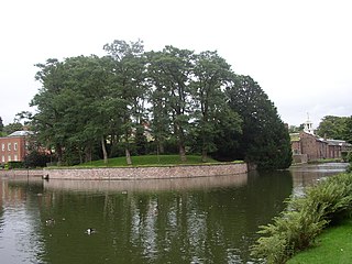
974:== {{int:filedesc}} == {{Information |description={{en|1=Dunham Massey Hall - the mound The mound is a possible site of Dunham Castle, which fell into ruin in the fourteenth century. According to the BBC Manchester website, "It has, in the past, been prot
437:– You must give appropriate credit, provide a link to the license, and indicate if changes were made. You may do so in any reasonable manner, but not in any way that suggests the licensor endorses you or your use.
65:
61:
57:
53:
47:
110:
78:
852:
754:
993:
956:
951:
689:
653:
617:
319:
269:
155:
69:
42:
739:
1184:
354:
1039:
This file contains additional information, probably added from the digital camera or scanner used to create or digitize it.
444:
552:
893:
866:
795:
768:
702:
673:
601:
575:
560:
545:
824:
732:
717:
637:
518:
501:
341:
400:
1059:
1042:
If the file has been modified from its original state, some details may not fully reflect the modified file.
1211:
443:– If you remix, transform, or build upon the material, you must distribute your contributions under the
361:
on the
Geograph website for the photographer's contact details. The copyright on this image is owned by
967:
397:
859:"}},"text\/plain":{"en":{"P7787":"135 degree"}}}}": -->
761:"}},"text\/plain":{"en":{"P7787":"135 degree"}}}}": -->
1247:
1069:
118:
214:
1153:
998:
724:
709:
567:
156:
http://www.bbc.co.uk/manchester/content/articles/2008/07/23/manchester_castles_feature.shtml
198:
325:
275:
1229:
1076:
988:
366:
105:
1116:
1257:
166:
1096:
309:
259:
187:
177:
1086:
346:
1016:
358:
924:
Click on a date/time to view the file as it appeared at that time.
311:
261:
286:
236:
143:
Dunham Massey Hall - the mound - geograph.org.uk - 1712295.jpg
93:
296:
53° 22′ 58″ N, 2° 24′ 02″ W
246:
53° 23′ 01″ N, 2° 24′ 09″ W
485:
Add a one-line explanation of what this file represents
1026:
83:(1,984 × 1,488 pixels, file size: 692 KB, MIME type:
137:
117:
Commons is a freely licensed media file repository.
654:
Creative
Commons Attribution-ShareAlike 2.0 Generic
454:https://creativecommons.org/licenses/by-sa/2.0
98:
460:Creative Commons Attribution-Share Alike 2.0
378:
8:
856:
758:
420:– to copy, distribute and transmit the work
1044:
994:Talk:List of castles in Greater Manchester
926:
481:
1009:The following other wikis use this file:
725:https://www.geograph.org.uk/photo/1712295
568:https://www.geograph.org.uk/profile/17090
1255:
1245:
1237:
1227:
1219:
1209:
1201:
1193:
1182:
1174:
1166:
1158:
1148:
1140:
1132:
1124:
1113:
1105:
1094:
1084:
1074:
1064:
1046:
986:
880:
864:
838:
822:
782:
766:
687:
671:
651:
635:
615:
599:
532:
516:
499:
496:
477:
470:
289:
239:
318:View this and other nearby images on:
268:View this and other nearby images on:
1054:
984:The following 3 pages use this file:
7:
365:and is licensed for reuse under the
915:
401:Attribution-Share Alike 2.0 Generic
389:
384:
369:Attribution-ShareAlike 2.0 license.
1037:
490:
484:
375:
352:
154:natural hummock of glacial sand".
147:
130:
76:
489:
1107:Date and time of data generation
769:coordinates of the point of view
475:
431:Under the following conditions:
396:This file is licensed under the
388:
383:
377:
345:
324:
310:
302:
274:
260:
252:
97:
31:
21:
1051:OLYMPUS DIGITAL CAMERA
472:
148:
14:
690:file available on the internet
471:
353:This image was taken from the
229:Dunham Massey Hall - the mound
210:Dunham Massey Hall - the mound
26:
1:
867:coordinates of depicted place
36:
740:Geograph Britain and Ireland
546:object of statement has role
497:Items portrayed in this file
301:
251:
1195:Date and time of digitizing
1013:Usage on ceb.wikipedia.org
1279:
1023:Usage on www.wikidata.org
882:53°22'58.15"N, 2°24'1.80"W
445:same or compatible license
1160:File change date and time
916:
784:53°23'1.03"N, 2°24'9.00"W
16:
1017:Dunham Massey (kastilyo)
703:geograph.org.uk image ID
474:
411:
227:Chris Denny /
208:Chris Denny /
104:This is a file from the
1060:OLYMPUS OPTICAL CO.,LTD
973:
199:required by the license
183:
172:
165:
162:
140:
108:. Information from its
1203:Image compression mode
359:this photograph's page
330:53.382820; -2.400500
280:53.383620; -2.402500
111:description page there
46:Size of this preview:
1221:Maximum land aperture
1134:Horizontal resolution
1081:1/320 sec (0.003125)
70:1,984 × 1,488 pixels
1168:Y and C positioning
1142:Vertical resolution
1056:Camera manufacturer
952:08:06, 5 March 2011
426:– to adapt the work
52:Other resolutions:
576:author name string
66:1,280 × 960 pixels
62:1,024 × 768 pixels
1266:
1265:
1224:3.1 APEX (f/2.93)
1005:Global file usage
999:User:Nev1/sandbox
977:
858:
760:
638:copyright license
483:
374:
373:
357:collection. See
335:
334:
285:
284:
234:
233:
202:
126:
125:
106:Wikimedia Commons
32:Global file usage
1270:
1176:Exposure Program
1045:
964:
904:
903:
898:
806:
805:
800:
742:
737:
727:
722:
718:described at URL
712:
707:
602:copyright status
583:
580:
570:
565:
555:
550:
467:
464:
461:
458:
455:
447:as the original.
409:
398:Creative Commons
392:
391:
387:
386:
381:
380:
367:Creative Commons
355:Geograph project
349:
342:
331:
328:
314:
313:
307:
306:
305:
299:
298:
287:
281:
278:
264:
263:
257:
256:
255:
249:
248:
237:
196:
168:
152:
144:
138:
122:
101:
100:
94:
88:
86:
73:
58:640 × 480 pixels
54:320 × 240 pixels
48:800 × 600 pixels
1278:
1277:
1273:
1272:
1271:
1269:
1268:
1267:
1033:
1003:
978:
970:
962:
918:
917:
914:
913:
912:
911:
910:
909:
908:
907:
906:
905:
901:
899:
896:
887:
886:
885:
883:
873:
872:
871:
869:
850:
849:
848:
847:
846:
845:
844:
843:
841:
831:
830:
829:
827:
816:
815:
814:
813:
812:
811:
810:
809:
808:
807:
803:
801:
798:
789:
788:
787:
785:
775:
774:
773:
771:
752:
751:
750:
749:
748:
747:
746:
745:
744:
743:
738:
735:
729:
728:
723:
720:
714:
713:
708:
705:
696:
695:
694:
692:
680:
679:
678:
676:
665:
664:
663:
662:
661:
660:
659:
658:
656:
644:
643:
642:
640:
629:
628:
627:
626:
625:
624:
623:
622:
620:
608:
607:
606:
604:
593:
592:
591:
590:
589:
588:
587:
586:
585:
584:
581:
578:
572:
571:
566:
563:
557:
556:
551:
548:
539:
538:
537:
535:
525:
524:
523:
521:
510:
509:
508:
507:
506:
504:
488:
487:
486:
469:
468:
465:
462:
459:
456:
453:
452:
410:
407:
404:
393:
370:
340:
329:
303:
294:
293:
290:Object location
279:
253:
244:
243:
240:Camera location
235:
224:
217:
205:
178:geograph.org.uk
158:
142:
135:
128:
127:
116:
115:
114:is shown below.
90:
84:
82:
75:
74:
51:
12:
11:
5:
1276:
1274:
1264:
1263:
1260:
1254:
1253:
1250:
1244:
1243:
1240:
1236:
1235:
1232:
1226:
1225:
1222:
1218:
1217:
1214:
1208:
1207:
1204:
1200:
1199:
1196:
1192:
1191:
1188:
1181:
1180:
1179:Normal program
1177:
1173:
1172:
1169:
1165:
1164:
1161:
1157:
1156:
1151:
1147:
1146:
1143:
1139:
1138:
1135:
1131:
1130:
1127:
1123:
1122:
1119:
1112:
1111:
1108:
1104:
1103:
1100:
1093:
1092:
1089:
1083:
1082:
1079:
1073:
1072:
1067:
1063:
1062:
1057:
1053:
1052:
1049:
1036:
1032:
1031:
1030:
1029:
1021:
1020:
1019:
1007:
1006:
1002:
1001:
996:
991:
982:
981:
976:
975:
972:
968:
965:
961:1,984 × 1,488
959:
954:
949:
945:
944:
941:
938:
935:
932:
929:
922:
921:
892:
891:
890:
889:
888:
884:
881:
879:
878:
877:
876:
875:
874:
870:
865:
863:
862:
861:
860:
854:
842:
840:19 August 2007
839:
837:
836:
835:
834:
833:
832:
828:
823:
821:
820:
819:
818:
817:
794:
793:
792:
791:
790:
786:
783:
781:
780:
779:
778:
777:
776:
772:
767:
765:
764:
763:
762:
756:
731:
730:
716:
715:
701:
700:
699:
698:
697:
693:
688:
686:
685:
684:
683:
682:
681:
677:
674:source of file
672:
670:
669:
668:
667:
666:
657:
652:
650:
649:
648:
647:
646:
645:
641:
636:
634:
633:
632:
631:
630:
621:
616:
614:
613:
612:
611:
610:
609:
605:
600:
598:
597:
596:
595:
594:
574:
573:
559:
558:
544:
543:
542:
541:
540:
536:
533:
531:
530:
529:
528:
527:
526:
522:
517:
515:
514:
513:
512:
511:
505:
500:
498:
495:
494:
493:
492:
491:
480:
479:
476:
473:
451:
450:
449:
448:
438:
429:
428:
427:
421:
414:You are free:
405:
395:
394:
376:
372:
371:
350:
339:
336:
333:
332:
322:
316:
291:
283:
282:
272:
266:
241:
232:
231:
225:
222:
219:
218:
213:
206:
203:
191:
190:
185:
181:
180:
174:
170:
169:
167:19 August 2007
164:
160:
159:
145:
136:
134:
131:
129:
124:
123:
102:
92:
91:
45:
41:
40:
39:
34:
29:
24:
19:
13:
10:
9:
6:
4:
3:
2:
1275:
1261:
1259:
1256:
1251:
1249:
1246:
1241:
1238:
1233:
1231:
1230:Metering mode
1228:
1223:
1220:
1215:
1213:
1212:Exposure bias
1210:
1205:
1202:
1197:
1194:
1189:
1186:
1183:
1178:
1175:
1170:
1167:
1162:
1159:
1155:
1152:
1150:Software used
1149:
1144:
1141:
1136:
1133:
1128:
1125:
1120:
1118:
1114:
1109:
1106:
1101:
1098:
1095:
1090:
1088:
1085:
1080:
1078:
1077:Exposure time
1075:
1071:
1068:
1065:
1061:
1058:
1055:
1050:
1047:
1043:
1040:
1034:
1028:
1025:
1024:
1022:
1018:
1015:
1014:
1012:
1011:
1010:
1004:
1000:
997:
995:
992:
990:
989:Dunham Castle
987:
985:
979:
971:
966:
960:
958:
955:
953:
950:
947:
946:
942:
939:
936:
933:
930:
928:
927:
925:
919:
895:
868:
826:
797:
770:
741:
734:
726:
719:
711:
704:
691:
675:
655:
639:
619:
603:
577:
569:
562:
554:
547:
520:
503:
457:CC BY-SA 2.0
446:
442:
439:
436:
433:
432:
430:
425:
422:
419:
416:
415:
413:
412:
406:Attribution:
402:
399:
382:
368:
364:
360:
356:
351:
348:
344:
343:
337:
327:
323:
321:
320:OpenStreetMap
317:
315:
297:
292:
288:
277:
273:
271:
270:OpenStreetMap
267:
265:
247:
242:
238:
230:
226:
221:
220:
216:
212: /
211:
207:
200:
195:
193:
192:
189:
186:
182:
179:
175:
171:
161:
157:
151:
146:
139:
132:
120:
113:
112:
107:
103:
96:
95:
89:
80:
79:Original file
71:
67:
63:
59:
55:
49:
44:
38:
35:
33:
30:
28:
25:
23:
20:
18:
15:
1239:Light source
1198:Unknown date
1163:Unknown date
1117:focal length
1110:Unknown date
1066:Camera model
1041:
1038:
1008:
983:
923:
920:File history
553:photographer
440:
434:
423:
417:
362:
300:
250:
228:
215:CC BY-SA 2.0
209:
149:
119:You can help
109:
77:
22:File history
1258:Color space
1252:Flash fired
1126:Orientation
1070:C300Z,D550Z
1048:Image title
969:GeographBot
618:copyrighted
582:Chris Denny
441:share alike
435:attribution
408:Chris Denny
363:Chris Denny
194:Attribution
188:Chris Denny
141:Description
980:File usage
937:Dimensions
534:some value
85:image/jpeg
27:File usage
1097:ISO speed
934:Thumbnail
931:Date/Time
825:inception
338:Licensing
223:InfoField
204:InfoField
150:English:
1171:Co-sited
1154:v574p-76
1087:F-number
1035:Metadata
1027:Q5315242
963:(692 KB)
733:operator
478:Captions
424:to remix
418:to share
403:license.
37:Metadata
1242:Unknown
1234:Pattern
1187:version
948:current
943:Comment
894:heading
853:heading
796:heading
755:heading
710:1712295
519:creator
502:depicts
482:English
133:Summary
81:
1145:72 dpi
1137:72 dpi
1129:Normal
1099:rating
902:degree
857:degree
804:degree
759:degree
308:
258:
184:Author
173:Source
1248:Flash
1115:Lens
1091:f/2.9
176:From
1262:sRGB
1185:Exif
1121:6 mm
940:User
900:135
802:135
466:true
463:true
163:Date
17:File
1190:2.1
561:URL
1102:85
897::
799::
736::
721::
706::
579::
564::
549::
68:|
64:|
60:|
56:|
50:.
1216:0
1206:1
201:)
197:(
121:.
87:)
72:.
Text is available under the Creative Commons Attribution-ShareAlike License. Additional terms may apply.

_heading:135.00&language=en)
_heading:135.00&language=en)
