33:
234:
240:
245:
89:
519:
292:– You must give appropriate credit, provide a link to the license, and indicate if changes were made. You may do so in any reasonable manner, but not in any way that suggests the licensor endorses you or your use.
559:
540:
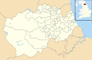
County
Council area, UK with electoral divisions and wards shown. Equirectangular map projection on WGS 84 datum, with N/S stretched 170% Geographic limits: *West: 2.40W *East: 1.05W *No
63:
59:
55:
51:
47:
43:
37:
72:
100:
554:
223:
430:
394:
299:
137:
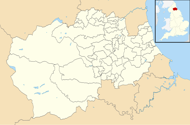
County
Council area (excluding Darlington, Hartlepool and Stockton-on-Tees), UK with electoral divisions and wards shown.
378:
450:
414:
361:
518:
513:
32:
194:
255:
298:– If you remix, transform, or build upon the material, you must distribute your contributions under the
252:
180:
108:
177:
529:
134:
537:
95:
211:
198:
166:
140:
Equirectangular map projection on WGS 84 datum, with N/S stretched 170%
560:
Knowledge talk:WikiProject
Politics of the United Kingdom/Archive 4
486:
Click on a date/time to view the file as it appeared at that time.
263:
Contains
Ordnance Survey data © Crown copyright and database right
83:
77:(SVG file, nominally 1,425 × 934 pixels, file size: 1.26 MB)
345:
Add a one-line explanation of what this file represents
431:
Creative
Commons Attribution-ShareAlike 3.0 Unported
122:
107:
Commons is a freely licensed media file repository.
309:https://creativecommons.org/licenses/by-sa/3.0
88:
315:Creative Commons Attribution-Share Alike 3.0
233:
8:
275:– to copy, distribute and transmit the work
128:Durham Council UK ward map 2010 (blank).svg
36:Size of this PNG preview of this SVG file:
488:
341:
555:List of electoral wards in County Durham
536:{{Information |Description=Blank map of
552:
464:
448:
428:
412:
392:
376:
359:
356:
337:
330:
550:The following 2 pages use this file:
187:Most data from Boundary-Line product.
7:
256:Attribution-Share Alike 3.0 Unported
214:, created using Ordnance Survey data
477:
244:
239:
350:
344:
230:
190:Lake data from Meridian 2 product.
120:
70:
349:
335:
286:Under the following conditions:
251:This file is licensed under the
243:
238:
232:
87:
21:
332:
14:
331:
26:
1:
195:File:England location map.svg
357:Items portrayed in this file
576:
300:same or compatible license
478:
16:
334:
266:
94:This is a file from the
535:
218:
207:
172:
165:
162:
125:
98:. Information from its
101:description page there
514:01:09, 25 April 2011
60:2,560 × 1,678 pixels
281:– to adapt the work
193:Inset derived from
143:Geographic limits:
42:Other resolutions:
64:1,425 × 934 pixels
56:1,280 × 839 pixels
52:1,024 × 671 pixels
543:
415:copyright license
343:
328:
327:
227:
224:Reusing this file
116:
115:
96:Wikimedia Commons
567:
526:
379:copyright status
322:
319:
316:
313:
310:
302:as the original.
264:
253:Creative Commons
247:
246:
242:
241:
236:
235:
221:
168:
129:
123:
112:
91:
90:
84:
78:
67:
48:640 × 419 pixels
44:320 × 210 pixels
38:800 × 524 pixels
575:
574:
570:
569:
568:
566:
565:
564:
544:
532:
524:
480:
479:
476:
475:
474:
473:
472:
471:
470:
469:
467:
457:
456:
455:
453:
442:
441:
440:
439:
438:
437:
436:
435:
433:
421:
420:
419:
417:
406:
405:
404:
403:
402:
401:
400:
399:
397:
385:
384:
383:
381:
370:
369:
368:
367:
366:
364:
348:
347:
346:
329:
324:
323:
320:
317:
314:
311:
308:
307:
265:
262:
259:
248:
178:Ordnance Survey
127:
118:
117:
106:
105:
104:is shown below.
80:
76:
69:
68:
41:
12:
11:
5:
573:
571:
563:
562:
557:
548:
547:
542:
541:
534:
530:
527:
521:
516:
511:
507:
506:
503:
500:
497:
494:
491:
484:
483:
468:
465:
463:
462:
461:
460:
459:
458:
454:
449:
447:
446:
445:
444:
443:
434:
429:
427:
426:
425:
424:
423:
422:
418:
413:
411:
410:
409:
408:
407:
398:
393:
391:
390:
389:
388:
387:
386:
382:
377:
375:
374:
373:
372:
371:
365:
360:
358:
355:
354:
353:
352:
351:
340:
339:
336:
333:
326:
325:
306:
305:
304:
303:
293:
284:
283:
282:
276:
269:You are free:
260:
250:
249:
231:
228:
216:
215:
209:
205:
204:
203:
202:
191:
188:
174:
170:
169:
164:
160:
159:
158:
157:
154:
151:
148:
130:
121:
119:
114:
113:
92:
82:
81:
35:
31:
30:
29:
24:
19:
13:
10:
9:
6:
4:
3:
2:
572:
561:
558:
556:
553:
551:
545:
539:
533:
528:
522:
520:
517:
515:
512:
509:
508:
504:
501:
498:
495:
492:
490:
489:
487:
481:
466:24 April 2011
452:
432:
416:
396:
380:
363:
312:CC BY-SA 3.0
301:
297:
294:
291:
288:
287:
285:
280:
277:
274:
271:
270:
268:
267:
261:Attribution:
257:
254:
237:
229:
225:
220:
217:
213:
210:
206:
200:
196:
192:
189:
186:
185:
184:
182:
179:
175:
171:
167:24 April 2011
161:
156:South: 54.43N
155:
153:North: 54.95N
152:
149:
146:
145:
144:
141:
138:
136:
133:Blank map of
131:
124:
110:
103:
102:
97:
93:
86:
85:
79:
74:
73:Original file
65:
61:
57:
53:
49:
45:
39:
34:
28:
25:
23:
20:
18:
15:
549:
523:1,425 × 934
485:
482:File history
295:
289:
278:
272:
176:
142:
139:
132:
109:You can help
99:
71:
22:File history
395:copyrighted
296:share alike
290:attribution
150:East: 1.05W
147:West: 2.40W
126:Description
546:File usage
499:Dimensions
219:Permission
27:File usage
531:Nilfanion
525:(1.26 MB)
496:Thumbnail
493:Date/Time
451:inception
212:Nilfanion
338:Captions
279:to remix
273:to share
258:license.
199:Spischot
181:OpenData
510:current
505:Comment
362:depicts
342:English
75:
538:Durham
208:Author
173:Source
135:Durham
502:User
321:true
318:true
163:Date
17:File
197:by
183:.
62:|
58:|
54:|
50:|
46:|
40:.
226:)
222:(
201:.
111:.
66:.
Text is available under the Creative Commons Attribution-ShareAlike License. Additional terms may apply.

.svg)