344:
277:
227:
269:
219:
291:
241:
312:
350:
355:
67:
820:"}},"text\/plain":{"en":{"":"heading"}}},"{\"value\":{\"amount\":\"+315\",\"unit\":\"http:\\\/\\\/www.wikidata.org\\\/entity\\\/Q28390\"},\"type\":\"quantity\"}":{"text\/html":{"en":{"P7787":"315
756:"}},"text\/plain":{"en":{"":"heading"}}},"{\"value\":{\"amount\":\"+315\",\"unit\":\"http:\\\/\\\/www.wikidata.org\\\/entity\\\/Q28390\"},\"type\":\"quantity\"}":{"text\/html":{"en":{"P7787":"315
816:
121:
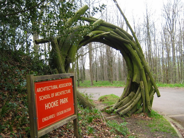
Entrance - Hooke Park Wooden sculpture adorns the entrance to the park. Hooke Park is 350 acres of woodland owned by the
Architectural Association Inc who provide educational environmental programmes from which to experiment, build and design in timber and at the same time uphold the natural
260:
210:
973:== {{int:filedesc}} == {{Information |description={{en|1=Entrance - Hooke Park Wooden sculpture adorns the entrance to the park.
Hooke Park is 350 acres of woodland owned by the Architectural Association Inc who provide educational environmental progra
38:
402:– You must give appropriate credit, provide a link to the license, and indicate if changes were made. You may do so in any reasonable manner, but not in any way that suggests the licensor endorses you or your use.
78:
46:
817:
753:
654:
618:
582:
284:
234:
674:
319:
998:
This file contains additional information, probably added from the digital camera or scanner used to create or digitize it.
409:
545:
887:
858:
831:
794:
767:
682:
638:
566:
538:
523:
510:
955:
950:
37:
725:
697:
667:
602:
483:
466:
306:
365:
1001:
If the file has been modified from its original state, some details may not fully reflect the modified file.
983:
The following pages on the
English Knowledge (XXG) use this file (pages on other projects are not listed):
408:– If you remix, transform, or build upon the material, you must distribute your contributions under the
326:
on the
Geograph website for the photographer's contact details. The copyright on this image is owned by
966:
362:
824:"}},"text\/plain":{"en":{"P7787":"315 degree"}}}}": -->
760:"}},"text\/plain":{"en":{"P7787":"315 degree"}}}}": -->
86:
704:
689:
530:
163:
290:
240:
331:
73:
179:
131:
987:
274:
224:
152:
142:
311:
323:
923:
Click on a date/time to view the file as it appeared at that time.
276:
226:
251:
201:
61:
261:
50° 47′ 50″ N, 2° 40′ 23″ W
211:
50° 47′ 50″ N, 2° 40′ 23″ W
450:
Add a one-line explanation of what this file represents
111:
Entrance - Hooke Park - geograph.org.uk - 1247768.jpg
47:
Entrance_-_Hooke_Park_-_geograph.org.uk_-_1247768.jpg
105:
85:
Commons is a freely licensed media file repository.
619:
Creative
Commons Attribution-ShareAlike 2.0 Generic
51:(640 × 480 pixels, file size: 131 KB, MIME type:
419:https://creativecommons.org/licenses/by-sa/2.0
66:
425:Creative Commons Attribution-Share Alike 2.0
343:
8:
821:
757:
385:– to copy, distribute and transmit the work
1003:
925:
446:
705:https://www.geograph.org.uk/photo/1247768
531:https://www.geograph.org.uk/profile/19422
1005:
985:
901:
885:
845:
829:
781:
765:
739:
723:
652:
636:
616:
600:
580:
564:
497:
481:
464:
461:
442:
435:
254:
204:
283:View this and other nearby images on:
233:View this and other nearby images on:
7:
330:and is licensed for reuse under the
914:
366:Attribution-Share Alike 2.0 Generic
354:
349:
334:Attribution-ShareAlike 2.0 license.
996:
455:
449:
340:
317:
115:
98:
44:
454:
768:coordinates of the point of view
440:
396:Under the following conditions:
361:This file is licensed under the
353:
348:
342:
310:
289:
275:
267:
239:
225:
217:
65:
21:
437:
116:
41:No higher resolution available.
14:
655:file available on the internet
436:
318:This image was taken from the
26:
1:
832:coordinates of depicted place
31:
675:Geograph Britain and Ireland
539:object of statement has role
462:Items portrayed in this file
266:
216:
847:50°47'49.96"N, 2°40'23.16"W
783:50°47'49.63"N, 2°40'22.80"W
1027:
410:same or compatible license
915:
122:conservation of the area.
16:
683:geograph.org.uk image ID
439:
376:
192:Sarah Smith /
173:Sarah Smith /
72:This is a file from the
972:
951:16:26, 26 February 2011
164:required by the license
148:
137:
130:
127:
108:
76:. Information from its
324:this photograph's page
295:50.797210; -2.673100
245:50.797120; -2.673000
79:description page there
194:Entrance - Hooke Park
175:Entrance - Hooke Park
391:– to adapt the work
511:author name string
1014:
1013:
976:
823:
759:
603:copyright license
448:
339:
338:
322:collection. See
300:
299:
250:
249:
199:
198:
167:
94:
93:
74:Wikimedia Commons
1018:
1004:
963:
869:
868:
863:
805:
804:
799:
707:
702:
698:described at URL
692:
687:
677:
672:
567:copyright status
548:
543:
533:
528:
518:
515:
432:
429:
426:
423:
420:
412:as the original.
374:
363:Creative Commons
357:
356:
352:
351:
346:
345:
332:Creative Commons
320:Geograph project
314:
307:
296:
293:
279:
278:
272:
271:
270:
264:
263:
252:
246:
243:
229:
228:
222:
221:
220:
214:
213:
202:
161:
133:
120:
112:
106:
90:
69:
68:
62:
56:
54:
1026:
1025:
1021:
1020:
1019:
1017:
1016:
1015:
992:
984:
977:
969:
961:
917:
916:
913:
912:
911:
910:
909:
908:
907:
906:
904:
894:
893:
892:
890:
879:
878:
877:
876:
875:
874:
873:
872:
871:
870:
866:
864:
861:
852:
851:
850:
848:
838:
837:
836:
834:
815:
814:
813:
812:
811:
810:
809:
808:
807:
806:
802:
800:
797:
788:
787:
786:
784:
774:
773:
772:
770:
751:
750:
749:
748:
747:
746:
745:
744:
742:
732:
731:
730:
728:
717:
716:
715:
714:
713:
712:
711:
710:
709:
708:
703:
700:
694:
693:
688:
685:
679:
678:
673:
670:
661:
660:
659:
657:
645:
644:
643:
641:
630:
629:
628:
627:
626:
625:
624:
623:
621:
609:
608:
607:
605:
594:
593:
592:
591:
590:
589:
588:
587:
585:
573:
572:
571:
569:
558:
557:
556:
555:
554:
553:
552:
551:
550:
549:
544:
541:
535:
534:
529:
526:
520:
519:
516:
513:
504:
503:
502:
500:
490:
489:
488:
486:
475:
474:
473:
472:
471:
469:
453:
452:
451:
434:
433:
430:
427:
424:
421:
418:
417:
375:
372:
369:
358:
335:
305:
294:
268:
259:
258:
255:Object location
244:
218:
209:
208:
205:Camera location
200:
189:
182:
170:
143:geograph.org.uk
123:
110:
103:
96:
95:
84:
83:
82:is shown below.
58:
52:
50:
43:
42:
12:
11:
5:
1024:
1022:
1012:
1011:
1008:
995:
991:
990:
982:
981:
980:
975:
974:
971:
967:
964:
958:
953:
948:
944:
943:
940:
937:
934:
931:
928:
921:
920:
905:
902:
900:
899:
898:
897:
896:
895:
891:
886:
884:
883:
882:
881:
880:
857:
856:
855:
854:
853:
849:
846:
844:
843:
842:
841:
840:
839:
835:
830:
828:
827:
826:
825:
819:
793:
792:
791:
790:
789:
785:
782:
780:
779:
778:
777:
776:
775:
771:
766:
764:
763:
762:
761:
755:
743:
740:
738:
737:
736:
735:
734:
733:
729:
724:
722:
721:
720:
719:
718:
696:
695:
681:
680:
666:
665:
664:
663:
662:
658:
653:
651:
650:
649:
648:
647:
646:
642:
639:source of file
637:
635:
634:
633:
632:
631:
622:
617:
615:
614:
613:
612:
611:
610:
606:
601:
599:
598:
597:
596:
595:
586:
581:
579:
578:
577:
576:
575:
574:
570:
565:
563:
562:
561:
560:
559:
537:
536:
522:
521:
509:
508:
507:
506:
505:
501:
498:
496:
495:
494:
493:
492:
491:
487:
482:
480:
479:
478:
477:
476:
470:
465:
463:
460:
459:
458:
457:
456:
445:
444:
441:
438:
416:
415:
414:
413:
403:
394:
393:
392:
386:
379:You are free:
370:
360:
359:
341:
337:
336:
315:
304:
301:
298:
297:
287:
281:
256:
248:
247:
237:
231:
206:
197:
196:
190:
187:
184:
183:
178:
171:
168:
156:
155:
150:
146:
145:
139:
135:
134:
129:
125:
124:
113:
104:
102:
99:
97:
92:
91:
70:
60:
59:
40:
36:
35:
34:
29:
24:
19:
13:
10:
9:
6:
4:
3:
2:
1023:
1009:
1006:
1002:
999:
993:
989:
986:
978:
970:
965:
959:
957:
954:
952:
949:
946:
945:
941:
938:
935:
932:
929:
927:
926:
924:
918:
889:
860:
833:
796:
769:
741:12 April 2009
727:
706:
699:
691:
684:
676:
669:
656:
640:
620:
604:
584:
568:
547:
540:
532:
525:
512:
485:
468:
422:CC BY-SA 2.0
411:
407:
404:
401:
398:
397:
395:
390:
387:
384:
381:
380:
378:
377:
371:Attribution:
367:
364:
347:
333:
329:
325:
321:
316:
313:
309:
308:
302:
292:
288:
286:
285:OpenStreetMap
282:
280:
262:
257:
253:
242:
238:
236:
235:OpenStreetMap
232:
230:
212:
207:
203:
195:
191:
186:
185:
181:
177: /
176:
172:
165:
160:
158:
157:
154:
151:
147:
144:
140:
136:
132:12 April 2009
126:
119:
114:
107:
100:
88:
81:
80:
75:
71:
64:
63:
57:
48:
39:
33:
30:
28:
25:
23:
20:
18:
15:
1000:
997:
922:
919:File history
546:photographer
405:
399:
388:
382:
327:
265:
215:
193:
180:CC BY-SA 2.0
174:
117:
87:You can help
77:
45:
22:File history
968:GeographBot
583:copyrighted
517:Sarah Smith
406:share alike
400:attribution
373:Sarah Smith
328:Sarah Smith
159:Attribution
153:Sarah Smith
109:Description
1007:_error
988:Hooke Park
979:File usage
960:640 × 480
936:Dimensions
903:image/jpeg
888:media type
499:some value
53:image/jpeg
27:File usage
933:Thumbnail
930:Date/Time
726:inception
303:Licensing
188:InfoField
169:InfoField
118:English:
994:Metadata
962:(131 KB)
668:operator
443:Captions
389:to remix
383:to share
368:license.
32:Metadata
947:current
942:Comment
859:heading
818:heading
795:heading
754:heading
690:1247768
484:creator
467:depicts
447:English
101:Summary
49:
867:degree
822:degree
803:degree
758:degree
273:
223:
149:Author
138:Source
141:From
939:User
865:315
801:315
431:true
428:true
128:Date
17:File
524:URL
862::
798::
701::
686::
671::
542::
527::
514::
1010:0
166:)
162:(
89:.
55:)
Text is available under the Creative Commons Attribution-ShareAlike License. Additional terms may apply.
_heading:315.00&language=en)
_heading:315.00&language=en)
