203:
267:
38:
214:
273:
278:
94:
653:
623:
325:– You must give appropriate credit, provide a link to the license, and indicate if changes were made. You may do so in any reasonable manner, but not in any way that suggests the licensor endorses you or your use.
400:{{Information |Description=Map showing the ] including the City of London, in 2010. Equirectangular map projection on WGS 84 datum, with N/S stretched 170% Geographic limits: *West: 6.75W
420:{{Information |Description={{en|1=Counties of England in 1851. Exclaves and major rivers shown.}} |Source={{own}} |Author=] |Date=26 July 2010 |Permission= |other_versions= }} ]
368:
229:
197:
68:
64:
60:
56:
52:
48:
42:
534:
498:
105:
77:
332:
149:
671:
482:
674:
excluding the City of London, in 1851. Exclaves and major rivers shown. Equirectangular map projection on WGS 84 d...
554:
518:
465:
652:
647:
408:
238:
208:
288:
331:– If you remix, transform, or build upon the material, you must distribute your contributions under the
285:
113:
684:
No pages on the
English Knowledge (XXG) use this file (pages on other projects are not listed).
429:
622:
617:
37:
202:
181:
100:
663:
633:
395:
385:
375:
233:
248:
213:
154:
Equirectangular map projection on WGS 84 datum, with N/S stretched 170%
152:
excluding the City of London, in 1851. Exclaves and major rivers shown.
670:== {{int:filedesc}} == {{Information |Description={{en|Map showing the
415:
242:
699:
590:
Click on a date/time to view the file as it appeared at that time.
709:
88:
82:(SVG file, nominally 1,108 × 1,345 pixels, file size: 315 KB)
364:
This image is a derivative work of the following images:
449:
Add a one-line explanation of what this file represents
535:
Creative
Commons Attribution-ShareAlike 3.0 Unported
132:
112:
Commons is a freely licensed media file repository.
342:https://creativecommons.org/licenses/by-sa/3.0
93:
348:Creative Commons Attribution-Share Alike 3.0
266:
8:
308:– to copy, distribute and transmit the work
41:Size of this PNG preview of this SVG file:
592:
445:
692:The following other wikis use this file:
369:File:English_ceremonial_counties_2010.svg
640:correction to status of Ireland in 1851
568:
552:
532:
516:
496:
480:
463:
460:
441:
434:
7:
289:Attribution-Share Alike 3.0 Unported
230:English_ceremonial_counties_2010.svg
198:English ceremonial counties 2010.svg
581:
277:
272:
454:
448:
263:
142:
125:
75:
453:
411:licensed with Cc-by-sa-3.0, GFDL
371:licensed with Cc-by-sa-3.0, GFDL
439:
319:Under the following conditions:
284:This file is licensed under the
276:
271:
265:
212:
201:
92:
31:
21:
436:
143:
14:
696:Usage on simple.wikipedia.org
672:historical counties of England
435:
409:File:England_counties_1851.png
150:historical counties of England
26:
1:
193:This file was derived from:
461:Items portrayed in this file
728:
706:Usage on sl.wikipedia.org
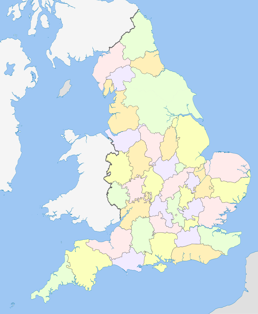
333:same or compatible license
582:
418:1459x1769 (103262 Bytes)
388:1108x1345 (301520 Bytes)
378:1108x1345 (308868 Bytes)
239:England_counties_1851.png
209:England counties 1851.png
138:English counties 1851.svg
16:
438:
398:817x990 (1391832 Bytes)
299:
99:This is a file from the
669:
639:
223:
188:
180:
177:
135:
103:. Information from its
106:description page there
414:2010-07-26T07:03:28Z
394:2010-10-26T20:34:20Z
384:2010-11-23T16:20:19Z
374:2010-11-23T16:39:55Z
648:20:17, 19 March 2012
618:23:08, 20 March 2012
182:19 March 2012, 20:13
69:1,108 × 1,345 pixels
65:1,687 × 2,048 pixels
700:Counties of England
360:Original upload log
314:– to adapt the work
157:Geographic limits:
47:Other resolutions:
61:843 × 1,024 pixels
688:Global file usage
677:
519:copyright license
447:
256:
255:
247:derivative work:
121:
120:
101:Wikimedia Commons
32:Global file usage
719:
710:Angleška grofija
660:
630:
483:copyright status
355:
352:
349:
346:
343:
335:as the original.
297:
286:Creative Commons
280:
279:
275:
274:
269:
268:
216:
205:
183:
148:Map showing the
147:
139:
133:
117:
96:
95:
89:
83:
72:
57:633 × 768 pixels
53:395 × 480 pixels
49:198 × 240 pixels
43:494 × 600 pixels
727:
726:
722:
721:
720:
718:
717:
716:
686:
685:
678:
666:
658:
636:
628:
584:
583:
580:
579:
578:
577:
576:
575:
574:
573:
571:
561:
560:
559:
557:
546:
545:
544:
543:
542:
541:
540:
539:
537:
525:
524:
523:
521:
510:
509:
508:
507:
506:
505:
504:
503:
501:
489:
488:
487:
485:
474:
473:
472:
471:
470:
468:
452:
451:
450:
362:
357:
356:
353:
350:
347:
344:
341:
340:
298:
295:
292:
281:
262:
257:
173:
137:
130:
123:
122:
111:
110:
109:is shown below.
85:
81:
74:
73:
46:
12:
11:
5:
725:
723:
715:
714:
713:
712:
704:
703:
702:
690:
689:
683:
682:
681:
676:
675:
668:
664:
661:
657:1,108 × 1,345
655:
650:
645:
642:
641:
638:
634:
631:
627:1,108 × 1,345
625:
620:
615:
611:
610:
607:
604:
601:
598:
595:
588:
587:
572:
569:
567:
566:
565:
564:
563:
562:
558:
553:
551:
550:
549:
548:
547:
538:
533:
531:
530:
529:
528:
527:
526:
522:
517:
515:
514:
513:
512:
511:
502:
497:
495:
494:
493:
492:
491:
490:
486:
481:
479:
478:
477:
476:
475:
469:
464:
462:
459:
458:
457:
456:
455:
444:
443:
440:
437:
428:Uploaded with
425:
424:
423:
422:
405:
404:
403:
402:
392:
382:
361:
358:
339:
338:
337:
336:
326:
317:
316:
315:
309:
302:You are free:
293:
283:
282:
264:
261:
258:
254:
253:
252:
251:
245:
236:
225:
221:
220:
219:
218:
206:
190:
186:
185:
179:
175:
174:
172:
171:
168:
165:
162:
140:
131:
129:
126:
124:
119:
118:
97:
87:
86:
40:
36:
35:
34:
29:
24:
19:
13:
10:
9:
6:
4:
3:
2:
724:
711:
708:
707:
705:
701:
698:
697:
695:
694:
693:
687:
679:
673:
667:
662:
656:
654:
651:
649:
646:
644:
643:
637:
632:
626:
624:
621:
619:
616:
613:
612:
608:
605:
602:
599:
596:
594:
593:
591:
585:
570:19 March 2012
556:
536:
520:
500:
484:
467:
433:
432:
431:
421:
417:
413:
412:
410:
407:
406:
401:
397:
393:
391:
387:
383:
381:
380:thicker lines
377:
373:
372:
370:
367:
366:
365:
359:
345:CC BY-SA 3.0
334:
330:
327:
324:
321:
320:
318:
313:
310:
307:
304:
303:
301:
300:
294:Attribution:
290:
287:
270:
259:
250:
246:
244:
240:
237:
235:
231:
228:
227:
226:
222:
217:
215:
210:
207:
204:
199:
196:
195:
194:
191:
187:
176:
170:South: 49.75N
169:
166:
163:
160:
159:
158:
155:
151:
146:
141:
134:
127:
115:
108:
107:
102:
98:
91:
90:
84:
79:
78:Original file
70:
66:
62:
58:
54:
50:
44:
39:
33:
30:
28:
25:
23:
20:
18:
15:
691:
589:
586:File history
430:derivativeFX
427:
426:
419:
399:
389:
379:
363:
328:
322:
311:
305:
192:
167:North: 56.0N
156:
153:
144:
114:You can help
104:
76:
22:File history
499:copyrighted
329:share alike
323:attribution
161:West: 6.75W
136:Description
680:File usage
603:Dimensions
164:East: 2.0E
27:File usage
600:Thumbnail
597:Date/Time
555:inception
396:Nilfanion
386:Nilfanion
376:Nilfanion
260:Licensing
234:Nilfanion
145:English:
659:(318 KB)
629:(315 KB)
442:Captions
312:to remix
306:to share
291:license.
665:Dr Greg
635:Dr Greg
614:current
609:Comment
466:depicts
446:English
296:Dr Greg
249:Dr Greg
211::
200::
128:Summary
80:
390:tweaks
224:Author
189:Source
184:(UTC)
606:User
416:MRSC
354:true
351:true
243:MRSC
178:Date
17:File
241::
232::
67:|
63:|
59:|
55:|
51:|
45:.
116:.
71:.
Text is available under the Creative Commons Attribution-ShareAlike License. Additional terms may apply.


