43:
391:
324:
274:
316:
266:
338:
288:
359:
397:
402:
99:
867:"}},"text\/plain":{"en":{"":"heading"}}},"{\"value\":{\"amount\":\"+180\",\"unit\":\"http:\\\/\\\/www.wikidata.org\\\/entity\\\/Q28390\"},\"type\":\"quantity\"}":{"text\/html":{"en":{"P7787":"180
803:"}},"text\/plain":{"en":{"":"heading"}}},"{\"value\":{\"amount\":\"+180\",\"unit\":\"http:\\\/\\\/www.wikidata.org\\\/entity\\\/Q28390\"},\"type\":\"quantity\"}":{"text\/html":{"en":{"P7787":"180
799:
307:
257:
449:– You must give appropriate credit, provide a link to the license, and indicate if changes were made. You may do so in any reasonable manner, but not in any way that suggests the licensor endorses you or your use.
65:
61:
57:
53:
47:
78:
110:
864:
800:
194:
701:
665:
629:
331:
281:
721:
1168:
366:
1031:
This file contains additional information, probably added from the digital camera or scanner used to create or digitize it.
968:
963:
69:
42:
456:
1137:
592:
905:
878:
841:
814:
744:
685:
613:
585:
572:
557:
772:
729:
714:
649:
530:
513:
353:
412:
1034:
If the file has been modified from its original state, some details may not fully reflect the modified file.
1242:
455:– If you remix, transform, or build upon the material, you must distribute your contributions under the
373:
on the
Geograph website for the photographer's contact details. The copyright on this image is owned by
409:
871:"}},"text\/plain":{"en":{"P7787":"180 degree"}}}}": -->
807:"}},"text\/plain":{"en":{"P7787":"180 degree"}}}}": -->
1278:
1000:
118:
226:
751:
736:
564:
210:
337:
287:
1370:
1260:
1216:
1060:
1053:
378:
105:
1100:
271:
1296:
162:
1080:
321:
979:
183:
173:
1388:
1070:
1043:
358:
370:
936:
Click on a date/time to view the file as it appeared at that time.
323:
273:
298:
258:
50° 55′ 42.84″ N, 3° 59′ 19.2″ W
248:
93:
308:
50° 55′ 43″ N, 3° 59′ 19″ W
497:
Add a one-line explanation of what this file represents
143:
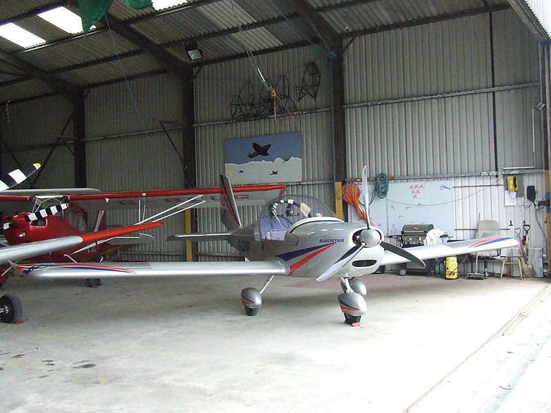
Eaglescott
Airfield North Devon (geograph 2405100).jpg
83:(2,592 × 1,944 pixels, file size: 1.22 MB, MIME type:
1018:
201:
Creative
Commons Attribution Share-alike license 2.0
137:
117:
Commons is a freely licensed media file repository.
666:
Creative
Commons Attribution-ShareAlike 2.0 Generic
466:https://creativecommons.org/licenses/by-sa/2.0
98:
472:Creative Commons Attribution-Share Alike 2.0
390:
8:
868:
804:
432:– to copy, distribute and transmit the work
1036:
938:
493:
1011:The following other wikis use this file:
737:https://www.geograph.org.uk/photo/2405100
565:https://www.geograph.org.uk/profile/63199
1396:
1386:
1378:
1368:
1360:
1352:
1344:
1336:
1328:
1320:
1312:
1304:
1294:
1286:
1276:
1268:
1258:
1250:
1240:
1232:
1224:
1214:
1206:
1185:
1177:
1166:
1158:
1150:
1142:
1132:
1124:
1116:
1108:
1097:
1089:
1078:
1068:
1058:
1048:
998:
892:
876:
828:
812:
786:
770:
699:
683:
663:
647:
627:
611:
544:
528:
511:
508:
489:
482:
301:
251:
1138:Digital Camera FinePix S5600 Ver1.00
986:Transferred from geograph.co.uk using
330:View this and other nearby images on:
280:View this and other nearby images on:
1038:
7:
377:and is licensed for reuse under the
996:The following page uses this file:
927:
413:Attribution-Share Alike 2.0 Generic
401:
396:
381:Attribution-ShareAlike 2.0 license.
1029:
502:
496:
387:
364:
147:
130:
76:
501:
1091:Date and time of data generation
815:coordinates of the point of view
487:
443:Under the following conditions:
408:This file is licensed under the
400:
395:
389:
357:
336:
322:
314:
286:
272:
264:
97:
31:
21:
484:
241:Eaglescott Airfield North Devon
222:Eaglescott Airfield North Devon
153:Eaglescott Airfield North Devon
148:
14:
702:file available on the internet
483:
365:This image was taken from the
26:
1:
1349:A directly photographed image
1283:Flash did not fire, auto mode
879:coordinates of depicted place
830:50°55'42.845"N, 3°59'19.198"W
36:
722:Geograph Britain and Ireland
586:object of statement has role
509:Items portrayed in this file
313:
263:
1322:Focal plane resolution unit
1179:Date and time of digitizing
894:50°55'43.03"N, 3°59'18.60"W
1418:
1333:One-chip color area sensor
1288:Supported Flashpix version
1015:Usage on www.wikidata.org
457:same or compatible license
1187:Meaning of each component
1144:File change date and time
928:
239:John Maynard /
220:John Maynard /
16:
1314:Focal plane Y resolution
1306:Focal plane X resolution
745:geograph.org.uk image ID
486:
423:
104:This is a file from the
1354:Custom image processing
985:
211:required by the license
189:
179:
168:
161:
158:
140:
108:. Information from its
1398:Subject distance range
1208:Image compression mode
371:this photograph's page
342:50.928620; -3.988500
292:50.928568; -3.988666
111:description page there
46:Size of this preview:
1252:Maximum land aperture
1118:Horizontal resolution
1341:Digital still camera
70:2,592 × 1,944 pixels
1152:Y and C positioning
1126:Vertical resolution
1040:Camera manufacturer
1001:Eaglescott Airfield
964:20:38, 21 July 2016
438:– to adapt the work
52:Other resolutions:
1380:Scene capture type
1375:Auto white balance
1182:11:55, 4 July 2010
1147:11:55, 4 July 2010
1094:11:55, 4 July 2010
573:author name string
66:1,280 × 960 pixels
62:1,024 × 768 pixels
1405:
1404:
1255:3.4 APEX (f/3.25)
1065:1/500 sec (0.002)
1007:Global file usage
989:
870:
806:
650:copyright license
495:
386:
385:
369:collection. See
347:
346:
297:
296:
246:
245:
214:
198:
195:Reusing this file
126:
125:
106:Wikimedia Commons
32:Global file usage
1409:
1160:Exposure Program
1037:
976:
916:
915:
910:
852:
851:
846:
754:
749:
739:
734:
730:described at URL
724:
719:
614:copyright status
595:
590:
580:
577:
567:
562:
479:
476:
473:
470:
467:
459:as the original.
421:
410:Creative Commons
404:
403:
399:
398:
393:
392:
379:Creative Commons
367:Geograph project
361:
354:
343:
340:
326:
325:
319:
318:
317:
311:
310:
299:
293:
290:
276:
275:
269:
268:
267:
261:
260:
249:
208:
192:
164:
152:
144:
138:
122:
101:
100:
94:
88:
86:
73:
58:640 × 480 pixels
54:320 × 240 pixels
48:800 × 600 pixels
1417:
1416:
1412:
1411:
1410:
1408:
1407:
1406:
1234:APEX brightness
1054:FinePix S5600
1025:
1005:
990:
982:
974:
930:
929:
926:
925:
924:
923:
922:
921:
920:
919:
918:
917:
913:
911:
908:
899:
898:
897:
895:
885:
884:
883:
881:
862:
861:
860:
859:
858:
857:
856:
855:
854:
853:
849:
847:
844:
835:
834:
833:
831:
821:
820:
819:
817:
798:
797:
796:
795:
794:
793:
792:
791:
789:
779:
778:
777:
775:
764:
763:
762:
761:
760:
759:
758:
757:
756:
755:
750:
747:
741:
740:
735:
732:
726:
725:
720:
717:
708:
707:
706:
704:
692:
691:
690:
688:
677:
676:
675:
674:
673:
672:
671:
670:
668:
656:
655:
654:
652:
641:
640:
639:
638:
637:
636:
635:
634:
632:
620:
619:
618:
616:
605:
604:
603:
602:
601:
600:
599:
598:
597:
596:
591:
588:
582:
581:
578:
575:
569:
568:
563:
560:
551:
550:
549:
547:
537:
536:
535:
533:
522:
521:
520:
519:
518:
516:
500:
499:
498:
481:
480:
477:
474:
471:
468:
465:
464:
422:
419:
416:
405:
382:
352:
341:
315:
306:
305:
302:Object location
291:
265:
256:
255:
252:Camera location
247:
236:
229:
217:
174:geograph.org.uk
154:
142:
135:
128:
127:
116:
115:
114:is shown below.
90:
84:
82:
75:
74:
51:
12:
11:
5:
1415:
1413:
1403:
1402:
1399:
1395:
1394:
1391:
1385:
1384:
1381:
1377:
1376:
1373:
1367:
1366:
1363:
1359:
1358:
1357:Normal process
1355:
1351:
1350:
1347:
1343:
1342:
1339:
1335:
1334:
1331:
1330:Sensing method
1327:
1326:
1323:
1319:
1318:
1315:
1311:
1310:
1307:
1303:
1302:
1299:
1293:
1292:
1289:
1285:
1284:
1281:
1275:
1274:
1271:
1267:
1266:
1263:
1257:
1256:
1253:
1249:
1248:
1245:
1239:
1238:
1235:
1231:
1230:
1227:
1223:
1222:
1219:
1213:
1212:
1209:
1205:
1204:
1203:
1202:
1201:does not exist
1199:
1196:
1193:
1188:
1184:
1183:
1180:
1176:
1175:
1172:
1165:
1164:
1163:Normal program
1161:
1157:
1156:
1153:
1149:
1148:
1145:
1141:
1140:
1135:
1131:
1130:
1127:
1123:
1122:
1119:
1115:
1114:
1111:
1107:
1106:
1103:
1096:
1095:
1092:
1088:
1087:
1084:
1077:
1076:
1073:
1067:
1066:
1063:
1057:
1056:
1051:
1047:
1046:
1041:
1028:
1024:
1023:
1022:
1021:
1009:
1008:
1004:
1003:
994:
993:
988:
987:
984:
980:
977:
973:2,592 × 1,944
971:
966:
961:
957:
956:
953:
950:
947:
944:
941:
934:
933:
904:
903:
902:
901:
900:
896:
893:
891:
890:
889:
888:
887:
886:
882:
877:
875:
874:
873:
872:
866:
840:
839:
838:
837:
836:
832:
829:
827:
826:
825:
824:
823:
822:
818:
813:
811:
810:
809:
808:
802:
790:
787:
785:
784:
783:
782:
781:
780:
776:
771:
769:
768:
767:
766:
765:
743:
742:
728:
727:
713:
712:
711:
710:
709:
705:
700:
698:
697:
696:
695:
694:
693:
689:
686:source of file
684:
682:
681:
680:
679:
678:
669:
664:
662:
661:
660:
659:
658:
657:
653:
648:
646:
645:
644:
643:
642:
633:
628:
626:
625:
624:
623:
622:
621:
617:
612:
610:
609:
608:
607:
606:
584:
583:
571:
570:
556:
555:
554:
553:
552:
548:
545:
543:
542:
541:
540:
539:
538:
534:
529:
527:
526:
525:
524:
523:
517:
512:
510:
507:
506:
505:
504:
503:
492:
491:
488:
485:
463:
462:
461:
460:
450:
441:
440:
439:
433:
426:You are free:
417:
407:
406:
388:
384:
383:
362:
351:
348:
345:
344:
334:
328:
303:
295:
294:
284:
278:
253:
244:
243:
237:
234:
231:
230:
225:
218:
215:
203:
202:
199:
187:
186:
181:
177:
176:
170:
166:
165:
160:
156:
155:
145:
136:
134:
131:
129:
124:
123:
102:
92:
91:
45:
41:
40:
39:
34:
29:
24:
19:
13:
10:
9:
6:
4:
3:
2:
1414:
1400:
1397:
1392:
1390:
1387:
1382:
1379:
1374:
1372:
1371:White balance
1369:
1365:Auto exposure
1364:
1362:Exposure mode
1361:
1356:
1353:
1348:
1345:
1340:
1337:
1332:
1329:
1324:
1321:
1316:
1313:
1308:
1305:
1300:
1298:
1295:
1290:
1287:
1282:
1280:
1277:
1272:
1269:
1264:
1262:
1261:Metering mode
1259:
1254:
1251:
1246:
1244:
1243:Exposure bias
1241:
1236:
1233:
1228:
1226:APEX aperture
1225:
1220:
1218:
1217:Shutter speed
1215:
1210:
1207:
1200:
1197:
1194:
1191:
1190:
1189:
1186:
1181:
1178:
1173:
1170:
1167:
1162:
1159:
1154:
1151:
1146:
1143:
1139:
1136:
1134:Software used
1133:
1128:
1125:
1120:
1117:
1112:
1109:
1104:
1102:
1098:
1093:
1090:
1085:
1082:
1079:
1074:
1072:
1069:
1064:
1062:
1061:Exposure time
1059:
1055:
1052:
1049:
1045:
1042:
1039:
1035:
1032:
1026:
1020:
1017:
1016:
1014:
1013:
1012:
1006:
1002:
999:
997:
991:
983:
978:
972:
970:
967:
965:
962:
959:
958:
954:
951:
948:
945:
942:
940:
939:
937:
931:
907:
880:
843:
816:
774:
753:
746:
738:
731:
723:
716:
703:
687:
667:
651:
631:
615:
594:
587:
574:
566:
559:
532:
515:
469:CC BY-SA 2.0
458:
454:
451:
448:
445:
444:
442:
437:
434:
431:
428:
427:
425:
424:
418:Attribution:
414:
411:
394:
380:
376:
372:
368:
363:
360:
356:
355:
349:
339:
335:
333:
332:OpenStreetMap
329:
327:
309:
304:
300:
289:
285:
283:
282:OpenStreetMap
279:
277:
259:
254:
250:
242:
238:
233:
232:
228:
224: /
223:
219:
212:
207:
205:
204:
200:
196:
191:
188:
185:
182:
178:
175:
171:
167:
157:
151:
146:
139:
132:
120:
113:
112:
107:
103:
96:
95:
89:
80:
79:Original file
71:
67:
63:
59:
55:
49:
44:
38:
35:
33:
30:
28:
25:
23:
20:
18:
15:
1270:Light source
1101:focal length
1050:Camera model
1033:
1030:
1010:
995:
935:
932:File history
593:photographer
579:John Maynard
452:
446:
435:
429:
420:John Maynard
375:John Maynard
374:
312:
262:
240:
227:CC BY-SA 2.0
221:
184:John Maynard
149:
119:You can help
109:
77:
22:File history
1338:File source
1297:Color space
1110:Orientation
788:4 July 2010
630:copyrighted
453:share alike
447:attribution
206:Attribution
163:4 July 2010
141:Description
1346:Scene type
992:File usage
949:Dimensions
546:some value
190:Permission
85:image/jpeg
27:File usage
1389:Sharpness
1081:ISO speed
975:(1.22 MB)
946:Thumbnail
943:Date/Time
773:inception
350:Licensing
235:InfoField
216:InfoField
150:English:
1383:Standard
1155:Co-sited
1071:F-number
1044:FUJIFILM
1027:Metadata
1019:Q3913912
715:operator
490:Captions
436:to remix
430:to share
415:license.
37:Metadata
1401:Unknown
1273:Unknown
1265:Pattern
1171:version
960:current
955:Comment
906:heading
865:heading
842:heading
801:heading
752:2405100
531:creator
514:depicts
494:English
133:Summary
81:
1393:Normal
1129:72 dpi
1121:72 dpi
1113:Normal
1105:6.3 mm
1083:rating
914:degree
869:degree
850:degree
805:degree
320:
270:
180:Author
169:Source
1317:4,442
1309:4,442
1279:Flash
1099:Lens
1075:f/3.2
172:From
1301:sRGB
1237:4.62
1221:9.03
1169:Exif
981:Rodw
952:User
912:180
848:180
478:true
475:true
159:Date
17:File
1229:3.4
1174:2.2
1086:800
558:URL
1198:Cr
1195:Cb
909::
845::
748::
733::
718::
589::
576::
561::
68:|
64:|
60:|
56:|
50:.
1325:3
1291:1
1247:0
1211:2
1192:Y
213:)
209:(
197:)
193:(
121:.
87:)
72:.
Text is available under the Creative Commons Attribution-ShareAlike License. Additional terms may apply.

.jpg)
.jpg¶ms=050.928568_N_-003.988666_E_globe:Earth_type:camera_heading:180.00_source:geograph&language=en)
.jpg¶ms=050.928620_N_-003.988500_E_globe:Earth_class:object_type:object_source:geograph-osgb36(SS60351623)_region:GB-GBN_heading:180.00&language=en)
