349:
282:
232:
274:
224:
296:
246:
317:
355:
360:
72:
825:"}},"text\/plain":{"en":{"":"heading"}}},"{\"value\":{\"amount\":\"+337\",\"unit\":\"http:\\\/\\\/www.wikidata.org\\\/entity\\\/Q28390\"},\"type\":\"quantity\"}":{"text\/html":{"en":{"P7787":"337
674:"}},"text\/plain":{"en":{"":"heading"}}},"{\"value\":{\"amount\":\"+337\",\"unit\":\"http:\\\/\\\/www.wikidata.org\\\/entity\\\/Q28390\"},\"type\":\"quantity\"}":{"text\/html":{"en":{"P7787":"337
821:
265:
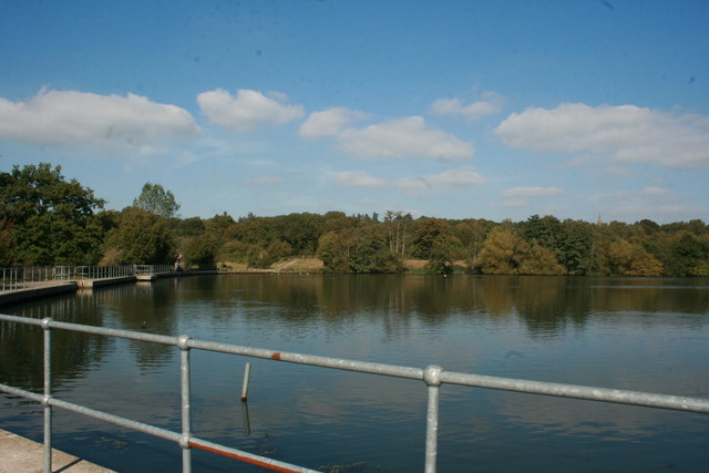
1144:== {{int:filedesc}} == {{Information |description={{en|1=Earlswood Lakes This is the top lake of the two lakes on a nice clear sunny day. The lake itself is not very deep and has an abundance of wildlife. It is a very quiet, relaxing spot, where you can e
215:
127:
there are more hidden surprises. Bursting with wild life, you may catch a glimpse of a rare species, a migrant bird. An ideal nature reserve, easily accessed from either the M25 or M23, good free parking, with refreshment available.
43:
407:– You must give appropriate credit, provide a link to the license, and indicate if changes were made. You may do so in any reasonable manner, but not in any way that suggests the licensor endorses you or your use.
83:
51:
822:
671:
1163:
1071:
757:
623:
587:
289:
239:
777:
324:
1194:
This file contains additional information, probably added from the digital camera or scanner used to create or digitize it.
414:
522:
1037:
1000:
963:
926:
892:
863:
836:
785:
741:
712:
685:
571:
543:
530:
515:
1064:
800:
770:
643:
607:
488:
471:
311:
1126:
1121:
42:
370:
1197:
If the file has been modified from its original state, some details may not fully reflect the modified file.
413:– If you remix, transform, or build upon the material, you must distribute your contributions under the
331:
on the
Geograph website for the photographer's contact details. The copyright on this image is owned by
1137:
367:
1154:
The following pages on the
English Knowledge use this file (pages on other projects are not listed):
829:"}},"text\/plain":{"en":{"P7787":"337 degree"}}}}": -->
678:"}},"text\/plain":{"en":{"P7787":"337 degree"}}}}": -->
91:
184:
1158:
807:
792:
550:
168:
295:
245:
336:
78:
136:
279:
229:
157:
147:
316:
328:
1094:
Click on a date/time to view the file as it appeared at that time.
281:
231:
256:
206:
66:
266:
51° 13′ 19″ N, 0° 10′ 51″ W
216:
51° 13′ 14″ N, 0° 10′ 49″ W
455:
Add a one-line explanation of what this file represents
1181:
110:
90:
Commons is a freely licensed media file repository.
624:
Creative
Commons Attribution-ShareAlike 2.0 Generic
56:(640 × 427 pixels, file size: 49 KB, MIME type:
116:Earlswood Lakes - geograph.org.uk - 1535802.jpg
52:Earlswood_Lakes_-_geograph.org.uk_-_1535802.jpg
424:https://creativecommons.org/licenses/by-sa/2.0
71:
430:Creative Commons Attribution-Share Alike 2.0
348:
8:
826:
675:
390:– to copy, distribute and transmit the work
1199:
1096:
451:
1174:The following other wikis use this file:
808:https://www.geograph.org.uk/photo/1535802
551:https://www.geograph.org.uk/profile/41585
1053:8c7e2ac29dfd51fe0f7722ab69531315cd3684f5
1201:
1164:List of local nature reserves in Surrey
1156:
1051:
1035:
1014:
998:
977:
961:
940:
924:
906:
890:
850:
834:
755:
739:
699:
683:
657:
641:
621:
605:
585:
569:
502:
486:
469:
466:
447:
440:
259:
209:
288:View this and other nearby images on:
238:View this and other nearby images on:
7:
335:and is licensed for reuse under the
1085:
371:Attribution-Share Alike 2.0 Generic
359:
354:
339:Attribution-ShareAlike 2.0 license.
1192:
460:
454:
345:
322:
120:
103:
49:
459:
686:coordinates of the point of view
445:
401:Under the following conditions:
366:This file is licensed under the
358:
353:
347:
315:
294:
280:
272:
244:
230:
222:
70:
31:
21:
442:
121:
46:No higher resolution available.
14:
758:file available on the internet
441:
323:This image was taken from the
26:
1:
837:coordinates of depicted place
36:
778:Geograph Britain and Ireland
516:object of statement has role
467:Items portrayed in this file
271:
221:
852:51°13'19.02"N, 0°10'50.88"W
701:51°13'14.12"N, 0°10'48.72"W
1223:
1178:Usage on www.wikidata.org
415:same or compatible license
1086:
16:
786:geograph.org.uk image ID
444:
381:
197:Tony Gillam /
178:Tony Gillam /
77:This is a file from the
1143:
169:required by the license
153:
142:
135:
132:
113:
81:. Information from its
329:this photograph's page
300:51.221950; -0.180800
250:51.220590; -0.180200
84:description page there
1065:determination method
1122:06:16, 3 March 2011
396:– to adapt the work
531:author name string
1210:
1209:
1170:Global file usage
1147:
828:
677:
659:27 September 2009
608:copyright license
453:
344:
343:
327:collection. See
305:
304:
255:
254:
204:
203:
172:
137:27 September 2009
99:
98:
79:Wikimedia Commons
32:Global file usage
1214:
1200:
1159:Earlswood Common
1134:
1074:
1069:
1019:
982:
945:
874:
873:
868:
810:
805:
801:described at URL
795:
790:
780:
775:
723:
722:
717:
572:copyright status
553:
548:
538:
535:
525:
520:
437:
434:
431:
428:
425:
417:as the original.
379:
368:Creative Commons
362:
361:
357:
356:
351:
350:
337:Creative Commons
325:Geograph project
319:
312:
301:
298:
284:
283:
277:
276:
275:
269:
268:
257:
251:
248:
234:
233:
227:
226:
225:
219:
218:
207:
166:
138:
125:
117:
111:
95:
74:
73:
67:
61:
59:
1222:
1221:
1217:
1216:
1215:
1213:
1212:
1211:
1188:
1168:
1155:
1148:
1140:
1132:
1088:
1087:
1084:
1083:
1082:
1081:
1080:
1079:
1078:
1077:
1076:
1075:
1070:
1067:
1058:
1057:
1056:
1054:
1044:
1043:
1042:
1040:
1029:
1028:
1027:
1026:
1025:
1024:
1023:
1022:
1020:
1017:
1007:
1006:
1005:
1003:
992:
991:
990:
989:
988:
987:
986:
985:
983:
980:
970:
969:
968:
966:
955:
954:
953:
952:
951:
950:
949:
948:
946:
943:
933:
932:
931:
929:
918:
917:
916:
915:
914:
913:
912:
911:
909:
899:
898:
897:
895:
884:
883:
882:
881:
880:
879:
878:
877:
876:
875:
871:
869:
866:
857:
856:
855:
853:
843:
842:
841:
839:
820:
819:
818:
817:
816:
815:
814:
813:
812:
811:
806:
803:
797:
796:
791:
788:
782:
781:
776:
773:
764:
763:
762:
760:
748:
747:
746:
744:
733:
732:
731:
730:
729:
728:
727:
726:
725:
724:
720:
718:
715:
706:
705:
704:
702:
692:
691:
690:
688:
669:
668:
667:
666:
665:
664:
663:
662:
660:
650:
649:
648:
646:
635:
634:
633:
632:
631:
630:
629:
628:
626:
614:
613:
612:
610:
599:
598:
597:
596:
595:
594:
593:
592:
590:
578:
577:
576:
574:
563:
562:
561:
560:
559:
558:
557:
556:
555:
554:
549:
546:
540:
539:
536:
533:
527:
526:
521:
518:
509:
508:
507:
505:
495:
494:
493:
491:
480:
479:
478:
477:
476:
474:
458:
457:
456:
439:
438:
435:
432:
429:
426:
423:
422:
380:
377:
374:
363:
340:
310:
299:
273:
264:
263:
260:Object location
249:
223:
214:
213:
210:Camera location
205:
199:Earlswood Lakes
194:
187:
180:Earlswood Lakes
175:
148:geograph.org.uk
128:
115:
108:
101:
100:
89:
88:
87:is shown below.
63:
57:
55:
48:
47:
12:
11:
5:
1220:
1218:
1208:
1207:
1204:
1191:
1187:
1186:
1185:
1184:
1172:
1171:
1167:
1166:
1161:
1153:
1152:
1151:
1146:
1145:
1142:
1138:
1135:
1129:
1124:
1119:
1115:
1114:
1111:
1108:
1105:
1102:
1099:
1092:
1091:
1063:
1062:
1061:
1060:
1059:
1055:
1052:
1050:
1049:
1048:
1047:
1046:
1045:
1041:
1036:
1034:
1033:
1032:
1031:
1030:
1021:
1015:
1013:
1012:
1011:
1010:
1009:
1008:
1004:
999:
997:
996:
995:
994:
993:
984:
978:
976:
975:
974:
973:
972:
971:
967:
962:
960:
959:
958:
957:
956:
947:
941:
939:
938:
937:
936:
935:
934:
930:
925:
923:
922:
921:
920:
919:
910:
907:
905:
904:
903:
902:
901:
900:
896:
891:
889:
888:
887:
886:
885:
862:
861:
860:
859:
858:
854:
851:
849:
848:
847:
846:
845:
844:
840:
835:
833:
832:
831:
830:
824:
799:
798:
784:
783:
769:
768:
767:
766:
765:
761:
756:
754:
753:
752:
751:
750:
749:
745:
742:source of file
740:
738:
737:
736:
735:
734:
711:
710:
709:
708:
707:
703:
700:
698:
697:
696:
695:
694:
693:
689:
684:
682:
681:
680:
679:
673:
661:
658:
656:
655:
654:
653:
652:
651:
647:
642:
640:
639:
638:
637:
636:
627:
622:
620:
619:
618:
617:
616:
615:
611:
606:
604:
603:
602:
601:
600:
591:
586:
584:
583:
582:
581:
580:
579:
575:
570:
568:
567:
566:
565:
564:
542:
541:
529:
528:
514:
513:
512:
511:
510:
506:
503:
501:
500:
499:
498:
497:
496:
492:
487:
485:
484:
483:
482:
481:
475:
470:
468:
465:
464:
463:
462:
461:
450:
449:
446:
443:
421:
420:
419:
418:
408:
399:
398:
397:
391:
384:You are free:
375:
365:
364:
346:
342:
341:
320:
309:
306:
303:
302:
292:
286:
261:
253:
252:
242:
236:
211:
202:
201:
195:
192:
189:
188:
183:
176:
173:
161:
160:
155:
151:
150:
144:
140:
139:
134:
130:
129:
118:
109:
107:
104:
102:
97:
96:
75:
65:
64:
45:
41:
40:
39:
34:
29:
24:
19:
13:
10:
9:
6:
4:
3:
2:
1219:
1205:
1202:
1198:
1195:
1189:
1183:
1180:
1179:
1177:
1176:
1175:
1169:
1165:
1162:
1160:
1157:
1149:
1141:
1136:
1130:
1128:
1125:
1123:
1120:
1117:
1116:
1112:
1109:
1106:
1103:
1100:
1098:
1097:
1095:
1089:
1073:
1066:
1039:
1002:
965:
928:
894:
865:
838:
809:
802:
794:
787:
779:
772:
759:
743:
714:
687:
645:
625:
609:
589:
573:
552:
545:
532:
524:
517:
490:
473:
427:CC BY-SA 2.0
416:
412:
409:
406:
403:
402:
400:
395:
392:
389:
386:
385:
383:
382:
376:Attribution:
372:
369:
352:
338:
334:
330:
326:
321:
318:
314:
313:
307:
297:
293:
291:
290:OpenStreetMap
287:
285:
267:
262:
258:
247:
243:
241:
240:OpenStreetMap
237:
235:
217:
212:
208:
200:
196:
191:
190:
186:
182: /
181:
177:
170:
165:
163:
162:
159:
156:
152:
149:
145:
141:
131:
124:
119:
112:
105:
93:
86:
85:
80:
76:
69:
68:
62:
53:
44:
38:
35:
33:
30:
28:
25:
23:
20:
18:
15:
1196:
1193:
1173:
1093:
1090:File history
523:photographer
410:
404:
393:
387:
332:
270:
220:
198:
185:CC BY-SA 2.0
179:
122:
92:You can help
82:
50:
22:File history
1139:GeographBot
588:copyrighted
537:Tony Gillam
411:share alike
405:attribution
378:Tony Gillam
333:Tony Gillam
164:Attribution
158:Tony Gillam
114:Description
1203:_error
1150:File usage
1131:640 × 427
1107:Dimensions
908:image/jpeg
893:media type
504:some value
58:image/jpeg
27:File usage
1182:Q60739927
1104:Thumbnail
1101:Date/Time
927:data size
644:inception
308:Licensing
193:InfoField
174:InfoField
123:English:
1190:Metadata
1038:checksum
771:operator
448:Captions
394:to remix
388:to share
373:license.
37:Metadata
1133:(49 KB)
1118:current
1113:Comment
942:49,722
864:heading
823:heading
793:1535802
713:heading
672:heading
489:creator
472:depicts
452:English
106:Summary
54:
964:height
872:degree
827:degree
721:degree
676:degree
278:
228:
154:Author
143:Source
1072:SHA-1
1018:pixel
1001:width
981:pixel
146:From
1110:User
1016:640
979:427
944:byte
870:337
719:337
436:true
433:true
133:Date
17:File
544:URL
1068::
867::
804::
789::
774::
716::
547::
534::
519::
1206:0
171:)
167:(
94:.
60:)
Text is available under the Creative Commons Attribution-ShareAlike License. Additional terms may apply.
_heading:337.00&language=en)
_heading:337.00&language=en)
